After a warming mug of tea accompanied by
chocolate biscuits, Allen, Grizzly, Shaun and Little Eric, were
sitting quietly reading, when Tetley came hurrying into the room.
"Would you like a cuppa, pal?, asked
Allen.
"Yes please", he replied accepting
the mug gratefully. "I come bearing news of a walk. Dad has
spoken with Uncle Eric, and they have agreed to do a walk from
High Bentham, called the Bentham Heritage Trail."
"That's just great", exclaimed
Grizzly. "It is months since we walked with Uncle Eric, due
to him not being well, so it will be lovely to have his company
again.
"It will be nice to have a rest from
the mountains, especially as the recent walks have been pretty
demanding", added Shaun. "Also, it is not a long drive
to Bentham."
"Roll on Thursday", cried Tetley,
holding his mug out for a refill.
"You are nearly getting as bad as me",
laughed Allen, as he poured the tea into his mug.
The Walk
We met Uncle Eric, who had
arrived before us, at the car park in High Bentham, situated
behind the main street. As far as the weather was concerned we
were to enjoy a dry day with quite a lot of sunshine, our timing
being quite impeccable, as it started to rain, just as we got
back to the cars, at the end of the walk.
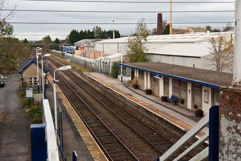
Ready, and us settled in the
rucksack, Uncle Eric and Dad walked through an alley to the main
street, then right at the junction to cross the Morecambe to
Leeds railway line, at the station.
The "Little" North-Western
Railway Company, opened this line in 1850 with five trains daily
each way. In 1859 the line was taken over by the Midland Railway,
builders of the mighty Settle-Carlisle line.
Hitherto, haulage to Bentham has
been by packhorse, as in this hilly country they were more
practical than carts. Strings of sturdy local ponies travelled
along the ancient trackways, carrying panniers of wool or lime,
coal, flagstones etc, accompanied by Drovers, a rough, hard-drinking
crew. Livestock also walked to city markets along these upland
drove roads often a journey of months, grazing on the way.
The coming of the railway changed
everything, and by 1880 Bentham Goods Yard was busy with Silk
Mills products, great bales of yarn and bundles of finished
fabrics, plus livestock, coal, stone - all manner of imports and
exports. Local coal and river water fuelled the steam engines.
The station was staffed by twenty six men - signalmen, porters,
wheel tappers and plate-layers, not forgetting the Stationmaster
himself. Besides too, there was a small army of carters to shift
the goods to their final destination.
The railways brought wealth and
energy, speed, ease and pleasure. City tycoons commuted from
their homes in airy Carnforth to their smoky mills in Bradford,
and workers from there could escape to the seaside or the country.
By the 1910s Bentham had a famous and thriving Holiday Camp, with
gents in tents on one side of the river, ladies and children on
the other. It was served by nineteen passenger trains at day, so
popular was it.
From 1923 the London Midland &
Scottish railway ran the line, and from 1948 British Railways.
Today the yards are gone and the Railway's potential is under-used.
While there are few trains daily each way, they still run on one
of the prettiest lines in England. East or West, it is a pleasant
ride, and the line still provides a vital link to the wider world.
The above notes, which we
acknowledge gratefully, are reproduced from one of a number of
information boards we encountered on our walk. As well as the
railway, they dealt with wildlife, industry, quarrying and mining.
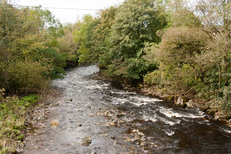
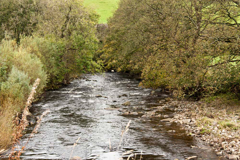
The road descended to cross the
River Wenning, seen here as it runs downstream. A few miles on it
passes through the pretty village of Wennington (no need to say
how that got its name), then through Hornby, where it soon joins
the River Lune, that runs into Morecambe Bay after passing
through Lancaster.
"We now turn left along that
narrow road", said Uncle Eric, who was carrying the
Heritage Trail leaflet.
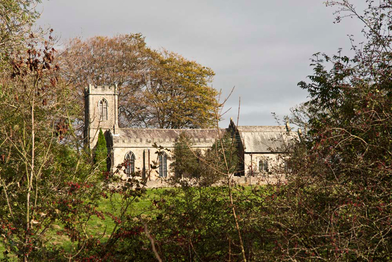
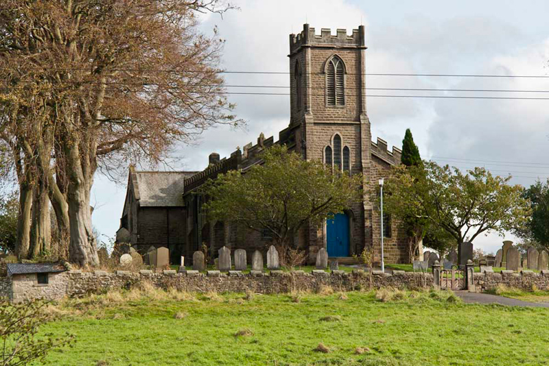
As we strolled along, Allen
commented, "that will make a nice picture of the church
bathed in sunlight."
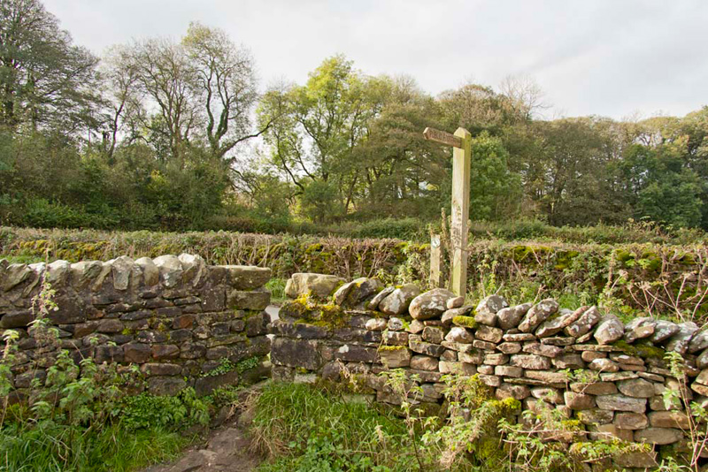
Soon the road turned sharp right. Shaun pointed, "the route is over that signed gap stile, and across the wet and muddy pasture."
"That's hardly surprising after all
the rain in the last few weeks", commented Little Eric.
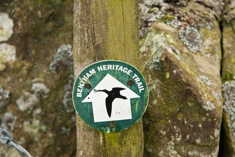
The route was clearly signed. A
depiction of a curlew contained within a white arrow on a green
background. However whilst the walk can be done either way, it
became apparent that it was normal to do it the opposite direction, as
the signs were on the wrong side of the stiles and gates etc.
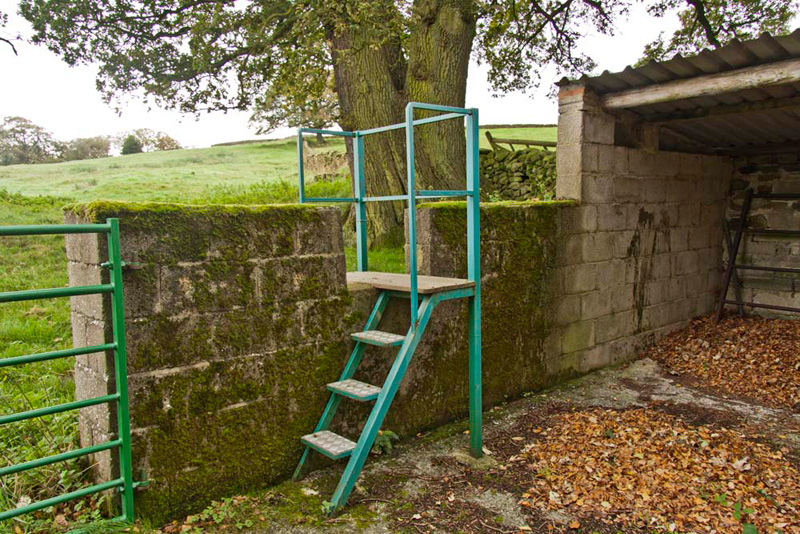
The way led on to Staggarth, where
there is a caravan site. Stiles allowed entry and exit from the farmyard, Tetley saying, "how considerate that such sturdy and safe ladderstiles have been provided."
Beyond, we crossed more fields, with
the River Wenning quite close by at times. Just before its course turned sharply left downstream, Allen called out, "that's a lovely view and will make a nice picture for the story."
Turning our backs on this scene,
the path climbed up to and over the gap stile in the stone wall.
Shaun called out, "look here, there's large information
board. I wonder what it is about."
In fact, as we mentioned earlier
this was the first a number we were to encounter today, and added
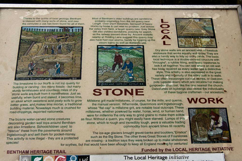
a great deal of extra interest. Here is the one, by this stile.
This told us that due to the
geology, the area is blessed with many sorts of stone, that have
been exploited over the centuries. Although not top quality for
building and carving, nonetheless the limestone has been used in
the construction of many farmhouses and countless miles of dry
stone walls. Also when burned and slaked, quicklime was produced
for spreading on the land and made lime mortar. Nowadays much is
crushed for road-chippings, exported nationwide.
Most of Bentham's other buildings
are sandstone that probably originated from an old quarry near
Lairgill. At Grey Stone a larger quarry also yielded sandstone,
that was maybe exported as the railway passed close by. Nearby
ancient coalpits suggest that the quarry may also have has coal
seams, handy for topping up the steam trains as well as for
domestic use.
Millstone grit made millstones, of
course, for the mills and querns, the manual version. Whernside,
Quernmore and Ingleborough are notable local outcrops. These
millstones, whether powered by water, horse, wind or human hand,
were for millennia the only way to grind grains to make them
edible as flour. Without a quern you might easily have starved.
Lumps of this stone which is incredibly tough, were a valuable
trading commodity from ancient times until recently.
"How fascinating", said
Tetley. "It just goes to show how ingenious our ancestors
were, and how much use they made of local resources."
Continuing, then we came to a point
where the path divided. One branch went left, while ahead we
could see a further waymarked stile.
Studying the map, Shaun said,
"we want to go left here."
"I agree", replied Uncle
Eric who had consulted the guide leaflet.
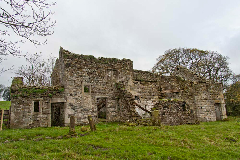
Soon we arrived at a forlorn and
long abandoned ruin that was once Dawson Close Farm.
"It looks so sad",
remarked Allen. "I wonder what stories those walls could
tell, if only they could speak."
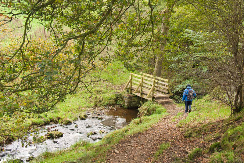
Beyond the gate, the path led down,
along a sort of shelf by Gill Brow Wood. Uncle Eric can be seen
here, heading on down to the footbridge over a stream.
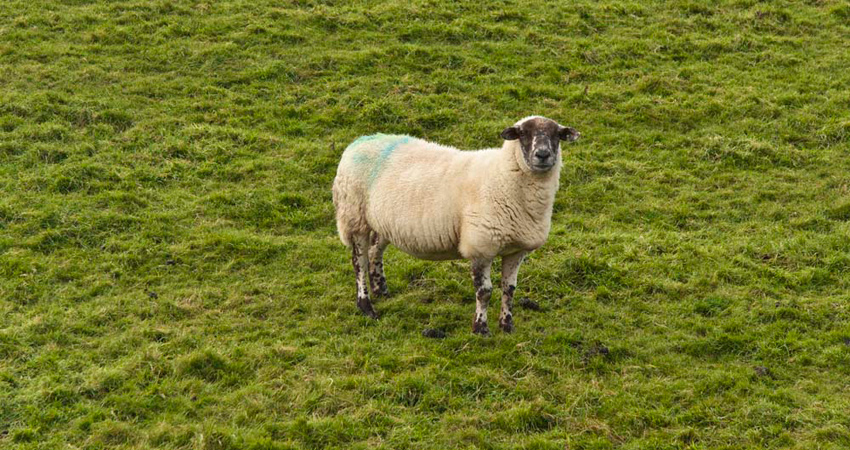
Over the bridge the path bent right
to a stile in a wall and then into a field, occupied by sheep, one of
which begging to have its picture taken, so Dad could not resist getting the camera out.
Soon we came to the road at New
House. "It's left here, then left again at the next junction",
advised Uncle Eric.
After the junction the road
descended quite steeply to arrive at the bridge over the railway
line. Just before a convenient seat provided a sheltered place,
for our lunch stop.
"Get the sandwiches out Allen",
said Shaun.
"OK pals", he replied.
"I'll also pour the tea, as I don't know about you, but I am
ready for a warming mug."
"No surprise there", said
Tetley laughing.
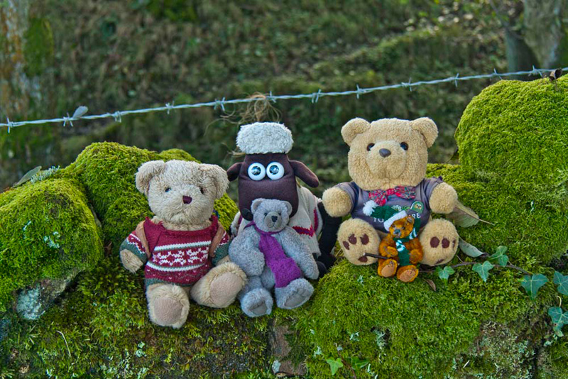
A little later, Little Eric said,
"we will have to appear in the story."
"Of course", replied Dad.
"Now just settle yourselves on that moss covered wall."
Jumping into the rucksack, it was
off again, crossing the railway, and then Greystonegill Bridge, where Shaun instructed, "it's over the stile left into the fields for the return leg."
Immediately over the stile was another information board, this
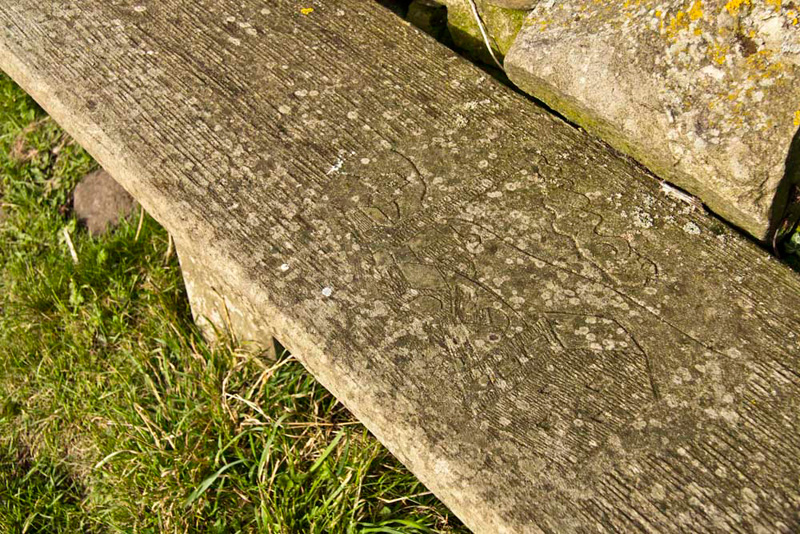
about the wildlife in the area. Tetley said, "it's interesting that there are stone seats by most of the boards, into which something relevant to it has been carved. In this case an otter."
After another stile or two, the
path swung right to a gate and on along by the woods, the muddy
way leading over more stiles, where we were lucky to see some
deer.
This finally led into a ploughed
field.
With his eyes on the map, Shaun said, "the route is diagonally across, but it will be so mucky and muddy, probably better to walk round the edge."
"Quite" agreed Uncle Eric.
Even so Dad and Uncle Eric's boots were caked with soil and mud, by the time we had rounded the corner of the field, and made our way half way along by the wall to the stile, over which was thankfully a grassy pasture.
Coming to a gate, we
walked on through the buildings of Low Linghaw & Ridding Lane.
At the latter Allen said, "the waymarks are a plenty", as we turned left
along a reinforced track.
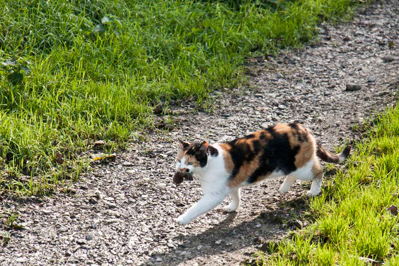
We had only walked a short distance
when Uncle Eric said, "we are going the wrong way, as this
leads across to the other side of the valley."
As he had been saying this, we
spotted this farm cat, who was obviously doing his job, from the
mouse or the like he had caught. (if you are squeamish, shut your
eyes and page down quickly).
Turning back we soon found the
correct path, that led to near Sunnyfield Farm and on along a
reinforced path to a junction. "We cross the stile in the wall on the left", called out Shaun.
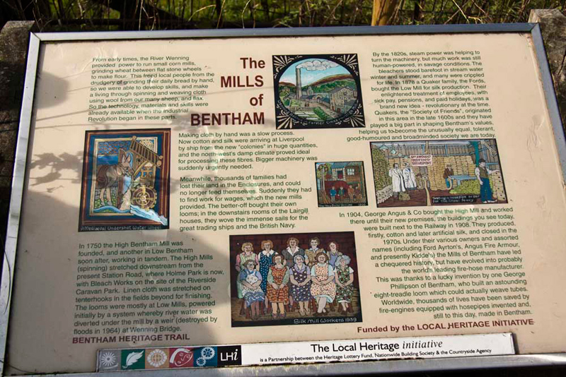
"Look", called out Little
Eric, "there's another of those excellent information boards,
this one about mills."
"There's a seat too",
added Allen. "This one has a picture of a mill carved into
it."
Having been further educated, it
was off again, descending to cross the railway line, looking
carefully each way before we went over the track. Here was the
last of the information boards, about the railway, extracts from
which were included at the beginning.
We were nearing the end now,
the path leading us along above the railway track, to pass by the
church of St Margaret of Antioch, where Dad took a few pictures,
of which the one below we judged to be the best.
Then we were back to the road we had
started out along, turning right to follow it over the
railway bridge.
On the right was the Tourist Information, but
unfortunately we were just too late as the office had closed a
little while before. However there were a number of leaflets
outside. Dad picked up one about food in the Bowland area, and a
tea shop list too.
"Can't think why you have decided to take that one", laughed Tetley, knowing what a tea belly Dad is.
It began to rain, but we were soon
at the cars, and we dived in to keep dry and have the rest of our
picnic and another mug of tea, which pleased Allen, who takes after Dad in that respect.
Joking apart, the tea shop
leaflet proved its worth, as it indicated there was one at 37
Main Street. Just a short walk, so this is where Dad and Uncle
Eric went for refreshment.
Pot of tea of course, and Uncle Eric had a nice piece of
chocolate cake, while Dad had a fruit scone with butter and jam.
Thanks Uncle Eric for taking us on
such an interesting walk, and we hope it will not be too long
before we walk together again.