EXPLORATIONS
OF ESKDALE & ATTEMPTS ON PEN (2500ft)
Summary
Date - 27th October 2011
& 12th November 2011
Distance - 10 miles & 9 miles
Ascent - 1850ft
& 1520ft
Map - OL6
Start point -
Car park at foot of Hard Knott Pass (NY
214011)
Summits Achieved
No summits reached
on these walks
Preface
"Just one summit
to go now to complete the Birkett challenge", mused Tetley,
tucking into one of the delicious triple chocolate cookies with
his mug of tea.
"Mmm",
replied Grizzly.
"It has been a
long long journey, with miles upon miles of walks and goodness
knows how many thousands of feet of ascent that Dad's poor legs
and knees have had to contend with", sighed Shaun.
"Where's Allen?",
said Little Eric. "He's such a tea belly, that it is not
like him to miss a brew."
"He'll be along
soon, as he can can smell it a mile off", replied Tetley,
letting out a bellow of laughter.
Sure enough not more
than a couple of minutes later, Allen came rushing in, worriedly
calling out, "I'm not too late? There's still some tea left?"
"Yes",
replied Shaun, handing him a steaming mug and offering the
biscuits.
"Thanks pal",
replied Allen gratefully accepting the mug. Then he went on,
"I come bearing good news. Dad has spoken with Uncle Bob,
who is staying in the Lakes at present, and they have arranged to
walk on Thursday, and we are walking in Eskdale, with the hope of
getting to the top of Pen and thereby completing the Birketts."
While he had been
speaking Tetley had booted Dad's laptop and was looking closely
at the weather forecast. It shows a lot of cloud and as we are to
be amongst the highest mountains we will just have to see how we go on, as the ultimate
objective is in an area we have not walked in before.
We were to remember
Tetley's forebodings, on each of the two attempts to get to Pen.
The Scafells and indeed Pen which is a lower acolyte, were each
time covered in low cloud. The length of the days too played a
part, with the long walk in and return, we really did not have
enough daylight. Still Pen is going nowhere, and reaching its
summit was to become the prime objective of 2012.
The Walk
Before we start, we
should point out that the narrative and all but one of the
pictures relate mainly to the first attempt in the company of
Uncle Bob. In each the approach route was the same. Whilst in the
first walk we made a circular route returning via Lingcove Bridge,
the second time we just returned via our outwards route.
We had to be up early, especially
for the second walk, when we set off at 06:00. That day we made
the sandwiches the night before and put them in the fridge to
keep fresh! The route was familiar as we have been this way many
times.
As we drove along near Broughton,
Shaun said, "the road works at the bottom of Birker Fell
should be over, if the signs we saw last time were anything to go
by."
However our hopes were dashed, as
when we reached Duddon Bridge the road closed signs were still in
place.
"Oh heck!", exclaimed
Little Eric.
"Well, it can't be helped",
replied Dad. "We will just take the roundabout route over
Corney Fell and then along the Birkby Road to get to Eskdale."
Corney Fell was familiar to us,
having walked from here in the past, but nevertheless it is
narrow especially the last section down to the A595 at
Waberthwaite. We had never been along the Birkby road, but had
seen it signposted at the bottom of Birker Fell many times. This
is a very narrow and winding road, and there were quite a
number of occasions that we were glad not to meet traffic coming
the other way.
"We'll not be using this as a regular route", said Allen, as we came to the junction with Birker Fell."
"Definitely not", said Dad, as he breathed a sigh of relief that we had not encountered any traffic coming the opposite direction.
Soon we were driving along the road
to Hard Knott Pass, and passing the telephone box by the track to
Brotherilkeld Farm, it was just a short distance to cross the
cattle grid, and find the parking just beyond on the right by
Jubilee Bridge.
Uncle Bob arrived very soon and we called out, "good morning, nice to see you."
"And you lads", he replied.
We waited patiently while they got ready, then settled
ourselves comfortably in Dad's rucksack, starting down the road
about 09:30. By the phone box we took the track that leads to
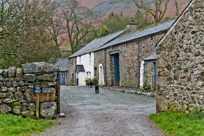
Brotherilkeld Farm.
The footpath skirts the farmyard,
and over a stile then goes on ahead up Eskdale towards Lingcove
Bridge. "We need to go left very soon, crossing the River
Esk by the footbridge and over the field to Taw House"
called out Shaun.
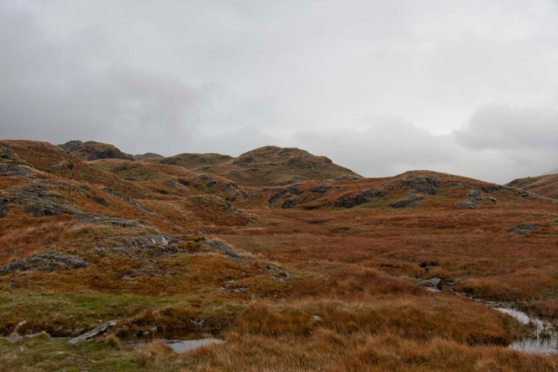
Passing through the gate, we turned
immediately right the path stretching away before us. As can be
seen the cloud, or clag as Uncle Bob says, was down on the fells,
a situation that was to persist all day.
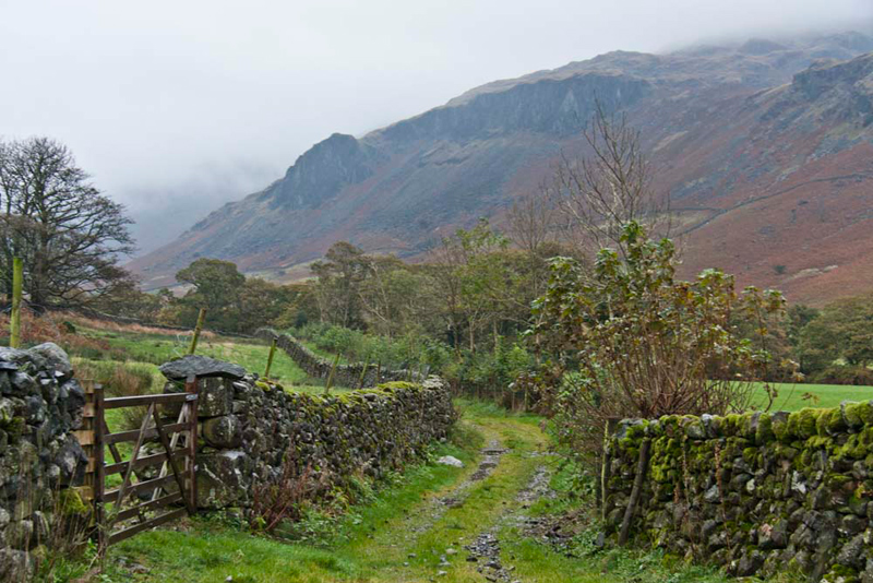
The way led up over pasture and on
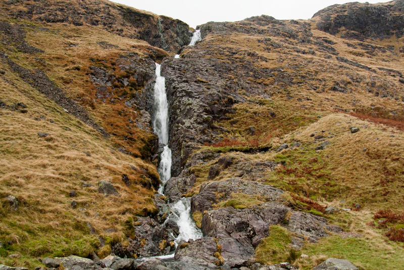
to Scale Bridge. "The waterfall is impressive. A picture for the story Dad", said Grizzly.
The path was muddy at times after all the rain. "Still unlike the south of England, our reservoirs are full,
so we will not face any water restrictions next year", commented Allen.
At the junction Shaun said, "to the right the path continues along the west side of Eskdale, but we
want to go left up the zig zags that climb steeply the slopes of Brock Crag."
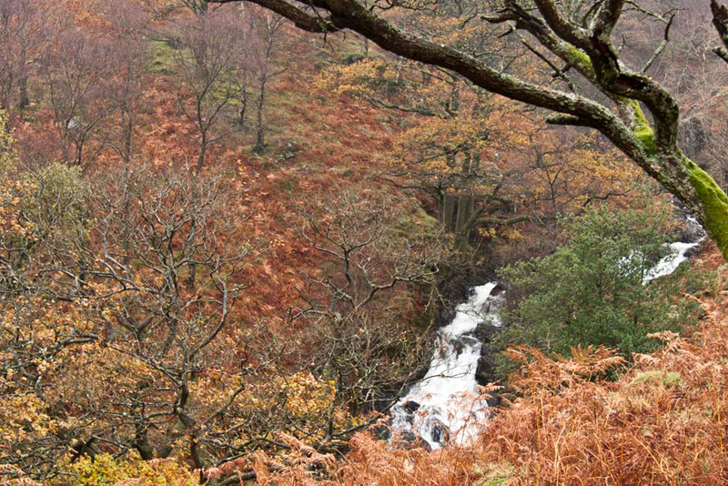
"That makes a lovely autumn
scene encompassing the rushing Scale Gill, in spate today",
cried Grizzly.
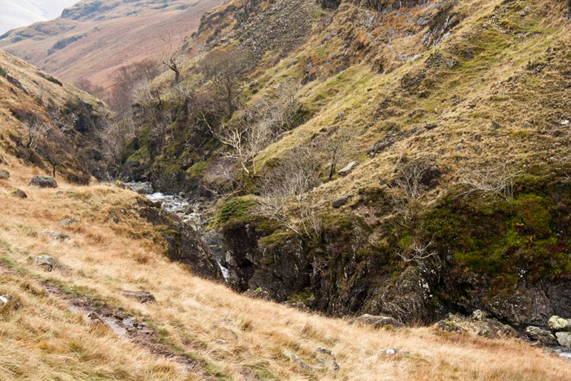
At the top, the desolate country stretches ahead. Rough featureless
and perennially boggy moor, the path winding its way through
undulating terrain, crossing at one point a stream by a narrow
plank bridge.
As Dad and Uncle Bob trudged on, Grizzly,
remarked, "this is the way we returned after that long day
when we climbed amongst others Scar Lathing. Another was
Silverybield, there over to the right and High Scarth that crag
to the left ahead being its eastern extent."
"It covers a large area, and
the summit is a long way up as we found out that day", sighed
Allen. "Then Dad left the GPS at the summit and had to reclimb a hundred feet or so to retrieve it."
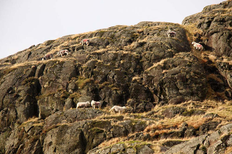
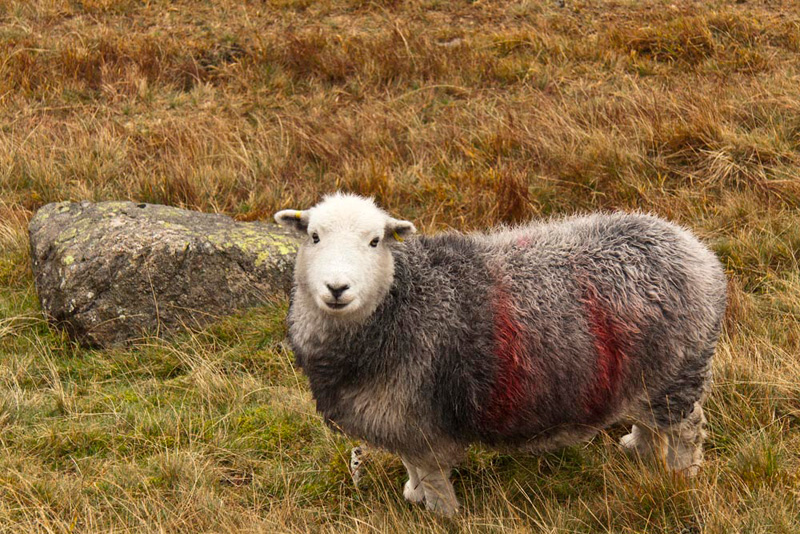
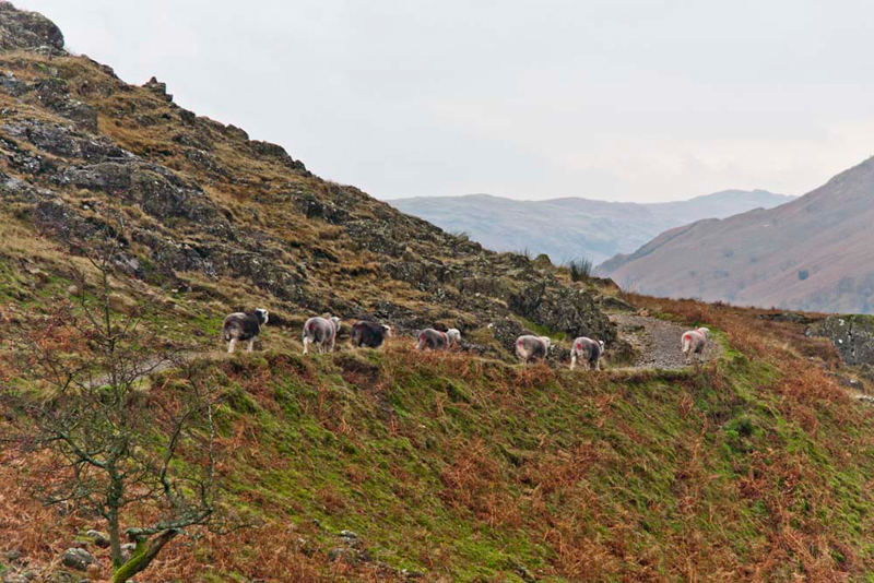
Our beloved Herdwick sheep were all
about wandering the fells at will, for much of the time left to
their own devices. We call them the mountain goats of Lakeland.
On the occasion of the second walk, Dad took this shot of them on
these very crags.
The path climbed on and at the brow Upper
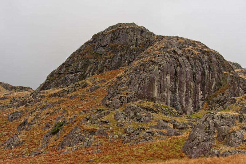
Eskdale would be revealed, but before this we paused to look back.
Besides Silverybield, a line of crags, forms the eastern boundary
of this desolate area. Tetley said, "of those only one is named, being Round Scar,
nearest the camera."
Just minutes later as we walked
along, some Herdwicks were browsing the grass. One kindly paused
and posed for his picture.
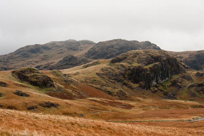
Cresting the rise, the path then
continued across the lower slopes of High Scarth, to finally
reveal Upper Eskdale. A fine view opened up with to the right
this group of fells.
Tetley said, "that's Scar Lathing to the right
foreground, with Low Gait Crags rising behind and then higher
beyond High Gait Crags. On our round in April that took in Scar
Lathing, we additionally had to make a detour from our route to
take in High Gate Crags, as this was another of the Birkett tops
to bag."
"I remember there were no paths and terrain was rough and rocky, adding
considerably to the effort required", went on Little Eric. "But as always you were up to the challenge Dad."
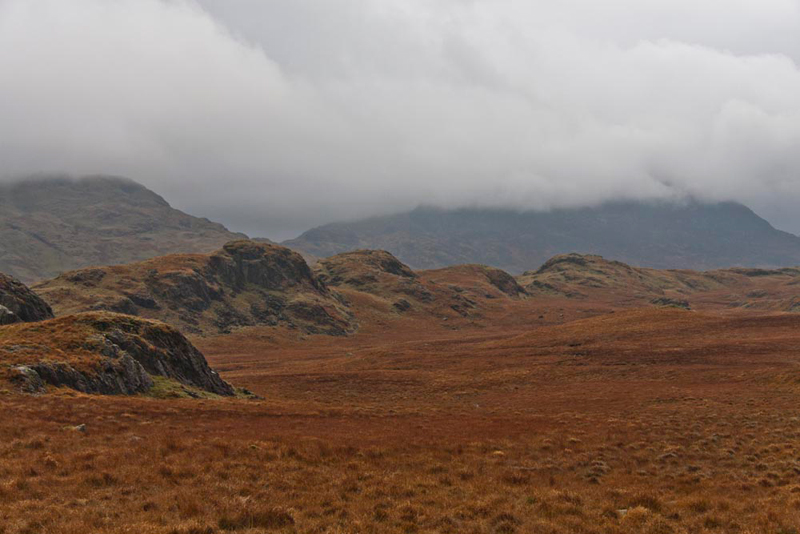
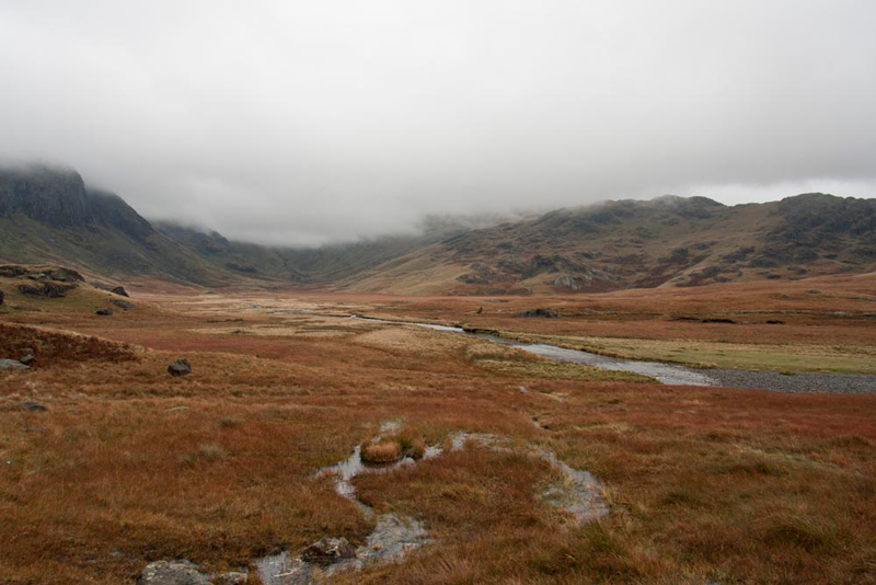
Ahead could be seen the River Esk
running down the valley, by the huge expanse of Great Moss,
before turning left on its course down to Lingcove Bridge and
beyond.
Lost in the low cloud to our left
are Scafell and Scafell Pike, England's two highest mountains. Allen said, "our objective Pen is lost in the
cloud. It does not bode well for getting to the summit today."
"Where do we have to go now?",
asked Little Eric, rather overawed by the scale of the landscape.
"To just beyond the furthest
descending ridge we can see", replied Shaun, who was looking
closely at the map.
"Ooh that seems a long long
way", sighed Little Eric in reply.
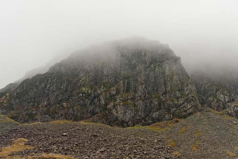
It was too, the rough and extremely
muddy path winding its way along the valley and undulating up and
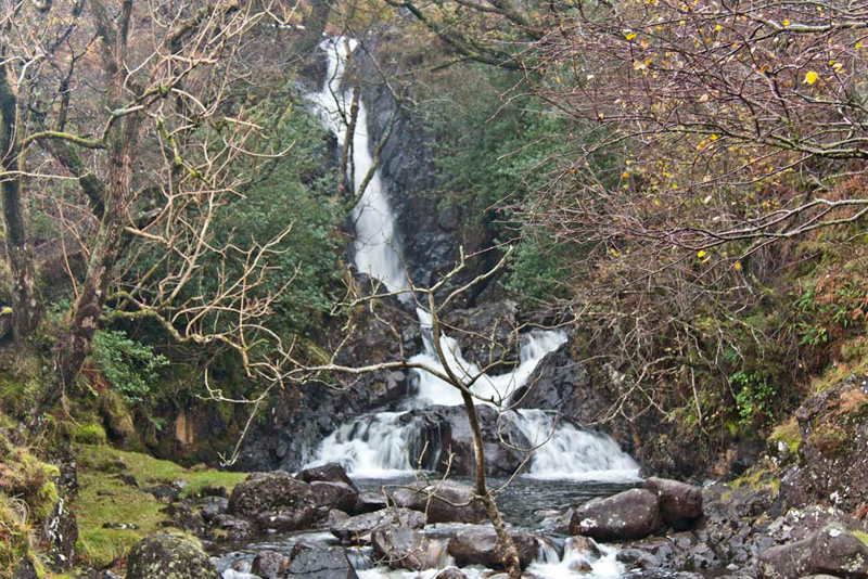
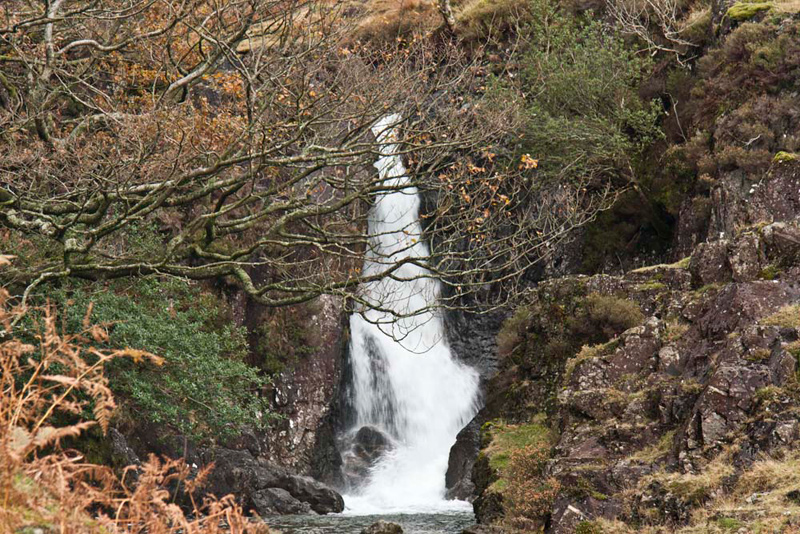
down over the intervening ridges. "That's the massive Cam Spout Crag, it's top lost in cloud", pointed Grizzly.
Then beyond the crag, we had this
terrific view of Cam Spout, tumbling down the fellside.
"That's got to be worth a
picture", enthused Tetley.
"Sure is" replied both
Dad and Uncle Bob, as they hauled their camera out of the bag.
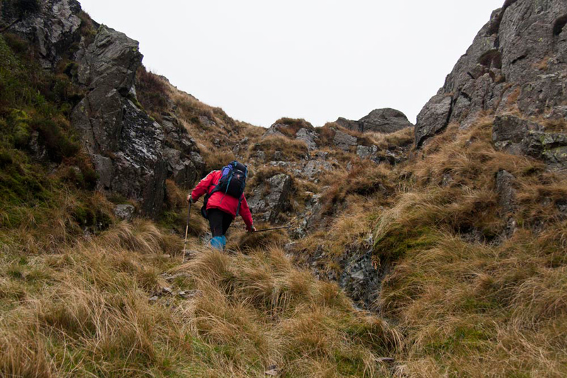
Finally the last ridge was crossed
and we arrived at the base of the ravine Little Narrowcove. We
found the narrow trod that climbed above the south side to reach
the easy gully. Yes, it is not a particularly difficult ascent
but the rocks were very wet and slippery, making it today more
dangerous and great care was necessary to reach the top and level ground. Here Uncle Bob makes the ascent.
Pen reared up to the left lost in
the cloud. Shaun checked the altitude on the GPS, saying, "there is a
further 600ft of ascent to reach the summit."
By now it was about
14:00 and both Dad and Uncle Bob felt that there was just not
enough time to make the climb and get down and back in daylight.
Uncle Bob
said, "it's up to you Gerry."
"Dad replied, "we
should abandon the summit on safety grounds. It is disappointing
but safety is paramount."
Tetley went on, "it's the last summit in the Birkett challenge,
but it will be there next year, and at least we will only have
this one to bag!!"
Suddenly Dad spotted a small dog
that initially appeared to be on his own, but then a group of
walkers emerged from behind a rise. Three young women and one man.
"Where are we?", the man
asked.
Uncle Bob replied, "have you
got a map, so I can show you."
"We haven't" he replied.
How absolutely foolish we thought.
Both Uncle Bob and Dad are vastly experienced and know the Lake
District extremely well, but they never ever set out without the
relevant map. Further questioning revealed the group had ascended
via the main path from Wasdale climbing to Scafell Pike. Here in
the cloud they had got disorientated, and descended in completely
the opposite direction.
As they made to descend the gully we had
just climbed, Uncle Bob said, "that is far too dangerous bearing in mind your level of experience. In any event, it will take you down into Eskdale, many miles from your car."
Up here it was cold and damp, and
some of them were not properly clothed for the conditions. One
poor girl was in tears, and we felt for her, but despite this we finally convinced them to return the way they had come to Scafell Pike and then ask
someone to direct them onto the correct path down to Wasdale. It
was a classic example of inexperienced walkers getting into
trouble in poor conditions. Both Dad, Uncle Bob and us worried about
them for the rest of the walk and even days afterwards wondered
if they had got safely off the mountain.
Seeing them on their way, Dad and
Uncle Bob returned down the gully taking extreme care, and then
at a convenient point crossed the River Esk, to turn right and
walk along beside it.
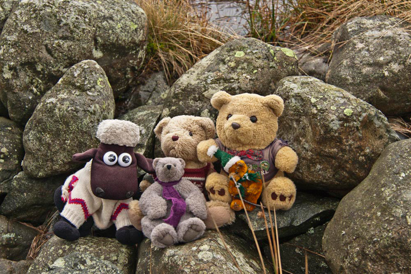
By a broken wall a stop was made for lunch. Shrugging his rucksack off, Allen
passed the sandwiches round and also poured us mugs of steaming
hot tea. "I'm gasping for a drink", he said, taking a
large mouthful.
Then we posed here for our picture, as we have to appear in every story.
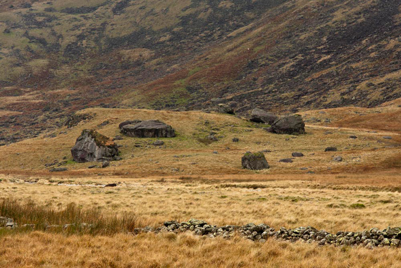
On the walk out, we had passed some huge stones as large as houses.
We could now see them and scrutinising the map, Shaun said, "they
are called Sampson's Stones."
Soon the path turned left following
the course of the River Esk, and we passed below Scar Lathing and
Throstlehow Crag, at the latter passing above where the river
passes through a gorge.
Beyond, a steep descent followed
down to Lingcove Bridge.
"This was the way we came up to get to the summit of Throstlehow Crag", commented Grizzly.
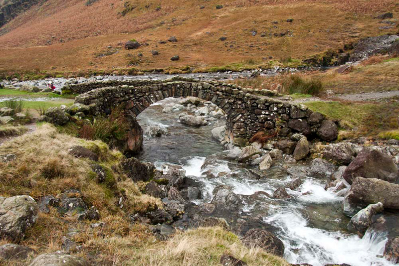
We were now at the confluence of Lingcove Beck
and the River Esk, the bridge itself spanning the former. On its
final rush to the Esk, is this waterfall.
And here too, is the pretty
packhorse bridge.
From here, we then walked along
Eskdale to Brotherilkeld and the start. At one point we suddenly
noticed that our beloved Herdwicks were coming down off the fell.
"I wonder if it is because of you Shaun?", laughed Allen.
But then they were
in front, padding along in a line. If you think that there is
only a few, many more came down after Dad had taken this picture.
Perhaps they gather at a lower level during the night?
Well finally tired and rather
footsore the cars were reached. Dad changed, then we all said our
goodbyes to Uncle Bob, and we drove home. After a long and
tiring day, we all slept very well that night. And finally thanks
Uncle Bob for your company on the walk.
12th November 2011 As we said at the beginning, about
a fortnight later Dad made a second attempt, starting very early,
due to the ever shortening days. However the cloud conditions were
even worse this time, and when we got to the foot of Little
Narrowcove, we could not even see the gully we knew we had to
climb. The previous night had been very wet, so Dad knew that it
would be very dangerous climbing that gully, and the fact that he
was on his own, in the circumstances he made the right decision
to once again abort the ascent. He has vowed that when we make
the third attempt it will be on a day when there are clear blue
skies and Pen will be clearly in view. It will be in the spring
most probably, when Uncle Bob is once again staying in the Lakes,
as he has said he wants to accompany us to this last summit.
Thank you!!