As we turned off at Braithwaite, Little Eric commented, "we seem to be crossing Whinlatter
Pass regularly at present."
"Yes pal", agreed Tetley. "A good few of the outstanding Birkett summits have been above the Vale of Lorton and around Loweswater and Crummock Water."
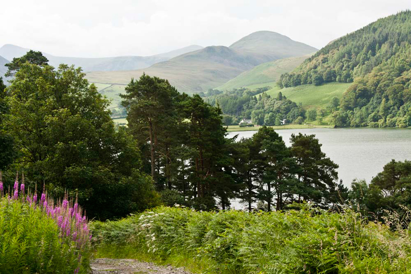
Shaun went on, "today our start point is by Loweswater. We will ignore the turn to Crummock and keep ahead. This will take us through the village of Loweswater and then we continue by the lake, to the road side pull off just beyond the track signed 'Mosser
unfit for cars'."
While Dad got ready we hopped down
the the edge of the lake. "What are those hills on the other
side?", asked Little Eric.
"Carling Knott & Burnbank
Fell", replied Allen.
Tetley adding, "which we all
climbed in July 2009 from Lamplugh."
Dad was now ready, so we settled in
his rucksack. Walking the short distance back along the road, we took the track to Mosser. It is surfaced, but rough in places,
hence the sign 'unfit for cars'. It climbed steadily coming out
of the trees, where we paused to take in the grand view of the
lake and fells beyond.
"There's Little Dodd and Hen Comb", pointed Tetley. "We will be having an adventure to climb them in the near future."
"The foxgloves make a colourful sight beside the track", commented Allen.
Dad
spotted an animal ahead and said, "look Lads that's a fox."
It was completely unaware of us, and we watched it, until it disappeared let off the path, its brush of a tail being clearly seen. "I've never seen one before", said Little Eric. "Lovely."
Soon now,
we reached the stile on the right signed 'footpath to Foulsyke'.
"That's our route", called out Shaun.
Here the real climbing started as we ascended steeply. "Thankfully not as steep as Scale Knott", said Dad.
The path zig-zagged through the
bracken and then on by the fence. When this turned away left, Shaun said, "keep ahead over the stile for the summit of Darling Fell."
Beyond a shallow dip, is a cairn. Allen said, "that appears to be considered the
top of the fell, but the actual highest point is immediately beyond the stile."
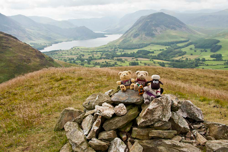
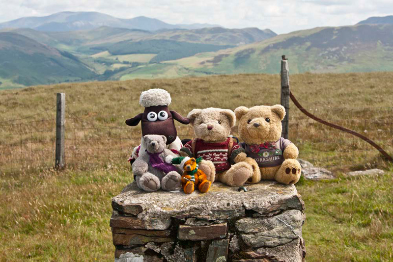
"Well that's the outstanding
Birkett done, just 13 left now", said Tetley brightly. "Picture time pals."
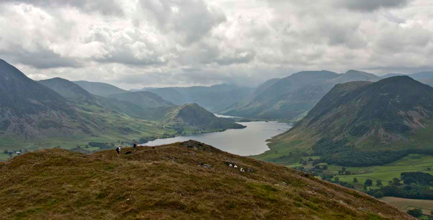
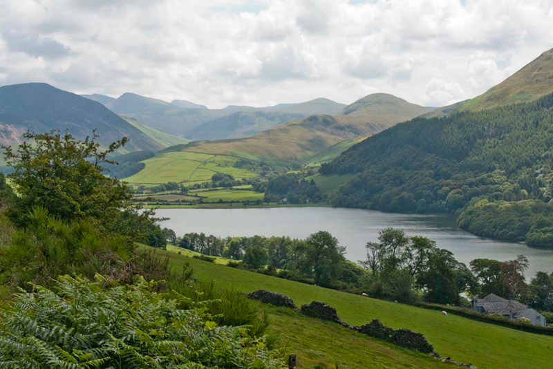
Then we sat for a little while to look at the superb view. "A true classic of Crummock Water with Buttermere beyond", said Grizzly. "Rannerdale Knotts is above Crummock to the left. On the right is of course Mellbreak that we climbed on our last walk. Distantly behind that is the Buttermere Ridge, of High Stile, High Crag and Red Pike."
"Breathtaking", said Little Eric.
Settled in Dad's rucksack again, "we descended steeply, to cross
Crabtree Beck and rise up the other side. At a junction, Shaun said, "we want the right fork to Loweswater Fell."
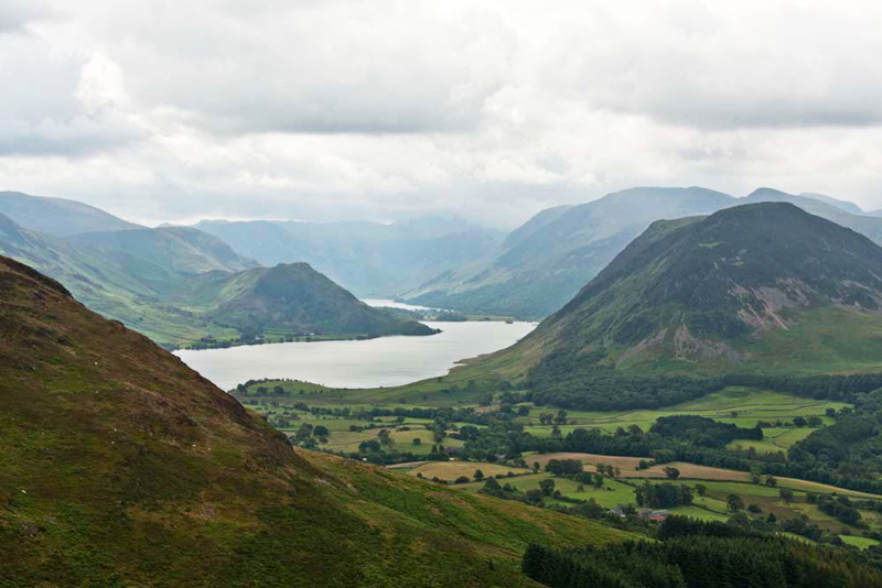
A cairn marks the top and we quickly scrambled out and sat on it.
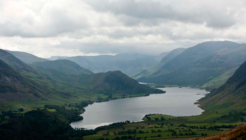
Once again there was that breathtaking view of
Crummock Water, Buttermere and the surrounding fells and
mountains. We make no apologies for including the shot Dad took.
Here we met a couple from Gloucester and
Dad chatted to them. They had climbed via Darling Fell, but were
now going down. There was a little expression of surprise, when
Dad said we were doing all the tops!
So tearing our eyes from the view,
Shaun said, "we now go north for Low Fell."
Descending, a stile was crossed, to then climb on up the
nose to the cairned top of Low Fell. "This is our highest point today", commented Tetley, as we settled on the cairn.
Looking south we again had that breathtaking view of Crummock Water with Buttermere in the distance. Allen said, "the advantage of the view from here is that we can see all of Crummock Water."
Dad said, "I recall after a particularly tough walk taking in Mellbreak and a few other tops on a hot day, I went to the Kirkstile Inn at Loweswater for water and a pint. Chatting to some of the locals, one said 'the view from Low Fell is one of the finest in the Lake District'."
"Can't argue with that", said Allen earnestly.
Tearing our eyes once again from the view, we set off, the path meandering up and down and crossing two stiles.
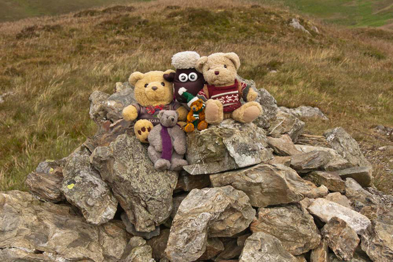
Immediately beyond the second, Shaun called out, "we abandon the path for a while, to climb left to summit Sourfoot Fell."
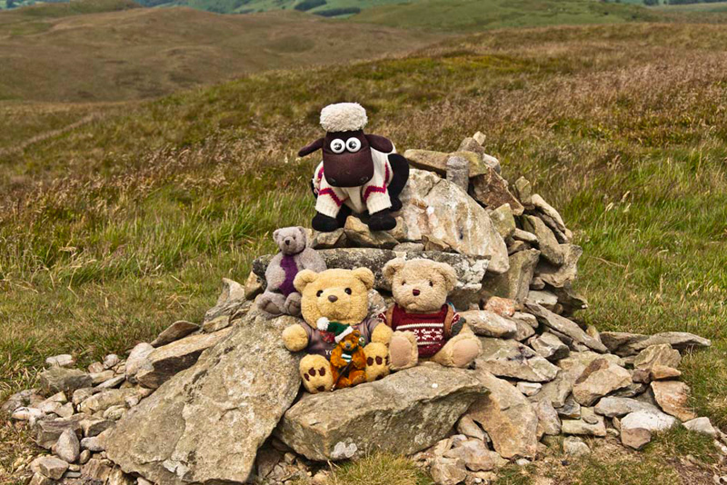
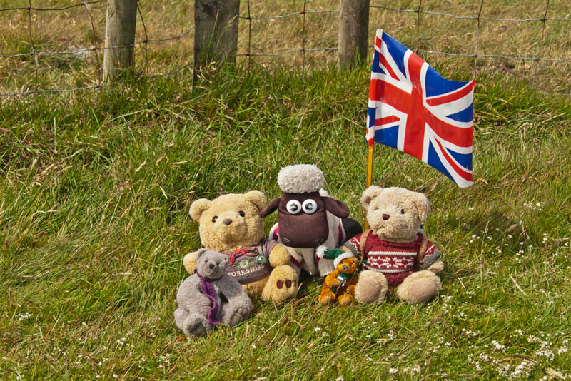
Just a few stones mark the top, and we gathered round for the obligatory picture. "Can we have the flag to add some colour, please?", said Little Eric.
Grizzly said, "according to Diana Whaley, the first part sour could refer to muddy ground from the Old Norse saurr. She goes on the say that to describe the place as the foot of this would be apt, since 'this is where the gradient levels out and a spring line created wet boggy land'. She credits Mr Danny Leck for this information."
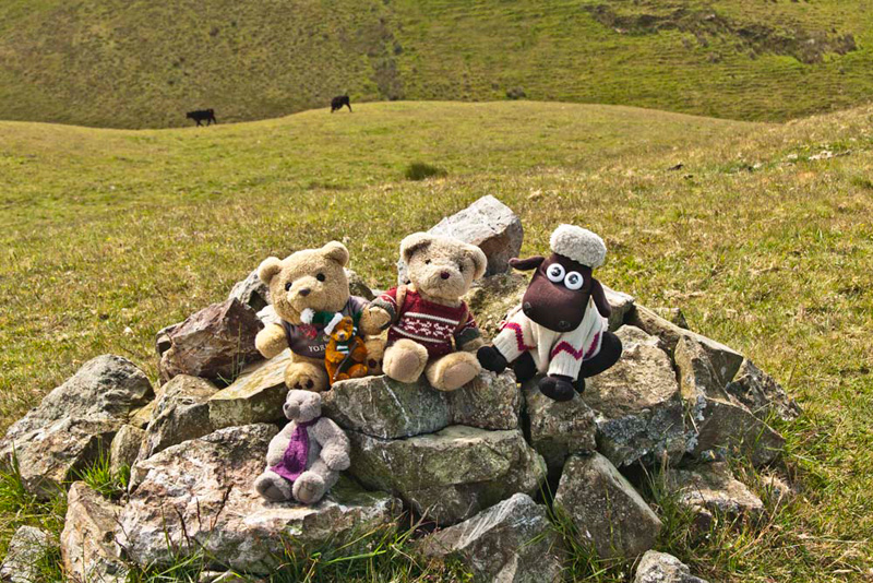
Off again, after a short steepish descent, the path was rejoined, that then led via a short climb to Smithy Fell, the highest point clearly being at the
fence corner.
Once again Grizzly added interest to our adventure with details about the name. "According to Wainwright in his chapter on Fellbarrow, a smithy site nearby is not unlikely, given the proximity of a drove-road."
Onwards we descended to cross the stile left, and then with the fence to the right a steady climb brought us to the trig
point on Fellbarrow, bring the highest point on Mosser Fell.
Allen said, "we must pause and think about Uncle Bob. I recall seeing him taking a picture of this grandson Jack,
standing on this."
"What a lot of wonderful
adventures we have had since, with him", said Shaun.
"Fate certainly dealt us a
good hand that day", added Tetley. "let's hope he soon recovers from his ankle injury so we can have more adventures."
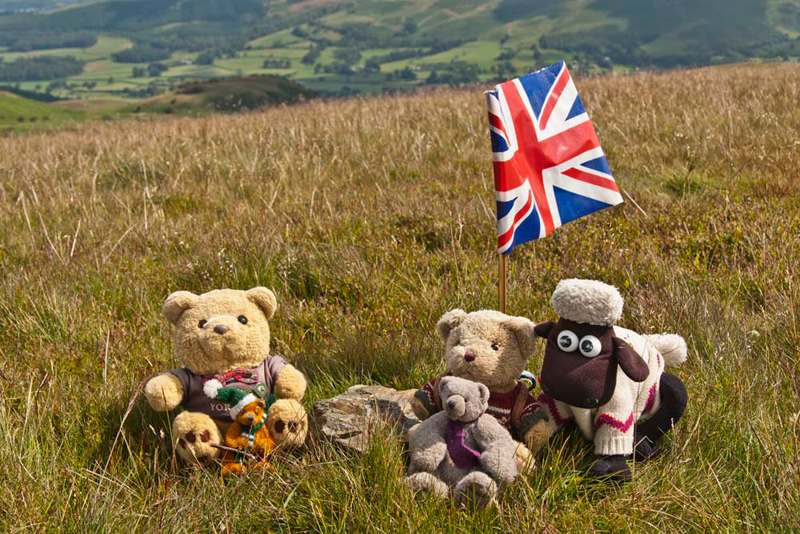
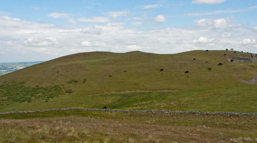
"So that leaves just one top to go Hatteringill Head on Whin Fell", said Shaun pointing to the north.
Heading down, Dad then climbed the
ladderstile over the stone wall to gain access. On the slopes
the cows had young.
"We need to be wary", said Dad. "I plan to take a wide circuit left to avoid them."
As we approached the cairn, Allen said, "that's sods law", seeing the calf standing beside it.
After a minute or so it did move
away, so we leapt out and settled quickly on it for our
picture.
Tetley said, "this summit is the most northerly of the Western fells."
Quickly back in the rucksack, we retreated to the
ladderstile and retraced the path to Fellbarrow. As the trig
point came into view, we remembered, once again how we had seen
Uncle Bob taking Jack's picture standing on it.
Earlier today, Dad had of course taken our picture sitting on top.
"Which way now?", asked
Little Eric.
Looking up from his study of the
map, Shaun replied, "we should head west down Mosser Fell."
Taking a bearing, Dad fixed this on
a piece of distant woodland, keeping this as much as possible
directly in front as we descended. There was an intermittent path
that became clear as it led through bracken. By now we could
clearly see the track we needed to gain that led to the Mosser
track once again.
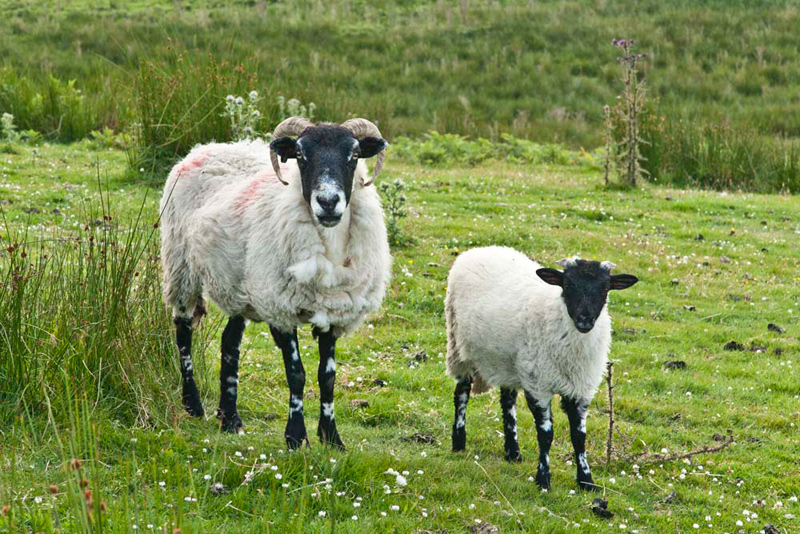
Sheep were grazing and Allen let out an, "oh no, there goes the sheep picture free story again", as Dad snapped this of a ewe with its lamb.
Once the Mosser track was gained, we went left to the start, with at times beautiful views of Loweswater and the
fells beyond.
"It has been a great day, and
we have all finally completed this group of fells", said
Allen enthusiastically. Laughingly he went on, "I guess it
is cafe time now Dad."
"Absolutely. I'm going to
Greystone House, of course."
Here he enjoyed a pork and apple
burger with salad, followed by delicious apple and blackcurrant
crumble with custard, and of course plenty of tea.
"A grand day out", said Tetley, as we headed south on the M6 for home."