LANCASTER CANAL, RIVER KEER, WARTON & YEALAND CONYERS from BORWICK
Summary
Date -
5th January 2013 & 22nd January 2014 (with Uncle Eric)
Distance - 8.5 miles
Ascent - 630ft
Map - OL7
Start point -
Parking by canal at Borwick (SD 5242 7295)
Summits Achieved
No summits were reached on this walk
Preface
It was Christmas Day, and replete from lunch with all his Hug pals, Allen rubbed his tummy with satisfaction, saying, "Dad has indicated that our next walk will be in the Arnside/Silverdale area. So let's hope the weather will allow us to get out before the end of the year."
"That would be nice", replied Little Eric.
There was much merriment amongst the Hug, as they split into various groups chatting away. Scooter, Higgy and the rest of the Railway Bears, were musing over the prospects for the completion of the Bluebell Railway's link to East Grinstead, and hoping that Dad would take Uncle Brian to see his sister Joyce in Kent, so that they could travel on the newly opened line. Rex and Starbuck, our theatre going bears and Wayne and Crumble who go to the classical concerts, were talking about what they had seen and heard this year and what was to come in 2013. And so on.
Our new pal Wray who sits with us said, "I know that I will not be able to go on walks, for the simple fact that there is not any more room in Dad's rucksack, but I love to hear the tales you tell me about past adventures, and so do you mind if I sit in while you decide on the next walk."
"Not at all", replied Tetley, giving him a hug.
"There is a book in the map drawer of walks in Silverdale & Arnside, so perhaps that would be a good place to start", suggested Grizzly.
"I'll go and get it", said Allen helpfully.
We then poured over the list in the index, which would have been more helpful if the distances had been shown.
"Some we have done only recently, and others are rather short", said Shaun rather despondently after a while.
Wray who had been sitting quietly, piped up, "there are a few walks at the end of the book in the area nearby, so how about having a look at them?"
"That's a good idea", replied Tetley.
"Look", said Grizzly, "what about this one. I know we have done the Lancaster Canal before, but I do not think that any of us have walked by the River Keer, and then the route to Warton and under the crag is new too."
"I think that is a great idea", replied Allen. "Thanks Wray for suggesting we looked at these walks."
"You're welcome pal. Anything to help, and I look forward to you telling me about it afterwards."
"Right", said Allen, "I will go and see Dad later, after they have finished watching the Nutcracker ballet."
This he did and Dad liked the idea. However we were not to do it this year, as on the day planned it rained all the time. Dad then said he would take us on New Years Day, but again the weather was rather poor. It was the Saturday then when Dad was next free to walk and thankfully the weather behaved itself, so we were able to get our 2013 campaign under way.
We repeated this walk in the company of Uncle Eric, on a day in January 2014, when the weather was rather uncertain, and indeed it rained on the section to Capernwray and along by the Keer, but it was dry thereafter. It was nice to be able to take Uncle Eric along some paths he had not walked before. The distance was slightly shorter at 8 miles, because we did not walk into and around Borwick.
The Walk
As it was not far to the start, we did not have to set off too early. We well recall the early starts in past winters going to meet Uncle Bob in Yorkshire it still being dark as we passed through Hawes after an hours drive. Today it was fully light when we leapt into the car. The way was to Carnforth then north to the third roundabout, where we took the turning to Borwick, Dad parking at the start of a rough track on the right just before the canal bridge. He soon go his boots on and we settled in the rucksack, but before we set off he took a few pictures, some that will appear at the end of the story, as they fit the sequence better.
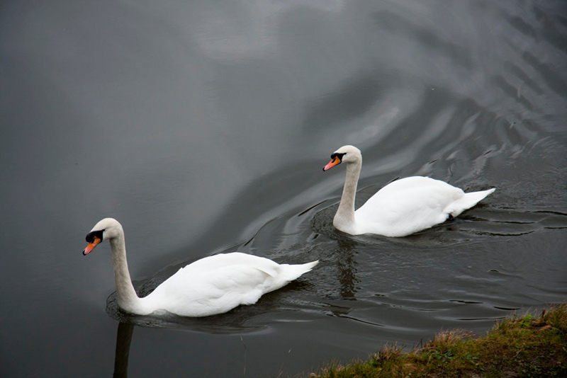
Looking over the bridge to the canal, Tetley called out, "look at those two swans, paddling sedately along, line astern.
"We go through the gate on to the towpath, then head right", said Shaun, checking the book and the map.
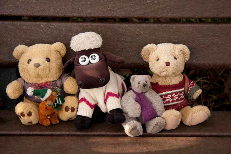
No sooner had Dad started to stride out, when Little Eric cried, "look there's a seat. The ground will be wet and muddy, so it is a good place for us to pose for our picture."
"Good idea", enthused Allen, " and we will make an early appearance too."
"OK", said Dad slipping the rucksack off so we could scramble out. "The seat is wet so you had better sit on the map case."
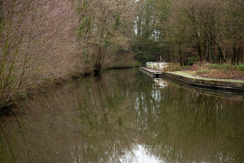
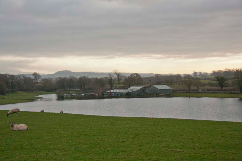
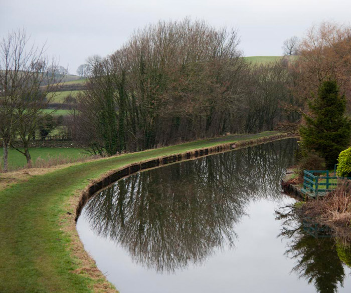
Settled again, Dad shouldered the rucksack and we set off properly this time. Very pleasant, the countryside being open on both sides. The day was cloudy but there was little or no wind, so the surface of the canal was hardly ruffled at all, providing some nice reflections of the trees. Canals are pretty shallow, especially at the sides, but these tall trees we thought give an impression of greater depth.
We had now reached Capernwray, and walking on just a few yards, Little Eric called out, "there is a branch off the main canal. Where does that go to?"
"That is the Capernwray Canal Arm, also known locally as Lover's Creek, which does not go much further than can actually be seen", replied Grizzly. "It is now used as a mooring for pleasure boats, but was originally built to take barges into the heart of Webber Quarry, where they were loaded with limestone. There was also a narrow gauge railway that ran around the site, which had quarry workers houses called 'New England'. It is now the New England Caravan site."
"Thanks pal", replied Little Eric, "you are ever so knowledgeable."
"Well, I knew you would ask, so I checked it all out on the Internet", admitted Grizzly.
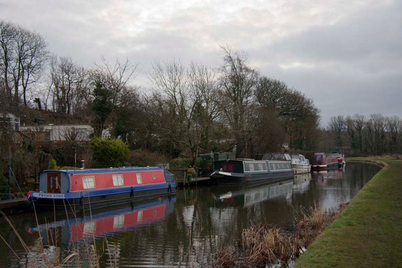
Beyond and in front of the caravan site, a number of barges we berthed on the far bank.
Strolling on, just round the corner, we passed under the railway bridge, carrying the Carnforth to Skipton line, and Tetley remarked, "when we were last here, the bridge sides were all rusty, so it is good to see it restored and repainted."
"In a nice green colour too", added Allen.
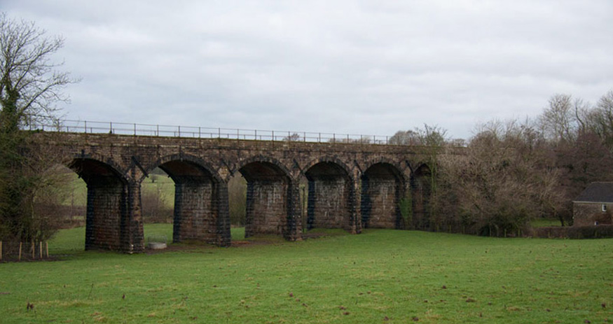
Shortly then we crossed the Keer Aqueduct, that carries the canal over the River Keer. A plaque told us that it is 43ft long and carries the canal 35ft above the river and was first used in 1797. It was designed by the famous engineer John Rennie (1761 - 1821), whosework on canals, aqueducts, bridges and dockyards mark him as one of the greatest engineers of his age.
"We leave the canal at the next bridge, and walk ahead down the lane to a corner, where we then cross the facing stile", called out Shaun. This done he then said, "we now go right under the Keer railway viaduct."
"OK Lad, but first I want to get a picture of it, so we will have to walk ahead across the field to get an angle", replied Dad.
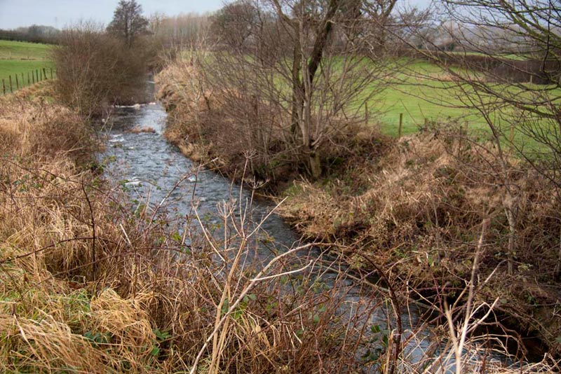
Once under the viaduct, we kept left to cross a stile, then it was diagonally right over the field to another stile to come beside the River Keer, that danced along beside us. It rises on Docker Moor near the village of Whittington in the Lune Valley, then flowing past the villages of Capernwray, Borwick and Warton before reaching Carnforth. Here it then runs through salt marshes to enter the Kent Estuary and finally Morecambe Bay.
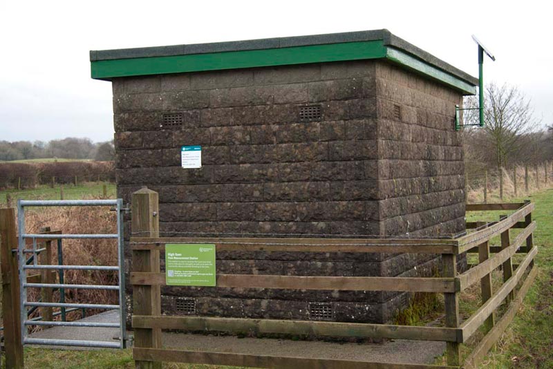
The way now led over two more stiles, passing this small building.
"I wonder what that is for?" remarked Little Eric.
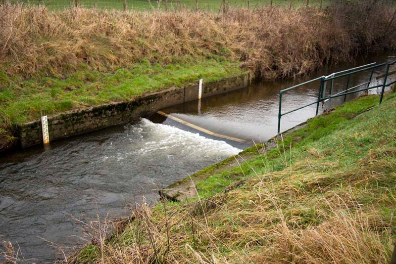
Reading the notice, Grizzly replied, "it is the High Keer flow measurement station for the Environment Agency. The station is used to monitor the local river level and to help plan for droughts as well as to warn the community about potential flooding to the area."
This was done as far as we could see via this small weir linked to the measuring equipment.
Continuing we finally we reached the Over Kellet road, by climbing a steep gap stile in the wall.
"We need to cross the bridge and then go through the gate immediately on the left to continue along on the opposite bank of the river", advised Shaun.
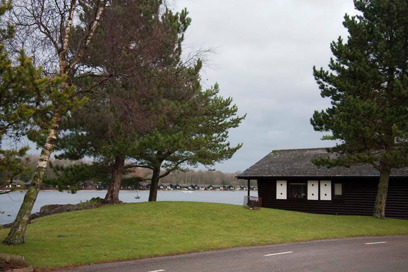
Compared to the open fields we had walked over before, this path was narrow and muddy. It brought us eventually along beside Pine Lake Resort with its log cabins clustered on the shore of the former gravel pit called Dock Acres.
"We leave the river here, and keep going right round the perimeter of the resort", called out Shaun.
The path was narrow and overgrown, and it would have been much easier if we could have walked along the surfaced road within Pine Lake. Still Dad ploughed steadily on coming to and crossing the road access, then on again along another narrow overgrown path, to a gate out on the the grass verge by the A6 road.
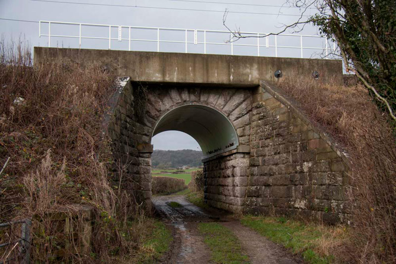
"Right", said Shaun, "now we need to cross the road and take the track ahead, that leads under the railway bridge.
"We've never been on this path before", remarked Tetley.
As we approached the bridge, Grizzly, said, "look how that arched metal sheet has been inserted to strengthen the original stone arch."
At the end of the track we passed by Boon Town Farm and joining the road then walking left into the village of Warton.
"At Main Street, we turn left then go right uphill just before the Black Bull public house", advised Shaun once again.
After a while we reached a right turn, but Allen said, "I do not see the Black Bull."
"That's because it has been renamed the George Washington" said Dad. "He of course was the first president of the United States of America, and his ancestor of seven generations, Lawrence Washington, is rumoured to have helped build the village church of St Oswald."
"Thanks for the history lesson", said Little Eric.
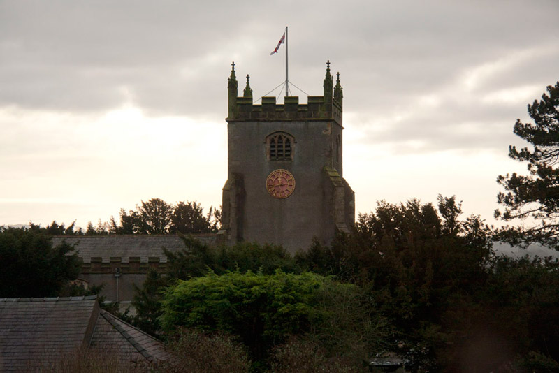
It was only very short climb to the car park in the long abandoned quarry, where looking left the solid tower of the church stood out against the grey sky.
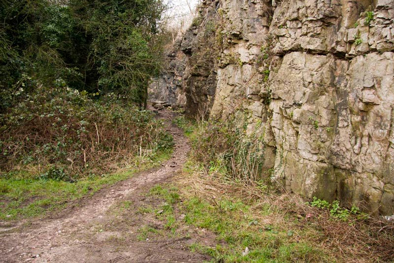
Entering the car park, we could clearly see our route, the narrow path at the top, under the rock face.
"OK we keep on this path to a junction, where we go right", said Shaun.
This Dad did the path being rather rocky, unsurprisingly. Almost immediately after turning right we passed through a gate to another junction.
"We keep on ahead here", instructed Shaun.
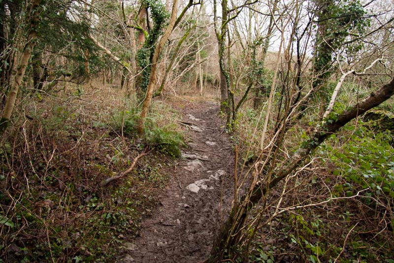
Effectively now we were walking along the lower slopes of Warton Crag. It was nice through the woodland, and would be nicer still in summer, when maybe the path would be not a muddy squelch all the way!
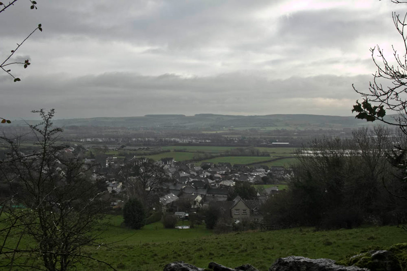
On the day with Uncle Eric, we paused to take in the view over the village of Warton, with distantly, fringed by trees, Dock Acres around the perimeter of which we had walked earlier. The weather on this January day in 2014 was not greatly different from a year earlier, but if anything was more overcast. By the end of 2012 there had been so much rain that the paths were muddy and the ground thoroughly waterlogged. Well December 2013 proved to be very wet too and the paths were in the same state in 2014. It all dried up eventually by spring 2013, and we can only hope for the same in 2014.
The path meandered on and after a short steep rocky section, we reached a gap stile out onto the Occupation Road, a rough track, that runs east/west across the northern slopes of Warton Crag. Turning right a short descent brought us to the Coach Road.
"Ooh look a seat!", exclaimed Allen.
"Time for lunch", added Tetley, "my tummy is rumbling, so I bet yours is Allen."
"Yes", he replied in earnest.
Settled we all munched away on our sandwiches.
"There's my chocolate caramel shortbread for afters", said Grizzly.
"Ooh lovely", said Shaun picking up a slice, after he had poured the mugs of tea from the flask.
Just to the side was a small picnic area too, and looking over Little Eric asked, "what is that structure of a cross bar with metal rings supported by posts?"
After a few seconds, Tetley replied, "it's a hitching post for horses.
We did not hurry, as there was a nice view over the road to a wide field backed by woodland. Then finally before settling in Dad's rucksack, we posed for our picture.
This also proved to be a satisfactory place to stop for lunch, when repeating the walk with Uncle Eric. The seat was a bit wet, that day, so Dad kindly let us sit on the map case, to keep us dry.
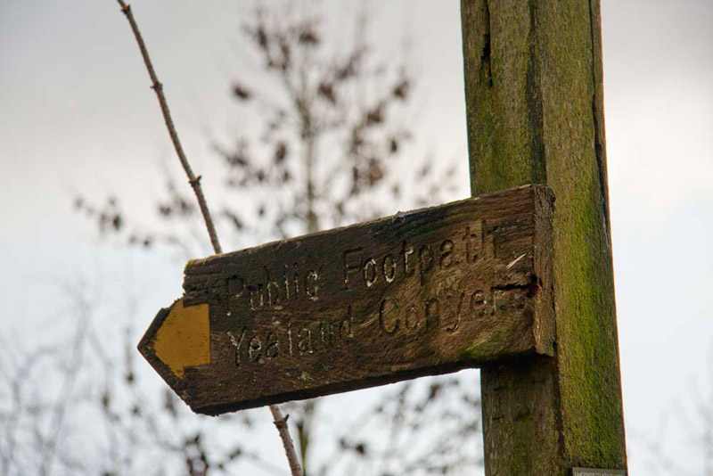
Ready, it was left along the road passing the stables. Two riders were just setting off as we passed by and they followed us along the road, Dad pausing after a while to let them pass and saying hello. We passed two tracks on the left, then soon reached the sign pointing right to Yealand Conyers.
"We take this path said Shaun.
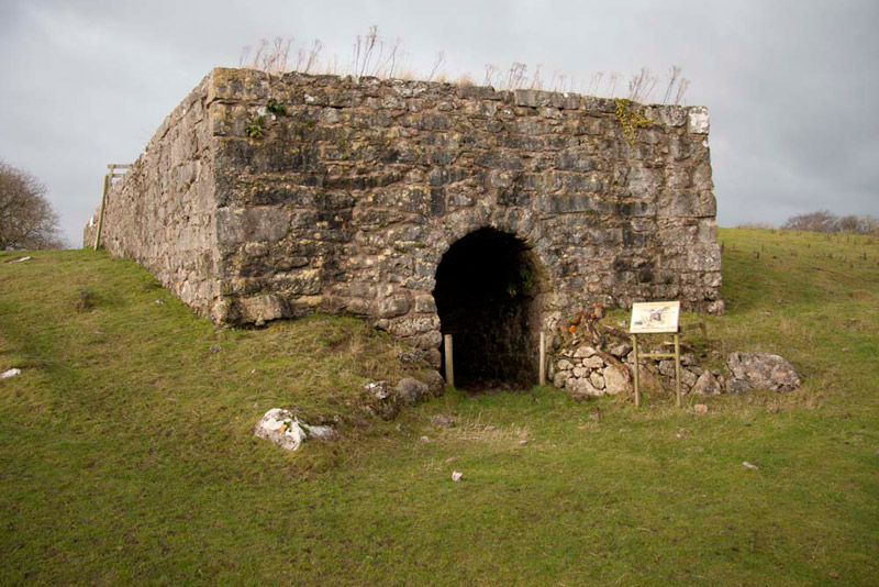
The path led across the pasture to a gate, then on down past Peter Lane limekiln that has been finely preserved and restored.
The information board told us that the first recorded limekiln was in Mesopotamia in 2450BC. Over the millennia the kilns have been used to extract the lime from the limestone, which was abundant in this area, The lime had many uses including for mortar in house building and spreading on the land as a fertiliser.
Onwards, we passed through a gap in trees then swung left to walk with a tall wall to the right, then through some trees to the road.
"We go right here and all the way down the hill to the junction", instructed Shaun.
By the junction is the entrance to Yealand Manor. Now private, it was once the training establishment for the Provincial Insurance Company, who our Dad worked for, for many years.
"I have been here many times on courses over the years", he remarked. "I still remember the induction course I attended just a few months after joining the company in January 1970. There were so many people on it that there was not enough room to accommodate everyone in the manor, so I and a couple of other lads had to stay the fortnight at the village shop."
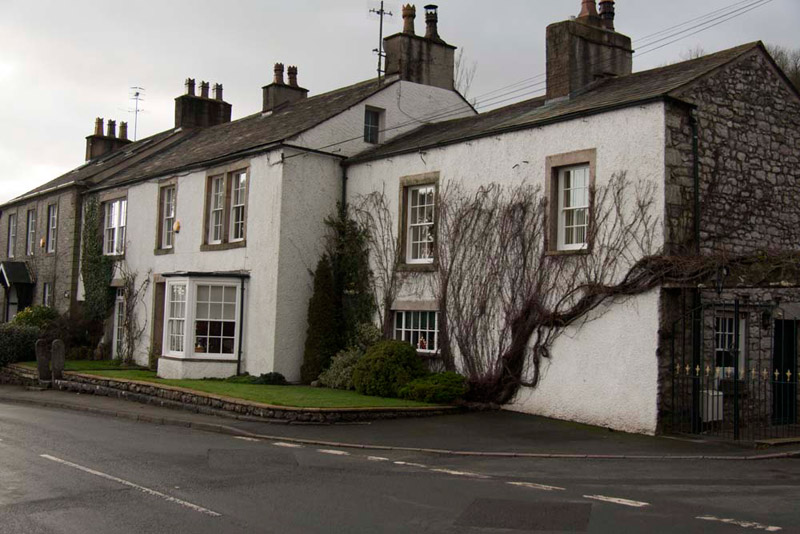
Yealand Conyers is a quiet, pretty village, with nice houses, like these by the junction.
"The way is left down to the next lane going right, but we can avoid some road walking if we take the footpath right just a little way down the road", said Shaun.
"Sounds good to me", replied Dad.
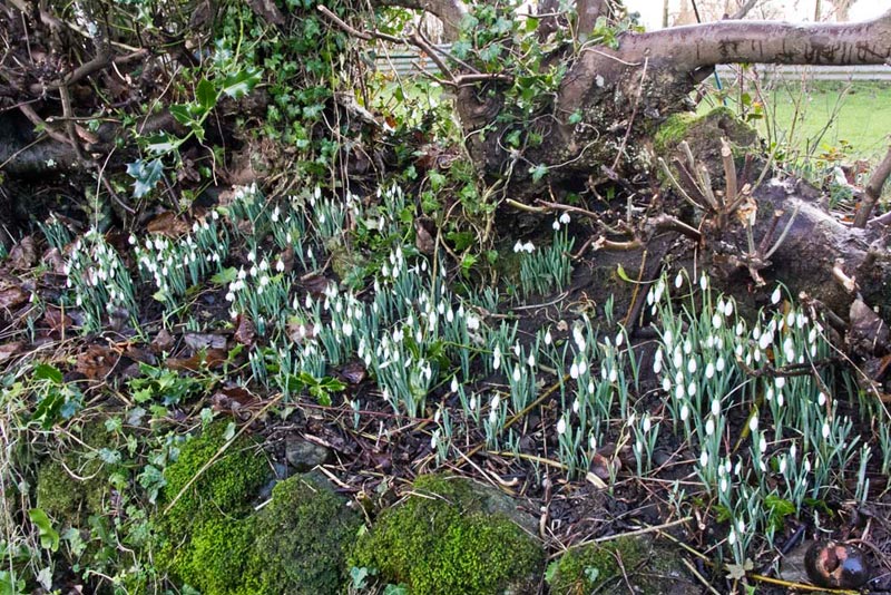
The path was clear to see across the field and led via a gate to a track by Dykes Houses and then going right along the track to Dykes Lane. On the day with Uncle Eric, it was decided to stick to the published route, along the road through Yealand Conyers, then turning right into Dykes Lane, where in the hedgerow, the snowdrops were out, a sign that spring is on its way.
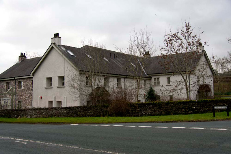
Continuing on Dykes Lane, brought us to its junction with the A6 by Holmere Hall.
Now offices, Dad reminisced once again, remembering going here in his younger days with his mum and dad for wonderful high teas like ham and eggs, super puddings and cakes.
"What a shame it is no longer a cafe, as it would be a good place to take Uncle Brian", mused Grizzly.
We carefully crossed the road and walked up the track opposite past houses and on to cross the West Coast Mainline railway. To the right there was a good view of Holmere Tarn. After all the rain it is very full the water going round behind the buildings, but in the summer it will disappear completely. The buildings are recent being occupied mainly by a plumbing company, but Dad told us that before that the site was occupied as a motor garage. It was certainly a day of reminiscence for Dad!
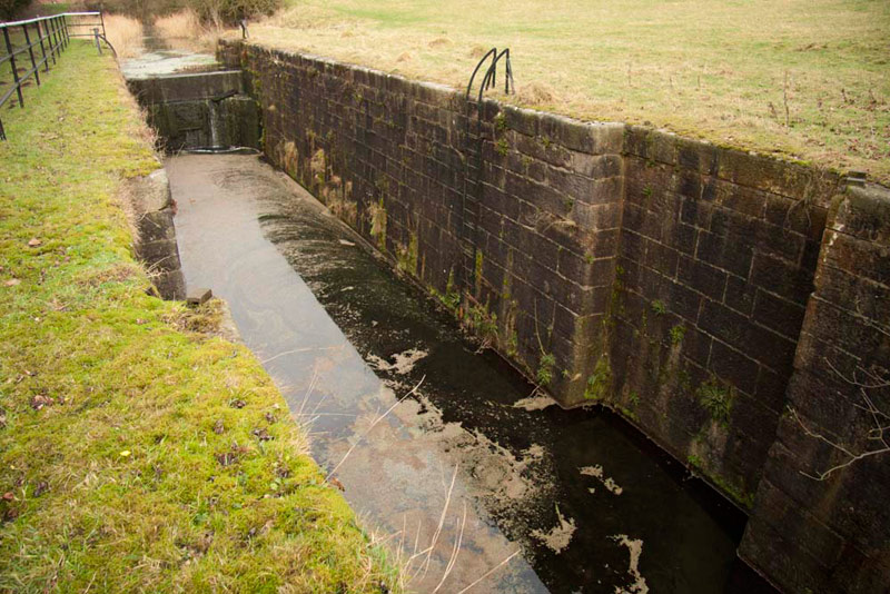
Beyond the railway, we passed through two tall iron gates, to then walk round the edge of a rough ploughed field, then left down and round to the right beside the M6 motorway. At the bottom of the field the path went left under the tunnel and rejoined the Lancaster canal by Tewitfield locks. These locks are long disused, this part of the canal being cut off from the limit of its northern navigation at Tewitfield by an embankment of a bridge spanning the motorway. There are a number of locks and one is shown below. The recess in the wall would have accommodated the lock gate when open.
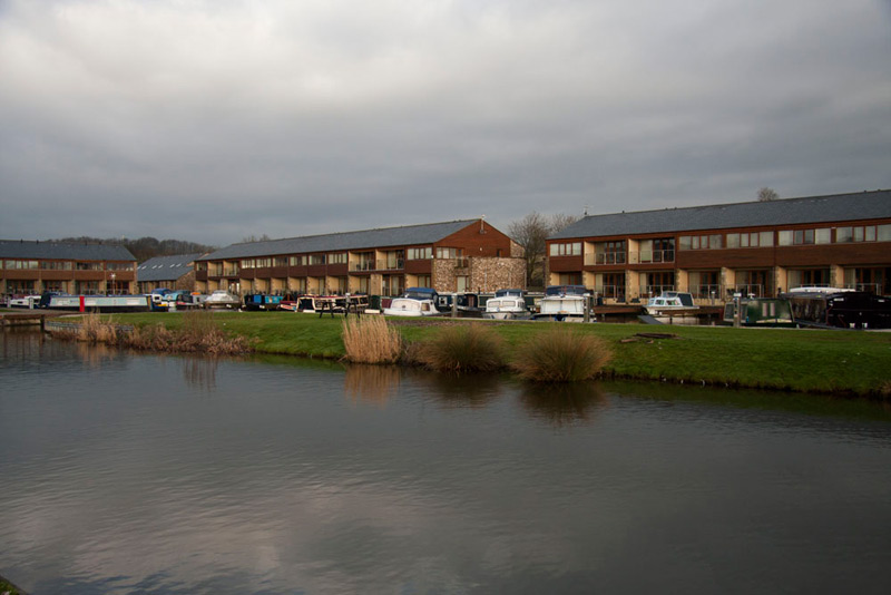
Walked the towpath south past the locks, then under the tunnel to Tewitfield Marina, the current northern end of the Lancaster canal. Here there was an interesting information board explaining exactly what needs to be done to reopen the canal to its full extent to Kendal. All they need is the money! Many millions of pounds too. In these days of austerity it is hard to see that this would be a high priority project.
The marina has accommodation for many boats and there are flats too.
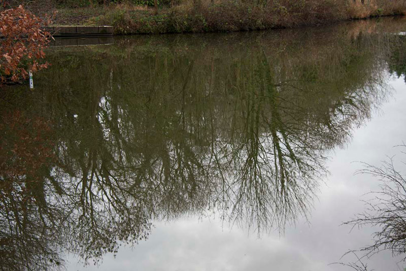
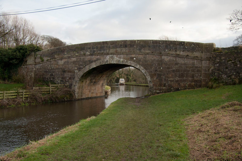
Now all that remained was to follow the towpath south to Borwick, this being the bridge by which Dad had parked the car.
Looking north from the bridge, Dad took this view before we set off this morning, but it seemed appropriate to include it here. Again lovely reflections.
Dad then said, "I'll take you down into the village to round off the walk."
"Thanks, that would be nice Dad", replied Little Eric.
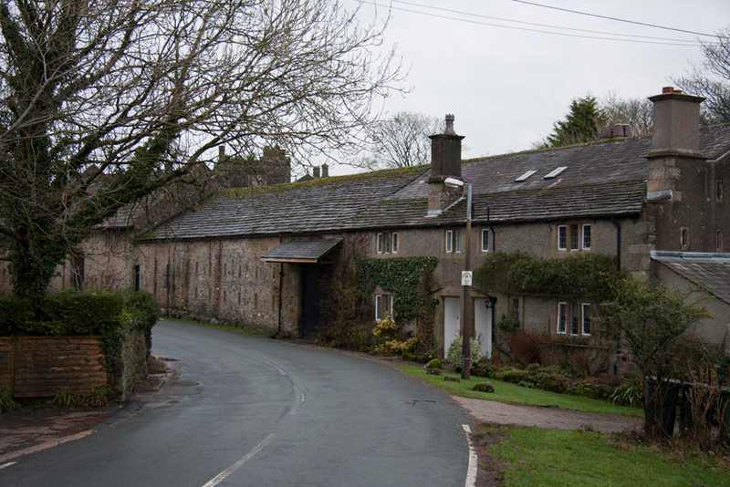
First the stone houses immediately over the canal bridge.
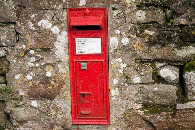
Then set in the wall this old post box dating from the reign of Queen Victoria.
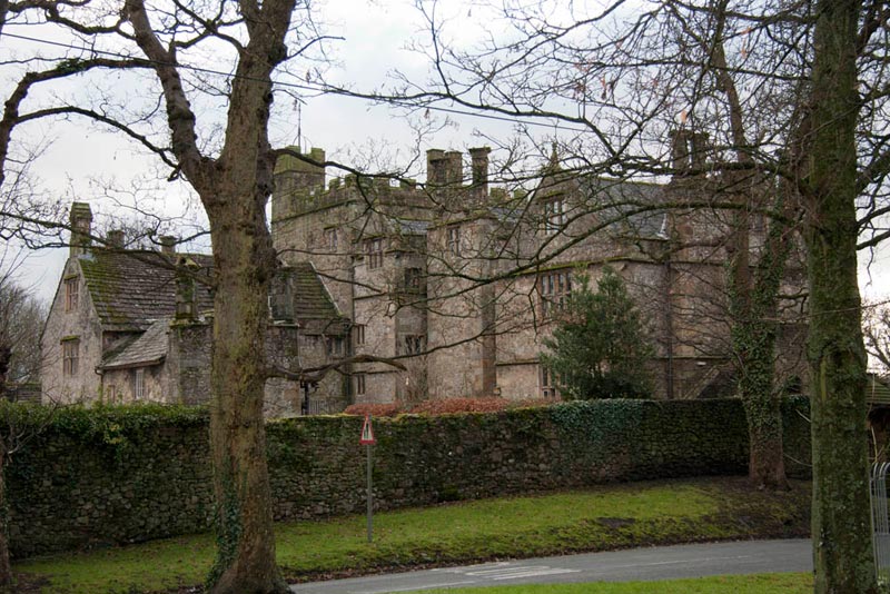
And finally this off Borwick Hall.
The manor of Borwick is mentioned in the Domesday Book as being part of the estates of Roger of Poitou, but the oldest parts of the building still in existence date from the 14th century when a pele tower was built. In the last decade of the 16th century the tower belonged to the Bindloss family and was extended to a manor house by Robert Bindloss.
By the early 19th century the Hall was falling into disrepair and was only repaired in the middle of the century when a tenant was installed with a specific condition to repair the building.
During the Second World War the hall was used as a military base, then afterwards the estate was sold to Lancashire Youth Clubs Association and later passed into the ownership of Lancashire County Council, who operate it as an Outdoor Education Centre.
Thanks for a nice day Dad", said Grizzly.
"Yes" said Allen, "but I'm ready now to get home now for welcome and warming mug of tea!"