DUNMALLARD HILL, MAIDEN CASTLE, DACRE & DALEMAIN from POOLEY BRIDGE
Summary
Date - 27th January 2013
Distance - 9.75 miles
Ascent - 2290ft
Map - OL5
Start point - Pooley Bridge (NY 471 244)
Summits Achieved
Name
Height (ft)
Height (m)
Grid Ref
Dunmallard Hill
787
240
NY 4677 2464
Preface
For once Allen did not have the iPad in paw, but was sitting in front of the laptop, with Little Eric and Tetley peering over his shoulder.
"Here are the pictures that Dad took last Sunday, when we climbed Wansfell", he said, opening up the folder.
"They really get the feel of the day and how wintry the fells looked covered in their blanket of snow", enthused Tetley scanning the thumbnails."
"What is clear is that there will be plenty enough for a new story", added Little Eric.
"We will have to be patient though Little Eric, as the rate we have been doing walks this year so far, we have built up a bit of a backlog", replied Allen.
"Yes I know", agreed Little Eric. "We are so very lucky to have such a great Dad, to take us on the walks and type the stories, amongst all the other calls on his time."
"So", said Tetley, "let's hope the weather is OK for Sunday, as the plan is to go to Pooley Bridge and climb Dunmallard Hill."
"I'll get the iPad and check the forecast", replied Little Eric.
While he was doing this Shaun and Grizzly arrived with the tea and cakes.
"What delight have you made for us today?" asked Allen, as he and Tetley went to get the mugs and plates.
"Lemon drizzle", he replied, cutting slices for each of us.
So settled with the steaming mugs of tea, we sank our teeth into the cake. "It's delicious", cried Shaun closing his eyes in ecstasy. "Just so so lemony."
"Thanks, just glad you like it" he replied.
Little Eric interrupted saying, "the weather looks to be mostly dry, with just the risk of an odd shower, but the wind will be strong so it will be rather cold."
"Looks good then", replied Grizzly helping himself to another slice of cake. "Roll on Sunday."
"Ooh yes", enthused Allen, "it will be my 999th summit and leave the way open to climb Sellet Bank again for my 1000th."
The Walk
Since our planning, we were rather dismayed to see snow on Friday, but it did not linger long, the rain washing it away, so there was no difficulty for Dad on the drive up the M6 and the short distance west on the A66 to turn left at Rheged towards Ullswater.
Along this road we passed Dalemain House, Shaun remarking, "we will walk to there on the second part of our walk today."
So just to be clear, we had better explain briefly the route. To take in Dunmallard Hill, we were using a walk published in the Westmorland Gazette, that makes a loop via Salmond's Plantation and the ancient site of Maiden Castle to return to the start, a distance of about 4 miles. Wanting to give us a decent outing, Dad had devised another circle via the village of Dacre then Dalemain, the majority of the walk being over land that is part of the Dalemain Estates.
Reaching the lake, we took the road left and then crossed the bridge into Pooley Bridge. The start point was actually the car park just before the bridge, which even by Lake District standards was very expensive. Pooley Bridge is a busy place in the summer and street parking is very restricted, but such restrictions as relaxed at this time of year, so Dad took advantage of this to park for free.
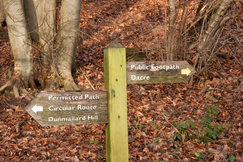
When Dad was ready and we were settled in the rucksack, Shaun said, "we recross the bridge over the River Eamont and then through the gate take the path going right under Dunmallard Hill."
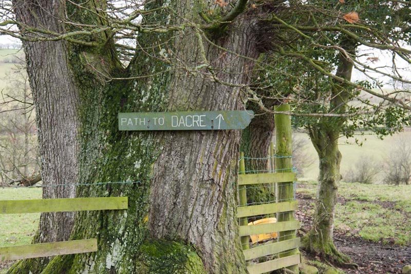
Looking at the signposts, Little Eric said, "Dunmallard Hill is signed to the left. Are you sure Shaun?"
"Yes quite definitely, as the ascent path described by Wainwright is opposite the place where the footpath branches off the circular route, towards Dacre", insisted Shaun.
"Well you're the expert", responded Little Eric.
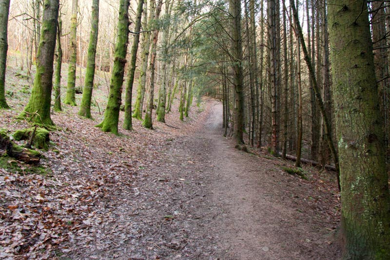
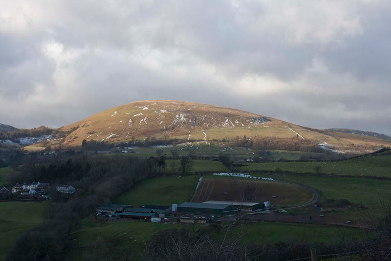
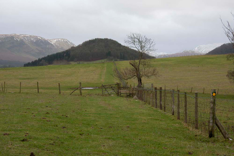
The path was wide and rose quite steeply for a while on its circuit of the hill, through the trees that cover Dunmallard all round and from foot to summit.
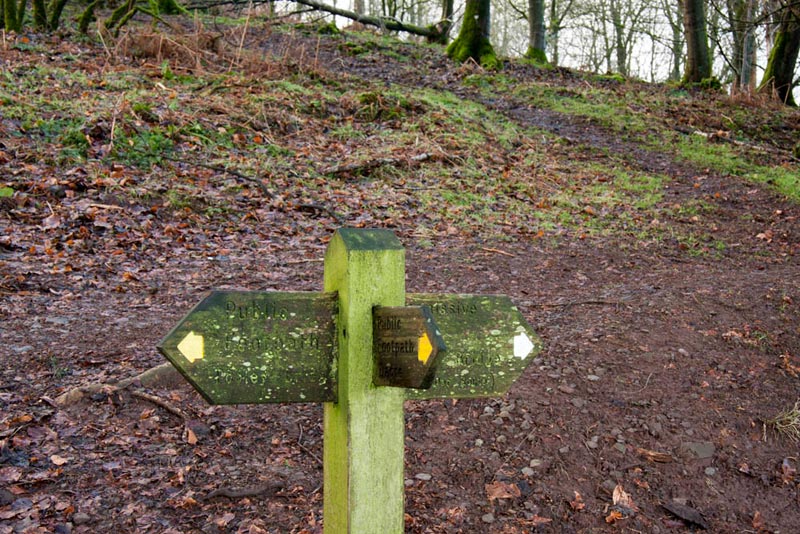
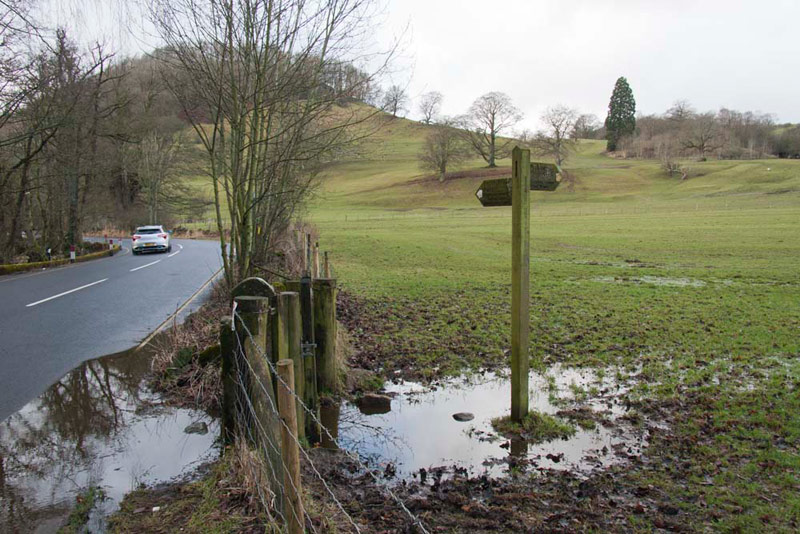
After a little while the path levelled out and we reached the signpost directing walkers right out of the trees and over a stile on the path to Dacre.
"We take the unsigned path left that climbs the hill", called out Shaun, and which can be seen in the rear of the picture below. The other two arms of the signpost merely indicate the circular route for walkers who have approached on the path from Dacre.
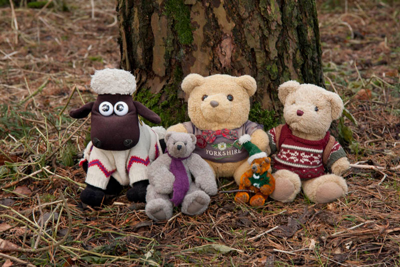
This was steep, but Dunmallard being of very modest stature compared to many of the fells and mountains, it was not long before we were at the mound that is clearly the summit. Here we sat by one of the trees for our picture.
"Yippee", cried Little Eric. "That's another Outlyer ticked off and my total is up to 90. Just 14 to go to complete the challenge."
Taking in the summit had been a diversion from the published walk, so Shaun said, "we should descend the way we came up, and then continue left on the circular route."
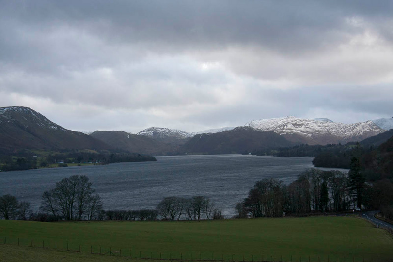
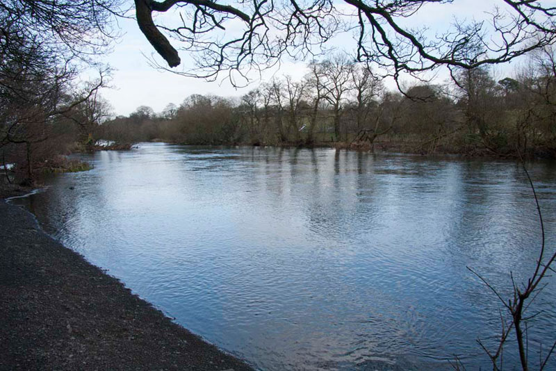
As we walked along a gap in the trees opened up a wonderful view along Ullswater. "That's worth a picture", called out Tetley.
"What can I see?", asked Little Eric.
Allen replied, "the large fell on the right with the snow is Place Fell, with the dark mass of Hallin Fell in front. To their left, the fell with the snow is Gowk Hill, with in front to dark mass that is Steel Knotts, whose summit goes under the wonderful name of Pikeawassa!"
Little Eric replied, "thanks pal, I suppose I will get to be able to rattle the names off myself soon. I do recall that I have climbed most of those you mentioned."
Going on, it was not long before we saw a narrow path dropping right to a stile. "We need to climb that stile, and then follow the path on above the road, to come to the main A592", instructed Shaun.
This we did passing a convenient seat, but it was too soon for the lunch stop. At the road we crossed to a gate, into a very wet field. The snows had gone, with the milder temperatures, but the downside was that the ground was no longer frozen, so we were back to paddling across the waterlogged ground.
Looking at the picture above, our route is quite well illustrated. It was left as the signpost directed along by the road, although Dad had to go more to the right in the field to avoid the wettest areas. This led to another gate and beyond to a track rising right through the isolated group of trees seen directly behind the signpost. Soon then it was left as directed by the waymark to climb on up into Salmond's Plantation whose trees can be seen in the distant left of the picture.
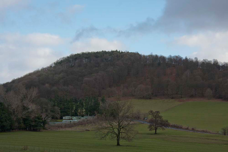
During the final part of this we paused to look back to the tree shrouded Dunmallard Hill.
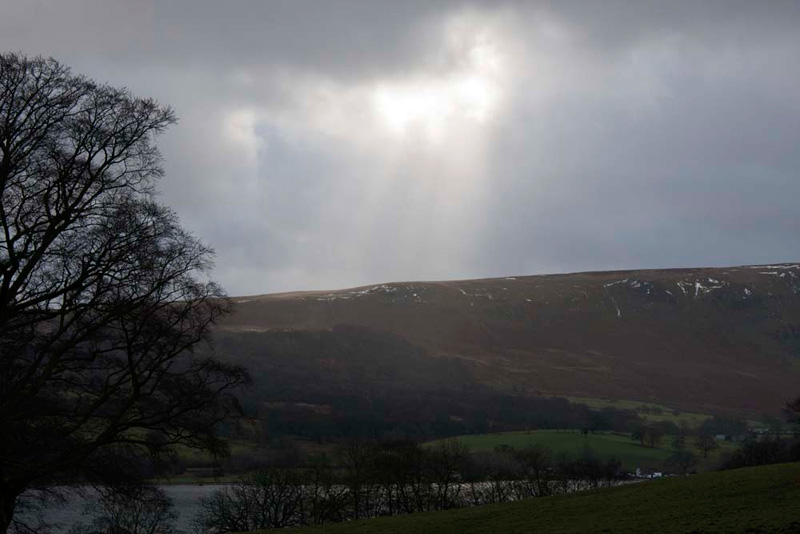
And also Dad captured this of the rays from a brief appearance of the sun over the fells to the east of the lake. More than once today we were to be glad not to be on those fells, as they were subjected to periods of heavy rain, that thankfully passed us by.
Entering Salmond's Plantation, we followed the narrow path through the trees, now high above the lake. This led to a stile in the fence to the right, over which the path doubled back, to then at a prominent waymark, double back left yet again just below the highest part of the hill. Now on open ground the path led to a stile into pasture beside Rumney's Plantation. The ground was very soft and cut up too, so this bit was hard work and Dad was glad to get to the stile out of this.
"What a lovely view of Little Mell Fell, bathed in sunlight", called out Grizzly.
"Where now?", asked Allen.
"We go right to descend to the bottom by the hedge, and then right along by the taller hedge to a barn", replied Shaun.
The descent was easy ground, but the ongoing pasture to the barn was boggy, especially so on the last section where Dad's boots constantly sank in up to this ankle, before he gained a solid farm track.
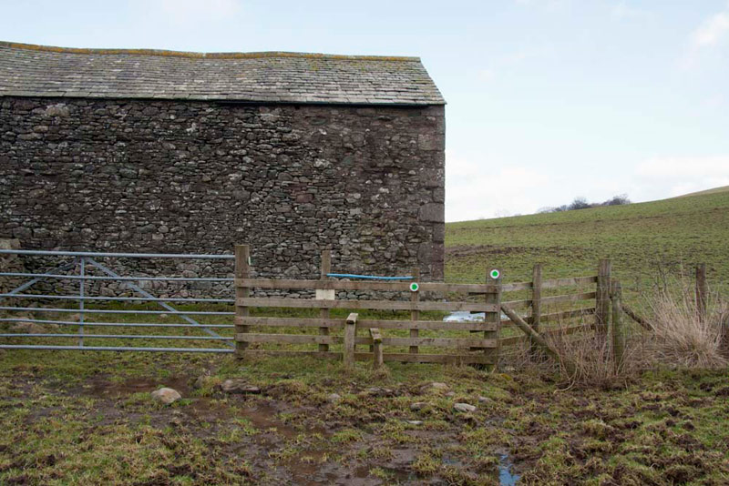
"I am sorry, but I forgot to mention that we have to climb the stile by the barn, meaning Dad you will have to recross the soft ground", said Shaun apologetically.
This is clearly illustrated in this picture.
"Hmm, I don't fancy that", replied Dad. Then thinking for a few seconds, he went on, "I bet if we go along the track past the barn, we will find there is a gateway into the field beyond the stile."
He was right too!!
We now walked ahead over this huge field and at its end crossed a stile, to then immediately go left over another stile and climb steeply up the field to Maiden Castle.
"I don't see any walls", said Little Eric.
"Look there is an information board over there", called out Tetley. "That will tell us all we need to know."
Maiden Castle is a defended settlement (probably home to a family group) of the 1st millennium BC and would have been located within or near to arable fields.
The enclosure we could see is circular, having a diameter of about 65 metres and is defended by an inner rampart, ditch and counterscarp bank. Part of this can be seen in the picture below.
The ditch and the banks, which may have been topped by wooden fences, would have been much more substantial than they are today, to provide protection against attackers.
We noted also the two circular platforms of about eight metres diameter that might indicate the position of circular huts. They can just about be made out in the shot below.
These are likely to have been of timber construction, with wattle and daub walls and thatched roof.
"Wow", said Little Eric. "It's hard for me to understand that people were living here over 2000 years ago."
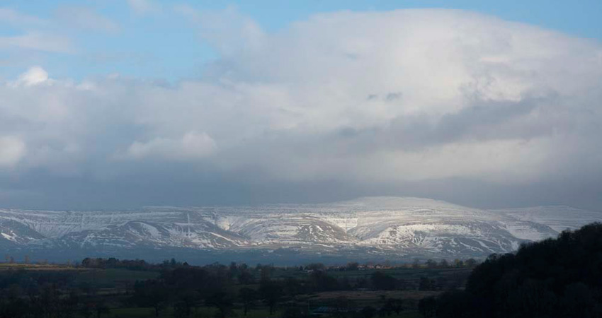
So, having been thoroughly educated in this bit of ancient history, we descended to main path again and continued on over the rough wet pasture to a stile, with this magnificent view of the Pennines with towering clouds, before us.
"We continue on over this next field, going down to the bottom left corner and a stile on to a narrow road", instructed Shaun.
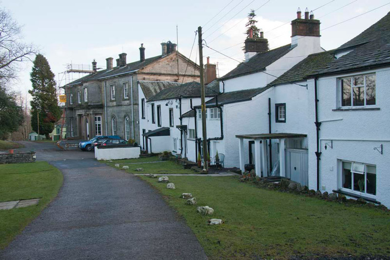
At the road a signpost directed us through the caravan park and past the Waterfoot Hotel, a Georgian building.
Beyond the building a succession of waymarks led us through the caravan park, to emerge via a stile into a field . This was crossed to a gate into the field we had walked over earlier and led back to the flooded gate onto the A592.
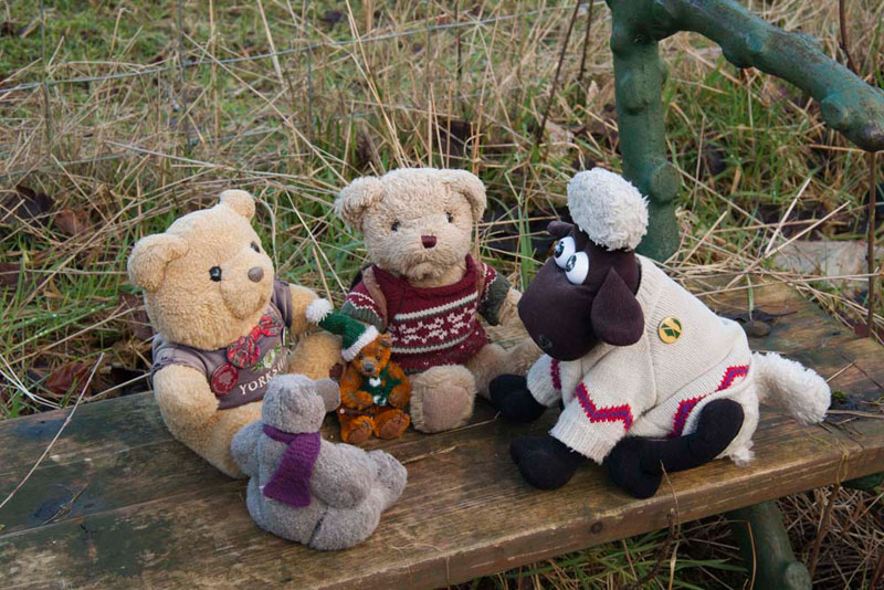
Now the seat we had passed before, provided the perfect place to sit and have lunch and Dad took our picture gathered round, before Tetley said, "get the sandwiches out Allen, my tummy is rumbling."
After while Grizzly said patting his tummy, "that's better."
"Right Lads, time to get going again.", said Dad, so we hopped into the rucksack.
We were now on the outward route and walked along to regain the Dunmallard circular path, going right to complete the circuit and reach the car park by the river.
So, that was the end of part one of the walk. Now from this car park we started part two that Dad had devised from the map, walking ahead as directed by the signpost,
and with the River Eamont, the outfall from Ullswater to our right.
The trees clothing Dunmallard Hill were to the left and once we had reached their end, we continued on through a gate into an open field and then on to next gate.
Maybe it was because Dad was distracted looking at the line of debris when the river had been in flood and remarking about this to us, but we completely missed seeing the prominent waymark. directing us left.
As we reached the next wall and went through the gate, Shaun said, "I am sure we should have gone left before this." Then looking more closely at the map he went on, "going left here will be OK though, as if I read right, the path we should have taken crosses this wall further up and comes into this field."
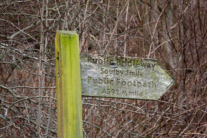
So off Dad strode, and sure enough about halfway, we saw the stile into this large field. At it's end we arrived at a stile on to the main A592. Crossing carefully we then took the path immediately opposite and further across the field, at an angle in the fence, this sign nailed to an obviously very old tree, clearly pointed the way to the road at Soulby.
At Soulby, we walked right to the junction, here turning left as directed towards Dacre. The quiet road bent right then dropped down the hill and looking towards the village Tetley called out, "there's a castle and not a ruin too."
"Let's hope we get to see it properly", responded Allen.
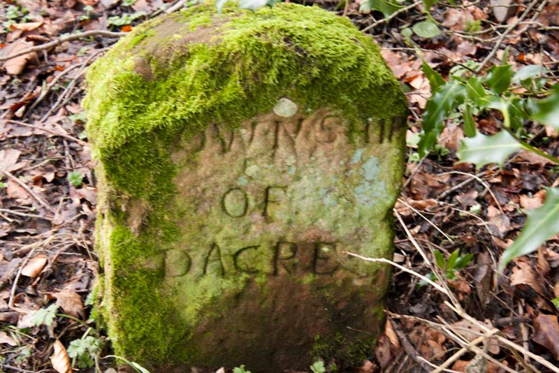
A little further on Little Eric suddenly called out, "what's that beside the road.
Peering closely, Grizzly replied, "it's a stone marking the boundary between the two villages. This side reads 'Township of Soulby', which we are leaving and the other 'Township of Dacre", where we are headed."
"I like seeing things like this from bygone days and it is really only by walking that you get the chance to properly appreciate them too", went on Allen.
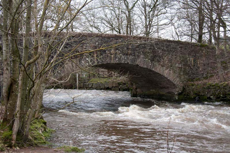
In a further short distance we were entering the village via Low Bridge over the rushing Dacre Beck on its way to join the River Eamont.
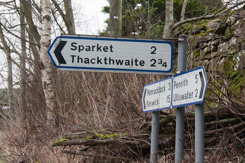
Shortly we passed a road going left. "Those are interesting place names", remarked Tetley. "I wonder what the origin is?", he mused on.
"We can look at Dad's book on Lake District place names by Diana Whaley, which he bought in Cockermouth", suggested Grizzly.
"Good idea pal", agreed Tetley.
This told us that -
Thackthwaite means - 'the clearing where thatching material is found', and that
Sparket probably means - 'the high ground where brushwood grows'.
Now, Shaun was again scrutinising the map and said, "we take the first signed track on the right."
"Thanks Lad", replied Dad.
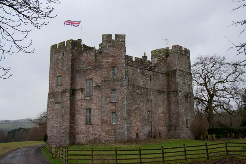
"We seem to have completely lost sight of the castle", said Tetley, but then almost as soon as we had started along the track it was there before us, the Union Jack proudly streaming out in the wind.
Dacre Castle with walls seven feet thick and 66 feet high was built in the 14th century and is really a pele tower, for protection against the Scots. By the 17th century marauding was dying out so the castle was made more habitable by the fifth Lord Dacre, who added the large windows.
When the Earl died in 1715, his possessions were sold off and the castle was bought by Edward Hasell of Dalemain and to this day remains part of the Hasell estate. After careful renovation it has now become a comfortable and extremely desirable residence.
"Where are we heading now?", asked Little Eric.
Shaun replied, "to Dalemain, which is about a mile or so along this track."
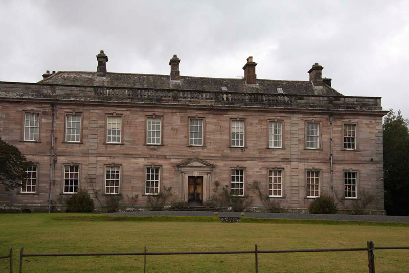
After passing the castle the track descended slightly and curved left, to then become pretty arrow straight between fields all part of Dalemain Estates, to come behind the house. This led into a courtyard, which is where the public enter, when the house is open for viewing. We exited to car park and on round to the front, Dad walking across the grass to get a picture of the house.
Dalemain is a mediaeval, Tudor and early Georgian house with Lake District gardens that has been home to the Hasell family since 1679. The name means 'manor in the valley' and there has been a settlement here since Saxon times. The first recorded building was a fortified pele tower in the reign of Henry II, built like Dacre Castle to protect the country against marauding Scots to the north. To this was added a manor hall in the 14th century, with a second tower and in turn, in the 16th century were added two wings housing kitchen and living quarters, one on each side of the main building. The impressive Georgian front was completed in 1744, and the facade to the gardens was rebuilt in 1748 to match. Since then there have been no major alterations.
Since Dacre we had been walking across part of the Dalemain estate, and the next section to the A592 would be too. The estate also extends to large areas of the fells to the east side and south of Ullswater from notices we had seen on walks in these areas.
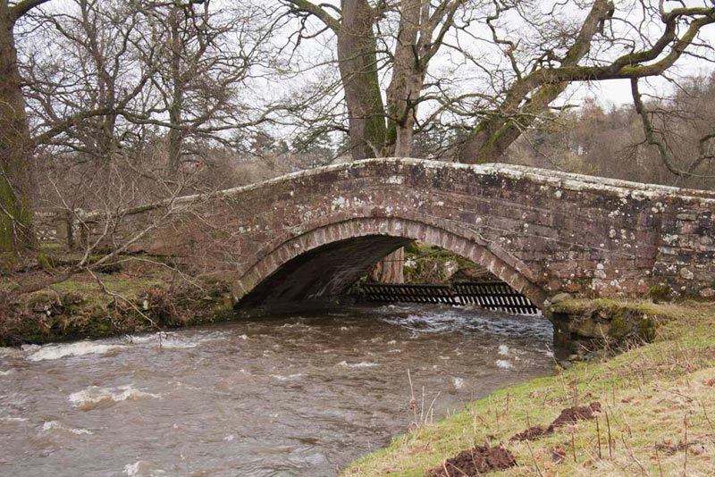
Ahead over the grass was Dacre Bridge, beyond which lay our return path, and we crossed this. This spans the Dacre Beck, now very close to its confluence with the River Eamont.
"We go ahead and climb up to a stile by the woodland", advised Shaun. "This part of the estate is known as West Park. After the stile we continue on crossing more fields and over, according to the map Flusco Hill, then curving right down to the A592 once again."
"Will that be another summit?", asked Grizzly.
"No pal. The summit is in another field off the path, which is not access land for the public."
"Just as well, as climbing Dunmallard leaves me just one more summit to achieve 1000, and that is planned to be Sellet Bank, near Kirkby Lonsdale", said Allen.
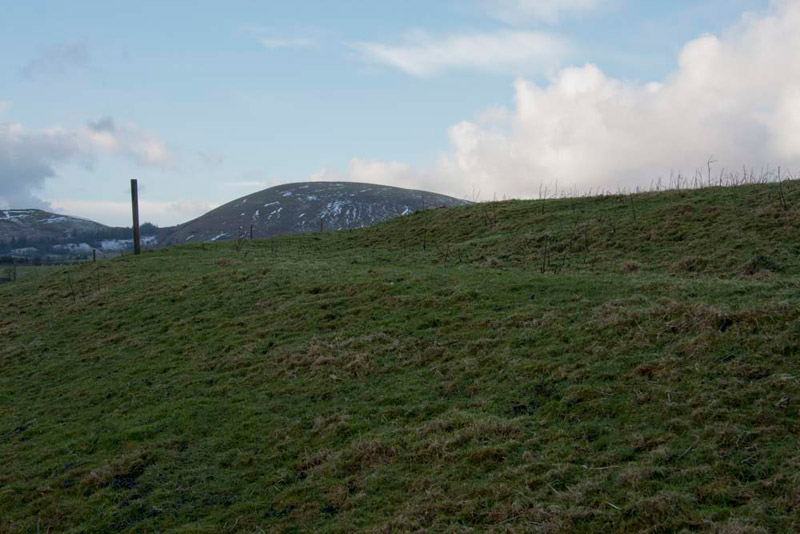
After the first stile the view ahead opened out and Little Eric called out excitedly, "that's Dunmallard Hill we can see."
As Shaun had said after the brow at the end of the green path by the fence the path swung right and dropped down. The footpath continued right, but Dad took a track bearing left to a gate so cutting off the corner.
"We go left now on the road and then right over the stile, just before the corner", instructed Shaun.
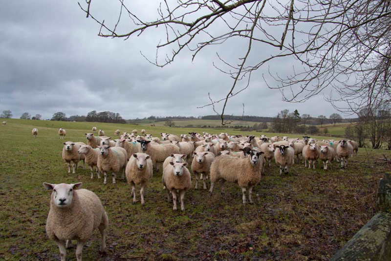
Immediately over the stile the path dropped down and then followed over three tiny bridges crossing small streams. Into the next field the sheep spotted us. Whether it was Shaun, or the fact that they thought Dad was bringing food, all of a sudden they came across as a flock, baaing loudly and following as we walked along. What was even more embarrassing was that the flock in the adjacent field joined in too!
"Well", laughed Tetley. "It's not the first time this has happened Dad."
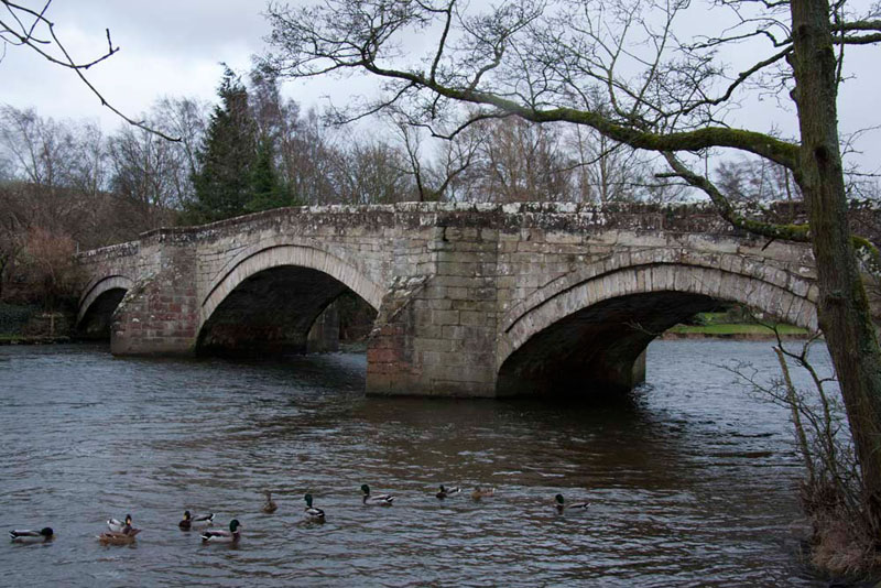
In a few yards we reached a stile over the fence, where to the left was a small pond. Beside this and around the gate right through the next fence, the ground was especially wet and muddy making for awkward progress, but soon we were past and on more solid ground. Now we were beside the Eamont once again and we followed the path to rejoin the outward route and return to the car park by the 16th century Pooley Bridge, after which the village takes its name. This derives from a large pool in the River Eamont, just before it flows out of Ullswater which gives the name Pooley. The village was once known as Pooley How, meaning the pool by or below the hill (Dunmallard). It assumed its current name as a result of the bridge being built.
As we walked into the village Tetley said, "the cafe is open Dad, so I guess you are going for some refreshment."
"I wonder what gave you that idea", laughed Dad in reply.
This is Granny Dowbekin's cafe where he had pot of tea with extra hot water and chocolate caramel shortbread. "It was very nice", he told us. "There is a very extensive menu and I am sure it is a very busy place in the summer months. It was doing a pretty good trade today. They do homemade gingerbread, so I have bought some for you to take for Uncle Brian."
"Thanks Dad", cried Tetley. "It is ages since we took him a gift."
"And thanks for another lovely day out", added Little Eric.
"Roll on the next walk and my 1000th summit!", cried Allen with feeling.