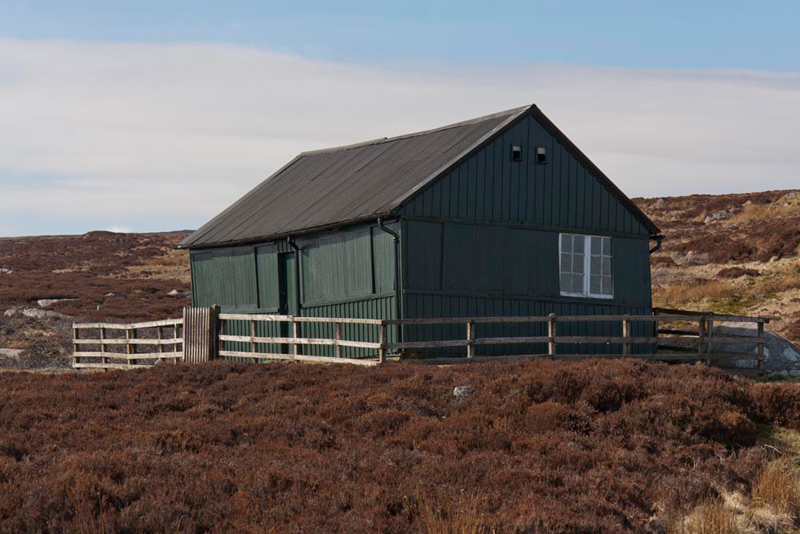
Allen, Tetley and Little Eric were sitting looking out of the window, and watching the birds busy at the feeders on the tree at the bottom of the garden.
"We seem to get a lot of those cream coloured ones with red markings", said Little Eric. "What are they?"
"Goldfinches", replied Allen. "We also get chaffinches and less frequently blue tits and great tits."
"It's lovely to see them, thanks to Dad keeping the feeders topped up", added Tetley. Then on a completely different tack, he went on, "this weekend Dad is not at the Lifeboat shop, so we have two possible days for walking."
Grabbing the iPad, Allen quickly opened the Met Office app, and replied, "Saturday seems to be best with a dry day with fresh south-westerly winds."
"Sounds like it might be a good day for the hills", Little Eric piped up hopefully.
"Mmm", said Allen, whose thoughts had turned to tea and cake. "I'll be able to think better with a steaming mug in paw."
Shaun and Grizzly came to his rescue, entering at that moment. Grizzly said, "I have made cherry and ginger scones and fruit scones."
Ooh yummy", cried Little Eric, going to help Tetley get the plates and mugs.
We were soon all sitting contentedly, mugs in paw and with scones on our plates.
"They are delicious as always pal", enthused Allen, taking another as he had seen that Little Eric had already eaten two and was eyeing a third.
Turning matters back to the walk, Tetley said, "I agree Little Eric, it will be a good day for the hills, and perhaps some more of the Outlying Fells you have still to bag."
To this Shaun said, "Dad had suggested doing the Wet Sleddale Horseshoe, but we had to put it off due to the snow that would have made the road to the dam impassable."
"That's sounds like a good idea", replied Grizzly. "The snows have gone now. Also if I remember rightly when we did it last time, the route is mostly trackless and can be very wet underfoot as the name suggests, so with the dry period we have had the last few weeks it is perhaps an opportune time to do it."
"I agree entirely", replied Tetley. To give you a rest Allen, I will go and ask Dad."
"Thanks pal", said Allen. "I will see that your mug is refilled, and save another scone for you, before Little Eric scoffs the lot."
"Yes I think we will have to call him 'cake stuffer', like Uncle Bob calls Dad?", cried Tetley as he strolled off.
"Humph!", exclaimed Little Eric, helping himself, nevertheless.
It was not very long before Tetley was back and the smile told us that Dad had agreed. "Thanks Allen", he said accepting the refilled mug. Dad has agreed, but says on the return we are taking the route past Sleddale Hall."
Shaun trotted off to get the Outlyer Book and opening it at the appropriate page, we all looked at the map, as he said, "Dad means, instead of keeping all the way along the bridleway, we will take this path branching right to cross the valley. This is because I guess, he intends to start from the dam, rather than further back on the road as Wainwright suggests."
"Whatever that will be just great, so roll on Saturday", cried Little Eric through a mouthful of scone.
The Walk
We got up early to get the picnic packed and stowed in Allen's rucksack, then calling goodbyes to Uncle Brian, dashed out and settled in the car ready for the off. Dad took the quickest route, north on the M6 to junction 39 for Shap, where the slip road joins the road to Hardendale. Here it was left down to the A6, going right then taking the first turn left onto a narrow road.
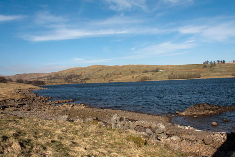
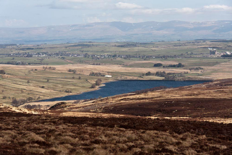
"Look Little Eric", called out Shaun, "you can see the dam that encloses the Wet Sleddale Reservoir, by which we will park."
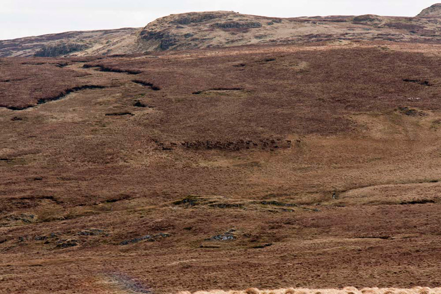
The sun was shining as we approached and it was to be a dry and mostly sunny day with the brisk wind making it still feel cool for the time of year. Areas on this trackless walk never dry out so it was wet underfoot at times, but not anywhere as much as when we last did this walk in November 2005.
Arriving at the car park Allen remarked, "it is a big and rather ugly looking dam, but rather surprisingly the reservoir is not all that large."
"It was built in the 1960s when the valley was taken over by Manchester Corporation to augment the supply of water to Haweswater, but unlike that valley, large areas of Wet Sleddale remain undrowned, and unchanged", informed Grizzly.
There were two cars parked already as we arrived, and almost immediately another car pulled in beside us, occupied by a lady and gentleman. As Dad got out, he remarked to the gentleman, "I did not think that there would be anyone else here today".
The discussion continued, and it transpired that they were from Ulverston and were doing the Wainwright Outlying Fells, having just these at Wet Sleddale and Black Combe to do.
The gentleman said, "we tried to do this a few weeks ago after the snows, but could not get along the road."
Dad replied, "I had considered it too, but thought better of it for the same reason."
The lady had now got out of the car and remarked, "I love the Shap Fells. They are so remote and wild and unfrequented too."
All the time Dad was getting ready, and bringing us out of the car, we began to settle in the rucksack, at which point the gentleman said, "do you have photos on the Internet".
"Yes", replied Dad, under Stagwalks."
"I recognise the bears", said the lady. "You have taken some good photos and the site has been useful in giving us a sense of what to expect on some of our walks and in locating the summits."
"Thank you", said Dad on our behalf too. "I am glad that people like the stories and find the site useful."
As they headed off, Dad said, "enjoy the walk."
"They are going down the road, which seems to me to be the wrong direction", remarked Little Eric.
Looking at the Outlyer Book, Shaun replied, "that is because I guess they want to follow exactly Wainwright's route that starts along the road, by the weather station and cattle grid."
"Are we doing that?, asked Allen.
"No", replied Dad, "I intend to take the grassy track from here up to the gate in the wall to join Wainwright's route."
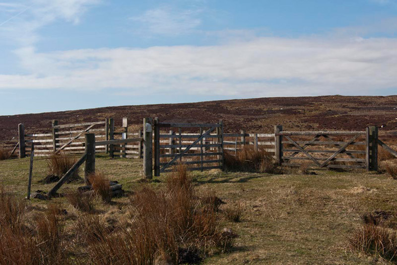
This we did, the route then being indistinct at times, but presenting no difficulty, keeping parallel to and a little way from the fence on the left, so arriving at a complex of gates.
"OK", said Shaun. "It may look simplest to go ahead through the gate on the right, but the correct way is left through the gate in the fence, on to the wide track and then right through the facing gate."
"Right Lad, you're word is my command", replied Dad.
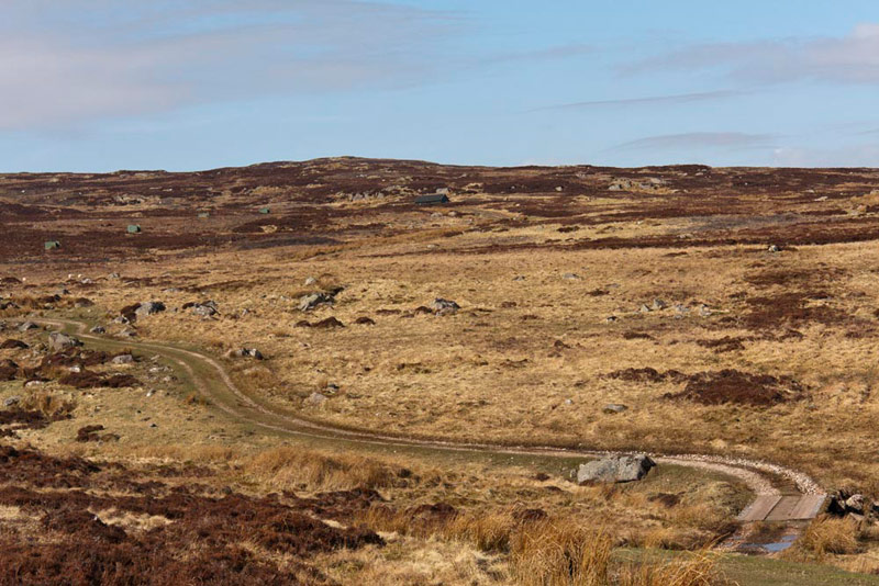
Beyond the track descended to cross a stream and then onwards towards the building that can be seen in the rear centre.
"This is a grouse shooting moor, and the track is used to bring the participants in and out", said Tetley. "You can see a line of grouse butts, from which they shoot, over to the left."
"We have seen lots of them and walked across miles and miles of grouse moor, during our exploration of the Yorkshire Dales, with Uncle Bob", replied Allen.
"They were good times", mused Grizzly.
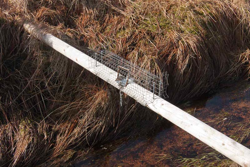
Crossing the bridge over Howe Gill, the track then continued with the gill to the left. "What's that on the pole across the stream?", queried Little Eric.
"A trap to catch such animals as weasels and stoats, that prey on the young grouse", replied Tetley.
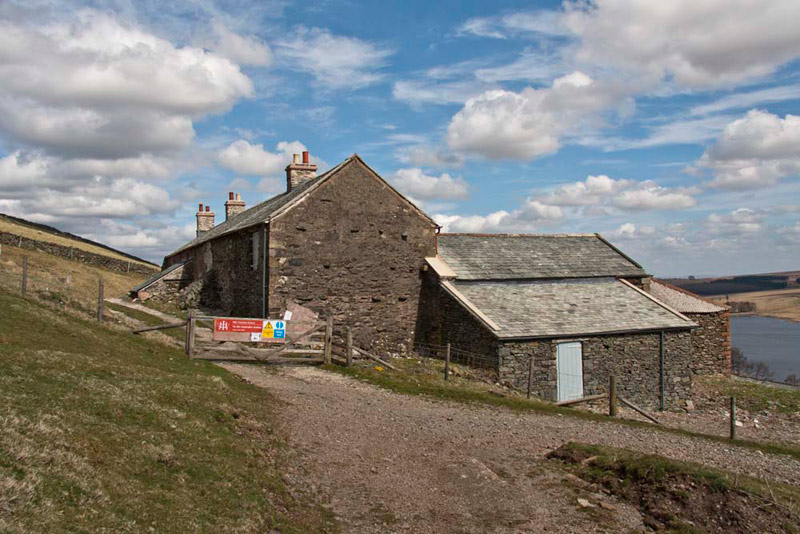
We strolled on, the track reaching its end at the building shown on the map as the Lunch House, where during the grouse shoots, food is served.
"It's all locked up", said Allen disappointedly. "I was hoping that we might get a mug of tea, to speed us on the walk."
"What a tea belly you are, pal", replied Tetley. "You will just have to be patient and wait until we stop for lunch."
"According to Wainwright, we now just go on upstream for about a half-mile", instructed Shaun.
From here on there were no proper paths and it was to be a hard slog over the rough ground, to the three summits and on until we finally reached the bridleway and a proper path once more.
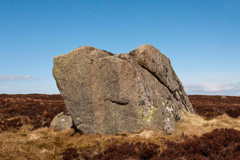
Dad picked his way as best as he could above the stream, finding at times a semblance of a path through the heather. After a while Shaun said, "we need to look out for the prominent large boulder, over to the right on the skyline."
Suddenly Tetley called out, "there it is."
"OK", replied Shaun, "we need to head straight for it."
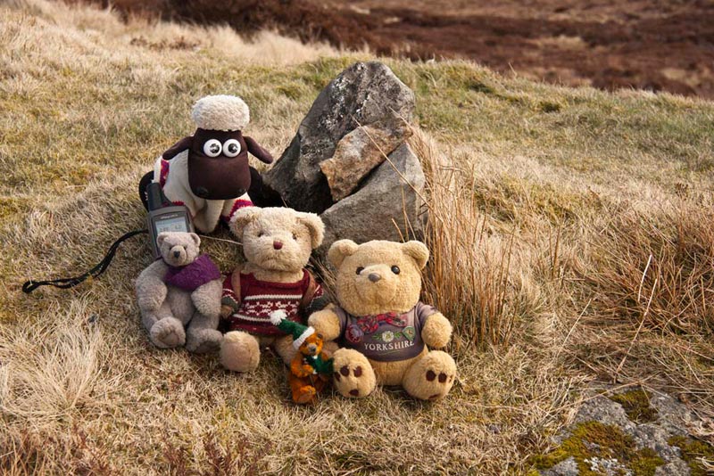
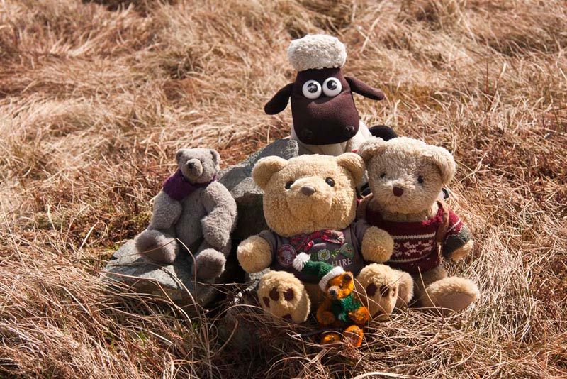
It was not much of a climb, however the thick heather made it harder going, but finally we arrived. It is a nine-foot cube of lovely pink Shap granite, known as Gray Bull.
On its far and northern facing side, the top is clothed with heather and we scrambled up amongst it, for our first picture of the day.
If you are wondering what Shaun is looking at so intently, it is a pool of water, that had we not clung on to the heather, we would have been in danger of falling into.
Safely tucked in the rucksack once again, Little Eric asked, "where now?"
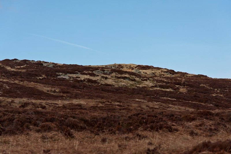
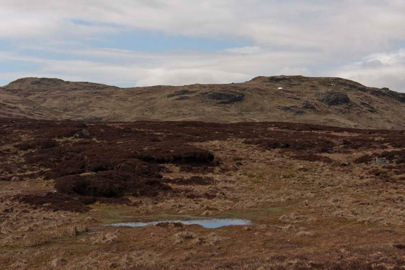
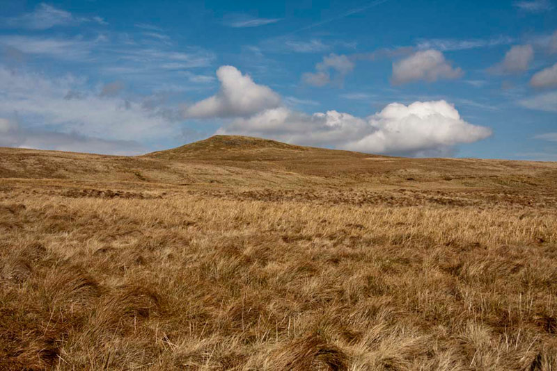
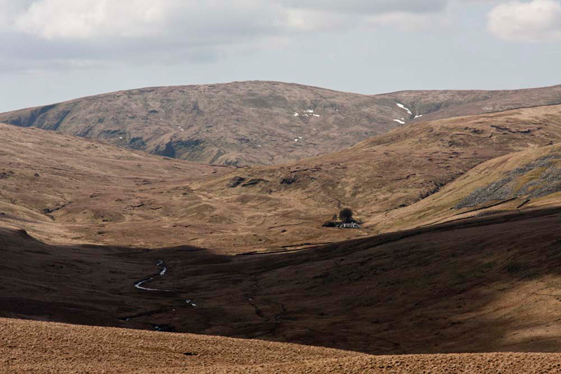
Checking the map, Shaun said, "basically it is north-west, to the first summit Sleddale Pike, the top of which can just be seen overtopping the moor."
This was the view to it, showing the terrain we faced. The tiny pimple of the summit cairn can be discerned on the skyline.
After a steady trudge of about 15 minutes, Dad taking care to avoid any bog, we reached the cairn and our pal Little Eric had bagged his first summit of the day.
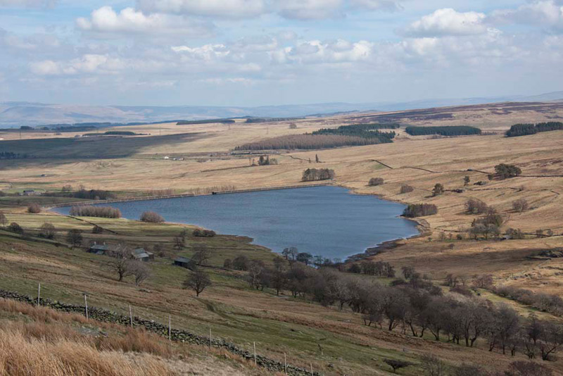
Looking round, he exclaimed, "what a wonderful view to the reservoir. Worth a picture don't you think Dad?"
"That is the long linear village of Shap beyond and the unmistakable cement works to the right, the whole scene backed by the Pennines", informed Allen.
"Yes, the highest with the line of snow below its summit is Cross Fell", added Tetley knowledgeably.
Then, needing to mark reaching Sleddale Pike, we all gathered by the small cairn, Shaun checking and noting the grid reference for our records.
"OK, where now?", demanded Little Eric.
"We head south-west for Great Saddle Crag" replied Shaun, which could be clearly seen Dad taking this shot soon after we set off again. The highest point is that to the right. To the left is the lower Little Saddle Crag.
The first section was very rough over the heather, and there were bogs to avoid as can be seen. Unseen from here, about halfway, Dad climbed the wire fence, where beyond the going was more grassy, but still rough and again he had to watch out for bogs. Finally in a dip, we crossed Saddlecrag Gill and then made the steady climb to the summit where there was a cairn. We took this as the summit, but in fact it could have been any one of three small rises on the flat top. It took about a half-hour.
"Phew, I bet you are glad to get that out of the way", cried Grizzly.
"Sure am", replied Dad with relief sounding in his voice.
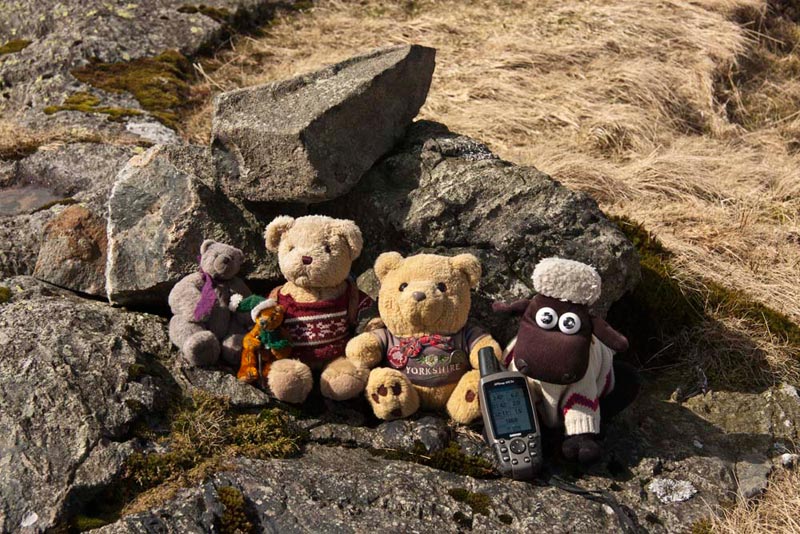
Here we are at the cairn, Shaun once again checking and noting the grid reference.
"Right that's two down, now for Ullthwaite Rigg to complete the three Outlyers on this walk", enthused Little Eric.
"This is probably the most difficult part as far finding the right direction", said Shaun. "Really we need to head west for a little way, before turning north-west to our objective."
Looking across in the direction Shaun had indicated, Dad pointed and said, "that must be Ullthwaite Rigg."
With terrain like this, it is really not a walk to tackle in mist", said Allen.
"You are right", replied Dad, and also to get the lovely views, it needs to be a day like today."
So, off we went, Dad using the GPS compass to get a bearing. More rough ground, needless to say, and we crossed a few small watercourses too in the process. Then when he judged it about right we turned more to the north encountering some very boggy ground. Dad had been so careful, but at one point here he momentarily lost concentration and wandered into a bog, the water coming over the top of his boots, before he could get back to more solid ground.
"Oh well", sighed Dad, "this is not the first time this has happened to me."
Soon now we began to ascend Ullthwaite Rigg, where two farmers on quad bikes were driving the sheep away from us.
"Great", cried Allen, "that's stopped Dad taking any sheep pictures."
Indeed he did not get any at all, so for once we have a sheep free story!
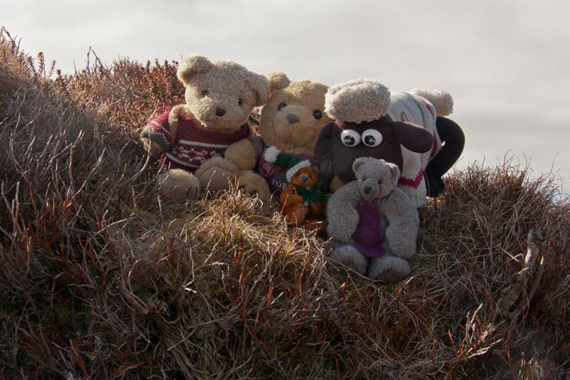
As we made the relatively gentle ascent, and reached the small cairn, Grizzly suddenly called out, "look, there is a large herd of deer crossing the fellside."
The top like so many of the fells of this type was a large flat area, and a rise a little further right seemed to be higher. Dad walked to it, but the altitude reading on the GPS showed no real difference, so we decided to treat the cairn as the summit and we gathered round for our picture.
"Yippee", cried Little Eric, "that's got these out of the way and moved my total on to 93. Just 11 to go now to complete the challenge and catch up with the rest of you."
"Right, it is due north to pick up the bridleway", advised Shaun.
Looking across Dad said, "that is more or less directly towards Scam Matthew, so all I have to do is keep it directly ahead."
"I know you climbed that a long time ago, before anyone of us came with you, but that is an additional summit we could all bag", implored Allen.
"Well Lads, I fully intend to take you there, as I did not do it for you when we did the round from Swindale, over Seat Robert etc", replied Dad.
"Thanks Dad", cheered Allen in reply. "We really do have the best Dad in all the world."
First though we had to get over the intervening ground, seen below in this view towards Scam Matthew.
"The clouds look rather like a giant duck, don't you think", remarked Tetley.
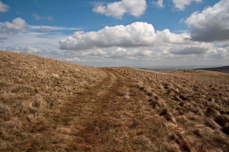
The descent of the fell took us between a series of drainage channels. Then onwards, from where the shot above was taken, over very rough and unsurprisingly boggy ground fed by the water down the drainage channels. Finally this brought is to a clear cross path, the first we had seen since the Lunch House. A further climb then brought us up to the bridleway, which can be seen running left to right over the slopes of Scam Matthew. Here it is, the path track we were to follow, after climbing the fell.
As climbs go it was not very steep nor difficult, and soon Scam Matthew was added to our list of summits climbed. When we got home, we checked and found that it had been April 1997, when Dad had climbed it in the company of Uncle Eric. From the summit, looking west there was a fine view to lonely Mosedale, and its solitary building Mosedale Cottage. The dominant fell behind is Harter Fell, part of the Kentmere Horseshoe.
Settling in the rucksack, Dad strode off, descending in an easterly direction, so picking up the bridleway a little further along, and so on to a gate, where we stopped for lunch.
"Thank goodness", exclaimed Allen and Little Eric in unison, "I'm hungry and thirsty!"
While we were there a farmer was coming along the track on his quad bike, so Dad kindly opened the gate for him.
"Thanks", the farmer said has he passed by.
All suitably refreshed, and settled in Dad's rucksack again, we strolled on to come eventually to a second gate, just before which we enjoyed this fine view of Wet Sleddale reservoir.
Shaun said, "soon after the gate we take the path right that zig-zags down to Sleddale Hall."
A steady winding descent then brought us to the building, that is famous as the location for the 1987 comedy/drama film Withnail and I. Since then the property had fallen into disrepair, but we noted as we passed by today that is was under undergoing considerable renovation.
Here our route was the stony track that descended right, to then turn left below and behind the building.
"At the next junction we go right", called out Shaun, "along a wooded path."
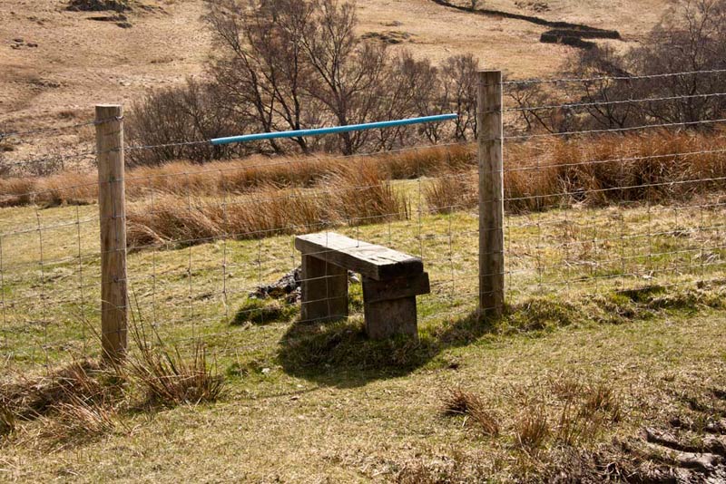
The trees were still bare, so in fact it was pretty open and soon we came to a stile on the left over a fence. "We should climb that", said Shaun.
Grizzly called out, "I know it is not much of a stile, but it is the very first we have encountered today, in marked contrast to some of our recent walks, when you have had to climb so many. The most was 47 on that walk from High Bentham."
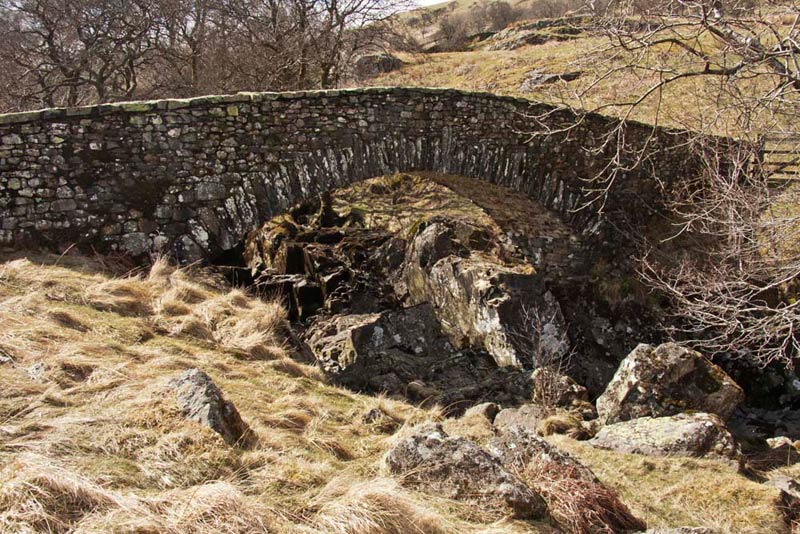
Down the field beyond we soon came to the new packhorse bridge over Sleddale Beck, erected by Manchester Corporation. The picture was taken after we had crossed.
Going left, some white topped posts now indicated the route to a ladderstile and then on to cross a footbridge. Here we joined a good track that led us to the car park.
"I know it has been hard going Dad, but thanks for a great day", cried Little Eric.
"You're welcome Lad, but I am in need of some refreshment now", replied Dad.
"How about going to the Old School House in Tebay", suggested Tetley.
"That's a good idea Lad", replied Dad.
The good thing too was that we got to go in as well and see Uncle Steve.
Dad enjoyed tomato soup, followed by a breakfast, all washed down with a welcome pot of tea.