CAM END, OLD ING, NETHER LODGE & THORNS from GEARSTONES
Summary
Date - 24th July 2013 & 2nd February 2018
Distance - 7.25 miles
Ascent - 830ft
Map - OL2
Start point -
Layby near Gearstones Lodge (SD 778 799)
Summits Achieved
Name
Height (ft)
Height (m)
Grid Ref
Cave Hill (climbed on 2nd February 2018 only)
1260
384
SD 8037 7885
Preface
"Phew, it really is hot", said Tetley.
"It sure is pal", replied Allen. "We are finally getting summer, for the first time for some years too."
"Dad says we must not complain, but really it is far too hot for him, and honestly he hopes it will cool down a bit soon. When they were staying recently at Armathwaite Hall, the room was so hot at night he and Uncle Brian had difficulty sleeping. But it did make for some nice days out, and Fletcher and his guests got to go as well". said Tetley.
"I know", went on Allen. "Fletcher wants to do an account of the stay, and we must try to give him a chance, but we had got so far behind with stories, that we have rather been hogging Dad's time."
Grizzly and Shaun, trotted in just then, with Little Eric who had hitched a ride on Shaun's back.
"We bring cakes, and drinks", announced Grizzly. "Being so hot we have brought chilled soft drinks, but there is a flask, as we know how much you like tea, Allen."
"Thanks pal. I know it's very warm, but I would still prefer tea", responded Allen.
"What's the cake?", asked Tetley.
"Scones", replied Grizzly. "There are two flavours. I have made some fruit scones, and Little Eric has made apple and cinnamon. He is proving to be quite a good cook, and I really appreciate his help."
"I enjoy doing the baking, and at least too, you cannot complain if I am eating my own cakes", said Little Eric with a broad grin on his face.
Taking a bite, Allen said, "they are really very nice Little Eric."
"Thank you", he replied.
All settled our thoughts then turned to walking. "We have a day down to go with Uncle Eric, tomorrow, and the weather looks to be OK, but with it being so warm, a low walk would seem to be the best option", mused Shaun.
"I have been looking through the walks binders again, and found this one in Yorkshire, that none of us have done, starting from Gearstones, and taking in parts of the Dales Way, Pennine Way and Ribble Way, said Allen.
Shaun got the map and spread it out, so that he could trace the route. "Although we have done the hills in the area, this walk is certainly on paths that we have never walked, so it sounds a good prospect. I'll go and ask Dad and see what he thinks, if you like."
"OK", replied Allen. "It gives me more time for another mug of tea."
Returning a few minutes later, Shaun said, "Dad likes the idea, but of course needs to discuss it with Uncle Eric, when they speak on the phone tonight."
In the event, Uncle Eric was happy with the suggestion, and here is our account of the adventure.
2nd February 2018
On our own, the walk was repeated, with some slight variation. Firstly the weather was in complete contrast as would be expected from the different time of year. It was a cold winter day, but there was little wind, so it made for pleasant walking. Clear views too, the Three Peaks being blanketed with snow. Shaun, ever eagle-eyed as our guide, had spotted on the map that above the Pennine Way along our route, is Cave Hill adorned with a trig point.
On hearing this Allen excitedly asked Dad, "please can we go to the summit. It will be another addition to our Yorkshire Dales Fells."
"Of course lad", replied Dad.
"Great", cheered Tetley, who of course is from Yorkshire.
We have taken the opportunity to include a number of pictures from today to expand the original story, and show some contrasts too.
The Walk
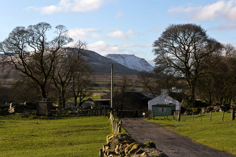
The drive to the start was one we had done many times, over the years, going to meet Uncle Bob, for the walks on the Yorkshire Dales fells. From Ingleton the road climbs below Ingleborough, and on to pass the Hill Inn. Then very soon the magnificent Ribblehead Viaduct came into view, with Whernside rising high behind. It was then just a couple of miles to the layby just before Gearstones Lodge, our start point.
"Good morning Uncle Eric", we called out, "nice to see you."
"And nice to see you lads, too", he replied.
He and Dad then got ready, and we sat patiently looking at the landscape. We were to have a dry if rather cloudy day, but this did reduce the temperature a bit, for which Dad was grateful. The views were a bit hazy, but still good enough to enjoy.
"Right, I'm ready", called out Dad, so we dashed over and settled in the rucksack.
"We go on along the road past the lodge and round the corner, and then go right on the Dales Way", instructed Shaun.
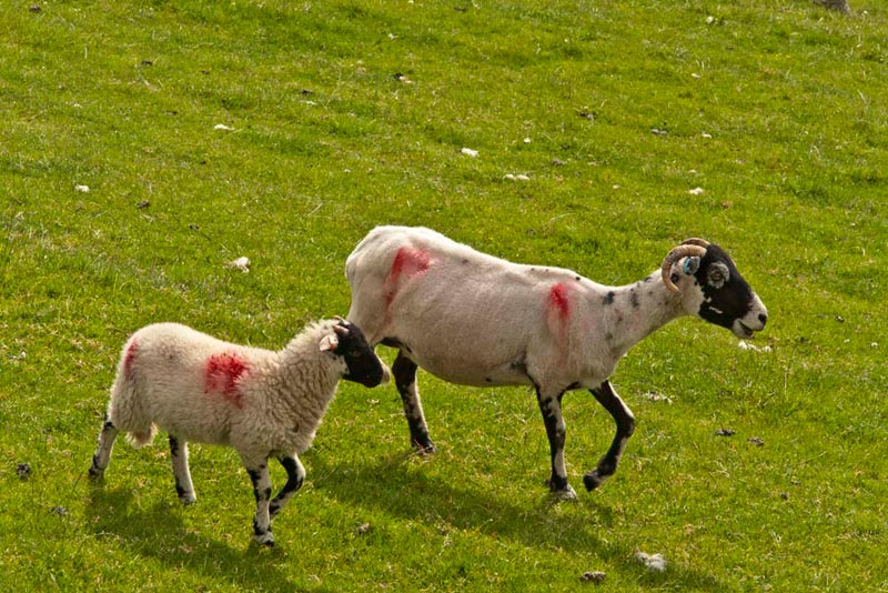
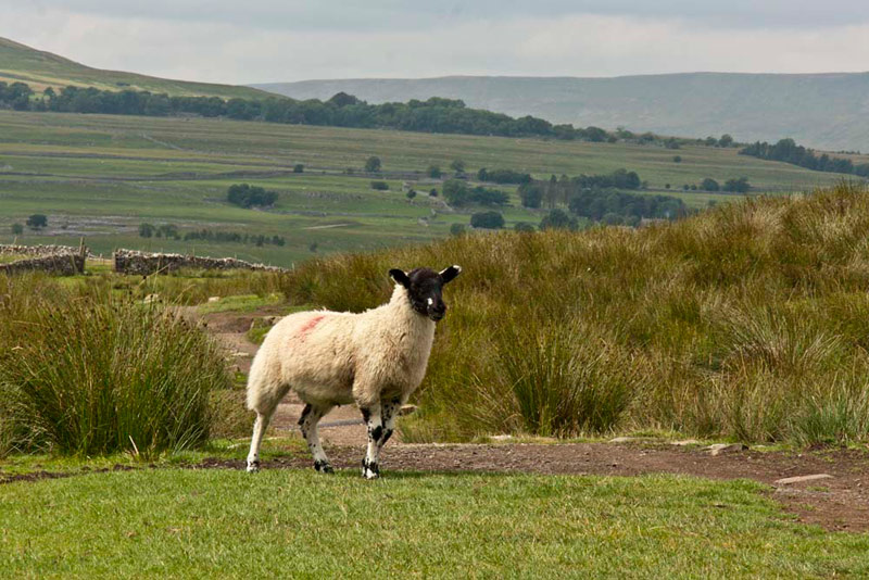
However Dad's thoughts were elsewhere, as he had spotted this ewe and her lamb, over the wall in the adjacent field.
"Huh!", exclaimed Allen. "It has not taken you long at all to spoil our chance of having a sheep free story."
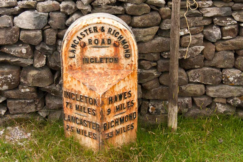
Our route was to be up the Cam Road, that years ago was the old drove route and only road to Hawes, until a new road was built through Widdale. The road runs from Lancaster to Richmond, indicated by these milestones that are placed at intervals.
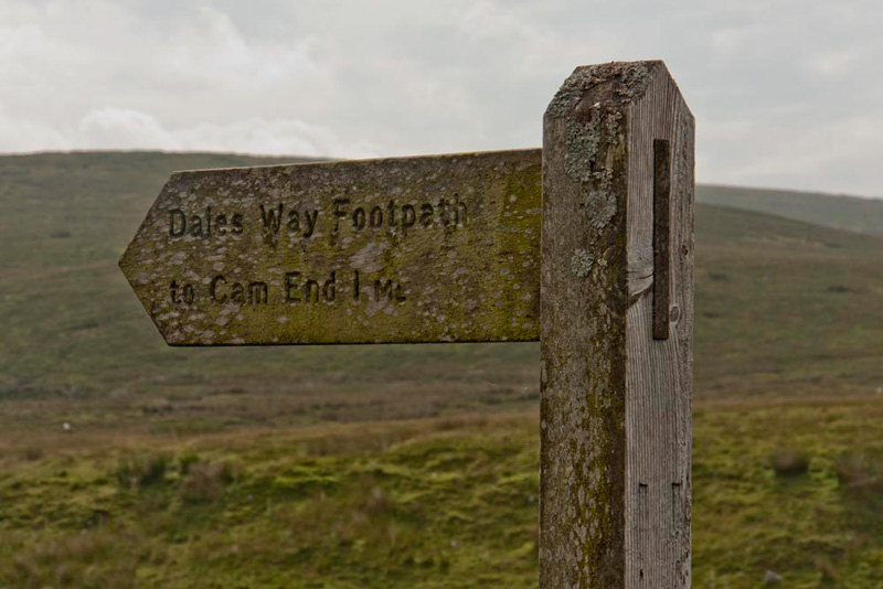
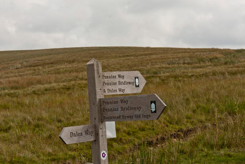
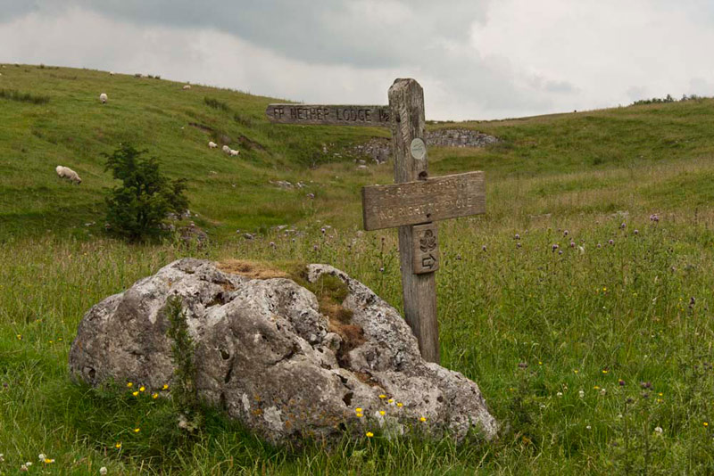
Strolling on, soon Tetley called out, "here's the sign for where we turn off. You can tell too, that this side of the signpost faces north due to the moss and lichen that covers it."
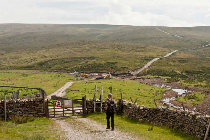
This view, taken just before, with Uncle Eric strolling down to the gate, shows clearly the Cam Road climbing the fell beyond Gayle Beck.
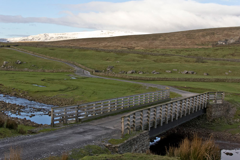
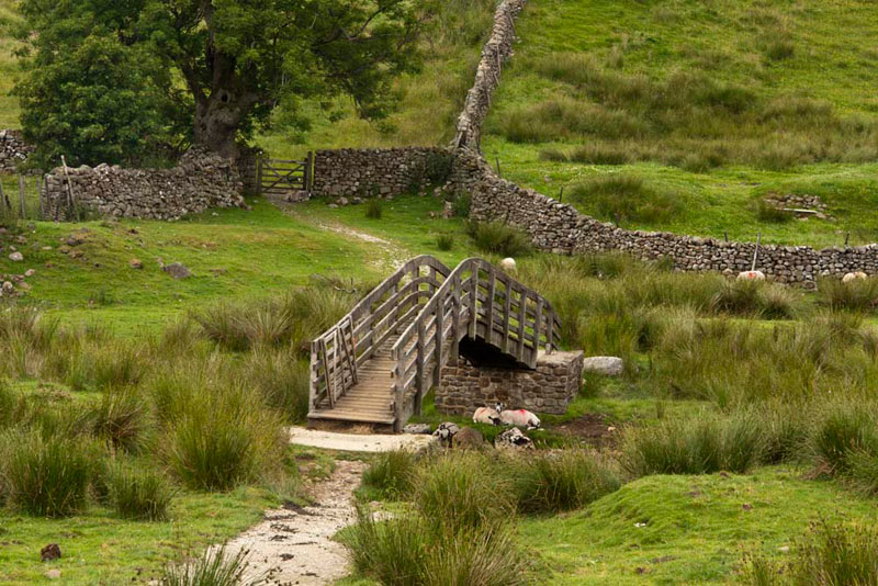
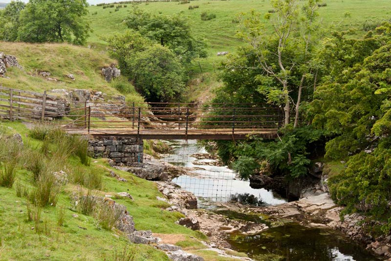
Until very recently the way over the beck was via a footbridge, but this was in the process of being replaced by a road bridge, and the surface of the road beyond has been improved. The reason for all this is to facilitate timber extraction over the next ten years. The new bridge was not finished, so it was necessary to ford Gayle Beck, but with all the summer weather this had almost completely dried up, so presented no problem!
The new bridge, looked to be a long way off completion, but without a word of a lie, Dad told us that just one week later when he and Uncle Brian came along the road on the way to Hawes to see Uncle Bob and Aunt Ann, it had been finished! This was taken in 2018.
Climbed steadily, the newly restored and surfaced Cam Road almost to the brow, reaching a clearly signed junction.
If the sign looks to be new, you would be right, as the directions now need to include the Pennine Bridleway, a new long distance route primarily for horse riders. Indeed its route goes past Elaine's at Feizor, and we hope that this will bring her even more deserved trade!
"Our way is right, south, and we will be going all the way to Old Ings too", advised Shaun.
The good track wound its way through the moorland, and we passed a few people, who it was obvious were doing the Pennine Way, as they had the guide book clutched firmly in their hands. Dad and Uncle Eric, passed the time of day with most of them, who all asked if we were doing the Pennine Way too.
"No" replied Uncle Eric, "we are doing a pleasant circular walk." Then briefly outlining our route.
We wished them luck on their quest. It is many miles that they will have to walk, to reach the end at Kirk Yetholm, in Northumberland.
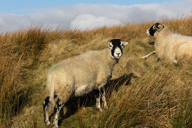
Further on we met a farmer on his quad bike. He was trying to find some of his sheep, which was proving to be a bit difficult as they were hunkered down in the long grasses.
Allen said after he had gone on ahead, "I am sorry that it is difficult for him to spot the sheep, but good from our point of view, as it stops Dad taking any sheep photographs!"
"Huh. Spoil sport", quipped Dad.
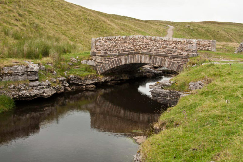
The moorland was featureless and uninteresting, but eventually we dropped down a slope to reach pretty Ling Gill Bridge.
"Hmm, that's nice", remarked Grizzly.
Dad took a few shots, but this after we had crossed, we thought was the best. There is a nice reflection, and our approach path can be clearly seen behind.
Calm and tranquil, this is the view upstream from the bridge in 2018. "Brr", said Grizzly. "It looks every bit as cold as the day."
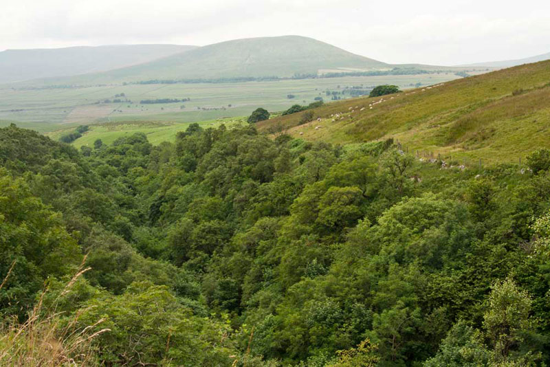
Walking on, the path then passed above the deep limestone gorge of Ling Gill, which is all securely fenced off as it is dangerous.
As the picture shows little can be seen but the dense woodland. However an information board told us that Ling Gill is a small upland woodland in the narrow limestone gorge. This type of woodland is scarce, Ling Gill having survived because the steep slopes and cliffs have prevented access to grazing animals. The tree and shrub species present include birch, rowan, ash and bird cherry. Beneath the trees there is a rich ground flora, including baneberry, globe-flower and melancholy thistle. Cam Beck crossed by Ling Gill Bridge, flows through the ravine over a series of waterfalls, descending about 100ft in the process.
The track continued with the slopes of Cave Hill to the left, and a substantial stone wall on the right.
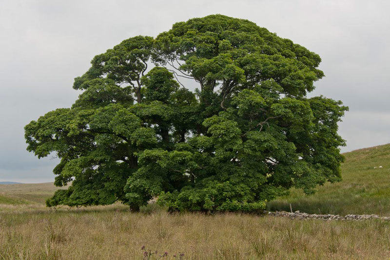
"That tree ahead, is magnificent", called out Tetley. "How about taking a shot for inclusion in the story."
"OK lad", replied Dad.
He took a shot on approach, but just past Uncle Eric said, "there is a gate here, Gerry. If you go into the field you will be able to get a clear shot without the wall."
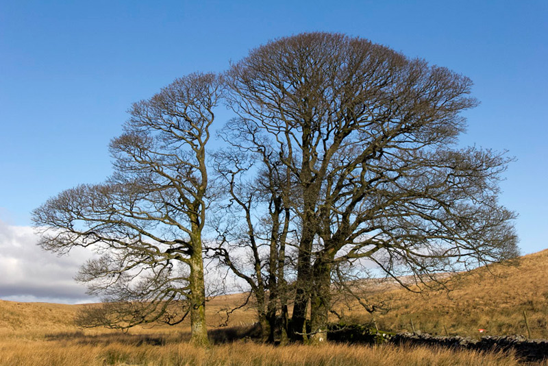
Bare of the foliage, it was plain that there were more than one tree.
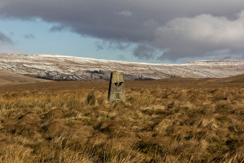
Still in 2018, now was the time to make for the top of Cave Hill. We had in fact seen the trig point from a distance from where we joined the Pennine Way.
"This looks a likely place", said Tetley, pointing to a vague quad bike track up the fell.
Dad trudged on climbing steadily to reach a brow, where it was clear that a slight descent across the ground was next before the final climb to the trig point.
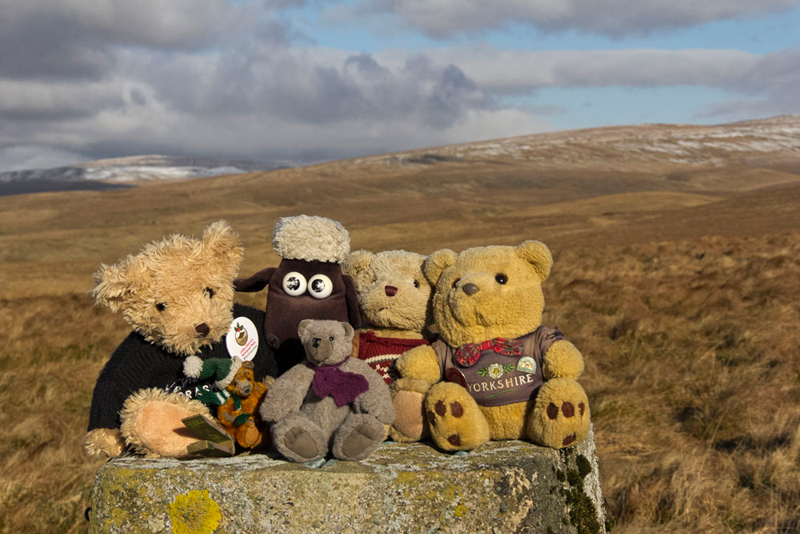
"Come on" cried Southey. "Let's sit on top for our picture."
After looking round to admire the views, we quickly settled in Dad's rucksack, and descent was made in the direction of our route to soon rejoin the Pennine Way.
"Those sheep are just begging to be photographed", called out Southey mischievously.
"Winding me up again", laughed Allen.
As we then got to the end of the slopes of Cave Hill, we came to a gate, where on the left was a stile over the wall. Uncle Eric said, "this looks like a good place to have lunch."
"Great!", replied Allen. "My tummy has been rumbling for a little while now."
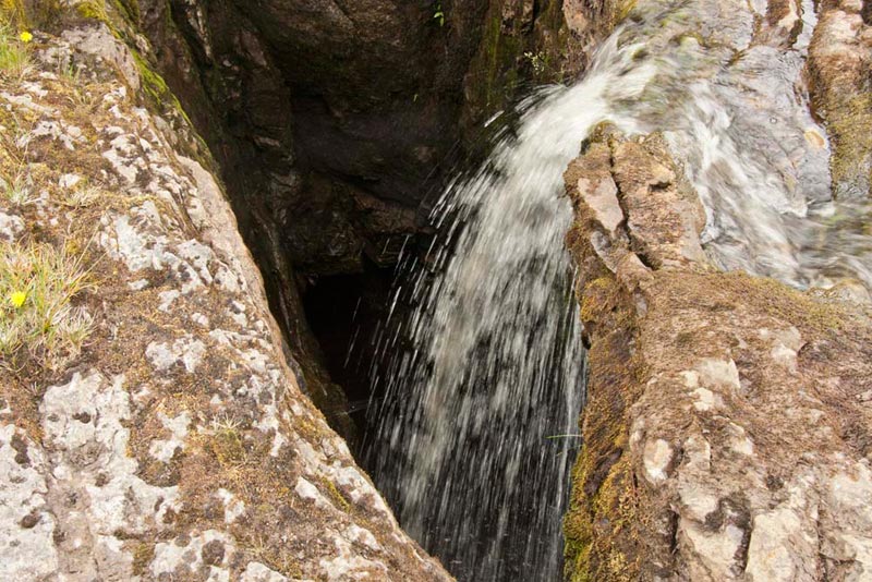
As we climbed over this was the lovely scene that presented itself.
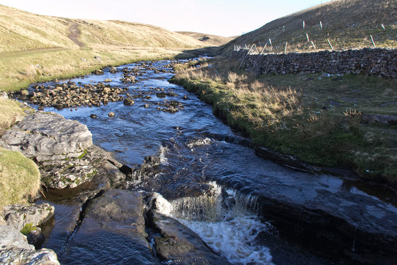
In the foreground, the stream can be seen dropping over the edge of the limestone, and in fact plunged in a waterfall at least 50 feet to a dark pool, to then disappear underground. With the dry weather there was not much water, but in spate it must be a truly spectacular sight. Going cautiously to the edge, Dad took this shot, that gives some idea of the scene and depth down to the pool.
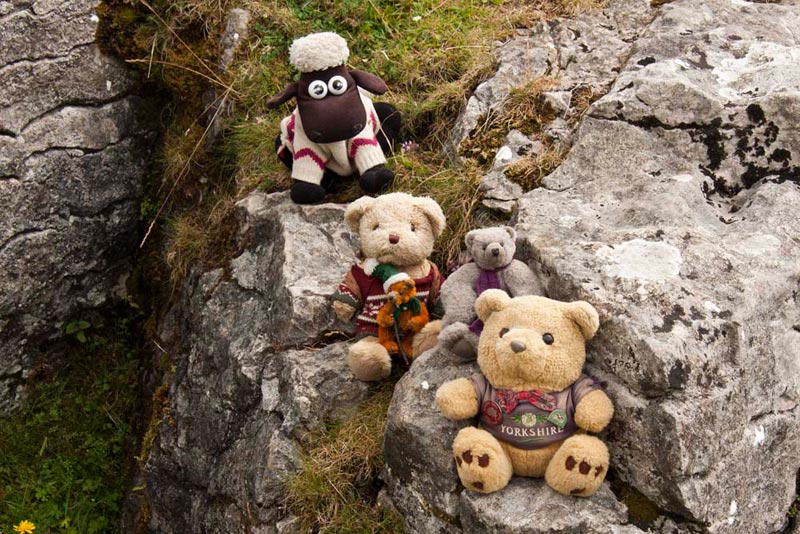
Away from this we found a convenient place to sit and have our lunch. Today we and Dad had brought smoked salmon sandwiches-very posh eh! We also had Grizzly's delicious raspberry and coconut slice. Cool drinks too, although Allen as usual had tea, as he of course takes after Dad, being a real tea belly.
Afterwards, we then posed while Dad took our picture. You did not think you were going to get away with us making an appearance.
Re-climbing the stile, we continued along the track to shortly reach Old Ing, the house being secluded in trees.
The Pennine Way was signed left, but Shaun called out, "our way is right through the gate, and on to pass the entrance to Old Ing."
The track then fairly soon leads to a road at High Birkwith, but again Shaun issued his instructions, saying, "soon we go right onto the Ribble Way, the path leading eventually to Nether Lodge."
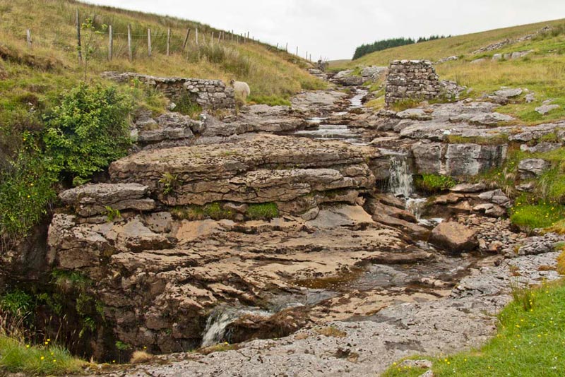
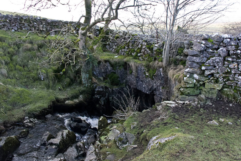
This route was undulating, being partly on a stony track and some grassy, to Gods Bridge. This was a wide grassy swathe walled either side. Only the noise of the stream gave any indication we were actually crossing a bridge.
Soon after this lamb stood defiantly blocking the way, and let Dad get quite close, for a picture.
"Grr", growled Allen, "I suppose we have not option but to allow that to be included in the story."
Descending now, we fairly soon reached Nether Lodge.
"The instructions say go left over the stile and right through the farmyard", said Shaun. "But there is a newish footbridge straight on, so perhaps the path has been diverted since the walk was published.
This indeed is now the route, over the bridge and through the gate in the wall, then going left. Shortly a multi-armed signpost was reached, and we initially took the path signed to Cam End, as it was a good way up the slope.
"This is OK for a short distance", said Shaun, "but soon we must cut away left and descend to cross the rough and boggy ground, to pick up a path over the shoulder of Swinset Hill, and on to eventually come to a gate in the cross fence."
At the gate, Little Eric, said, "where do we go now", looking about without success for a path to follow.
Showing him the map, Shaun said, "we are now in this huge area that is surrounded by walls, and we need to get to the the far left corner."
"Oh, I see", replied Little Eric. "I am so glad we have you to find the way for us, as I have still not grasped fully relating the map to the actual landscape."
"You'll get it in time, pal" replied Shaun gently.
The ground was rough and undulating, and not what we expected the Ribble Way to be like.
Shaun was quite correct in his directions, and finally Allen called out, "there is the gate we want, just to the right of the corner."
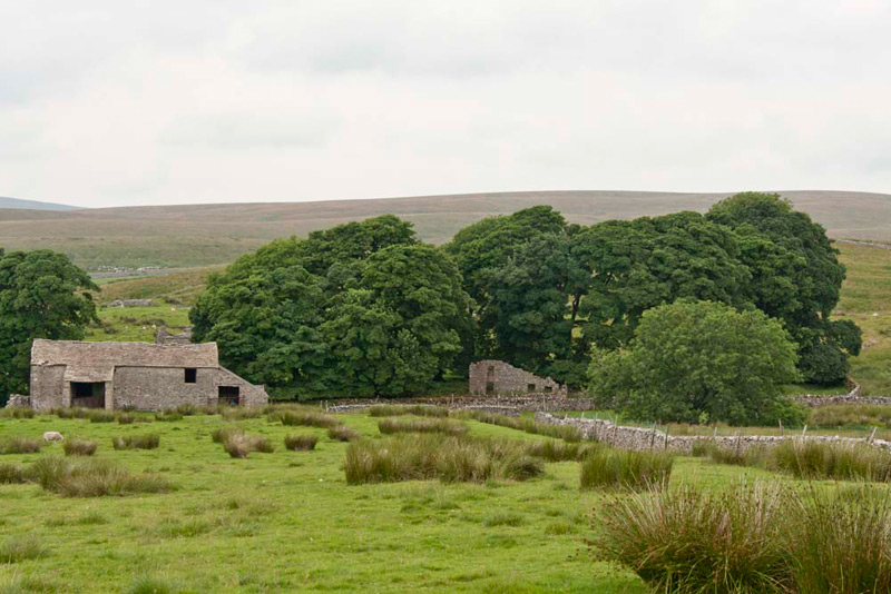
Beyond we followed by the wall for a while, but then kept to the path as it left the wall, to reach a step stile, by a ruined barn. Immediately past the building, we turned right climbing uphill and on through a gap, to then descend to what remains of the ruined buildings that was once the hamlet of Thorns.
Little remains now, but it seems that it started life, as far as is known, as a monastic lodge for Furness Abbey, then remaining an important stop-off point on the packhorse route running north to south. Of the houses only the frontage of the one seen in the picture remains. At the most prosperous times Thorns and Gearstones, was a thriving community with houses, farms, inn, shop and school, linked to the outside world by packmen, drovers and merchants. This all came to an end with the abandonment of the road through Thorns, and a severe depression in farming, the last inhabitants of Thorns leaving about 1890.
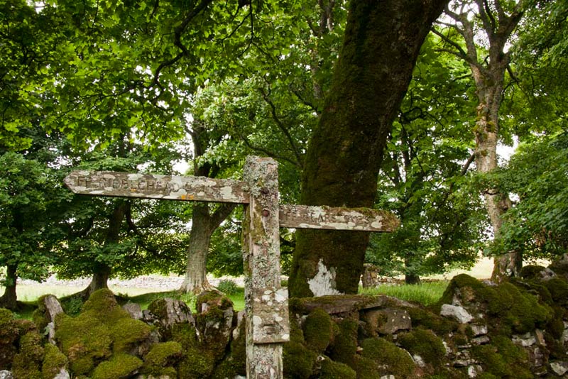
By the barn we entered what was once the street in the hamlet, and on the opposite side stands this lichen encrusted signpost.
"Our route is right", called out Shaun.
At the end, it was over a stile and through a small field and then to open fell, going left to pick up a track that led down to a ford over the infant River Ribble, where on the far side and slightly upstream is Low Gearstones Farm.
"We cross the river by a footbridge, that is a little way downstream", instructed Shaun.
"There it is", called out Little Eric.
Over the bridge, we walked up the field to join a track, here walking left to a gate, and then so on to another gate, to the roadside and the layby we had started from.
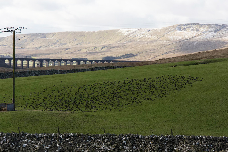
On the winter day, Southey pointed, saying, "what are all those birds in the field and on the telegraph wires?"
"Starlings" replied Shaun. "When they go to roost, they sweep around all together, which is quite a sight to see.
Whernside and Ribblehead Viaduct, form the backdrop.
"What a lovely walk", said Tetley. "I do so like walking in my home county."
"Thank you for your company, too, Uncle Eric, added Allen.
"Your welcome Lads", he replied.
"There are no cafes, in the vicinity, but how about going to Country Harvest, at Ingleton?", suggested Dad.
"Good idea", agreed Uncle Eric.
Here they had a refreshing pot of tea, with a scone and butter, and a good chat too, of course. Uncle Eric's treat too, for which Dad says, "thank you."
The visibility had really cleared by now, and before setting off for home, Dad snapped this tremendous view of Ingleborough from the car park.
A really nice day and another bit of Yorkshire explored.
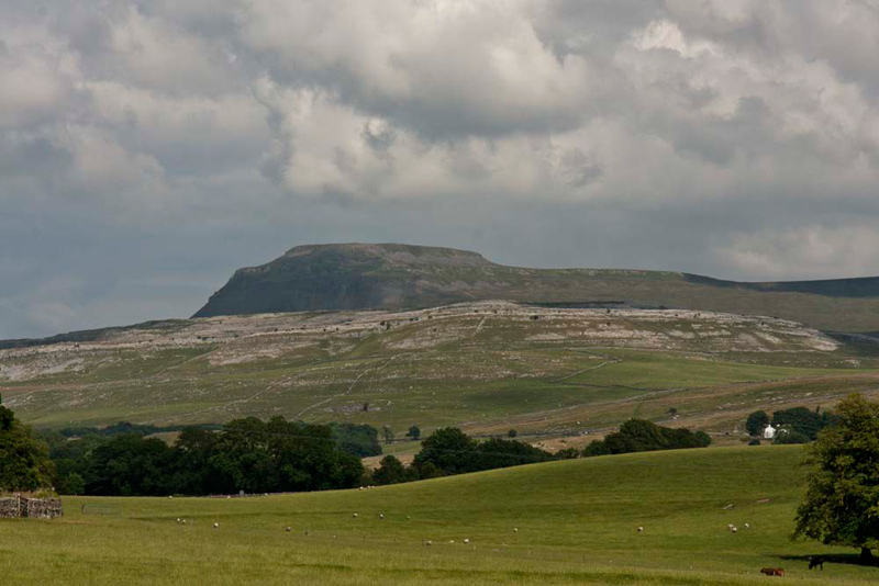
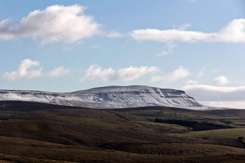
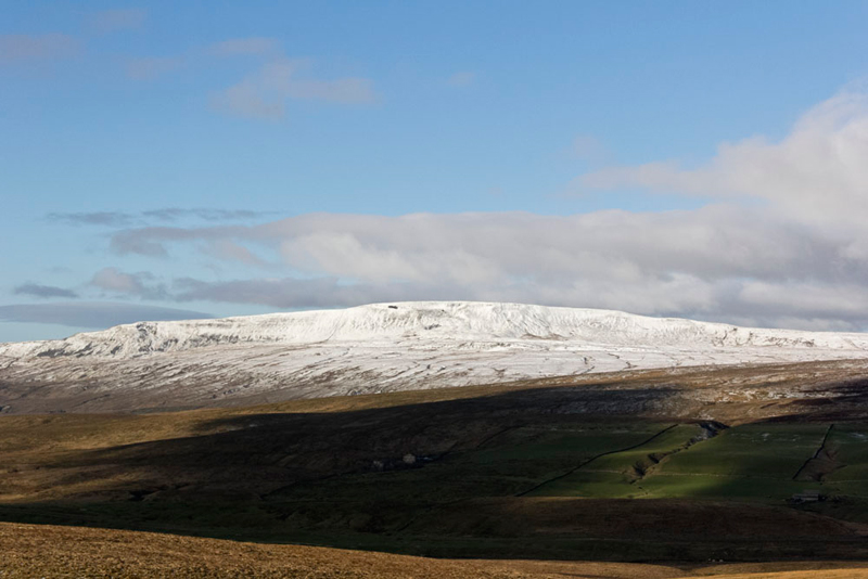
We never tire of seeing the Three Peaks, so include these shots taken on that lovely winter day.
In order of ascending height.
Pen-y-ghent (2278ft, 694m)
Ingleborough (2373ft, 723m) from the access to Low Gearstones Farm.