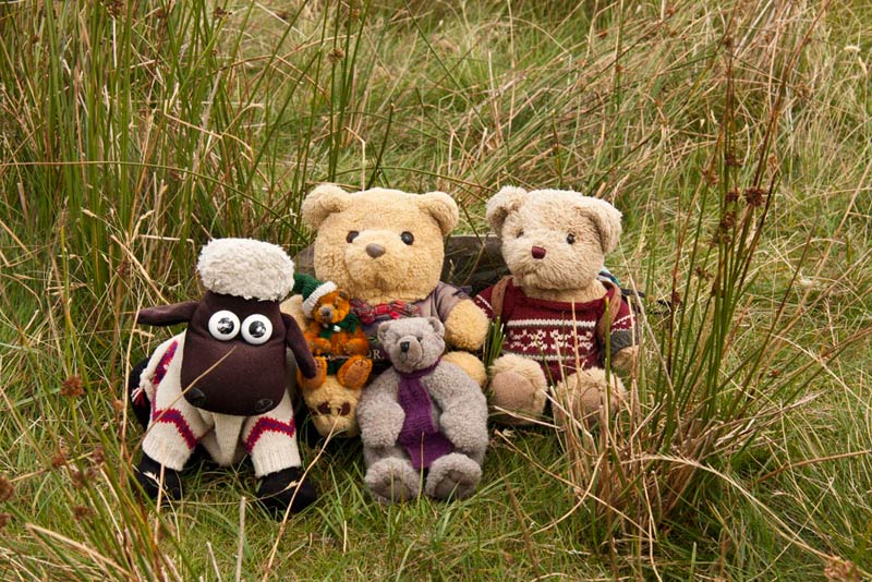
Tetley was sitting reading one of the many walking books and reminiscing about past adventures, when Shaun, Grizzly and Little Eric came in with flasks and cake tin.
"Tea?", said Shaun.
"Ooh yes", replied Tetley, putting the book down. "Thanks", he went on as Shaun handed him the steaming mug.
"There's cake too", said Grizzly, brightly. "Little Eric has been helping me again, and we have made, chocolate caramel shortbread, and cherry and coconut slice."
"We have just brought the caramel shortbread", added Little Eric. "We thought we could save the other for when we go walking this week."
"Good idea", agreed Tetley, taking a slice of cake. "Mmm, it's delicious.
"Where's Allen?", said Shaun.
"Don't know, but you can be assured he will be here very soon, as he can smell tea a mile off", replied Tetley, letting out a belly laugh.
Sure enough just minutes later he came dashing in, calling out, "I bring good news of our next walk, that will please you especially Little Eric. But, can I have tea and cake first."
"Of course pal", replied Little Eric, handing him a slice on a plate, Shaun passing him a mug of steaming tea.
"Thanks", pals. "Ooh, the cake is scrumptious." Then after another minute or so he went on. "We are walking on Thursday and the weather is good, and Dad and Uncle Eric have agreed to make a start doing the Bannisdale Horseshoe. When we did it in 2006, Dad took us on the whole round at once, but Uncle Eric does not feel able to do that, so it has been agreed to split it into two, descending each time to return through the valley."
Interrupting, Shaun said "I will get the map so we can all see clearly where we are going."
This was soon spread out before us, and Allen pointed, saying, "we are doing the south side, and the start will be by Dryhowe Bridge, which is where we started in 2006. Then we will climb to Whiteside Pike and follow the ridge over Todd Fell, Capplebarrow and Ancrow Brow, before making the descent and return through the valley."
"Great!", exclaimed Little Eric. "That will be three more Outlyers and four Birketts ticked off. Roll on Thursday."
The Walk
So Thursday arrived, and we were to have a dry day with sunny intervals and a nice breeze that kept it pleasantly cool. Dad drove us to Uncle Eric's, where we decamped to his car, and headed out of Kendal north on the A6, to take the narrow single track road into Bannisdale. We kept our paws crossed and thankfully in both directions we did not meet another vehicle!
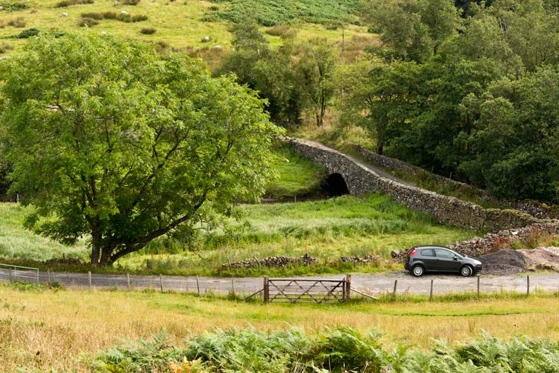
The place to park was clear and fortunately the gravel that had been dumped, still left enough room in the layby, at the junction just above Dryhowe Bridge, for Uncle Eric to park.
"Lovely to be back here again", remarked Allen, as we looked around at hills rising on each side of the valley.
They were soon ready, and we settled in Dad's rucksack, which he then shouldered. The route was through the gate opposite and quite steeply up the trackless hillside through some patches of tall grasses and bracken. Here is a shot looking back to Uncle Eric's car.
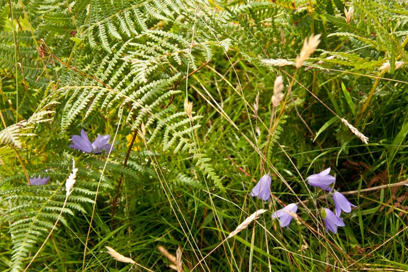
"What are those lovely little blue flowers?" asked Little Eric.
"Harebells", replied Grizzly.
"Birkett says, stride the fence", said Shaun.
Soon the fence indeed came into view, but since the book was written, as vicious looking barbed wire strand had been added on top. However where we came to the fence, a section beneath the barbed wire had broken away from the posts, so the obstacle was over come going underneath. Then it was on to come to the wall seen across the rough ground ahead.
"I think we should really climb further up beside the wall to find the stile across", said Shaun, "but there is a gap where it has broken down just over there."
"Well we may as well cross here", replied Dad, "just in case we cannot find the stile further up."
Over, we then headed on by wall and then right up a small valley to then crest a rise on the left, where the summit of Whiteside Pike surmounted by its tall cairn, came into view,
and striding purposefully over the rough ground, Dad and Uncle Eric made a beeline for it. Reaching the cairn, we could not wait to scramble up for our picture, Shaun balancing rather precariously on the top.
"Yippee", shouted Little Eric, "that's one summit bagged."
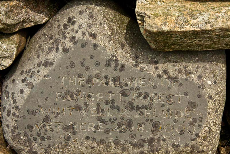
Uncle Eric then pointed out the inscribed stone, embedded in the bottom of the tall cairn. That reads - 'The Parishes of Fawcett Forest and Whitwell & Selside met here 28.8.2000'. These two parishes adjoin, with the valley and north side being in Fawcett Forest, the southern slopes being in Whitwell & Selside.
Looking north-west, Dad pointed out the next summit Todd Fell.
"What are those fells behind?", asked Little Eric.
Tetley was quick with the reply. "The prominent pointed summit is Ill Bell, with Yoke to its left and Froswick to its right. They are part of the Kentmere Horseshoe."
"Our way now is to descend to the wall and then climb the slope beyond to Todd Fell", said Shaun.
So, we followed the path from Whiteside Pike, that meandered on and brought us eventually to the wall, where, since the CRoW Act, a new stile has been made for ease of crossing.
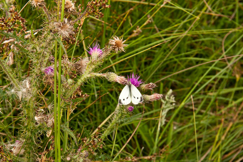
Beyond, after an uncertain start, a thin track emerged that led to the summit of Todd Fell. Part way Dad stopped as he had spotted a butterfly resting on a thistle, and he was able to get this shot.
Todd Fell summit is marked by a small cairn nestled amongst the long grass and as we arrived Little Eric called out "come on pals, let's get settled for our picture", as he leapt out of the rucksack.
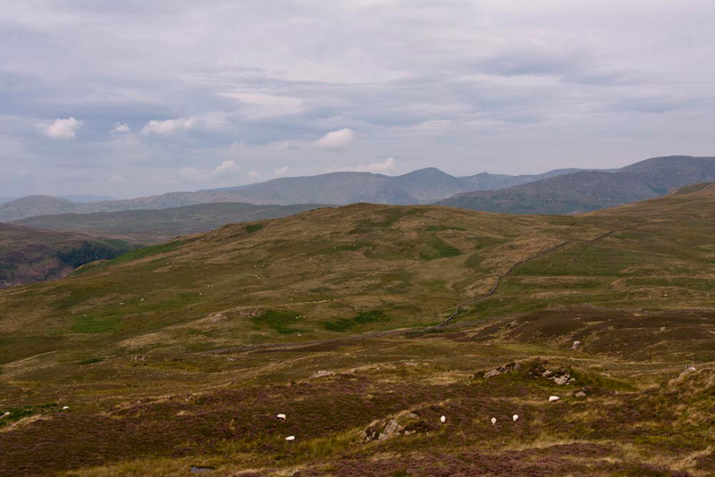
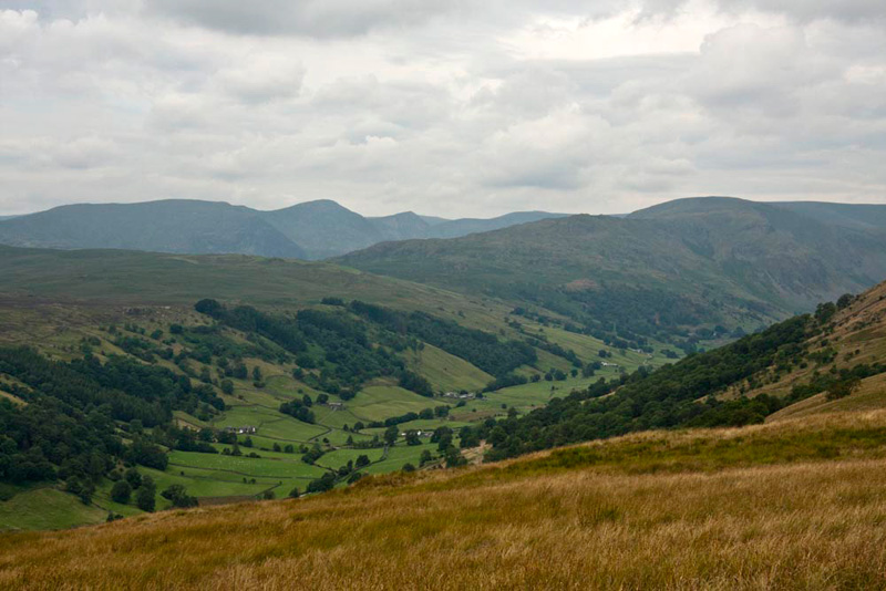
"Wainwright, may well refer to Todd Fell, as a minor height, but wow, what a superb view it provides of Longsleddale", enthused Grizzly.
It certainly is pal", agreed Tetley. "Must be worth a picture Dad."
"In view too, are most of the Kentmere Horseshoe summits", added Allen. "On the far skyline from the left, Yoke, then the prominent summit Ill Bell, Froswick dipping then rising to Thornthwaite Crag. Then forming the ridge on the left side of Longsleddale, again from the left the grassy Green Quarter Fell, rocky Shipman Knotts and Kentmere Pike."
Now looking right and due north, we could set our sights on the next objective Capplebarrow.
"We head down towards the wall, and if I remember correctly we will have to climb over near the corner", said Shaun.
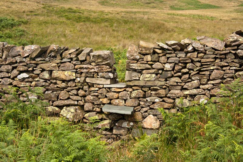
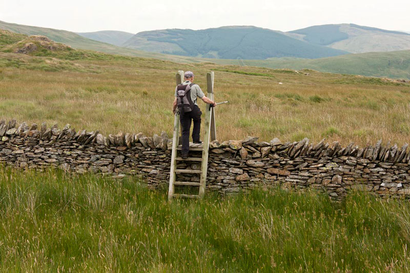
Well indeed that was the situation in 2006, but since then a new ladderstile has been provided to cross the wall on the right. The old path is still very much in evidence, and we guess it will take a while before the new route becomes so clear. Dad snapped this shot of Uncle Eric climbing the ladderstile.
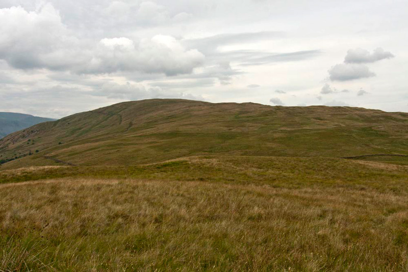
Then turning left, we joined the path by the fence on the long rather uninteresting climb to Capplebarrow. The fence crosses the summit although there is a small rise just to the left of the fence that perhaps marks the highest point.
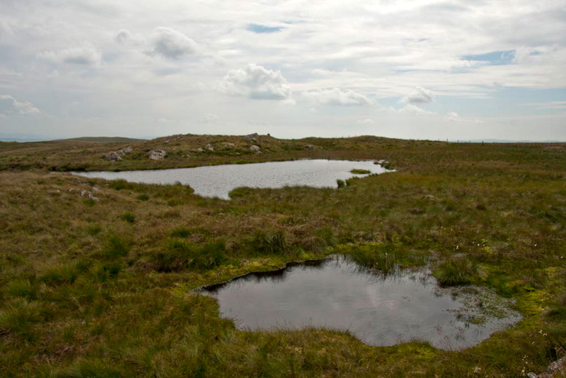
After Dad had taken our picture, we settled in his rucksack, and we walked on by the fence, descending into a dip, where the path deviated from the fence to avoid a boggy area, and circumnavigating two tiny tarns.
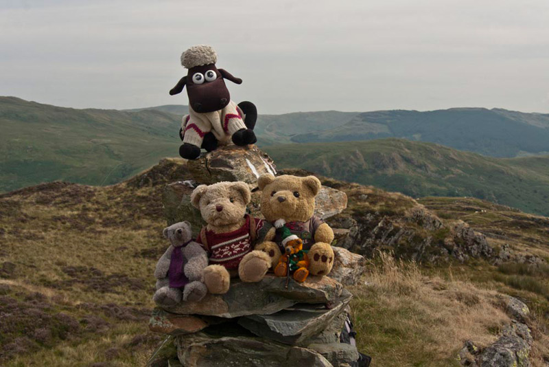
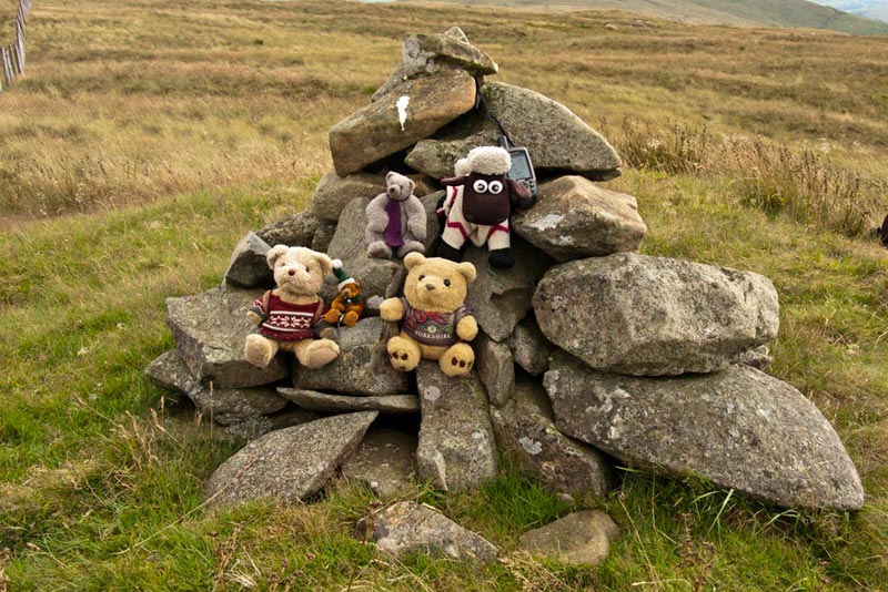
From here, it was just a short climb to the highest point today, marked by a cairn, just on the other side of the fence. This in Wainwright is the unnamed summit at 1819ft, but the name Ancrow Brow is shown on the OS map, which has been used by Birkett to name this summit.
"Come on pals", shouted Little Eric, "let's sit on the cairn for our final summit picture today."
"Yippee", cried Little Eric. "That is three Wainwright Outlyers bagged and four Birketts too. It takes my Outlyer total to 97, just leaving me 7 to climb to complete the challenge and catch up with the rest of you. I hope that I will be able to do them this year as it will mean that I will have completed both the Howgills and Outlyers."
"Yes, let's hope so", replied Allen adding his support.
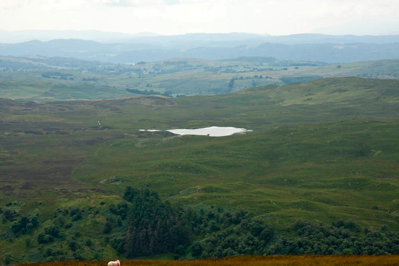
Then looking west, Little Eric asked, "what is that small lake over there."
"It is Skeggles Water, that sits above the far side of Longsleddale, nestled below Green Quarter Fell and Cocklaw Fell", said Shaun in a flash.
"Well having got the climbing out of the way, I think it is time for lunch", said Uncle Eric.
"Ooh yes", replied Allen enthusiastically, "my tummy is rumbling."
As well as the fence there was now a ruined wall and not far along we found a convenient place to sit. Once again us and Dad had brought smoked salmon sandwiches-how posh, eh! We also had the lovely cherry and coconut slice that Grizzly and Little Eric had made. It was quite delicious too.
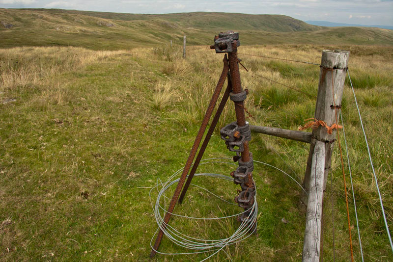
Lunch over we walked on past the 540m spot height and then the 541m spot height, where there was a small cairn on the opposite side of the fence and is referred to in Wainwright as the nameless summit at 1771ft. Then we continued a short way to where the fence bends away left. The fence has been replaced and wooden posts support it, but once long ago at this corner the support was this much more substantial metal corner post.
Uncle Eric said, "this is where we start to make our descent to the valley."
"Yes", replied Dad, "and we can see where we have to go", as Bannisdale stretched away into the distance below.
Looking at the map, Shaun said, "this is really the trickiest part of the walk, as the upper reaches are completely pathless and we have to find somewhere down the slope the track that will lead down to Bannisdale Head."
"Well if we were doing the rest of the horseshoe, Birkett says to head for a rocky outcrop on the far side, which is roughly where the track is too", said Uncle Eric.
So, we set off down, over the very rough terrain in that general direction. We kept stopping, Dad reading out the grid reference from the GPS, so that Uncle Eric could check against the map to keep us on course.
After a few stops, Uncle Eric said, "we now really need to turn away right from the direction of the outcrop into the valley.
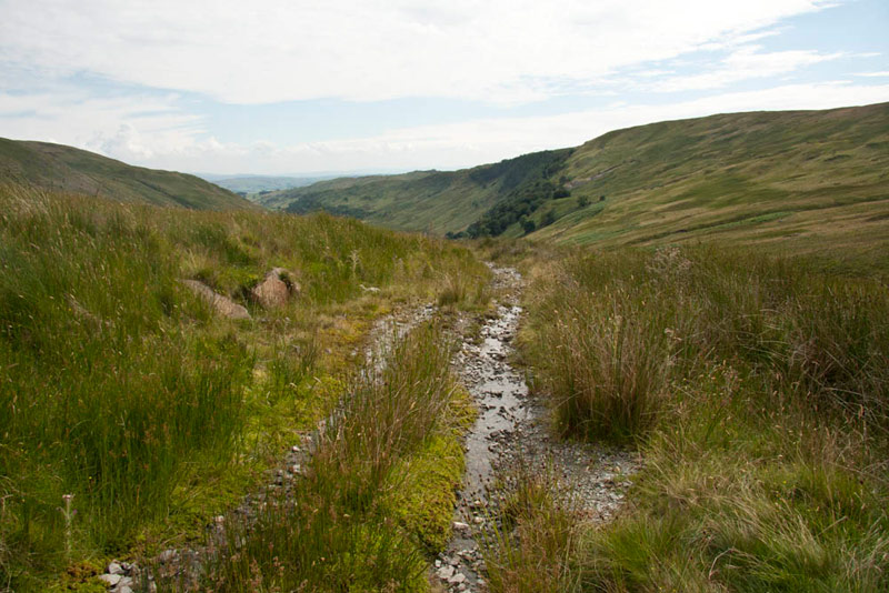
This we did and then soon after we picked up a path left by a farmer on his quad bike, and this seemed to be a good option to follow. It was and after it drifted on right, to everyone's joy we came to the start of the stony track.
"Great", cried Allen. "Now it is just plain sailing."
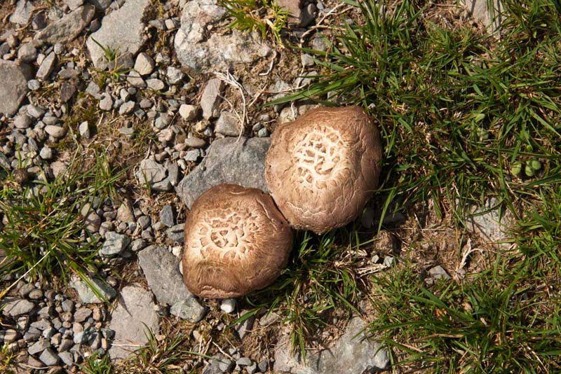
This was now followed as it wound its way down. At one point Dad stopped and pointed to the ground. "There is some fungi here, but what species it is I have now idea."
There was silence from the rest of us, as we had no idea either.
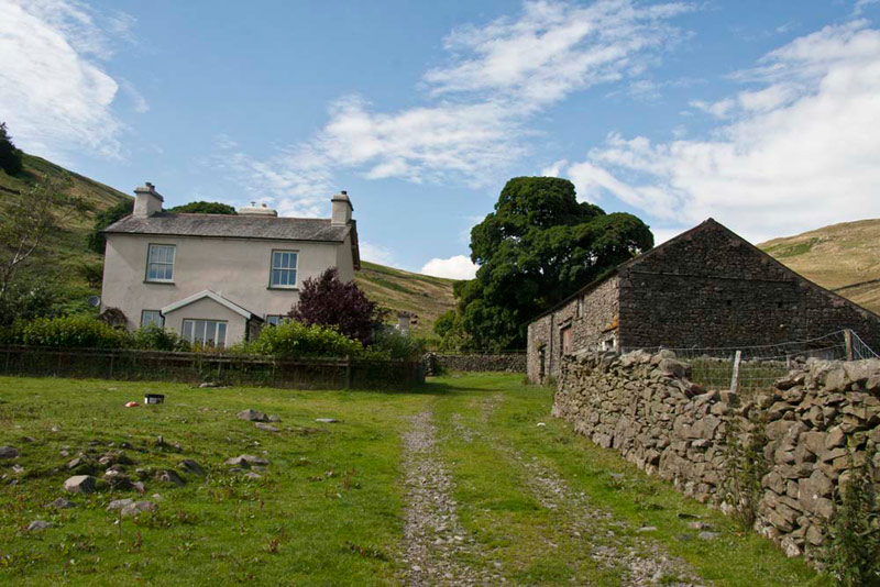
Towards its end the path descended in zig zags, coming finally to the buildings of Bannisdale Head.
"A bit lonely living here", remarked Tetley.
From here we now joined the access road for just under two miles to cross Dryhowe Bridge and reach the car.
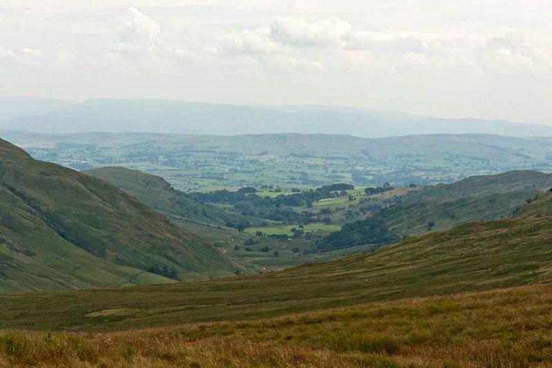
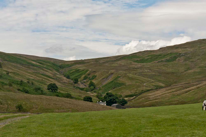
After a short way, Grizzly said, "that is a good view looking back up the valley and showing where we came down."
The track can be seen to the right zig-zagging down the slope. The ravine rising behind the house, contains Bannisdale Beck whose source is on the slopes just below the ridge between the 540m and 541m spot heights. It runs right through the valley and on, eventually becoming the River Mint, at Whelpside, at its confluence with a smaller stream, draining a group of small valleys from headwaters in The Forest, Combs Hollow and Mabbin Crag.
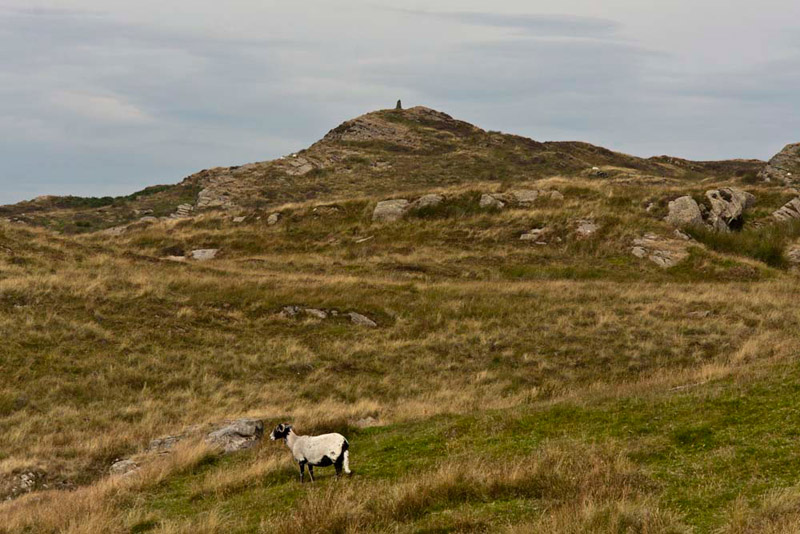
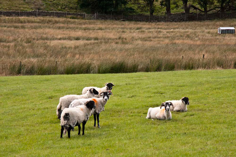
Now, you may have noticed that so far there have not been any pictures of sheep in this story, but just when we thought we were safe, a group were quietly grazing in the field where Dad had taken the above picture. He quickly swung the camera around and snapped off a shot, much to our despair!
"Well that has been an excellent walk, and good views too", said Uncle Eric, as we reached his car.
"Yes, agreed Allen, "and here's to getting the northern side done soon and further advancing yours and Little Eric's Outlyer totals."
So now all that remained was for Uncle Eric to kindly drive us to his house in Kendal, where we decamped to Dad's car for the drive home.