1.Clapham car park (SD 7460 6921)
2.Disused quarry on Storrs Common (SD 7021 7339)
Summits Achieved
Name
Height (ft)
Height (m)
Grid Ref
Ingleborough
2373
723
SD 7412 7455
Preface
Allen, Southey and Tetley were huddled round the laptop, with Allen tapping the keys with his paw. "That was a lovely walk last week with Uncle Eric to Eskdale and Muncaster Fell", said Allen, bringing up the pictures Dad had taken.
"Excellent weather and visibility, as the pictures portray", added Southey.
"I was so glad for your sake and Uncle Eric too, as the views are quite stunning", replied Tetley.
"I wonder if we will get out this week?", mused Southey.
Just then Shaun, Little Eric and Grizzly arrived with the tea and cakes. "I overheard you Southey, and can tell you all that Dad is taking us out on Wednesday. There will be no need to come up with a plan, as he is taking us up Ingleborough."
Grizzly went on, "Dad said that we have not been up a proper hill since climbing Pendle Hill last November, so he needs this to assess how much he has lost fitness."
"That's great", cheered Allen who had gone to get the plates and mugs.
"I'll help pour the tea, Shaun", said Southey.
"Thanks pal."
Opening the tins, Little Eric said, "Grizzly has made flapjack, and I have done mincemeat slice."
"We have not had those for a while, so we thought it would make a nice change", added Grizzly.
We all helped ourselves, Allen commenting, "they are scrumptious."
"Mmm", agreed Tetley. "Thanks pals as always."
"It was 2010 when we last went up Ingleborough, that being our third ascent", said Allen. "We have been up most of the ways from Clapham, Ingleton and the Hill Inn.
"That last is very steep up to the col", remarked Tetley. "As you approach there does not seem to be a path at all. Has Dad said which way we are going up this time?"
"From Clapham, via Trow Gill", replied Shaun. "The way we first climbed it with Uncle Bob in December 2006."
"I can't wait", cheered Southey, "It will be another summit I will bag."
At the time of our ascent from Clapham, Uncle Eric had not climbed either Pen-y-ghent or Ingleborough. At Dad's suggestion we took him up Pen-y-ghent on 31st March. This meant he had then done two of the Yorkshire Three Peaks, having been up Whernside with us some years ago.
We were anxious therefore for Uncle Eric to bag Ingleborough, so were very happy when Dad suggested to him to make the ascent from Ingleton.
The Walks
Ingleborough from Clapham
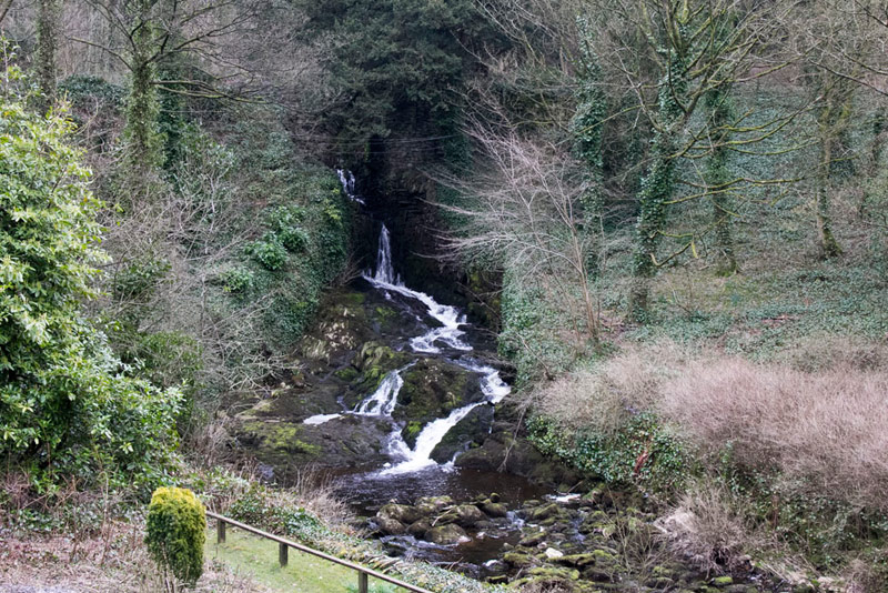
From the village we walked along the road towards the church, Dad pausing to snap this shot of the waterfalls on Clapdale Beck.
"Through this gateway?", queried Southey.
"That is the Ingleborough estate, and there is a toll for that path", replied Tetley. "Back in 1970, when Wainwright wrote his book, it was in 6d (2.5p) and the tickets were obtained from a cottage."
Grizzly pointed saying, "things have changed since then. There is now an electronic machine", and looking closely, "the cost is now 65p!"
"Well I have no change with me", said Dad. "I guess there will probably be no one to check whether we have bought a ticket, but for the sake of honesty, we can go via Clapdale Lane."
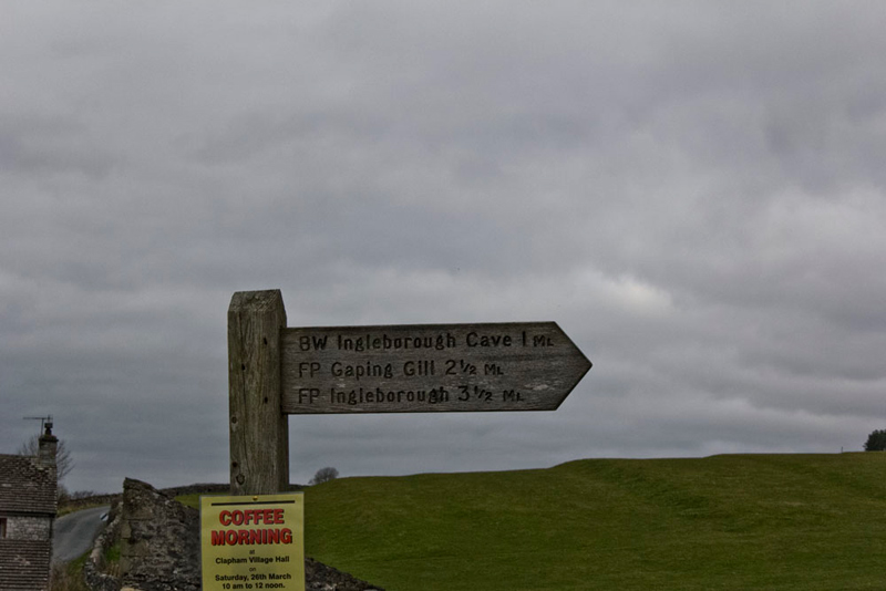
This was a few yards further on indicated by this signpost.
"Hmm", mused Shaun. "Wainwright indicates the distance as 4.5 miles, and he is not usually wrong."
Dad's GPS was to confirm this, so walkers beware, this signpost is a lie!
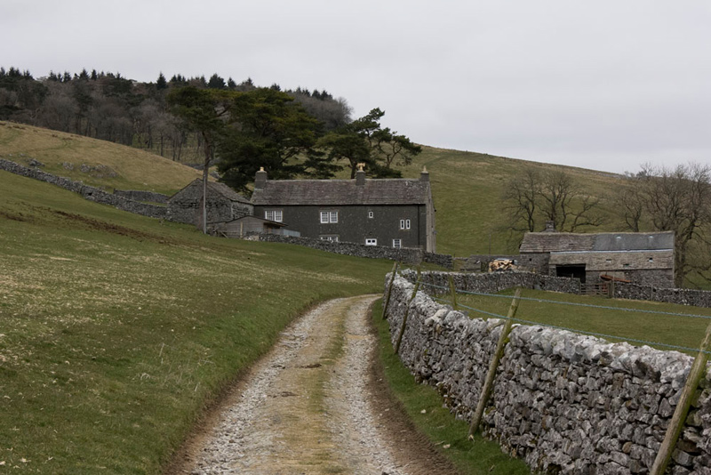
The lane is the access to Clapdale Farm, seen here on the approach.
"It is through the buildings, then immediately right to descend to the valley", instructed Shaun.
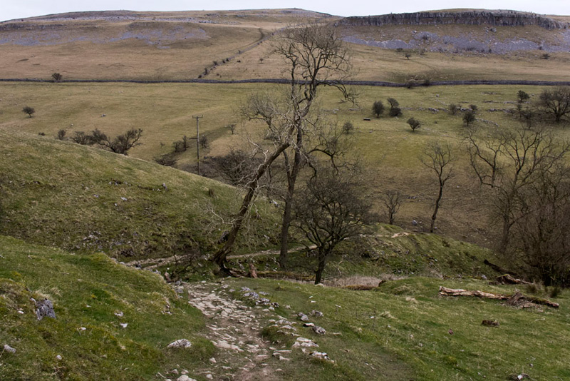
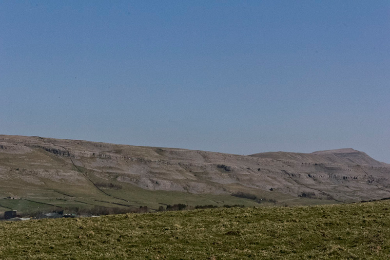
"That's Thwaite Scars on the far side", pointed out Allen.
Shaun studied the map, saying, "the cairn on the skyline above the tree, is likely the summit."
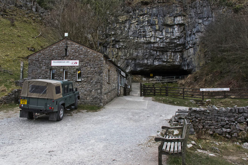
In the valley the good surfaced track was followed left, so soon pass the entrance to the famous Ingleborough Cave. A very popular tourist attraction that has been welcoming visitors for 175 years.
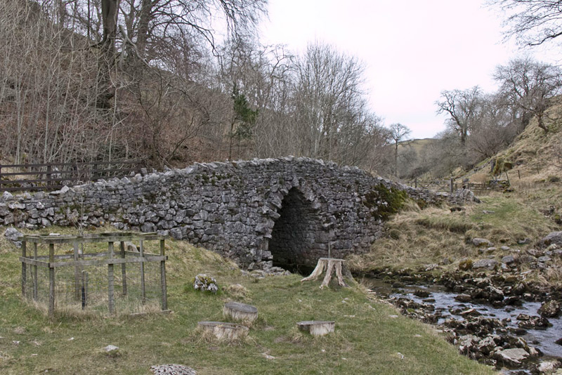
The track continued crossing the beck by this bridge, at the point where it emerges from underground. "How interesting", commented Southey.
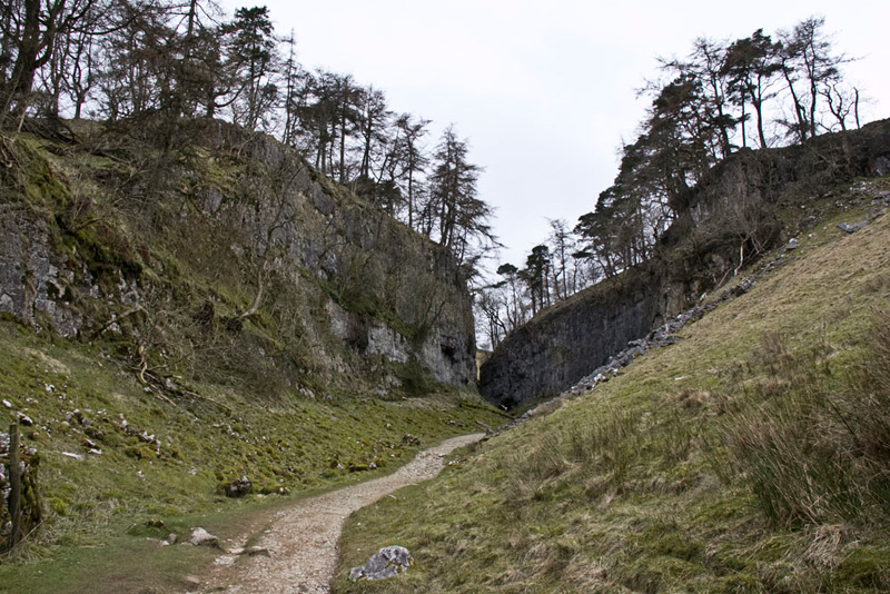
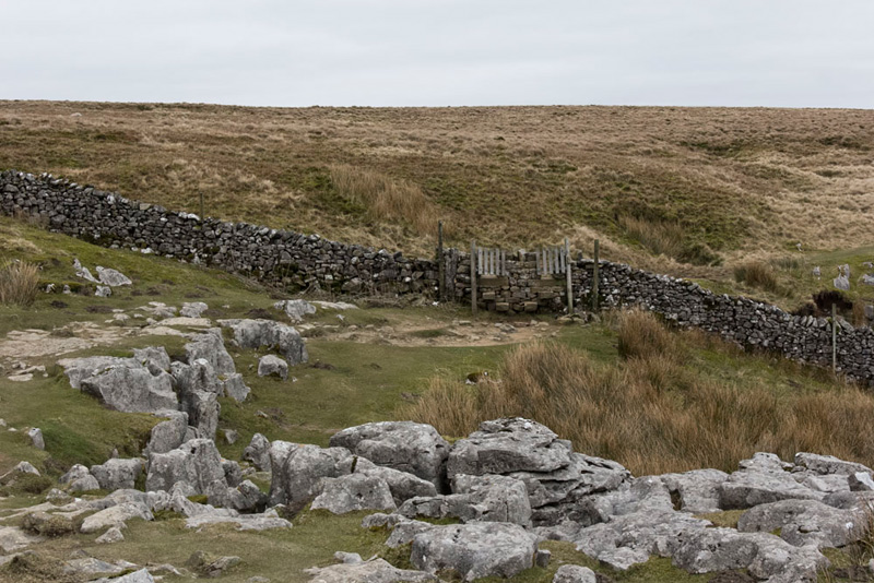
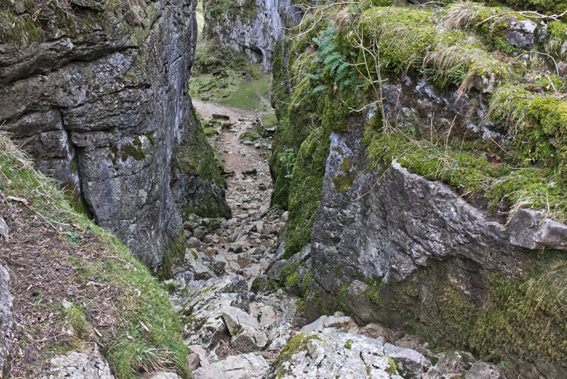
Crossing the bridge the track led on to a gate and step stile over the wall. Soon then to arrive at the towering cliffs of the ravine of Trow Gill...
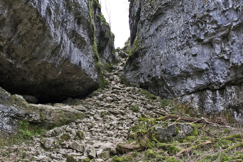
...where a rocky scramble up a narrow defile allowed progress.
Now with a wall on the left for company the path led on for another half mile to reach a double gated step stile into open moorland.
Soon at a divide in the path, Shaun said, "If we go left it will cut off a corner."
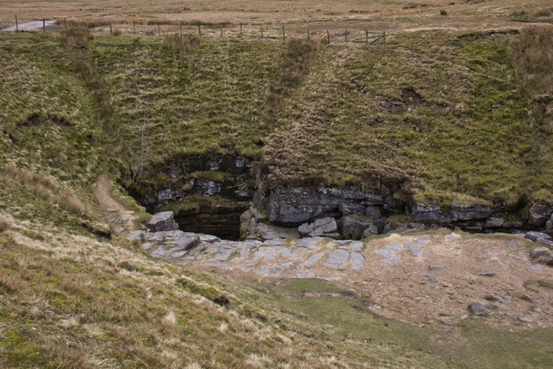
"Aye lad, but I want to go and have a look at Gaping Gill, the very famous pothole."
The area is fenced so we decided just to view it from there.
Gaping Gill, is a 98-metre (322 ft) deep pothole with the stream Fell Beck flowing into it. After falling through one of the largest known underground chambers in Britain, the water disappears into the bouldery floor and eventually resurfaces adjacent to Ingleborough Cave. Gaping Gill has the records for the tallest unbroken waterfall in England and the largest underground chamber naturally open to the surface.
The Bradford Pothole Club around Whitsun May Bank Holiday, and the Craven Pothole Club around August Bank Holiday, each set up a winch above the shaft to provide a ride to the bottom and back out again for any member of the public who pays a fee.
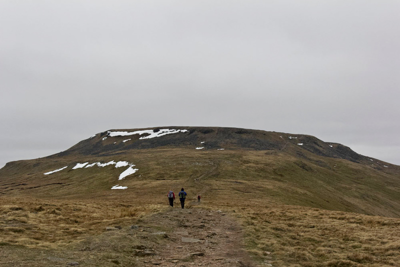
Returning to the path, Dad now put best foot forward towards Little Ingleborough, the steep path to the top, which has for the large part been flagged into steps, being the meat of the ascent.
This was the real test for Dad, and after one part he paused, saying, "phew my legs feel weak. I have certainly lost some of the muscle strength. I'll have to get that back if we are to tackle the Lake District fells."
It is not a race so Dad made a few stops before finally reaching the flat top. On the way we passed a gentleman from the National Park who was clearing the path gullies, Dad having a chat, and then with another walker.
The hard part done it was then a gentle stroll and ascent to the plateau. Just as we reached this we met a young lady, dressed just in short shorts and t-shirt, hardly seeming the attire for this chilly day.
She asked, "is this the path to Horton in Ribblesdale."
"No, Clapham", Dad replied. "The direction is that way", as Dad pointed towards Pen-y-ghent.
"I see the path, now", she replied. Then saying, "thank you", as she ran off.
There were a few other people doing this today, scoping out the route for the famous Three Peaks Fell Race to be held on 30th April. This starts and ends in Horton in Ribblesdale and involves some 4000ft of ascent up and down Pen-y-ghent, Whernside and Ingleborough over a course of some 23 miles. The record stands at 2hrs 46mins. Makes us tired just thinking about it!
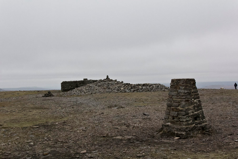
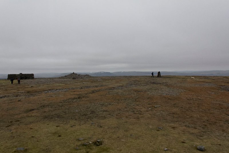
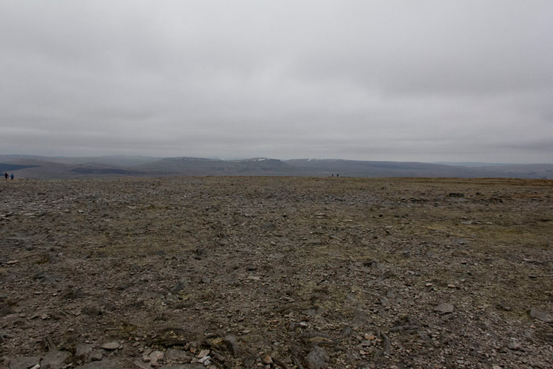
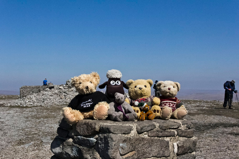
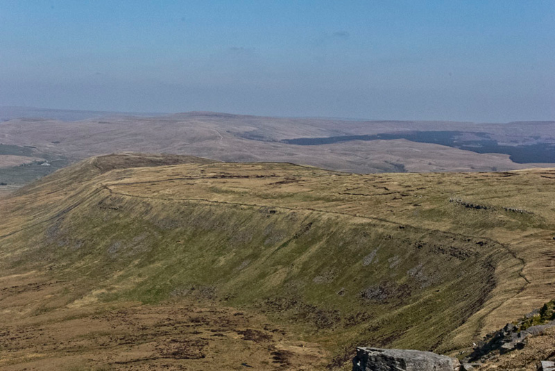
The summit of Ingleborough is a plateau a half mile in diameter tilting to the east. So there was still a little bit of ascent to reach the trig point, large cairn and shelter in the form of a cross.
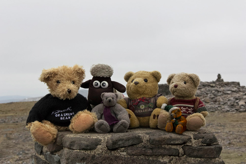
"Yippee", another summit bagged", cried Southey. "Come on pals, let's sit on top for our picture."
"Time for lunch", called out Allen, rubbing his tummy. "I'm hungry."
"You're always hungry", replied Tetley with a laugh.
We settled at the shelter enjoying our sandwiches, cake and tea, and listening to Dad chat to two different groups of walkers with lots of laughs.
They talked to a gentleman who was also checking the route of the Three Peaks Race. He told us " I am attempting it for the first time." Then went on, "if I make it to here, I think I'll just want them to shoot me!"
We were commented on by some walkers and at their request Dad gave our website address.
Wanting to give readers some idea of the extensive nature of the summit plateau, we asked Dad to take some pictures.
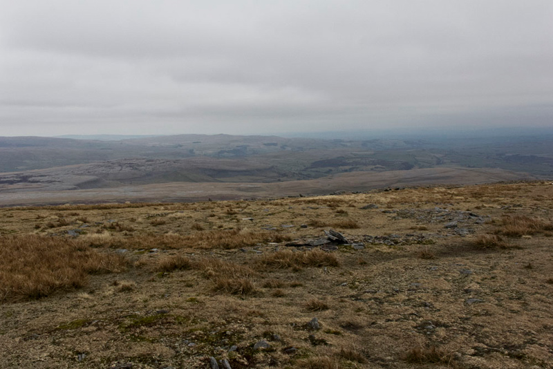
Below is the view looking east from where the path descends to Ingleton.
The full extent is not viewable due to the tilt, so still looking east this shot is taken from the trig point. Just note how small the distant figures are.
There are four routes on to the summit. From Clapham, Horton in Ribblesdale, Ingleton and from Simon Fell. If the mist were down it is easily conceivable how disorienting it would be and how easy it would be to take the wrong route down.
There are some interesting features too, including the low remains of the walls and some hut circles, from the Iron Age Hillfort, like this in the picture below.
So concluding our exploration it was time to make our descent the same way, first towards Little Ingleborough...
... to follow the stepped path. "It's hard on the knees", grimaced Dad.
"The path had to be repaired bearing in mind how popular the route is, but it would be a bit dicey in icy conditions", commented Grizzly.
"I agree", replied Dad. "In that case I would walk on the grass at the side"
Once down, Dad strode on coming to the double gated step stile.
"We used the left hand one on the ascent", said Little Eric.
"So, for the sake of completeness it's the right hand one this time", replied Dad.
Soon after we arrived at Trow Gill, making the rough descent...
...and so on to Clapham.
"That was a great day", exclaimed Little Eric.
"Aye pal, a grand day out", agreed Tetley.
"Yes lads a a good workout for my legs and I am sure the next climb will feel easier."
"I guess now it's to Elaine's for well earned refreshment?", said Allen.
"Sure thing lad."
Elaine was not there but he was looked after by Jo, Nicola and Hannah Booth. He had a delicious scone with butter and jam, a slice of chocolate caramel shortbread and warming pot of tea.
2. Ingleborough from Ingleton via Crina Bottom
So on a truly glorious spring day with cloudless skies, we met Uncle Eric at the disused quarry on Storrs Common, a very short distance along the Hawes road from Ingleton.
Our objective was Ingleborough once again, the main purpose being that Uncle Eric would finally bag the summit.
As they got ready Southey commented, "it is my second ascent, but the route is completely new to me, so I am really looking forward to the walk."
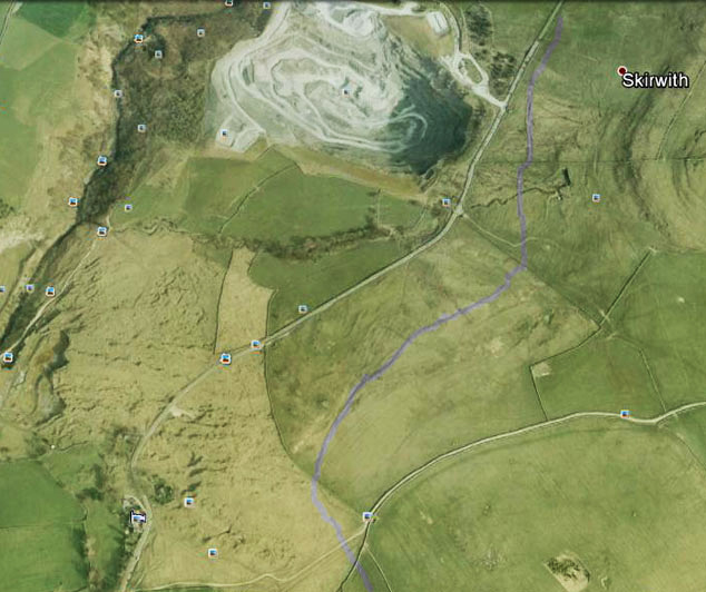
The route is described in Wainwright's, 'Walks in Limestone Country', and earlier Shaun had quoted from it, "'some 60 yards before the gateway the path crosses a low embankment, formerly a mineral railway serving the disused granite quarry on the Hawes road.' We must bring this to the attention of Uncle Eric as it will be of interest to him."
A narrow trod leaves the parking area and wound its way upwards and come by the wall, where following a short distance right we joined the main track, Fell Lane.
"We need to walk down to try and find the embankment", said Tetley.
"I'll pace it out", replied Uncle Eric, striding off, to come to a halt about a minute later.
Looking left and right, Grizzly said, "this is it. There is definitely a low rise marking the route.
"Yes", agreed Uncle Eric. "The large rock marks the point it crossed the path."
Now, with Uncle Eric's interest in railways he has many many books on the subject and said, "I will see if I can find out any information about this."
This apart, we are an inquisitive group, and decided to see what we could find out, when we got home. Tetley suggested, "let's look at Google Earth."
"Good idea", replied Allen, booting the laptop and bringing up the program. "I'll search for Ingleton to get us in the general area."
This done he then made adjustments to the actual location. "Look", pointed Grizzly. "There's Fell Lane, and here is the line of the embankment. It crosses the wall we walked by from the start, then there is clearly a line across the next pasture and on to run close to the Hawes road." This is illustrated after editing in Photoshop by the purple line.
Next time we saw Uncle Eric he told us that at the quarry end the railway terminated on the south side of the Hawes road. The quarry was on the opposite side, and the rock was brought across to be loaded. The continuation at the bottom of the picture cannot now be made out, but it went on over the next field before turning right to end at the Midland Railway Station, the site of which is now the main car park in Ingleton.
Right then, back to the walk.
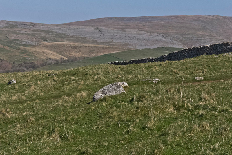
Returning to the gateway we then strode the wide Fell Lane. "What a terrific view of Twistleton Scars and Whernside", called out Little Eric."
"OK, I get the hint", replied Dad.
The lane meandered on, finally coming to a gate to the open fell.
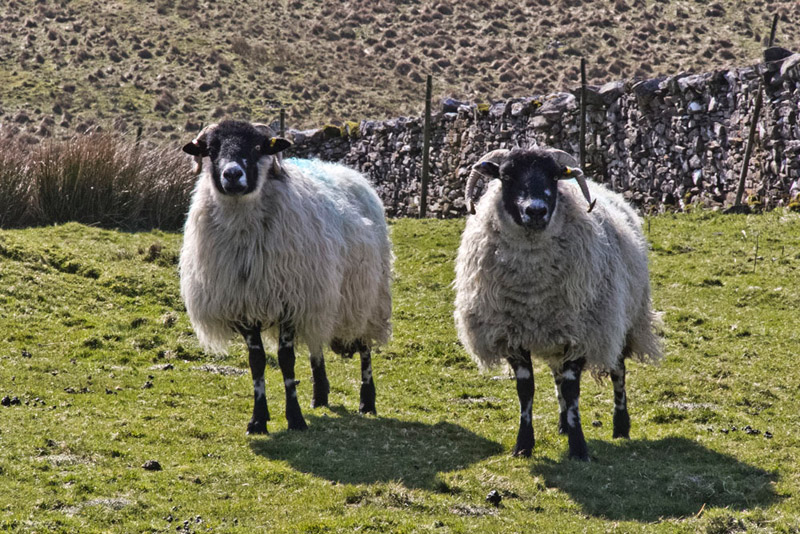
"Look", whispered Southey, "those two sheep are posing for a picture."
"Bother!", exclaimed Allen, "there goes the sheep picture free story."
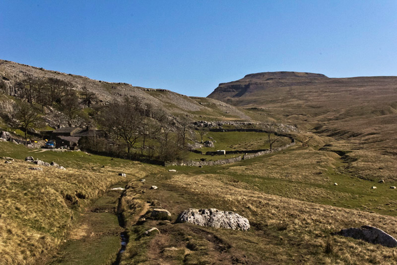
Fell Lane ends at Crina Bottom Farm. The scene of it nestling under the scar, with Ingleborough majestic behind, is a delight.
"We head down and then follow the grassy path to the right of the boundary wall", said Shaun,
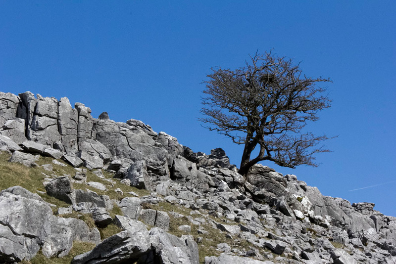
As we strolled on Little Eric commented, "I think that will make a nice picture of the limestone boulders and tree against the blue sky."
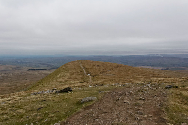
Further on the path is surfaced as it crosses moorland, to then finally ascend the escarpments by steps, to the summit plateau, where it was just a short way to the trig point.
"Come on", urged Shaun, "time for our picture again."
"Time for lunch", said Uncle Eric. "I'll head off to get a seat at the shelter."
"Ooh yes", agreed Allen rubbing his tummy, "I'm.."
"..hungry" interrupted Tetley, letting out a bellow of laughter.
It was very pleasant sitting here. Dad had met another walker while waiting for Uncle Eric to reach the top, and he came to sit at the shelter. They chatted. He was from Wigan and after his walk was then going to see a play at the Dukes Playhouse in Lancaster.
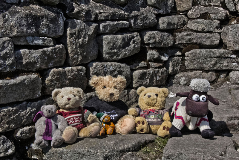
Before setting off again, we posed here too, for our picture.
At Dad's suggestion we now walked round the rim, so that Uncle Eric could see the various features, and take in the views.
Snapping off a few shots in quick succession, Uncle Eric joked, "come on Gerry you're English not Japanese!"
We laughed too, but here are the results of Dad's effort.
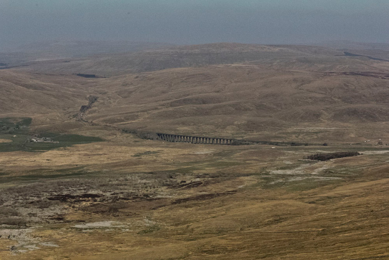
First, Ribblehead Viaduct looking like part of a model railway. The line can be seen curving left to the entrance of Blea Moor tunnel.
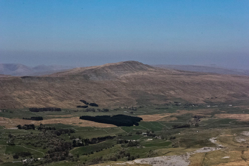
Then turning the camera left, this of Whernside, Yorkshire's highest hill.
To the right, Tetley said, "that's Simon Fell, with at the far end Park Fell."
He then went on, "the last time we climbed as we have done today, we were with Uncle Bob, and we then went on across them both and so down to Ribblehead."
"But the car was at Ingleton", said Southey in bewilderment.
In explanation, Allen said, "Uncle Bob's car was left at Ribblehead and Dad's at Storrs Common."
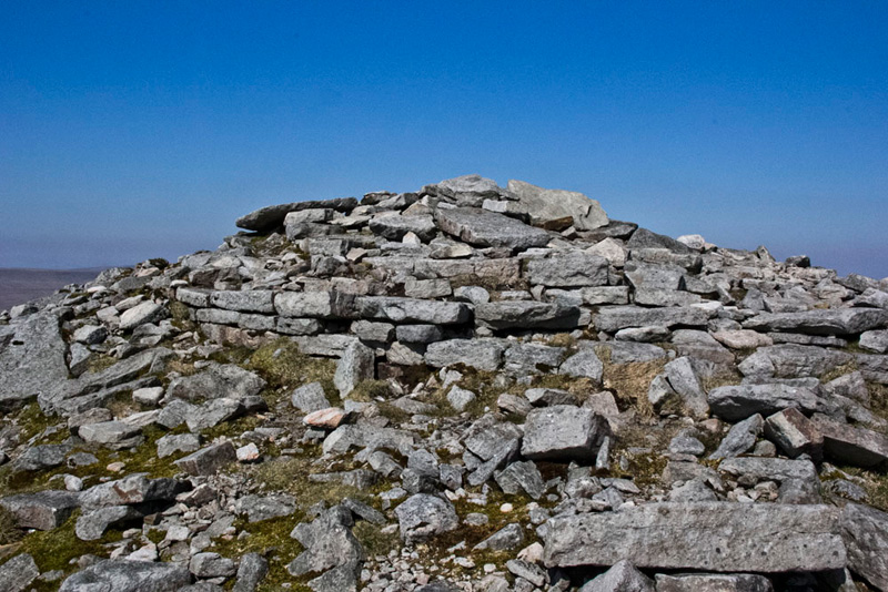
Completing the circuit we arrived at the pile of stones that had once been the hospice, and if you look carefully some of the foundation stones can still be seen.
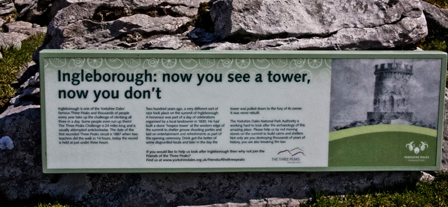
This information board has been provided showing a depiction of the hospice tower, and relating what happened on the opening day.
'Ingleborough with Pen-y-ghent and Whernside is famous for the Three Peaks Challenge that takes place on the last Saturday in April.
However, two hundred years ago, a very different sort of race took place on the summit of Ingleborough. A horse race was part of the day of celebrations organised by a local landowner in 1830. He had built a stone 'hospice tower' at the western edge of the summit to shelter grouse shooting parties and laid on entertainment and refreshments as part of the opening ceremony. Drink got the better of some disgruntled locals and later in the day the tower was pulled down to the fury of its owner. It was never rebuilt.'
"That has been very interesting", said Uncle Eric. "I have finally climbed Ingleborough."
So all that remained was for us all to descend and retrace the route to Storrs Common.
Time for a cup of tea, Dad suggested to Uncle Eric, "how about going to Country Harvest. A pot of tea and scone with butter and jam, was just the ticket to round off the day.
Saying our goodbyes to Uncle Eric, we all said in unison, "that has been a grand day out!!!