The day as forecast was beautiful, dry sunny and clear with no wind. Cold to start, but the day warmed up.
Dad had told us that he wanted to be walking before 09:30, so that meant getting up early and it was about 08:30 when we set off. An easy drive up the M6 to junction 39. At the top of the slip road we turned left onto the link to the A6, there being a layby on the right in just a few yards.
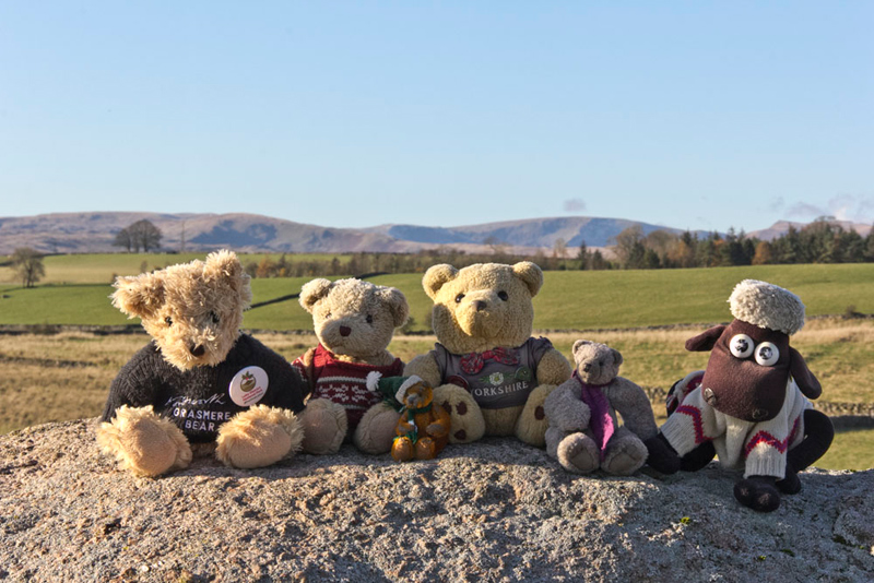
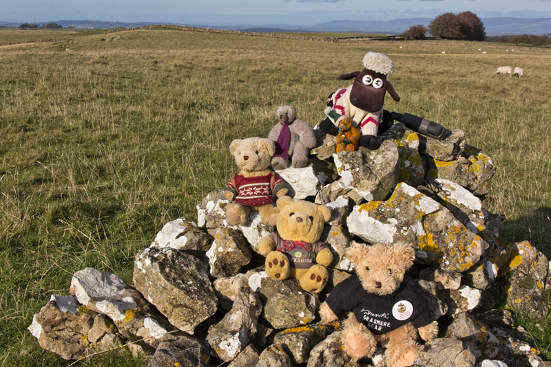
Dad busied himself getting ready, while we looked about. The air was clear, Tetley saying, "we are sure to be in for some good views today."
"Couldn't have chosen a better day for it", agreed Grizzly.
This walk is straight off the map and on paths that none of us had ever walked before, so we were eager to be off.
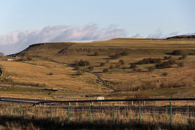
The area of the walk was east of the M6, and looking across, Allen, said, "that must be our route along that narrow road."
"That's right pal", replied Shaun. "It goes past that house called The Nab and on to the hamlet of Hardendale."
"I'm ready", called out Dad.
"OK", replied Grizzly. "Come on pals, let's get settled in the rucksack."
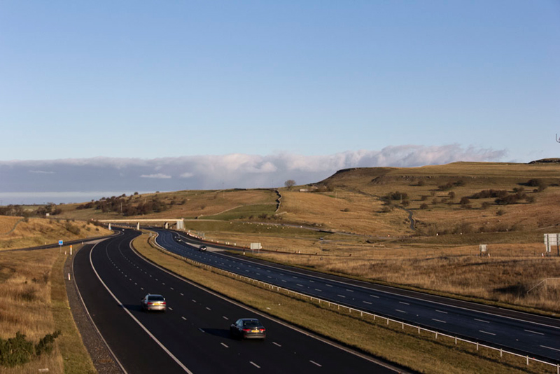
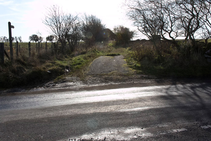
This shouldered, he strode off, crossing the M6. This is the view looking north.
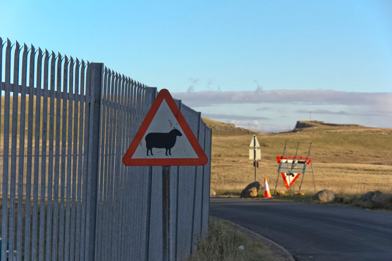
The road went left, Allen saying, "oh dear", as he saw this sign warning motorists to beware of sheep. "I'll have to keep my paws crossed that any sheep do not come into camera range."
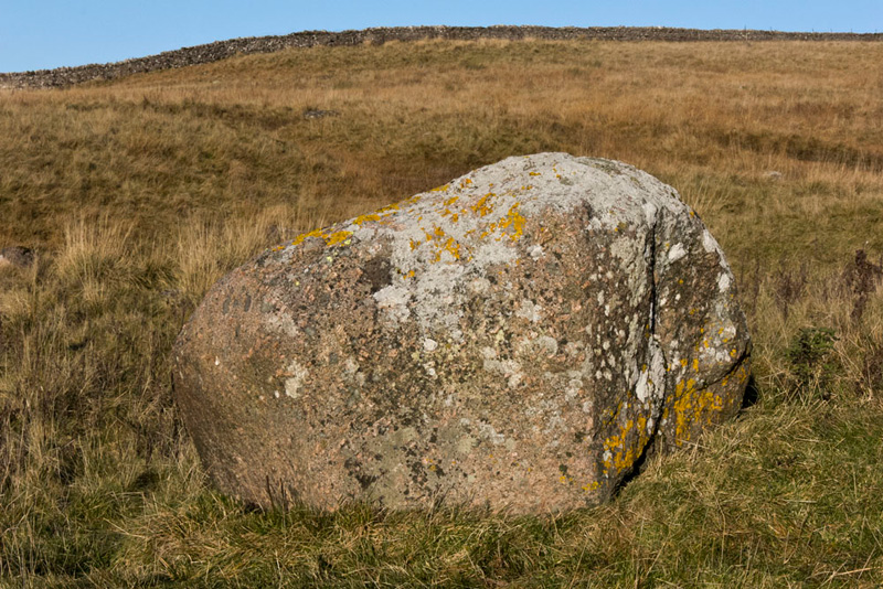
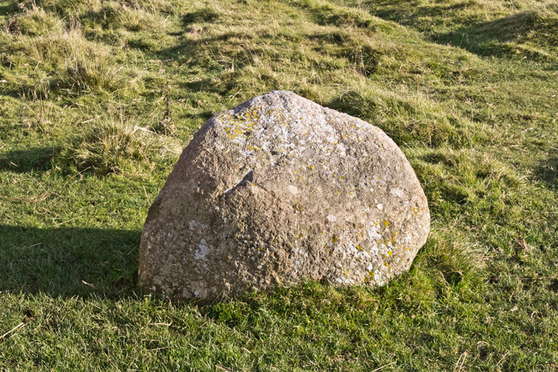
The road dropped down and was lined with boulders to the right, and this larger one stands just off to the left.
"They're all Shap granite", said Tetley. "This is of no surprise, of course, as there are a number of quarries in the immediate area."
"This is easily recognisable, from the pinkish tinge", commented Grizzly.
After passing the quarry roads going left and right, we climbed steadily to pass the house called The Nab.
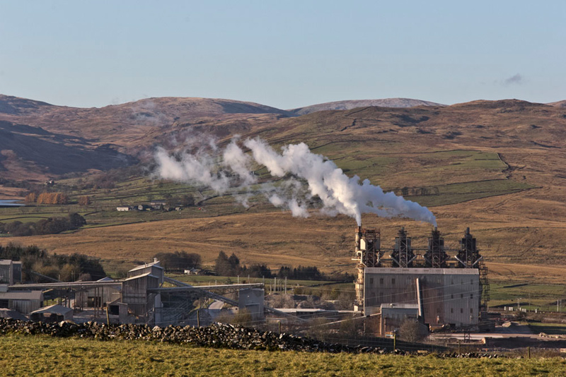
"Look", called out Allen pointing left. "There's the chip shop."
"What?", cried Southey mystified, as all he could see was the cement works.
"Oh pal this was started by Uncle Brian. Every time he passed he would say, here's the chippy. Then he would have gone on to say there are two pans on", explained Tetley, laughing. "It has stuck such that Uncle Eric also refers to it similarly."
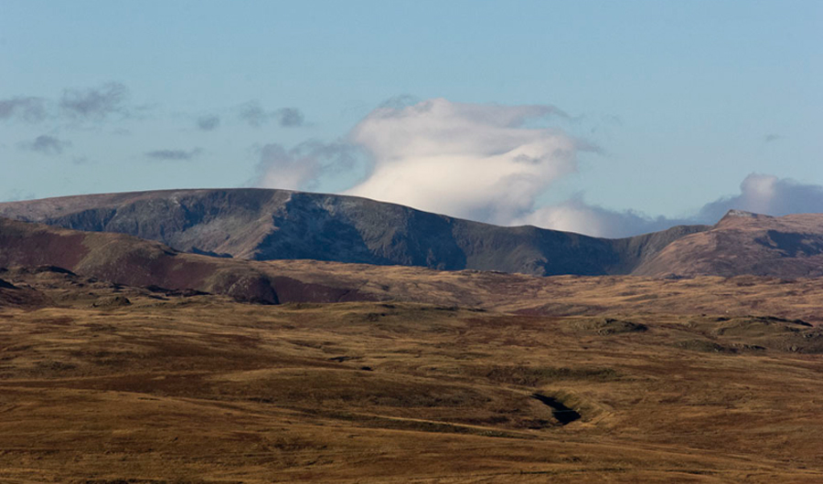
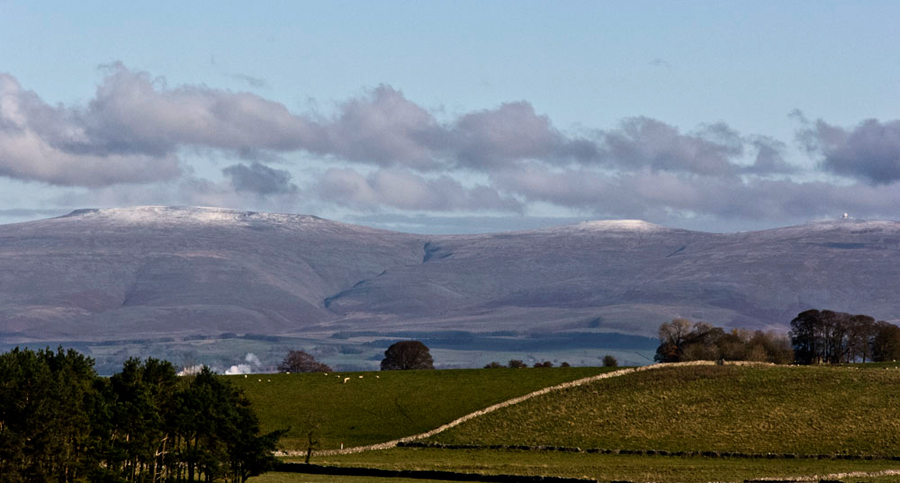
"Wow how clear the fells are. Do take a picture", implored Little Eric.
"What can I see?", asked Southey.
"High Street (828m 2718ft) is to the left of centre, and the triangular pointed summit to the right is Kidsty Pike (780m 2560ft)", obliged Tetley. "We all, you included pal, climbed High Street twice in a week in May 2016. The first was via that prominent spine over Rough Crag, rising almost to the summit. Then later that week along the ridge from The Knott and then on to Thornthwaite Crag."
"What a memory you have pal", breathed Southey.
The reverie over Dad now put best foot forward and continued along the road first over the shoulder of Hardendale Nab to our right, and on to its end in the scattered tiny hamlet of Hardendale.
A gentleman was finishing off building a wall at his property and Dad stopped to chat. He was very interesting to talk to as he knew Morecambe where we live and also Southport that is Dad's home town. He mentioned Lord Street in Southport with its Victorian verandahs, saying that is not what is was. Something Dad heartily agreed with. Sign of the times and changes in shopping habits. Dad explained where we were going today. He said "these paths are little walked and you are the first walker I have seen (we thought he was about to say today but instead said) all week!" They chatted until his wife brought a mug of tea for him, at which point Dad said goodbye and we strolled on.
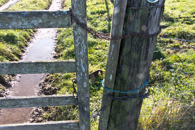
Now on a track we passed through a gate and on to the next. The route was not entirely clear. Despite the gate being tied up Dad climbed over and Shaun said, "it would be best if we cross towards the far wall and go right by it. If any readers should wish to do this walk we should point out that we did not follow the correct route here. The path is in fact on the far side of the wall referred to. At the tied up gate the correct route is down to the left and so to another gate on the right.
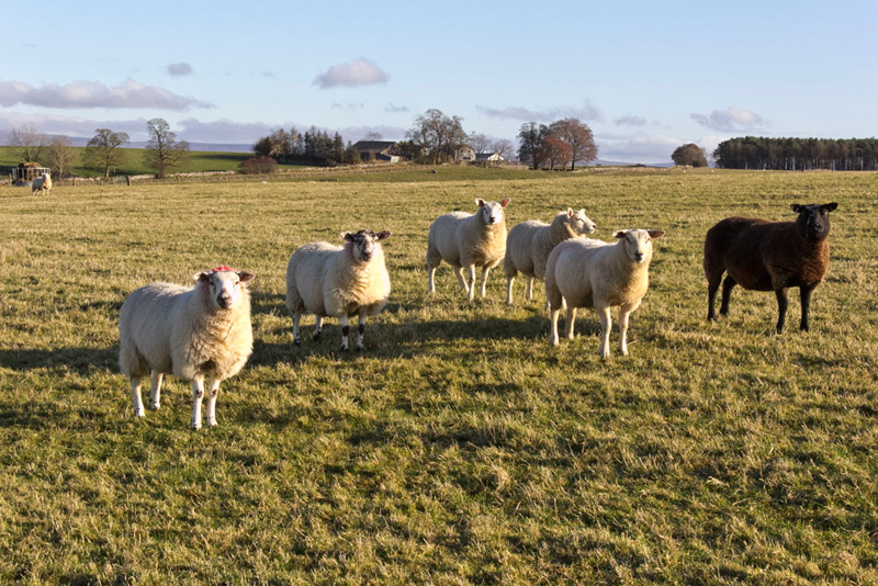
Up to now Allen's luck had held, any sheep indeed being out of camera range. Not so here as this group were in Southey's words, "begging to be photographed."
"Darn", said Allen, as Dad lined up the camera. "Still I would have been surprised to avoid any sheep pictures today."
Is it our imagination, but the one on the left seems to have a bow on its head?
As we approached a cross fence, Little Eric said, "there does not seem to be any way over at the corner with the wall."
Eagle eyed Grizzly called out, "no pal, but there is a climbable hurdle, over to the right."
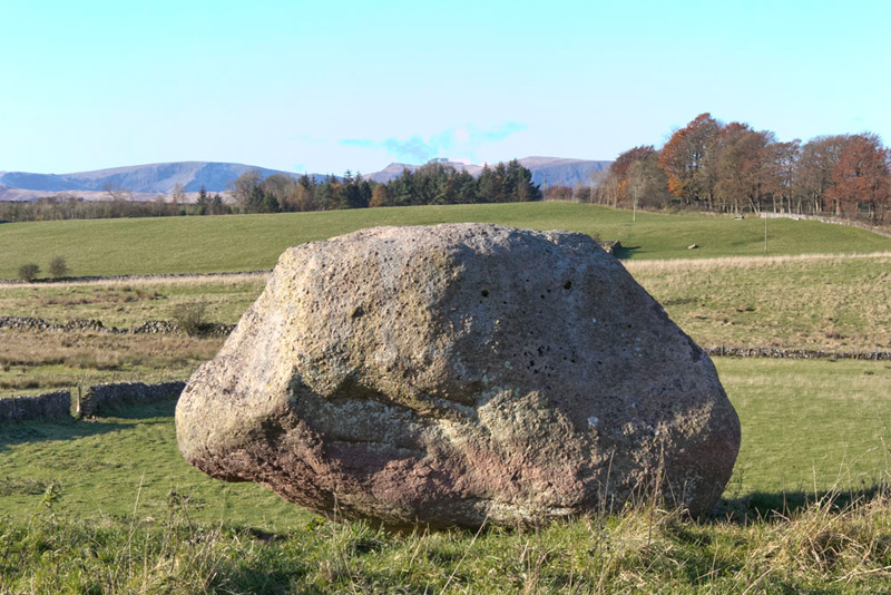
Beyond the ground dropped and we could see a gap in the next wall and the large boulder of Shap granite called the Thunder Stone. "That means we are on route", confirmed Shaun.
"It's got a nice flat top", pointed Southey. "Perfect for us to sit on and have our picture taken."
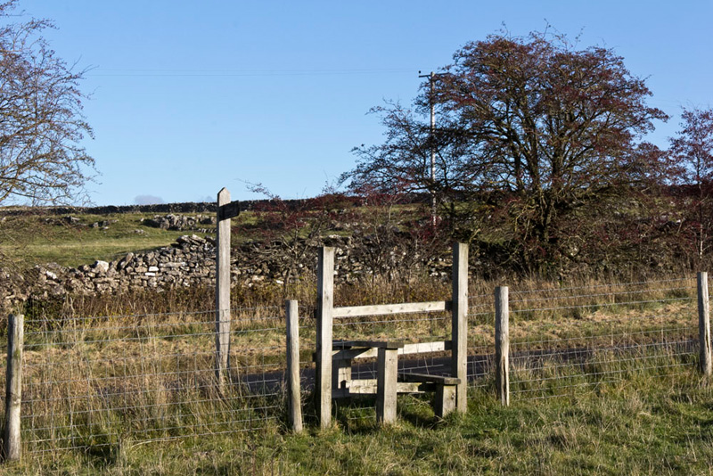
Settled in the rucksack again, Shaun pointed, "it's over that stile then right along the road."
Climbing steadily we passed the milk churn stand. "A relic of the days when the milk was collected in churns rather than as now by a tanker", commented Allen.
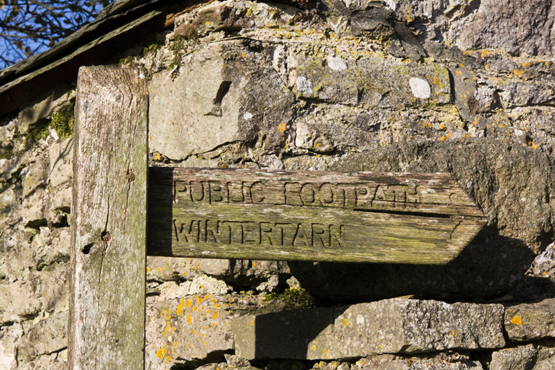
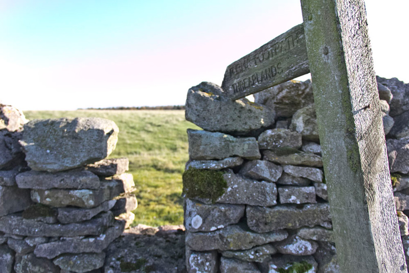
Shortly the entrance to Castlehowe Scar was reached, "Our route is through there", pointed Shaun.
While Dad was opening the gate, Grizzly looked up at the signpost, saying, "that is our destination for the next section of the walk."
In the yard Dad paused to make some notes, and we heard a lady call out, "hello are you lost."
"No", Dad replied, "I'm just making notes. The route is clearly through that waymarked gate."
Conversation ensued. The lady said, "these paths are very rarely walked. You are about the third walker I have seen this year! The former pheasant woods are rather overgrown, but you look like someone who is used to such difficulties."
Without a doubt we thought, but it was nice to be forewarned. Dad replied, "just a case of ploughing on. It has been nice to meet you and chat."
"Enjoy the rest of the day", she replied.
The first gate presented no difficulties, apart from the fact it had three fastenings. "Really belt and braces", laughed Southey.
Crossing the pasture Tetley said, "the Pennines look majestic today. "From left to right is Cross Fell (893m), Little Dun Fell (842m) and Great Dun Fell (848m)."
Through the sheep pens and on to pass right of a waymarked wall corner, to then go through the next gate in the wall on the left and walk on, now with the wall on the right, towards Great Field Plantation.
Peering ahead, Grizzly said, "looks like there is a stile just to the right of the boundary wall."
He was correct and immediately another stile was crossed over a broken down wire fence.
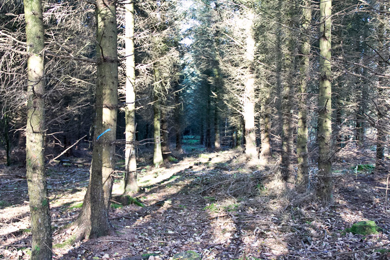
The path, if there really is one, is strewn with fallen branches, piled up more the further we ventured. "It's a bit eerie", said Little Eric, with a shiver in his voice.
After a few minutes, Tetley called out, "I can see light ahead marking the far boundary."
Nearing this any path seemed to be blocked by branches Dad just forcing his way through and carefully climbing the broken wall. Immediately left was a waymarked gate, and looking over this and left we could then see two stiles we should have used. We also spotted two deer moving through the trees.
Across the next two fields was Wintertarn Farm. "We head for the buildings according to the map", advised Shaun.
Moving to the gate, Dad said, "I just want to see where the waymark on the far side points as that will properly indicate the direction."
This was roughly diagonally across the field and not towards the farm. "Seems the path must have been diverted", said Shaun. "This will be fine as it will actually cut out some road walking and bring us to the road where directly opposite, is the start of the next section to Threaplands, over a stepped gap stile.
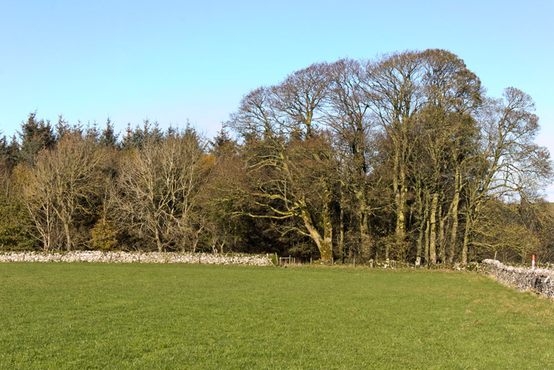
A pretty clear path led on. Dad stopped to get the camera out. "What are you taking now?", asked Allen.
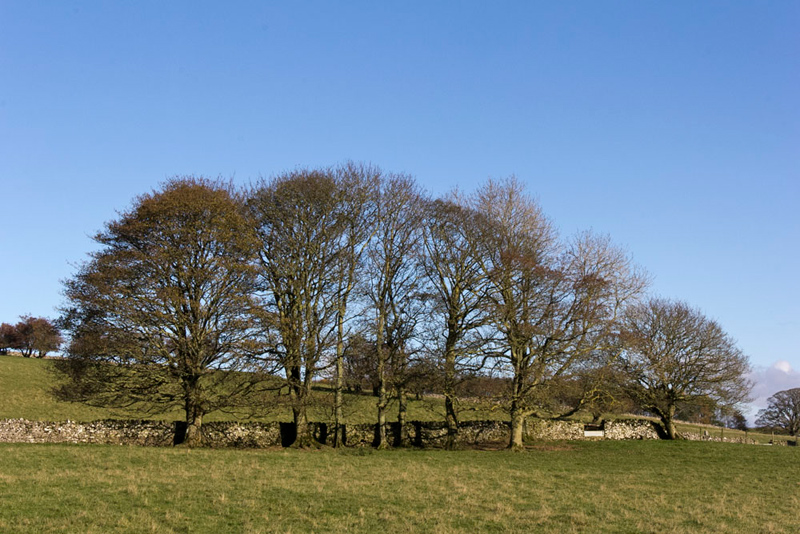
"That line of trees."
"I think you must have some Japanese blood", laughed Grizzly. "Taking so many pictures."
"Clicky clicky", laughed Tetley.
"Hey", replied Dad. "without these there would be nothing to illustrate your adventure."
Beyond a gate to the right of a barn called Broadslack, it was up over the hill by the wall, and down to cross the narrow stream of Plover Syke by a grassy bridge and through a gate. The waymark directed us diagonally left on a climbing track to a gate and then across the pasture to come to the right of the buildings of Threaplands. Here joined the reinforced farm access and walked to the road.
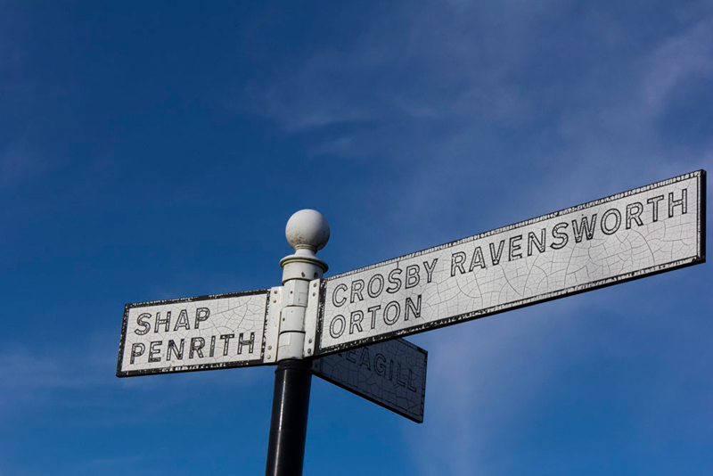
"Right then left", instructed Shaun. The narrow road that ran initially by Wyegill Plantation brought us to a junction.
Pointing to the road sign Allen said, "the background is all crazed."
"Hmm", agreed Little Eric.
"It's across and along the grassy path", instructed Shaun.
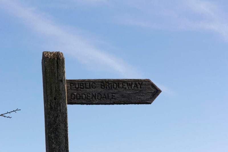
Looking at the signpost, Allen said, "that is our destination on this next section. We have been to the hamlet of Oddendale a number of times in the past on walks from Crosby Ravensworth."
"Quite", agreed Shaun, "although we do not go through Oddendale today."
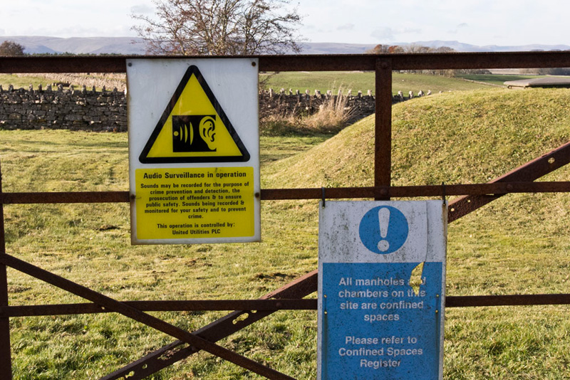
Seeing the signs on the gate to the reservoir installations, we for once kept very very quiet.
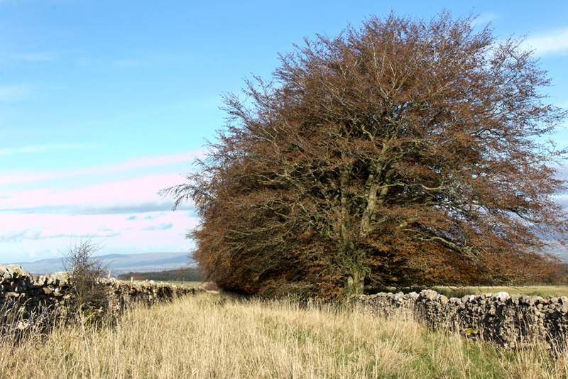
The path was rough walking, but unlike many such recently was not muddy, much to Dad's relief. At first to the left were a line of mature and impressive beech trees.
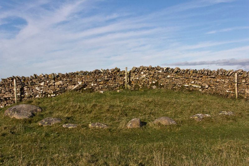
This ended at a gate on to open fell at Iron Hill. "This is where the stone circles are", said Southey excitedly.
First however was this stone immediately by the gate. It is an egg-shaped Shap granite erratic, called the Harberwain Stone that is named on Cumbria County Council's historic sites website as a 'Standing Monument'.
30m up the slope to the right is the first of two stone circles. This is Iron Hill Cairn Circle north. The stones are of Shap granite except the one on the right that is limestone. Once there were others on the far side of the wall but these have been lost.
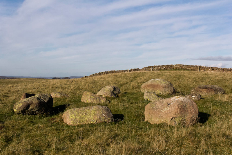
Below is Iron Hill South alternatively known as Harberwain. The tallest stands at 4 feet. A low mound occupies the centre, on top of which are 3 stones.
Thinking about what the exact purpose of these circles were, we wondered if they had been perhaps burial sites. Voicing our thoughts, Grizzly said, "the truth is long lost in the mists of time."
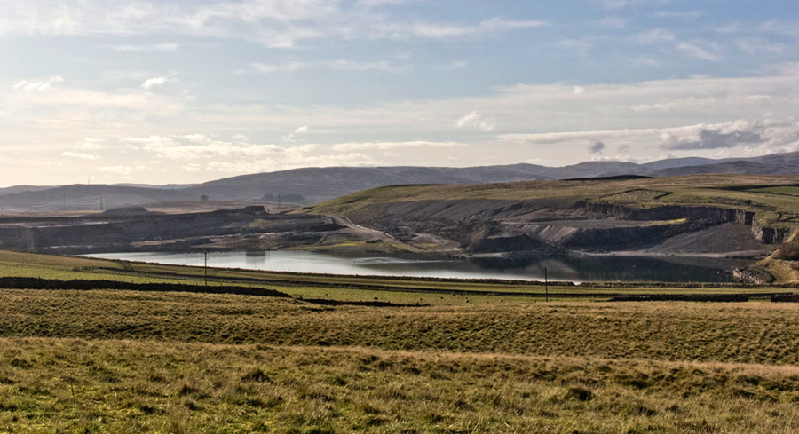
"Wow", cried Southey. "What a huge hole in the ground."
"That's Hardendale Quarry, and it is truly enormous", agreed Shaun.
"Something like the hole Brian's death has left in my life", said Dad sadly.
A wide grassy path took us to the left of a cairned rise across Harberwain Rigg. "Are we heading to the OS spot height of 353m, shown on the map?", asked Little Eric.
"Yes lad, I am presuming that is the summit", replied Dad.
There Dad took our picture, but our eyes were drawn to the cairned rise. "I know it can be deceptive, but that looks to be higher", commented Tetley.
"Mmm", agreed Allen. "And, why bother to build the cairn if it is not the highest point."
"I tend to agree, lad", said Dad. "Come on get settled again so we can walk back to the cairn."
From there the map spot height indeed was lower. Quickly we settled on the cairn for our obligatory summit picture. Despite searching the Internet, there is no reference to the height at the cairn. Looking at the map contours we have decided on a figure of 357m or 1171ft.
Continuing on the green path descended to a gate and beyond soon joined the narrow road to Oddendale.
Just before it turned into the hamlet Shaun said, "we go right on this wide surfaced track."
This skirts the edge of Hardendale Quarry and is also part of the Coast to Coast route. At the quarry access road the Coast to Coast path goes down steps, across the access and up steps on the far side. Then right for a few yards to cross a fence via a stile and then left over Hardendale Nab.
"That's a long way round", said Shaun. "It will be shorter to just go along the access road to join our outwards route."
"That's what I was hoping", replied Dad.
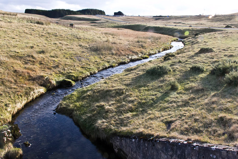
A bridge carried the road over this small pretty stream.
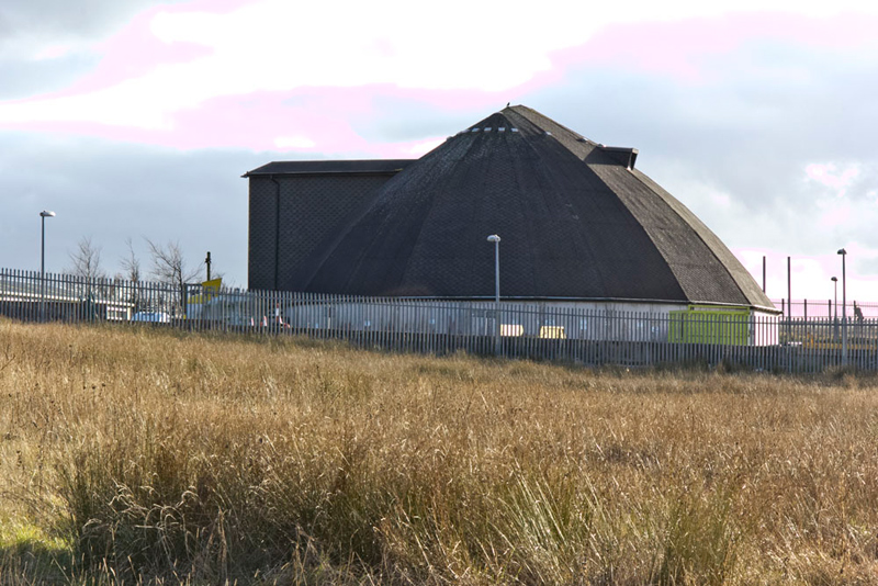
The road climbed gently, passing by this unusually shaped building that is Highways England's Hardendale Depot. Peering inside Grizzly said, "its use is to store the salt that is spread on the roads when it's icy."
"I have passed this countless times on my journeys up an down the M6, and always wondered what it was for. Now I know", responded Dad.
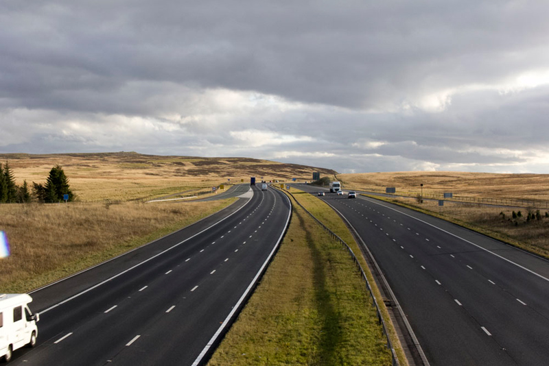
So back to the car crossing the M6 once again. Here is the view south, our direction home.
"What a super walk", exclaimed Southey.
"Wonderful", agreed Allen.
The lady and gentleman we had talked to were right about the paths being little frequented and we saw no other walkers at all. So peaceful too. At times there was just total silence that as they say was deafening.
"Time for refreshments, Dad?, asked Little Eric.
"Yes lad, I am going to the Tebay services at junction 38. Here had beef curry and rice with a poppadom and for afters a butterfly cake all washed down with a mug of tea. While Dad was having this we ate our picnic in the comfort of the car. Sandwiches, cakes and tea.
Afterwards Dad went to the shop and bought chocolate dipped ginger cookies made by Teoni's in Devon. This reminded us that when the opportunity allowed we would bring such gifts for Uncle Brian after a walk.
It is sad we can no longer do this. We miss Uncle Brian so much, but he is always in our hearts and minds forever.