PENHILL,
HEIGHTS OF HAZELY & HARLAND HILL
from CARLTON, COVERDALE
Summary
Date - 5th January 2008
Distance - 8.25 miles
Map - OL30
Start point -
Village Hall car
park, Carlton (SE 069 848)
Summits Achieved
Name
Height (ft)
Height (m)
Grid Ref
Penhill
1726
526
SE 0508 8673
Heights of
Hazely
1814
553
SE 0374 8600
Harland Hill
1756
535
SE 0283 0430
The Walk
It was further to the start this
time, so we were up and off at 07.00. The familiar road from
Ingleton to Hawes again was our route. Dad had enjoyed the
scenery the previous afternoon when he took Uncle Brian for a
drive, but not so for us as even when we reached Hawes it was
still dark. As we continued along the dale the day dawned. The
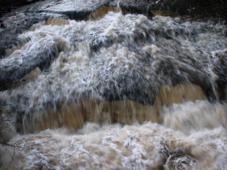
first village we reached was Bainbridge where we saw that the
River Bain was full and the water was rushing down. Here is a
close up to give you some idea of the force.
The village of West Witton was our
objective now and here we turned right along a very narrow road
that climbed steeply up at first in a series of very sharp bends
- we were glad that Dad is a good driver! We then crested the
ridge and descended into Coverdale to the village of Carlton, our
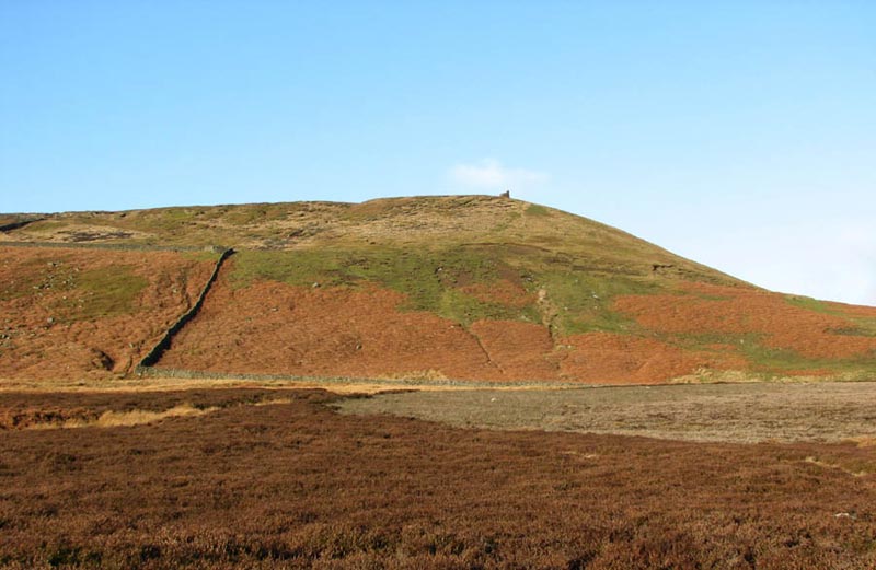
walk start point. At the summit of the road we had noticed a hill
with what seemed to be a tower on it. Dad told us it was Penhill,
and that we were going to climb it. As we got to Carlton we saw
Uncle Bob walking along to look at the car park by the Village
Hall that we had spotted as we came in. He and Dad agreed that
this was the best place to park. Well we Lads know best!
After they had got ready, we jumped
into Dad's rucksack and off we all went walking right through the
village. Taking a footpath we crossed a series of waterlogged
fields to reach a gate out on to Melmerby Moor. The official
track now went across the moor to reach the road we had travelled
over before turning west on to Penhill. After a little discussion
however Uncle Bob and Dad decided instead to follow a line of
grouse butts (the third side of the triangle thereby saving time
and distance). As we walked on ahead we had a good view of our
objective Penhill.
The route was to reach the wall
corner at the bottom of the fell, and then climb up by the wall
crossing it as it then turned left. Once over we then struck half-right
to reach the tower, which we discovered was in fact a large pile
of stones. Here is Dad standing by this. What a poser!
Some research later revealed that
this is actually called "Polly Peacham’s Tower". A
Lord of Bolton built this for his wife Lavinia Fenton, who was
the original actress to play the part of Polly Peacham in "The
Beggars Opera" by John Gay. It is said that when Polly
Peacham sang from the tower she could be heard at Bolton Hall, 2-miles
across the dale.
We walked left to reach a gate in
the wall and once through followed the wall along. Soon after we
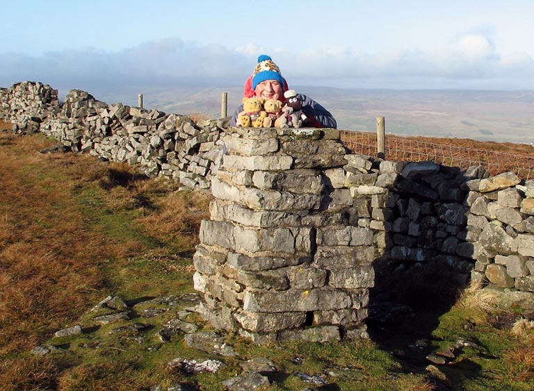
arrived at the trig point marking the summit. Despite it being
sunny and looking pleasant it was in fact cold in the strong wind.
Dad had to hold on to us while Uncle Bob took our photograph on
the trig point. The way Dad is popping up behind us made Uncle
Brian laugh out loud. We thought wherever did he get that hat!!
There was a path by the wall and
sensibly we followed this rather than struggle over the trackless
heather and bog. We were very glad that we did too, as from here
the whole of Wensleydale was laid out below us. The panorama was
too large to get any decent photographs but we were able to see
and identify many of the villages and hamlets in the dale. We
thought you might like to share with us the names of those that
we could see going west to east - Aysgarth, Carperby, Castle
Bolton, Redmire, Swinithwaite, West Witton, Preston under Scar,
Wensley, Leyburn and Middleham. We think that they are lovely
names and quite enchanting.
In the Middleham, Leyburn and West
Witton area there are a number of horse racing stables and indeed
as we had driven up over the high road we saw one of the gallops.
Aysgarth is famous for its waterfalls visited by thousands of
people every year. If any of you are familiar with the film
"Robin Hood Prince of Thieves" starring Kevin Costner,
the fight sequence with Little John was filmed at these
waterfalls.
Now we wish to digress a while -
hope you do not mind - and continue with the railway theme that
was part of our last adventure in the Yorkshire Dales. Until the
mass closure of the railway in the 1960s Wensleydale had its own
line. Most of it was taken up, but some miles were retained to
facilitate the transport of military equipment to the training
and firing ranges. In the last few years a band of volunteers
have got together and formed the Wensleydale Railway Association
(www.wensleydalerailway.com) reopening part of the line between Leeming
Bar and Redmire via Leyburn. The priority at first is to link
with the town of Northallerton, and the East Coast Main Line
providing a connecting service. Their long-term aims are to head
further west and reinstate the line to Aysgarth then to Hawes.
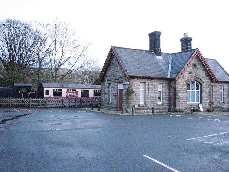
The old station at Hawes still stands and is now a museum.
The engine and carriage is merely a
static display on a short stretch of track. The line would then
continue through the dale to rejoin with the Settle to Carlisle
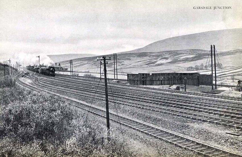
line at Garsdale Junction. Here is a photo of what the junction
once looked like. The single line in the foreground was the
Wensleydale line.
Garsdale is just over 1000 ft above
sea level and so prone to the vagaries of the wind. At the time
this was taken there was, as you can see in the right of the
picture, a wind begotten novelty here, a stockaded turntable. The
story ran that some years before, during a gale an engine was
being turned when the wind took it for a plaything and sent it
round and round interminably. The crews efforts to stop this new-style
roundabout was unavailing until they hit on the idea of
shovelling ballast and earth into the pit. After this event the
turntable got its stockade!
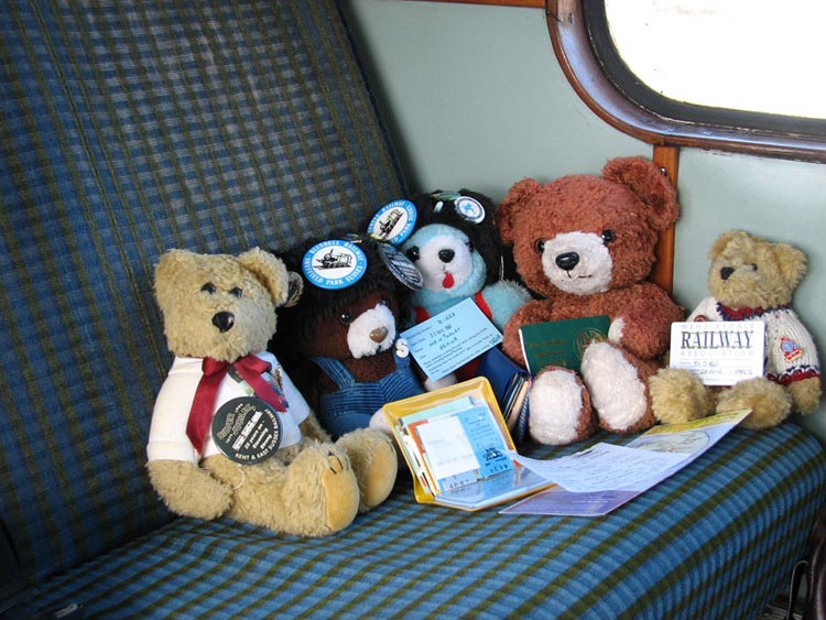
Now we bears are doing our bit to
help this and other volunteer railways. Dale is a member of the
Wensleydale Railway Association and here he is travelling on the
railway last summer.
Dale is on the right proudly holding his
membership card. He is with our other railway bear friends who
are also members of a railway society. From left to right is
–
Dunstan - Aln Valley Railway, Northumberland www.avrs.co.uk
So as you can see it is not just
STAG whom are active in our Hug!
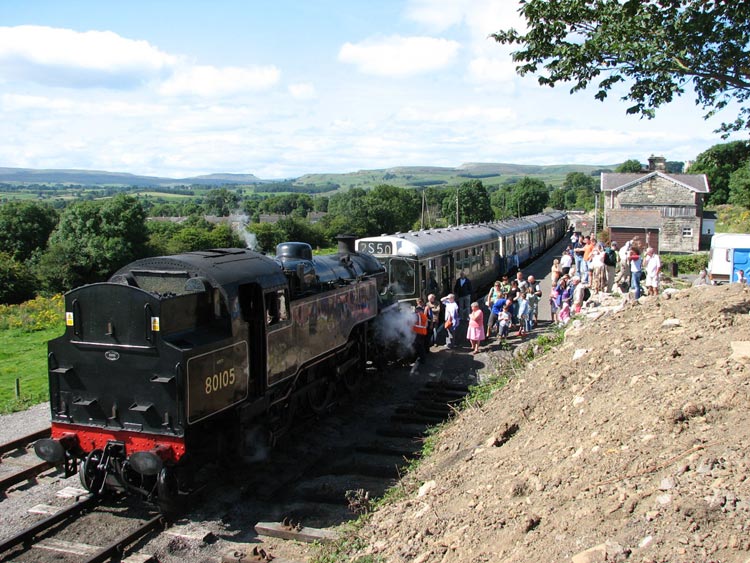
Finally before we return to the
walk, Dad took this photo of the train at Redmire Station.
Now where were we? Oh yes. We
continued on by the wall as it turned south where we could then
see down into Bishopdale. At its entrance lies the village of
West Burton, from which we were destined to do our next walk.
Possibly another tale? We walked on climbing slightly and then
were faced with a huge cross wall that we could not possibly
climb. Our hearts sank at the thought of our route being blocked,
but Uncle Bob consulted the map and led us left to where the wall
became a fence and then ended as it turned right. We had reached
a point known as the Heights of Hazely. Not a recognised hill but
having reached the highest point Dad took our photograph. Then we
followed the fence where it had turned and descended into a
valley between Penhill and our next objective Harland Hill. In
the valley is a bridleway that links Carlton in Coverdale with
Cote Bridge near West Burton in Bishopdale. Taking this in the
Carlton direction was our return route but first we had to climb
gently up Harland Hill. We reached a wall with a hurdle across a
gap. To reach the summit a few hundred yards on, it was necessary
to climb this and then negotiate a very boggy area and small lake
using stepping stones. Thankfully Dad was sure-footed and we got
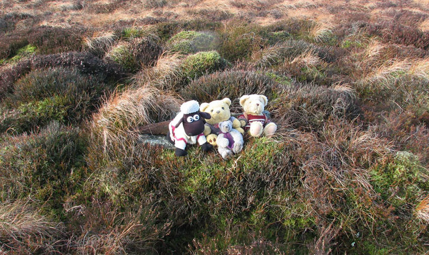
safely across. The summit was a rather large flat area but there
was a few small rocks making an untidy cairn that we considered
to be the top and Dad took our photo..
You might just make out that we
were leaning against piece of wood with a pointed end. Before we
left Dad stood this up so making the top more recognisable for
anyone else who might come here. We do not think that this top is
visited very often. It was now that Dad realised that he had
dropped his map. He is really not safe to be out on this own. He
remembered that the last time he had it was just before we had
climbed the hurdle. We had to return that way (good job) and so
he duly found it. Then it was down to the bridleway and turning
right through a gate we started the descent towards Carlton on a
very rough and muddy track. About half way down we passed this
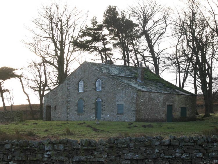
substantial building called Howden Lodge.
It is in a good state of repair but
was seemingly boarded up. After some discussion Uncle Bob and Dad
decided that it was probably used to entertain parties of grouse
shooters, as there was a line of grouse butts nearby. We have
searched the Internet for any details but to no avail, so we will
have to go with their idea. The surface of the track improved a
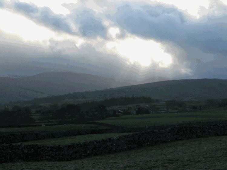
lot from here making for easier walking. It was cloudy but there
were breaks at times and suddenly the sun shafted through the
clouds and Dad snapped this photograph...
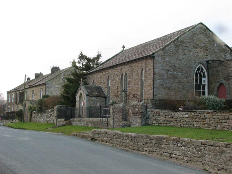
Soon now we reached
the pretty village of Carlton once again and we strolled along
the street passing the typical houses in the golden stone. This
shows some and the small church.
Another walk was under our paws and
we had had another super day. Dad then followed Uncle Bob to the
village of Leyburn where, surprise surprise, they went and had
tea and cakes in a cafe! We had our own picnic sitting in the car.
We said our goodbyes and Uncle Bob headed east and Dad headed
west for home. Soon after leaving Leyburn we came to the village
of Wensley. As we crossed the river, we looked up to the hill
ahead. This was none other than Penhill where we had been today.