AYE
GILL PIKE, RISE HILL & SNAIZWOLD FELL from DENT
Summary
Date - 24th March 2008
Distance - 13 miles
Map - OL2
Start point - Dent car park (SD
703871)
Summits Achieved
Name
Height (ft)
Height (m)
Grid Ref
Aye Gill Pike
1824
556
SD 7207 8862
Rise Hill
1697
517
SD 7350 8826
Snaizwold Fell
1595
486
SD 7506 8853
Preface
It was the Easter weekend, which
this year had fallen on the earliest date for 100 years. Wintry
weather prevailed over the country with snow in many places
although in our micro climate at home in Morecambe there was none.
We did not think that Dad would take us out, but the forecast for
Easter Monday was promising, so we set off in the early morning
along the Lune Valley to the village of Barbon, with its nice
church.
It is just across the road from
here, where Dad gets his lovely chutneys and marmalades from Mr
Williamson. Look on the links page for more details.
From here we travelled through
Barbondale where there was some snow on the slopes and then down
into Dentdale. We have walked from here before and featured a
story of our adventures up Flintergill, but today we were
destined to climb and walk along the long ridge on the opposite
side of the valley crossing its summit at Aye Gill Pike.
The Walk
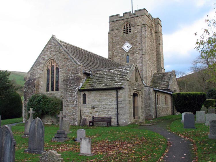
Settling into Dad’s rucksack
we walked through the village to come to Church Bridge over the
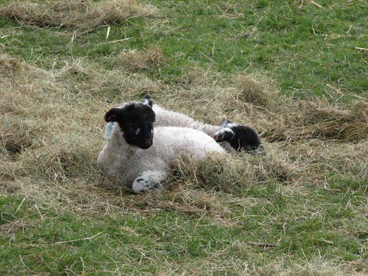
River Dee, where we took the path along by the river passing
through fields full of sheep with their lambs. On the cold
morning these two are snuggling in the hay to keep warm – ah!
Coming to Barth Bridge we crossed
the river, then soon turned up a narrow lane passing a house
called Hacra, and on to a footpath over the fields to a track
climbing steadily up the fell. Here Dad met a farmer on his quad
bike with his faithful dog. He had been up to feed his sheep. Dad
chatted to him for quite a few minutes. When Dad told him exactly
what our walk entailed, he said "you must be very fit lad".
We were fascinated by his dog, which seemed to understand what
was being said. The farmer told us that she is always eager to go
out to tend the animals but if he is going into town and it is
raining she will not come out preferring to stay in the dry. Such
is their intelligence.
Continuing on our way we climbed up
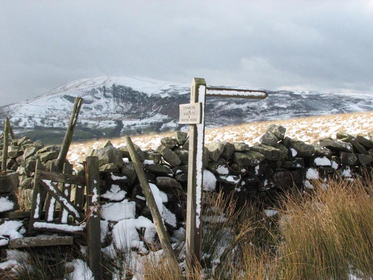
to reach the stile giving access to the open fell.
The signpost actually reads –
Footpath to Frostrow 1.5m. We were now well and truly above the
snow line. We walked in the direction indicated by the signpost
to the flat top summit of Long Moor (964ft). Looking ahead there
was a fine view of the Howgill Fells where we have walked
extensively. The snow-covered summit in the centre is the Calf
the highest point in these fells at 2215ft.
This had been a short diversion.
Now we retraced our steps to the stile and then continued up on
what was supposed to be a clear path. For the first few yards
this was the case but soon it disappeared as the snow got deeper.
By the wall on our right the snow had drifted up to at least two
feet, so all Dad could do was to pick his way along a little way
from the wall. He regularly sank up to his calf and at times up
to his knee. Sometimes the snow gave way completely leaving Dad
floundering and his foot completely immersed in the water below.
Yes, you have guessed it, he had wet feet, saying that with the
cold he could not feel them at times. However there was no
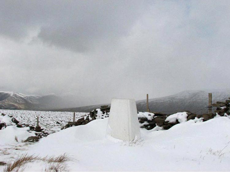
turning back and eventually we reached the trig point marking the
summit of Aye Gill Pike.
Note too the fact that
the hills behind have disappeared in cloud. This was one of the
frequent snow and hail showers that we had to contend with too.
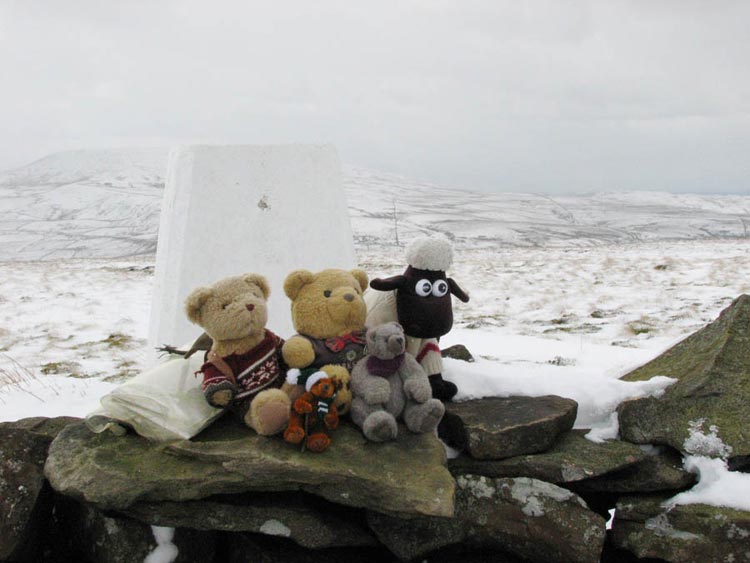
Still we are a hardy bunch and nothing would stop us hopping out
to have our photograph taken.
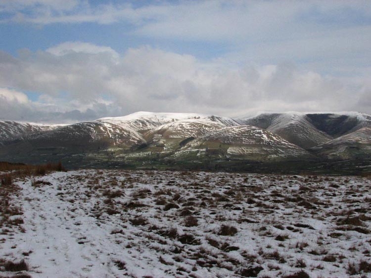
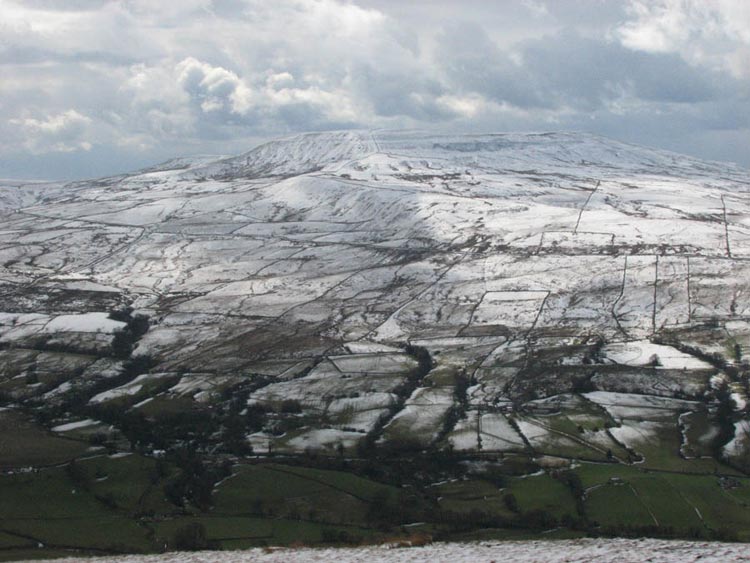
Across the valley covered in snow
too, was Great Coum, although that had not been the case when we
had climbed it on 23rd December 2007.
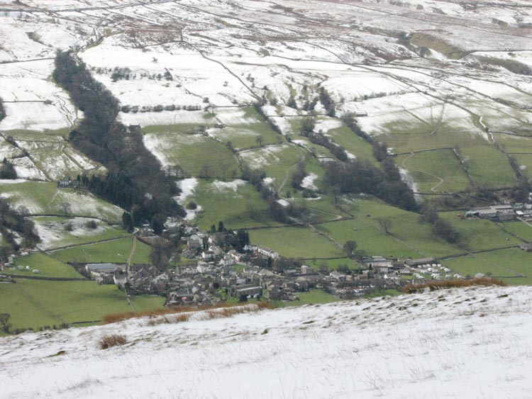
Dad walked a few hundred yards
towards this, from where we had this superb view of Dent village
in the valley below.
Well despite being at the summit,
we were barely half way along the ridge, so Dad battled on
through the snow and showers to reach first Rise Hill, and then
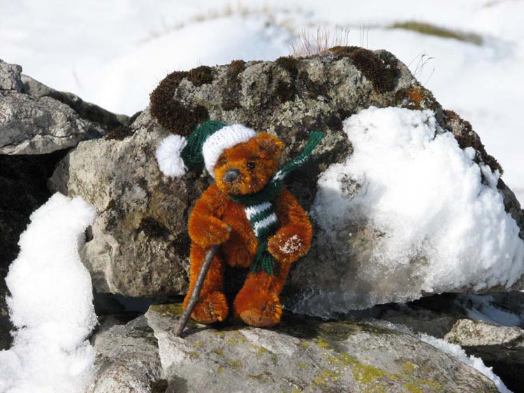
the lovely named Snaizwold Fell. Dad took our picture and one
with just Eric the latest member of our club. It had been a real
experience for him, as he had never seen snow before.
Descending now we passed alongside
a large plantation, then over very rough ground to reach a
bridleway, that runs between the valleys of Garsdale and Dentdale.
At first this was very difficult to negotiate as it had been
churned up by heavy machinery involved in tree felling operations.
Lower down it was easier going and we finally dropped below the
snow line. After the 5 miles in the snow we were all glad to
leave it behind especially Dad. While we had been on the ridge we
had seen a number of animal tracks, probably foxes. There were no
other human tracks and as Uncle Brian said when we got home, no
one else was daft enough to go up there!
Reaching the valley floor all that
remained was the 4 miles or so to Dent village. The majority of
this was on part of the long distance footpath known as the Dales
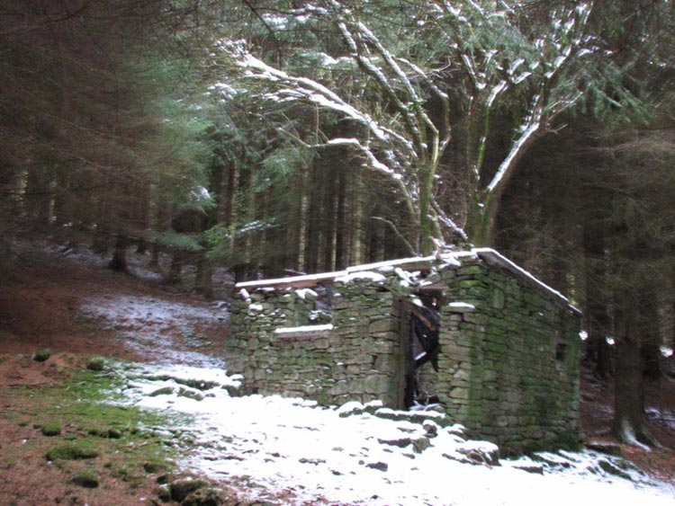
Way. Passing through woods close to a house known as Little Towne
we came across this ruined and forlorn building.
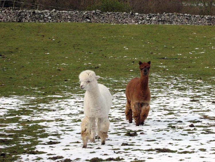
At Little Towne itself we passed
through a field with two rather inquisitive Alpacas.
Aren't they lovely animals?
Eventually the path brought us by
the Deepdale Beck that runs into the River Dee. This we followed
to reach Church Bridge and then just the short distance to the
village. The weather had just one more sting in the tail for Dad
as a hailstorm passed over while he was struggling to get his
boots and wet socks off. We were safely tucked in the car
thankfully.
While we had our picnic in the car,
Dad went to the nearby Stone Close tearooms for a warming pot of
tea and cakes. In our opinion he had certainly earned it today.
By the way when we got home Uncle
Brian told us that it had been completely dry all day in
Morecambe. Dad could only wish that had been the case in Dentdale!