JANET’S
FOSS, GORDALE SCAR, PARSON’S PULPIT, GREAT CLOSE
HILL & MALHAM COVE from MALHAM
Summary
Date - 13th April 2008
Distance - 12.5 miles
Map - OL2
Start point - Malham car park (SD
900627)
Summits Achieved
Name
Height (ft)
Height (m)
Grid Ref
Parson's Pulpit
1766
538
SD 9183 6875
Great Close Fell
1536
465
SD 9022 6681
Malham Cove
1047
319
SD 8970 6411
The Walk
Sunday again so Dad had arranged to
walk with Uncle Bob. We were up early and ready for off about 7.15am.
We jumped into the car and settled down for the drive to the
village of Malham. We waited patiently while Uncle Bob and Dad
got their boots on etc, then hopped into the rucksack and set off.
A short stroll through the village and over the bridge across the
beck, took us along the Pennine Way for a few yards, before
branching off along a good track that led into the woods. Uncle
Bob had told us to look out for the money trees and we did not
really understand what he meant. We soon realised when we saw
some fallen tree trunks with lots of coins that had been hammered
into them. Now we know where to come if we need some extra pocket
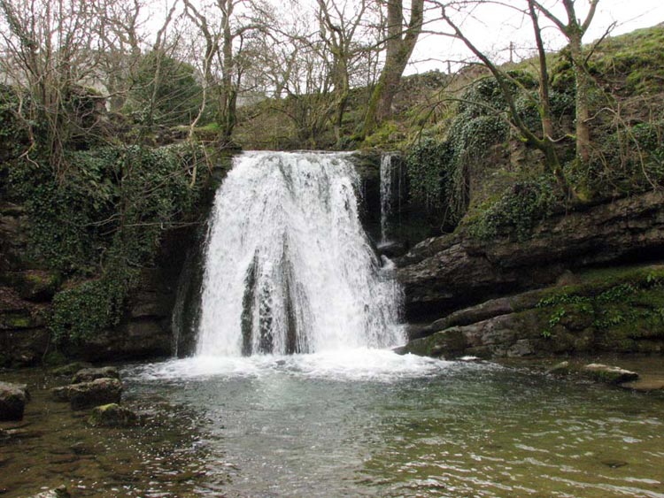
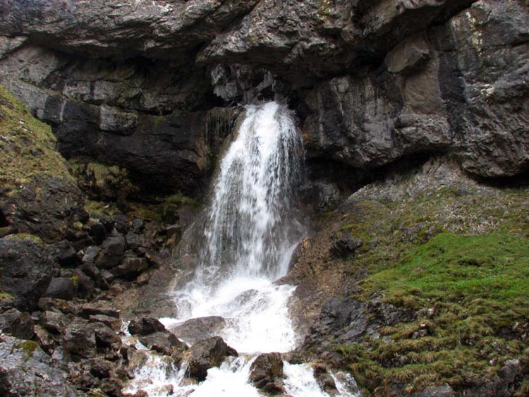
money! It was quite enchanting through the woods and suddenly we
came to this beautiful waterfall called Janet’s Foss.
Foss is the old Norse word for a
waterfall and Janet (or Jennet) was believed to be the queen of
the local fairies who lives in a cave behind the fall. At one
time the pool was used to wash sheep, in a similar manner to the
Wash Dub Field featured in our walk taking in Norber and
Smearsett Scar.
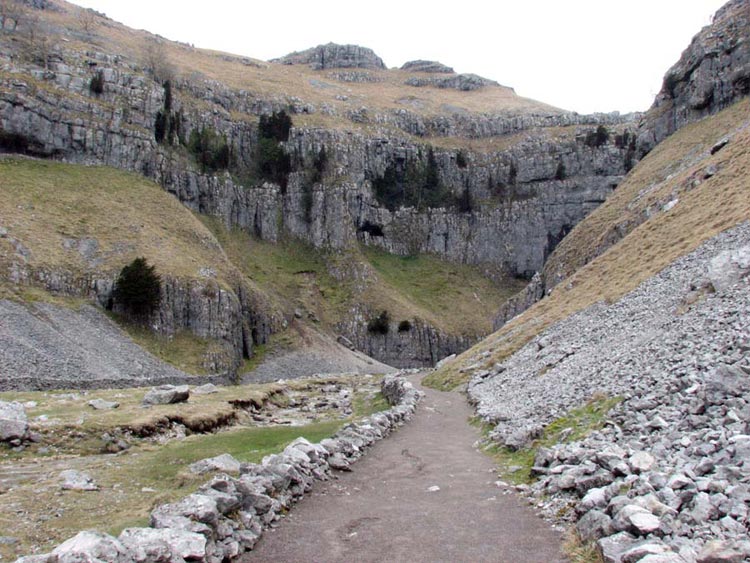
The track then led to the road at
Gordale Bridge, and here we went through a gate heading towards
the gorge known as Gordale Scar where the cliffs towered
vertically above us.
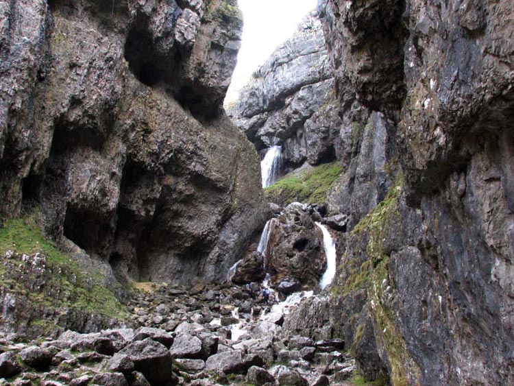
Rounding the corner the gorge was
revealed in all its glory. We could see the waterfall rushing
over the lip and in between was the rocky outcrop that Uncle Bob
and Dad had to climb.
Dad picked his way over the rocks
and then waded the stream to bring us below the rocky scramble.
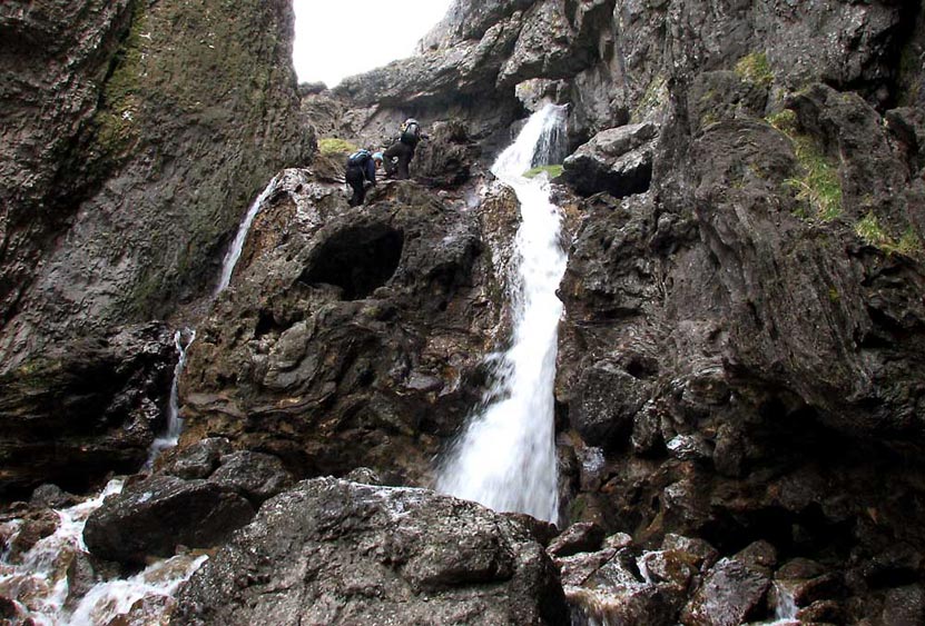
Here two walkers are just reaching
the top. Uncle Bob went first, pointing out the hand- and foot-
holds. Uncle Bob said the rule is three points in contact at all
times (e.g. two feet and one hand). The first part was the most
difficult Dad needing to kneel on a ledge while he hauled himself
up. Then followed a few more upward steps on the polished and
damp rock to reach the top and level ground. It was a bit scary
for us looking back down, but what a view and we had every
confidence that Dad would not slip and we would reach the top
safely.
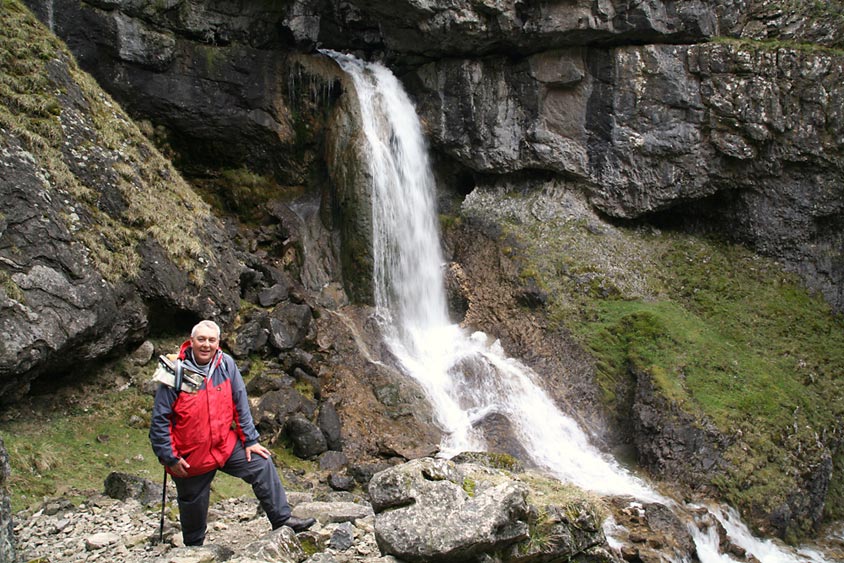
Here there is another waterfall
that plunges down through a circular hole in the cliff.
Uncle Bob kindly took this photo of
Dad posing by the fall.
Photo
courtesy Uncle Bob
After spending a little time taking
in this awesome scenery, we climbed steeply up the path finally
leaving the gorge behind, then across level ground through
limestone outcrops to reach a narrow road at Street Gate.
Now it was decision time, as Dad
had said he did not want to do a long walk today, and a gentle
stroll along the road would have brought us to Malham Tarn and an
easy return via the cove. However the temptation to "bag"
another three summits was too much, so we set off to find and
reach first the summit of Parson’s Pulpit. Our worry was
that being Sunday we fervently hoped we would not be delayed too
much by a long sermon.
Our route was the bridleway leading
to Arncliffe. First over at times boggy pasture down to a shallow
stream and boggy ground beyond, then the clear path made a long
ascent to a gate. On then through yet another gate and down to a
hollow, where we left the bridleway and made our way under the
slopes of Clapham High Mark, to gently make the final ascent to
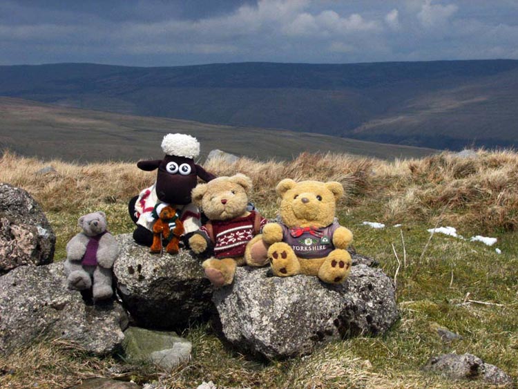
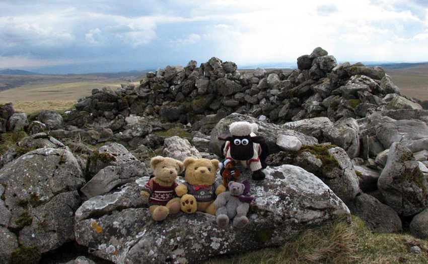
the summit of Parson’s Pulpit. Here we jumped out of the
rucksack so Dad could take our photograph to prove we had made it.
Its situation allows for fine views
of the surrounding fells, nearly all of which we had climbed.
Uncle Bob and Dad had their lunch here, enjoying a well earned
rest, and we had our picnic sitting at the trig point. Usually
these are columns as you will have seen from photos in previous
walks, but in this case it was a circular dome shaped stone
embedded in the ground, which can just be discerned in this photo.
The fell behind is Great Whernside.
We have looked on the Internet but
have to say we are at a loss as to why the hill is so named. We
can only speculate that maybe in the long past, a parson did
indeed deliver a sermon to a congregation here.
Well all packed up again, we
finally set off on the descent and after climbing a wall, we
reached a track called the Monk's Road, below the hill called
Flask. This track is an old monastic route between the villages
of Arncliffe and Malham. It seemed this was turning into quite a
religious walk so it seemed appropriate that we were doing it on
a Sunday. We were now on familiar ground, as this had been part
of our route on a previous walk, when we had climbed Fountains
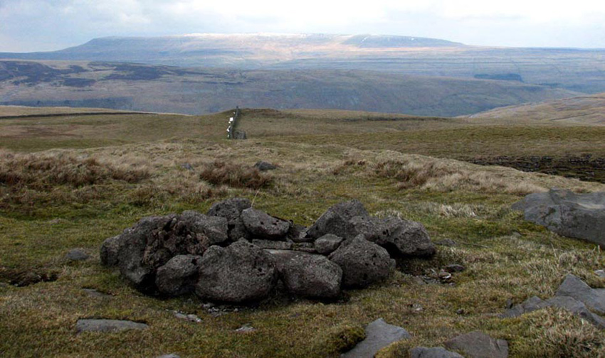
Fell, Darnbrook Fell and Flask. It passes below Great Close Hill
and today Uncle Bob and Dad were resolved to climb this and here
we are at the summit shelter.
After a careful examination of the
map Uncle Bob told Dad the descent had to be made in the
direction the above photo was taken. It seemed we were going in
the wrong direction but soon realised the wisdom, as the beeline
direction would have led to vertical crags and an early demise!
Malham Tarn was passed to our right
and the road reached. The ice cream van proved to be too much of
a temptation and Uncle Bob kindly bought one for Dad and himself
too. We decided not to have one, as it would have run all over
our paws.
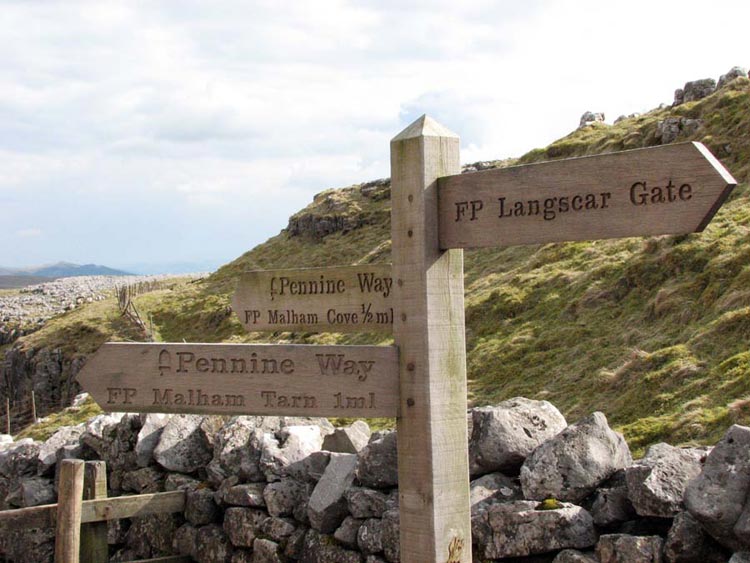
The Pennine Way was now followed
all the way to Malham and the end of our walk, but not without
more excitement. About half way we reached a stile and junction
of paths where this signpost clearly displayed our route so far,
and our on going route to Malham Cove.
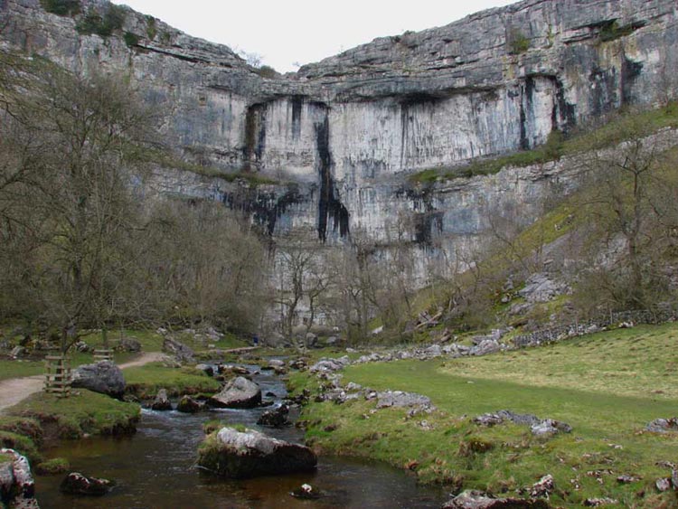
Just a half-mile down a rocky path
brought us to the cove. A huge curved wall of limestone cliffs
that has the infant river Aire issuing from the base.
Before the Ice Age the stream now
issuing from the base, had cascaded in much greater volume, along
the valley we had just walked along, and then poured over the
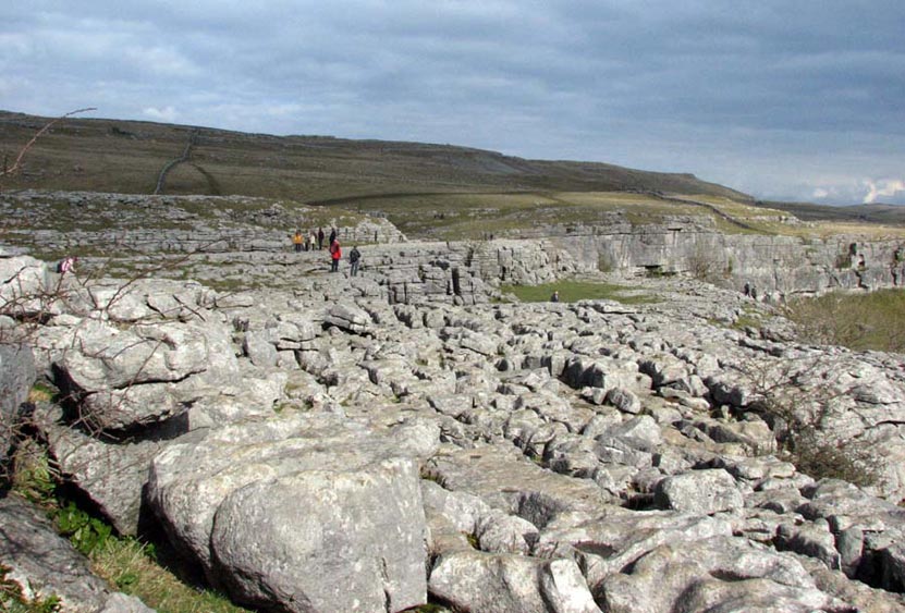
precipice in what must have been a magnificent waterfall. The top
is a magnificent limestone pavement with deep fissures called
"grikes", and care was necessary to avoid an accident.
From the base it was only a short
distance to Malham village and the cars. We sat and had another
picnic while Uncle Bob and Dad predictably went to the adjacent
café for tea and chocolate cake.