CONISTONE,
KILNSEY & KILNSEY MOOR from GRASSINGTON
Summary
Date - 3rd May 2008
Distance - 10.5 miles
Map - OL2
Start point - Grassington car park
(SE003637)
Summits Achieved
Name
Height (ft)
Height (m)
Grid Ref
Kilnsey Moor
1477
450
SD 9517 6606
The Walk
Dad arranged with Uncle Bob to walk
on Saturday this weekend. A wise choice too as we enjoyed warm
and mostly sunny weather. Sunday was poor by comparison. Our
start point was the village of Grassington in Wharfedale. Driving
along the B6265 we saw to our right on the ridge Rylstone Cross
and the Cracoe War Memorial, reminding us of our adventure almost
a year ago from Embsay along that ridge.
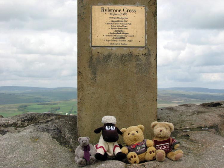
Here we are at Rylstone Cross. The
current one was erected in 1995 and replaced an earlier wooden
one. As we have said before it was originally erected to
commemorate the signing of the Treaty of Paris that ended the
Napoleonic Wars.
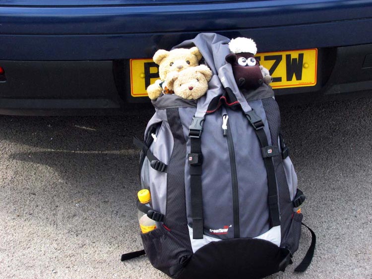
We arrived in Grassington at
exactly the same time as Uncle Bob and they were soon ready, so
we hopped into Dad’s rucksack and off we went. Dad had
bought a new rucksack and this was our first walk in it.
As you can see it fulfils the main
requirement from our point of view, that our heads can poke out
so we can see the scenery. Dad had pointed this out to the
assistant, Ian, at the shop where he bought it and indeed we had
gone along to ensure that it was suitable. He saw Shaun and said
he was a great fan having a tattoo of him on his wrist. As a
result he entered into the spirit of the request fully and indeed
asked if he could take a photo of Dad wearing it with us inside
of course. Now what are the chances of that!
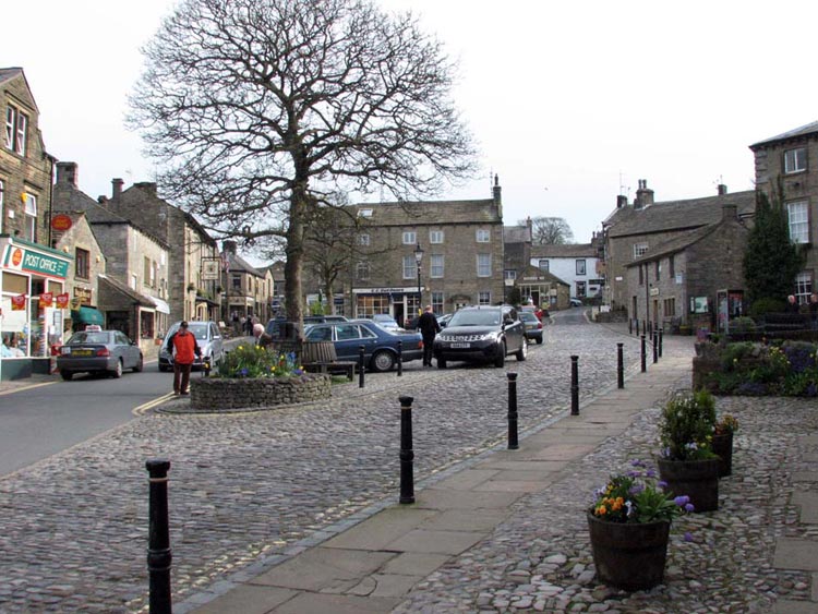
Now, back to the walk. Grassington
is a very pretty village and very popular with tourists although
it was quiet when we set off in the early morning along the main
street.
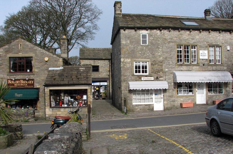
As we walked along we were
intrigued to see that almost next to the shop called The Rustic
Rabbit, was Robert Bunney menswear!
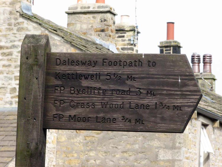
A signpost was reached pointing the
way, but with so many destinations, we hoped that Uncle Bob and
Dad knew which path we had to take.
Well of course we should never have
doubted them and soon we were on a clear path that led over the
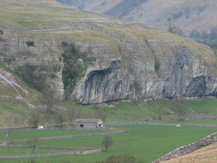
fields towards the villages of Conistone and Kilnsey. The latter
is famous for its namesake crag that literally hangs over the
road below it. It is 140 feet high and the overhang projects
thirty feet. It was created by the action of the Wharfedale
glacier, which cut through projecting spurs of land during its
attempt to straighten out the valley.
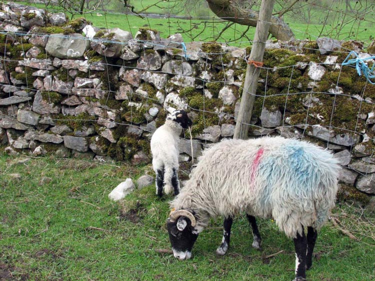
As we descended to Conistone we saw
this ewe and her lamb that was sharpening its teeth on a stick.
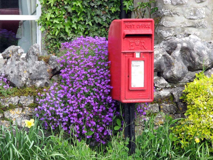
In villages small post boxes are
common, some embedded in a wall others, as here at Conistone,
supported on a post. With the colourful aubretia it made a very
pretty picture.
Leaving Conistone we crossed the
river Wharfe to the road under the crag. Once across this we took
a track just a little to the left, climbing up to reach another
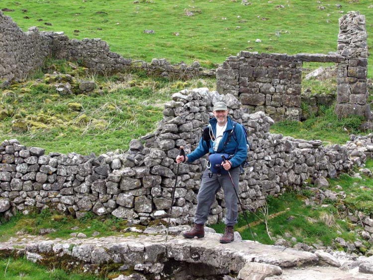
good track. On the way we passed by this ruined barn at Renard-Close
Laithe where Dad took Uncle Bob standing on this tiny stone slab
bridge. Laithe is a word that means a cow house with a crop
storage area and is a term used extensively for such buildings in
the Yorkshire Dales.
We followed the track taking the
left fork where it divided. Where this bent away left we kept
ahead alongside a broken wall and fence. Where the barbed wire
strand on the top had come away from a post, we took the
opportunity to cross it. A steep climb over rough ground followed
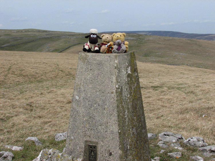
before striking half-right to reach the summit of Kilnsey Moor.
Here we scrambled up the trig point for our usual photograph.
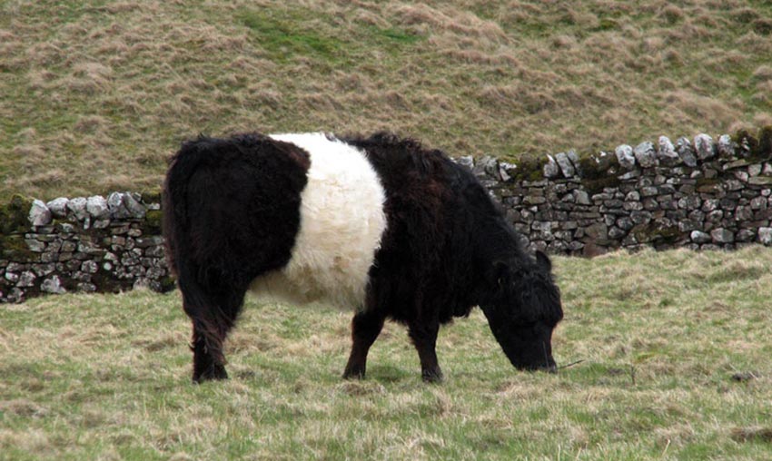
Earlier we had read an information
board about the "Limestone Country Project". This told
us that due to economic pressures there had been a reduction in
the numbers of cattle grazing the hills. They are however
important to help regenerate parts of the landscape, so that in
time trees and shrubs will return to the limestone pavement areas,
and wild flowers to the grasslands. The project is working with
local farmers to reintroduce upland cattle breeds such as
Highland and Belted Galloway.
We thought it would be nice if we
could see some of these so we kept our eyes peeled as we
descended from the fell. None were to be seen but after we had
climbed over another rise and reached the bridleway we espied
some Galloway cattle and called out to Dad to take a photograph.
As you can see they are very
distinctive with the white band. They were all sitting down when
we arrived, but gradually they stood up and some began to advance
on us so we all decided that perhaps we had better beat a retreat.
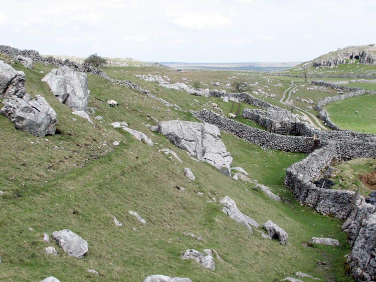
Taking a stile we crossed a track
and then another stile on the opposite side to walk down to the
farm at Height Laithe. We looked at the complex of the walls and
wondered how long it must have taken to build these and the
thousands of miles of such walls that criss cross the Yorkshire
Dales. Note too Height Cave in the distant hill.
We walked to the right of the hill
below Cow Close Wood, then through Wood Nook Caravan park to the
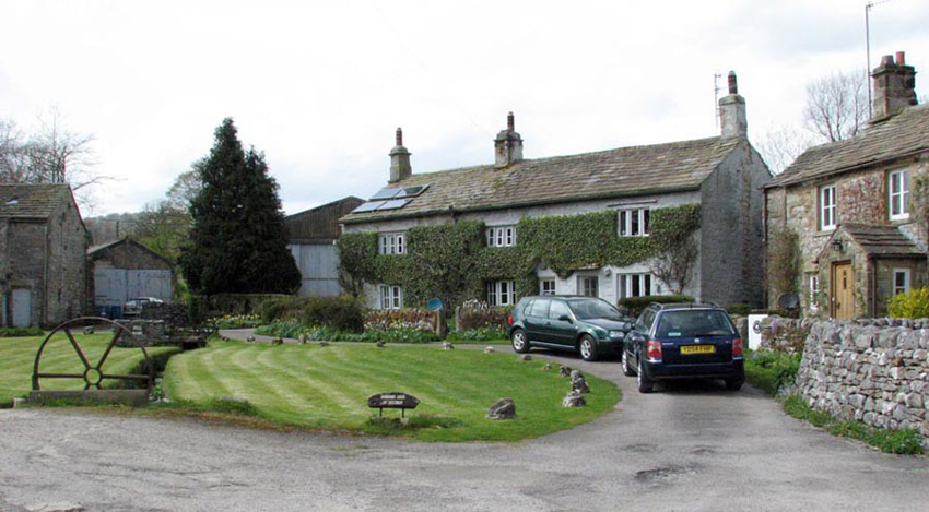
road. Continuing we passed this pretty group of houses at Bell
Bank. We all understand about climate change, but can’t help
but comment that the solar panels do rather detract.
We were now getting close to the
end of the walk. After passing through the village of Threshfield
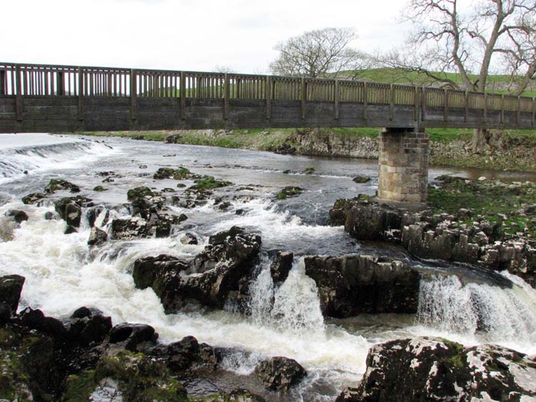
and crossing fields we came to Linton Falls on the river Wharfe.
We paused a while watching the
water rushing down, before Dad took us across the footbridge and
up the paved Sedber Lane to just pop out in the car park. We
decamped to the car to have a picnic and chat about what we had
seen today, while Uncle Bob and Dad went to the Lucy Fold
Tearooms for tea and chocolate cake. Apparently the waitress had
a good sense of humour and checked that they did not have any
chocolate round their mouths before she took the plates away. Dad
then drove us home after another super adventure.