BLACK
HILL & MELBRECKS MOOR from GUNNERSIDE, SWALEDALE
Summary
Date - 8th June 2008
Distance - 7.5 miles
Map - OL30
Start point - Gunnerside (SD
951982)
Summits Achieved
Name
Height (ft)
Height (m)
Grid Ref
Black Hill
1867
569
NY 9292 0010
Melbrecks Moor
1896
578
NY 9523 0075
The Walk
"Good news" Shaun said to
us. "I have just heard that Dad has arranged to walk with
Uncle Bob this weekend." We all cheered!
We were destined for the Yorkshire
Dales once again starting from the pretty village of Gunnerside
in Swaledale, which we think is perhaps the most beautiful of all
the Dales. Once Uncle Bob and Dad were ready we settled in his
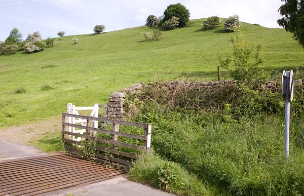
rucksack and walked out of the village on a quiet road, crossing
the cattle grid where we headed up on to the open fell side to
Knott Top and along Jingle Pot Edge.
Photo
courtesy Bob Woolley (Uncle Bob)
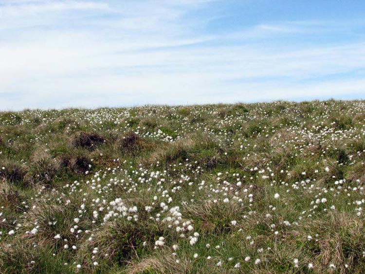
It was for once a glorious late
spring day with just enough breezes to take the fierceness of the
heat away. As we climbed up lapwings were flying over, and there
were many curlews circling overhead trying to draw us away from
their nests on the ground. By accident Dad stumbled across one
frightening the adult bird and leaving the chick on its own. He
quickly moved on to prevent further disturbance, and we are sure
that the adult returned soon afterwards. The cotton grass made a
pleasing sight as we climbed on up.
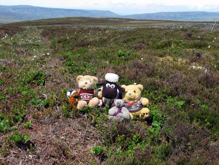
Ploughing on over the rough ground
we reached the top of the ridge we had been climbing. This is
Black Hill and our main objective of the day. It was another flat
topped fell with nothing to mark the actual summit, so it was
necessary to use the GPS to locate the position of the spot
height marked on the map. Finally a consensus was reached and we
hopped out for the usual photograph. The heather etc was a bit
prickly and so we were glad to get back in the rucksack.
Crossing the wall to the right of
the picture, we then descended beside it down Black Brae to reach
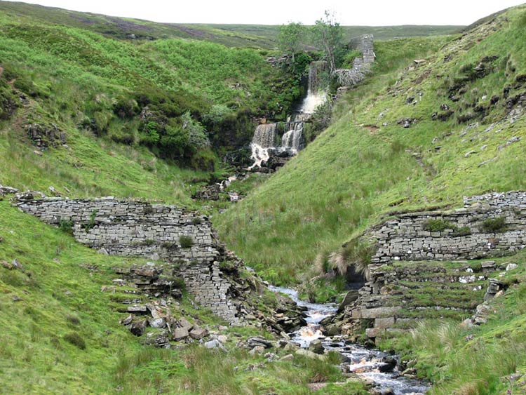
the main path at Botcher Gill Gate. Close by was a waterfall and
they decided to try to reach it for a photograph. This however
proved to be impossible but a narrow path was followed on down
Botcher Gill. Uncle Bob and Dad were very careful, as at times
there was a considerable vertical drop off the path to the right.
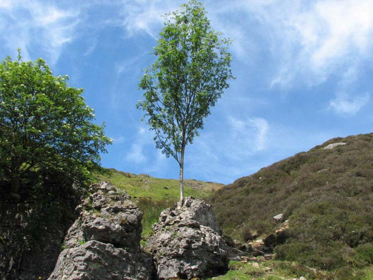
We spotted this tree that is literally growing out of the rock
– amazing!
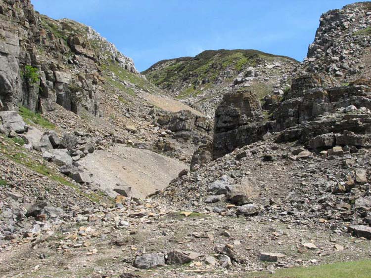
Eventually the path edged round
left and descended to Gunnerside Gill, crossing a tip from the
long defunct lead mining. This was all loose shale, and although
there was a narrow path across it we were a bit frightened that
Dad might suddenly slide down the hillside. However being sure
footed he crossed safely. Phew!
In the 18th and 19th
centuries this area was extensively mined for lead and there are
many remains of this now long gone industry. It would have been a
long walk each day from the valley to the mines and then there
would have been hours spent underground digging out the ore, just
by the light of a candle. Pondering this we thought how hard life
must have been and for little reward no doubt. No Health and
Safety then either!!
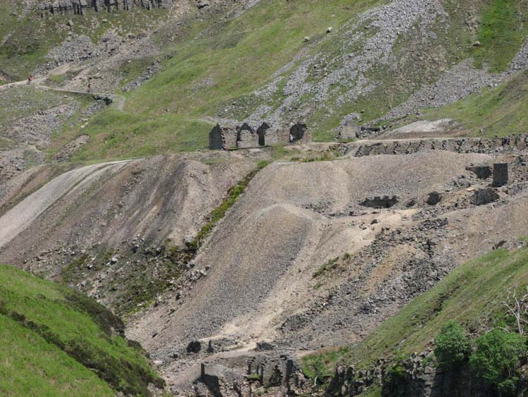
Here are some of the remains at
Bunton Hush.
The word "Hush" comes
from a process known as hushing. Water was dammed above likely lead veins
and released in a rush. The overlying debris was washed away
exposing the ore-bearing veins. The huge scars cut into the
valley sides are the remains of this process. We had been here
last year too, and had walked further up the gill to view the
remains of the Blakethwaite Dams once used in the hushing process.
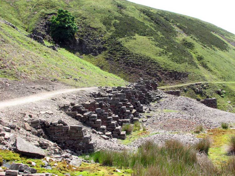
Below are remains that may have
been what was called a dressing floor where lead ore, galena, was
sorted and crushed before being sent to be smelted into lead.
We spent quite a while exploring
the remains while Uncle Bob and Dad were taking photographs and
chatting to other walkers. Then it was back into the rucksack and
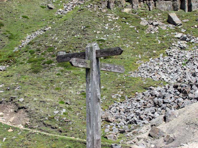
off once again. A few yards brought us the signpost at the
crossroad of paths.
Last time we took the path to
Blakethwaite Dams but today our route was towards Surrender
Bridge, up this steep rough ravine, but believe it or not there
was a path.
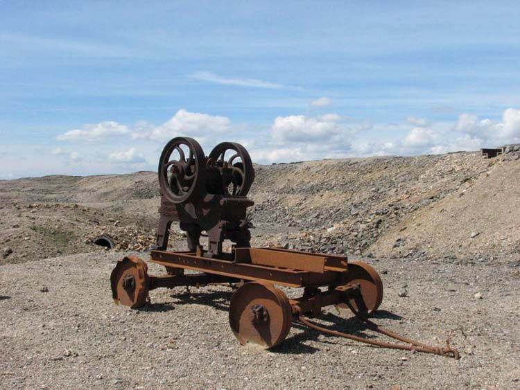
We came across this abandoned stone
breaker, another reminder of the industrial past. The nameplate
indicated it was made in Leeds.
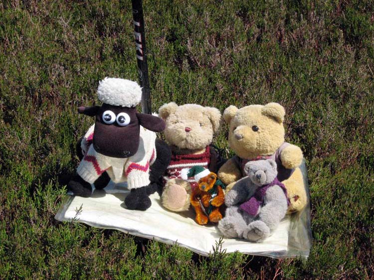
Leaving the main path we now turned
due south across Melbrecks Moor, another flat top covered in deep
heather. Dad manfully ploughed through this to reach the position
of the highest point marked on the map. Here we are sitting on
the magic carpet of Dad’s map case.
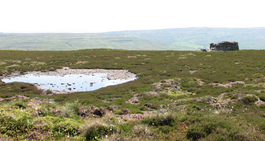
A prominent sheepfold by a small
pool provided a good landmark for our continuing route.
Now the steady descent started and
took us below the very impressive wall of High Scar. From the
spoil below we thought that this had been a quarry in the past.
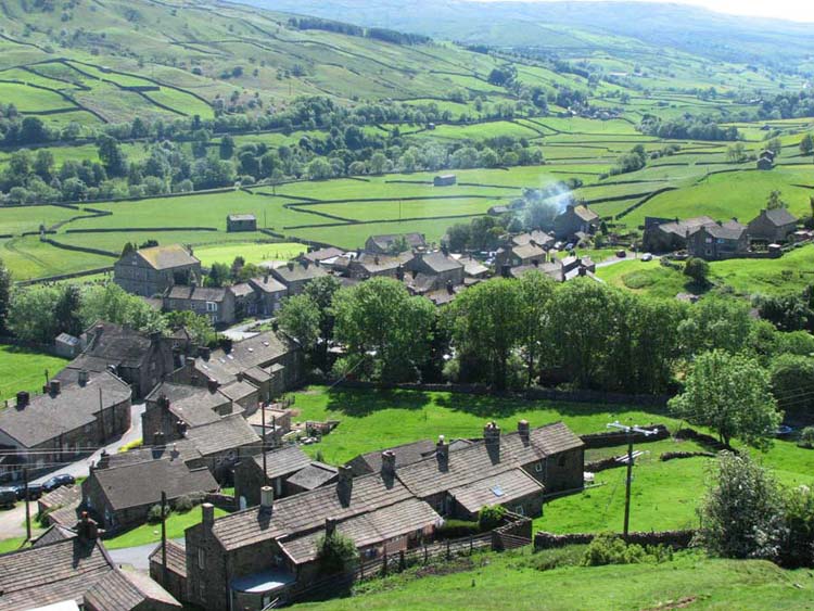
Soon now Gunnerside came into view
nestling in the valley.
The descent was down the field
behind the houses and then through a gate at the left end of the
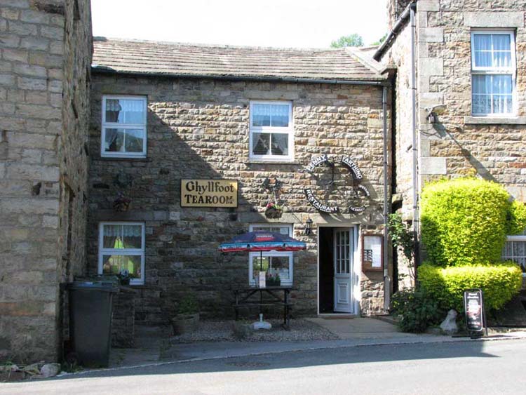
range and into the main street, and the Ghyllfoot Tearoom. Now
that’s what you might call planning!
While we had our picnic in the car,
Uncle Bob and Dad sampled the delights of the tearoom. Uncle Bob
had a scone with jam and cream and glasses of home made ginger
beer and lemonade. Dad had a piece of lemon cake with a pint mug
of tea. Not only this but on his way home he then stopped in
Hawes and went to the "Chippy" for delicious fish and
chips etc – his excuse was that it would save him having to
make a meal when he got home.