The many expeditions to the
Yorkshire Dales has meant that there are few of the hills left to
climb, so consequently "bagging" a few tops in a day is
now almost impossible. A mopping up operation is now the order of
the day with often just one summit as was the case in these two
walks.
BLEA
BARF from track to SUMMER LODGE
Summary
Date - 3rd August 2008
Distance - 4 miles
Map - OL30
Start point -
Verge parking on
Askrigg to Reeth road near junction with track to Summer
Lodge (SD 964949)
Summits Achieved
Name
Height (ft)
Height (m)
Grid Ref
Blea Barf
1772
540
SD 9555 9620
The Walk
A narrow lonely road climbs steeply
from just beyond the village of Askrigg in Wensleydale, leading
eventually to beautiful Swaledale to the north. As we climbed to
its summit up Long Band the wild desolate moorland stretched out
all around. At a sharp bend at the bottom of a steep hill Dad
parked, and we waited a few minutes for Uncle Bob to arrive.
"Hi Uncle Bob", we called out. "Good to see you and we are looking forward to the walk and ticking off another outstanding summit."
"Hello lads", he replied. "Here's to another cracking days walking."
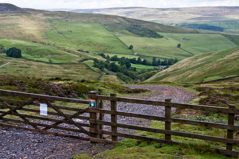
This gated track below leads to
Summer Lodge, where it becomes a road to Crackpot. Such a name
could be given to the unwary drivers who have blindly followed
the instructions of their Sat Nav to take the road to Crackpot
only to come to grief on this rough track. "They have only themselves to blame", said Allen, pointing to the sign warning it is unsuitable for motor vehicles.
"That track will be our return route", remarked Shaun. "Outwards it is over that gate to the left."
Dad and Uncle Bob strode out on the clear path. After a while Grizzly called out, "that is a lovely view down to Swaledale. There are the isolated farms and the landscape is dotted with the many field barns. It is a feature of the Dales."
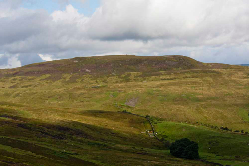
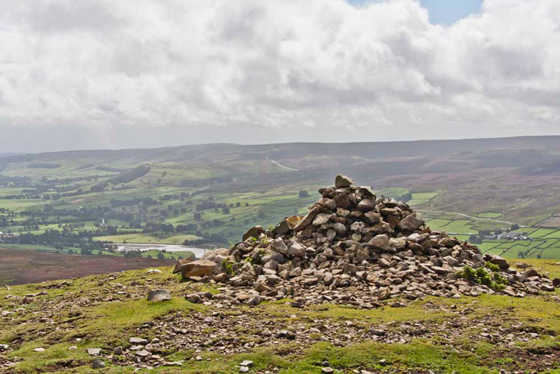
Pointing across the valley, Tetley said, "there's our objective Blea Barf. I can just make out the tall summit cairn on the skyline."
The path wound on passing a number
of piles of stones. Shaun said, "the map describes them as 'Tips (dis)'.
Meaning a disused tip from long defunct mining operations."
Quite
suddenly near a stream the path just disappeared. We skirted left
to cross the stream and to our left Summer Lodge Tarn came into
view. "We passed the tarn before on its other side when we had
climbed Blackstone Edge and The Fleak", commented Tetley.
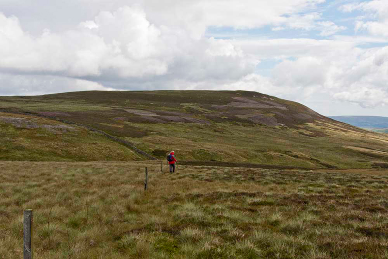
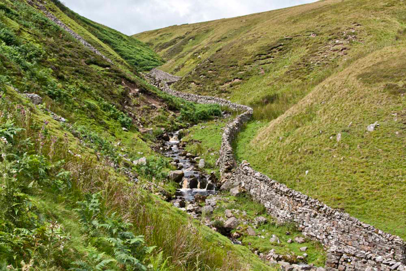
Ahead was a fence, where clearly following it right took us directly towards Blea Barf. The ground was very rough underfoot, and Uncle Bob can be seen here ploughing his way across it.
In a dip we crossed a stream called Black Gutter, and once through a gap in a wall it was just a steady climb right towards the summit.
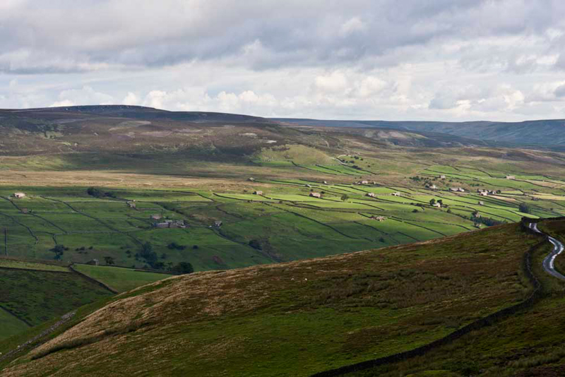
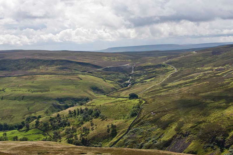
We paused part way. "That's a super view looking back to the start", commented Little Eric.
"The road can be seen and the track to Summer Lodge", pointed Allen. Then looking at the map he went on, "the stream in the centre is Summer Lodge Beck. The ravine immediately below us is the Bloody Vale. We have to cross that to get to the track that runs from the road to Summer Lodge."
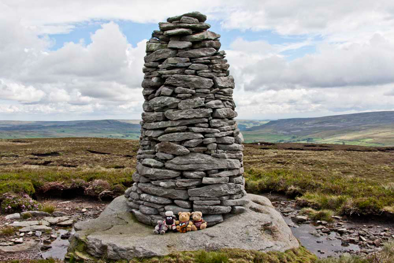
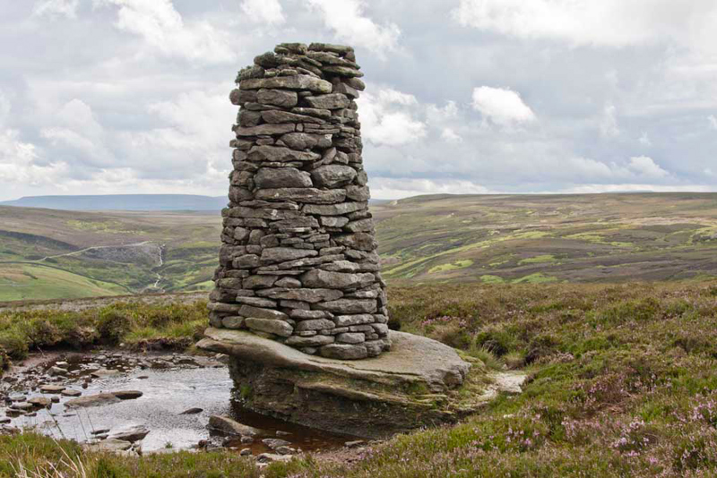
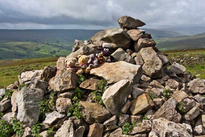
The reverie over, we commenced to climb once more, and quite soon Blea Barf summit was attained, marked by this tall and shapely cairn. "Quite beautiful", said Little Eric, as with the rest of us scrambled out of the rucksack to settle for our obligatory picture."
It stands on a rock plinth that due
to the erosion juts out over the pool behind.
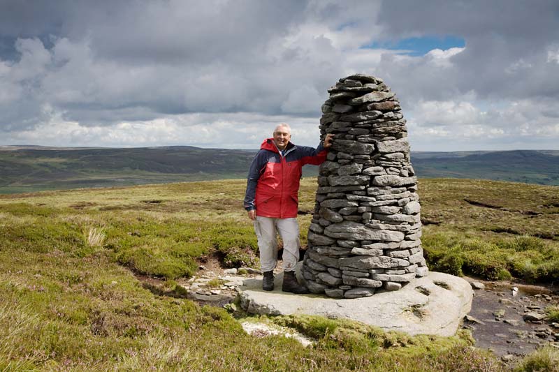
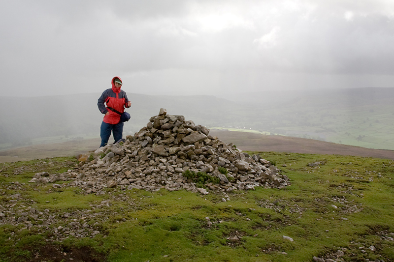
I know you might think this is
overkill, but we could not resist putting in this picture below
taken by Uncle Bob of Dad at the cairn. Allen says, "we appear so often it is only right that our dear Dad, who takes us on all these adventures, should appear too."
photo
courtesy Bob Woolley (Uncle Bob)
Heading roughly south the descent
was then made to the stream that runs through the Bloody Vale.
"One wonders what caused it to have such a name", mused Little Eric
Grizzly did some research and told us later, "according to local writers Marie Hartley and Joan Ingleby, this valley was the scene of a clash between Scots raiders and local men. Battle axes and pieces of armour have been found at nearby Crackpot."[source:'The Yorkshire Dales' 1956].
Shaun said, "we have to cross Croft Beck, then get over that wall somehow."
Now Uncle Bob and Dad are well used to climbing walls, but this one was taller than any they had ever encountered, such that it was above head height. They looked along in either direction, Uncle Bob saying, "there looks a good place with some protruding stones."
He went first, Dad following, having taken note of his route, and with care and perseverance it was accomplished.
"Phew", breathed Little Eric. "I am glad that is done."
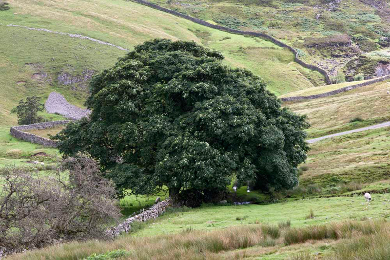
A steep climb up the bank from the
vale soon led to easier ground, passing under this clump of magnificent trees...
...and as can be see almost immediately join the track Summer Lodge, where it just a short stroll uphill to the car.
Away to
our left at the end of Swaledale was a shapely hill. "That's
Calver Hill", said Tetley. "Next weekends objective."
Well of course refreshment was now
in order so it was off to Hawes where they parked at the
Wensleydale Creamery. We then had our picnic while Uncle Bob and
Dad strolled down to "The Chippie" for delicious fish
chips and peas. They then shopped at the Creamery, Uncle Bob
buying some cheeses, while Dad bought some nice biscuits for us
to take as a gift to Uncle Brian. Roll on next Sunday!!
CALVER
HILL, ARKLE TOWN & ARKLE BECK from REETH
Summary
Date - 10th August 2008
Distance - 6.75 miles
Map - OL30
Start point - Reeth (SE 038993)
Summits Achieved
Name
Height (ft)
Height (m)
Grid Ref
Calver Hill
1598
487
NZ 0133 0029
The Walk
"Hooray" called out Allen,
Sunday is here. We were up early and needed no urging to hop into
Dad’s car for the drive to Reeth in Swaledale where we met
Uncle Bob. The route was along the familiar road to Ribblehead
passing by the mountains of Ingleborough and Whernside, although
the tops were covered in cloud. It was on then to Hawes (famous
for The "Chippie"). Dad then took the same lonely road
as last week passing where we had parked. This led down to the
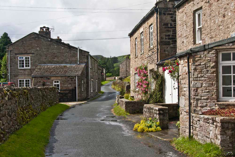
main road through Swaledale and then to the pretty village of
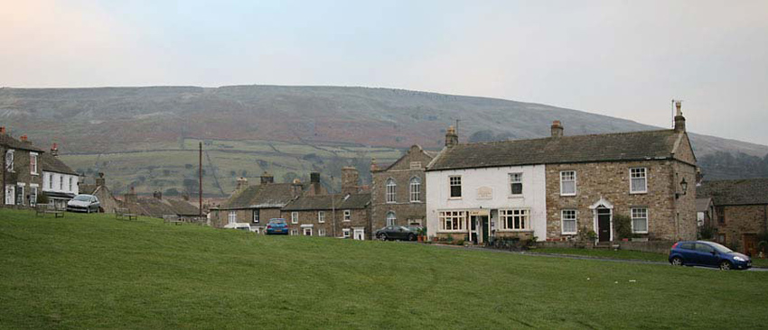
Reeth backed by the high ridge Fremington Edge that we had
climbed last December.
Photo
courtesy Bob Woolley (Uncle Bob)
"Look" pointed Allen. "That white fronted building is the Ivy Cottage Tearoom.
I am sure Dad and Uncle Bob will be going there later"
"Oh yes", confirmed Dad.
Soon he called out, "I'm nearly ready. Come and get settled in the rucksack lads."
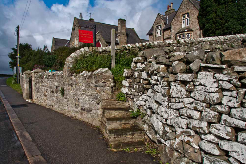
"We take that road out of the village", instructed Shaun. Then soon at the Old Schoolhouse B&B he pointed, "the footpath is up those steps."
This led to fields and then through a
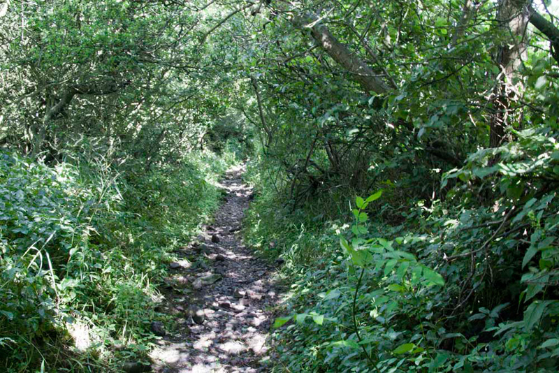
gate onto Skelgate Lane. Once upon a time probably a good track
but now rather narrower and overgrown. "The light filtering
through the trees creates a nice effect", commented Allen.
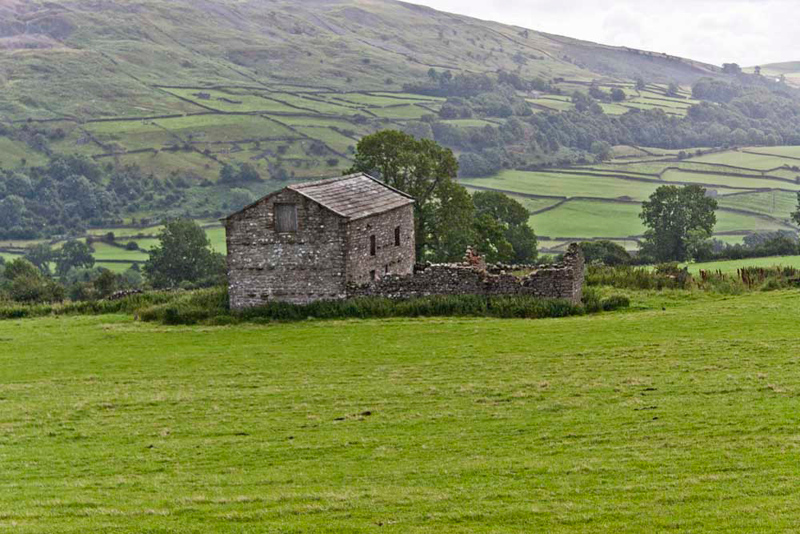
A gap in the trees afforded a view
of Fremington Edge with in the foreground one of the many field
barns that dot the landscape. "Such a typical sight in the Dales", said Grizzly.
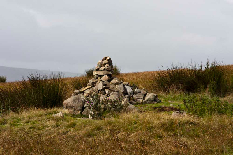
At the end of Skelgate Lane, near to
Ridding Farm, another gate gave access to open fell and ahead was
this rather stylish cairn. "Must be worth a photo", suggested Allen.
Although it may not look it the sky
was very dark and threatening. Uncle Bob said, "Gerry, I think it might be wise if we put our waterproof over trousers on."
"Hmm Bob, I agree", replied Dad.
"We should now follow that path climbing and slanting right", advised Shaun.
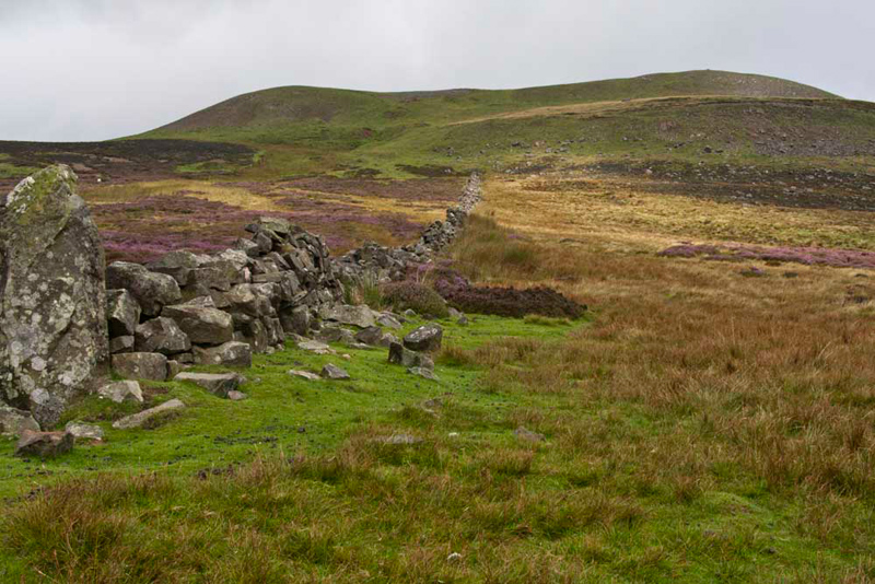
This brought us to this old tumbled down wall, from where we
could clearly see our objective Calver Hill. "I can just about make out the summit cairn on the right of the hill", pointed Little Eric.
From here it was now a simple matter of following the wall and then picking the best route to the summit.
Breezy at Reeth, here at the summit it was blowing
a full gale. "Blimey", said Dad. "It is hard to keep upright."
"Well gale or not, we are determined to climb up onto the cairn for our photograph", said Grizzly.
Shaun said", sit on my back Little Eric and hang on, so you are not blown away."
Take note now of the lowering sky
behind. This was where the weather was coming from.
Tetley said, "were going to
get soaked."
So Shaun said to Dad, "you had
better tuck us fully inside the rucksack when we set off".
Before doing so Dad took this nice
shot looking across Swaledale.
There was also time for Dad to pose by the cairn while Uncle Bob took his picture. As you can see he is prepared for the impending storm.
So off we went heading north west
down the fell. Now the wise decision for Uncle Bob and Dad to
wear over trousers paid off. The heavens opened and the wind
increased even further. We were safely snuggled deeply inside the rucksack but even so the noise was terrific.
"The rain hitting Dad’s hood sounds
more like someone is shooting gravel at it", called out Little Eric, such was the ferocity.
Once it had passed over we heard Uncle Bob remark to Dad, "Gerry I have rarely known rain heavier."
Oh were we so glad to be tucked up
inside!
Once it had passed Dad stopped and we popped our heads out once again.
Reaching a track Shaun said, "we turn right and
walk to the road that is called Raw Bank. There turn left for short way, before
turning right into the tiny hamlet called Arkle Town."
"Lovely stone houses", commented Allen. "So typical of Yorkshire."
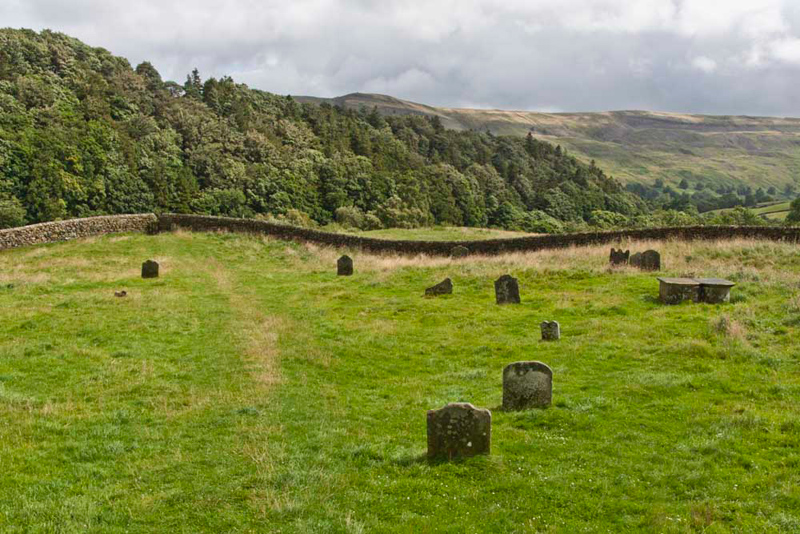
At the end of the houses Shaun pointed, "that's our route through the gap stile and down to Arkle Beck."
"Oh", said Little Eric once through the stile. "That's a surprise, we are in a burial ground."
On examining the graves we noted
that they all dated from the late 18th and early 19th
centuries.
Grizzly again did some research, telling us, "apparently at that time there was a church here
but this was later demolished. The villagers then travelled to nearby Langthwaite to worship. The map refers to this area as Kirk Park Hill, using the Scottish term Kirk for church."
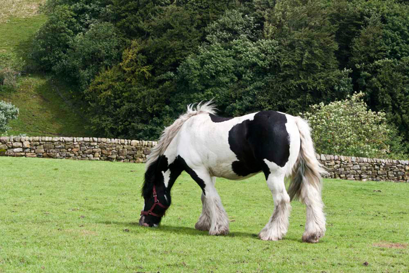
As we passed through here we
noticed this lovely horse in the next field.
"Please take a photo",
implored Allen.
Very soon we were beside Arkle Beck the path leading first through woods and then over many pastures, with Fremington Edge dominating to the left...
...and so to the road leading into Reeth, and its green, across which the Ivy Cottage Tearoom, pictured at the beginning, stands invitingly.
We happily settled in the car and
enjoyed our picnic. We should say that we divide the making of
this between us. Grizzly with Eric’s help makes the
sandwiches. Allen with Tetley’s help makes the cakes, and
Shaun provides the drinks. Black Sheep beer and either tea or pop
depending on how warm or cold it is.
Dad told us that he and Uncle Bob
had lovely Yorkshire Curd Tart with cream, and a warming pot of
Yorkshire tea.
Tetley said, "that has been another grand day out despite the storm. Thank you Dad and Uncle Bob."
Goodbyes were said for now and all that remained was for Dad to drive us home.
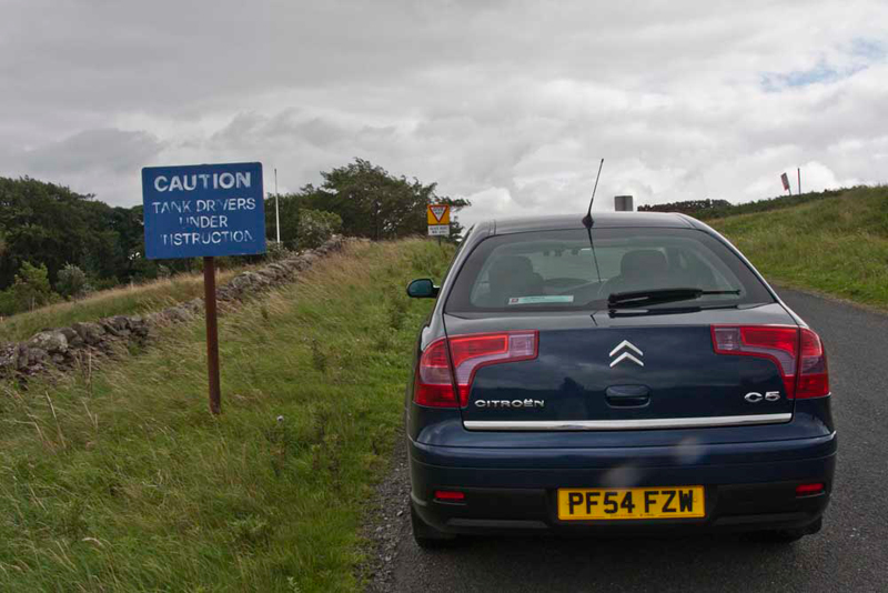
Dad’s car is rather big, and
Uncle Brian refers to it as a tank, and nicknames it Sherman.
As we crossed the Army Ranges towards Leyburn, Allen called out "look at that sign. Take a picture with the car parked by it. It will give Uncle Brian a laugh."