| RIVER RIBBLE, WHARFE & MOUGHTON from HORTON IN RIBBLESDALE |
Summary
| Date - 31st August 2008 | Distance - 8 miles | ||
| Map - OL2 |
|
Summits Achieved
| Name | Height (ft) | Height (m) | Grid Ref |
| Moughton | 1402 | 427 | SD 7868 7118 |
The Walk
Today we were in Yorkshire’s Limestone Country for our walk, with Uncle Bob for company too – hooray! It was to be Dad’s 50th walk with Uncle Bob. The start point was Horton in Ribblesdale, where we have walked from before when we climbed Pen-y-ghent. This is the first of the "Three Peaks" and is indeed where the Three Peaks Race starts and finishes.
We met at the main car park, where we called out a cheery "hello", to Uncle Bob.
Ready for the off, Shaun said, "we take that small path out of the car park that will leads us over a narrow bridge to the road."
There Shaun instructed, "now we cross the bridge over the River Ribble"...

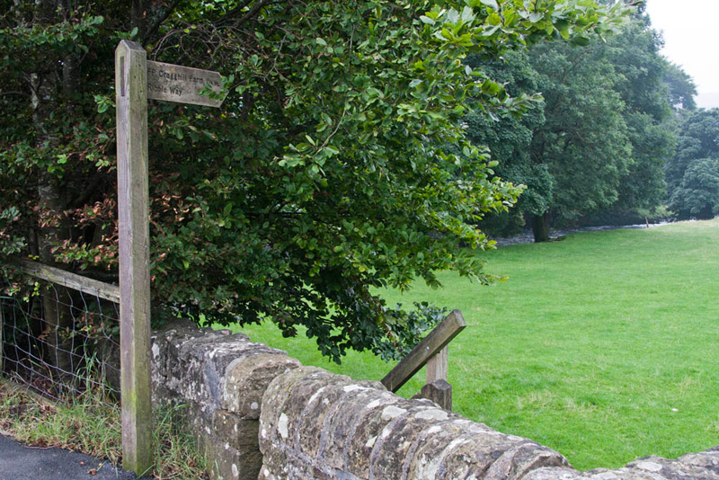
...and then go through that signed gap stile."
As the sign reads, the path we now walked, is part of the long distance footpath called the Ribble Way.
Tetley looked at the map, saying, "the path stays close to the river and leads to Cragghill Farm."
"A very pleasant stroll", commented Grizzly on reaching the farm.
"We leave the Ribble Way here and take that footpath forking off right", advised Shaun.
This led between the farm buildings and then beyond over a field to reach the railway crossing. This was the Settle to Carlisle railway that has been mentioned by us in previous stories.
"We must be careful crossing", called out Little Eric.
So as the warning sign instructed we all looked left then right and listened too. Then once we were sure that no train was about to pass we walked across the tracks.
Some inquisitive sheep approached and Dad could not resist taking a photograph, although we do not like these as much as our lovely smiley Herdwicks that roam the Lakeland Fells.
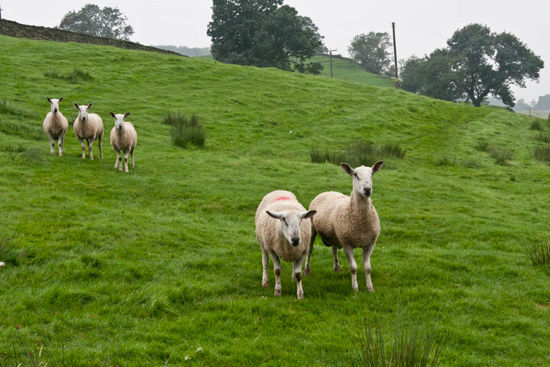
"Hmph", cried Allen. "There goes the sheep picture free story."
The path climbed initially to a shelf below the huge Arcow Quarry. Grizzly said, "I'm glad we are up here as the fields below are clearly very boggy indeed."
"I would not be surprised if you and Uncle Bob would have sunk up to your knees", stated Tetley.
"Uncle Bob said, "I can imagine the comment Brian would have made about the state of your trousers, Gerry."
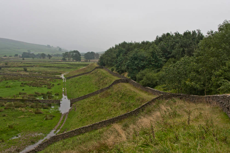
A number of walls had to be crossed and gap stiles allowed passage. We liked the effect of the symmetry of these walls.
The path took us to a road and on to pass Foredale Farm, then at this sign, Shaun said, "it's left here."
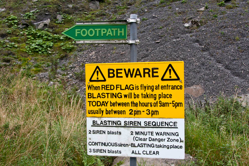
We were ready to stick our paws in our ears, but thankfully there was no sign of a red flag nor any siren blasts. "Well it's Sunday", said Grizzly, "they will not be working."
The footpath led to another quarry called Dry Rigg, where reaching the encircling embankment, we climbed up for the view.
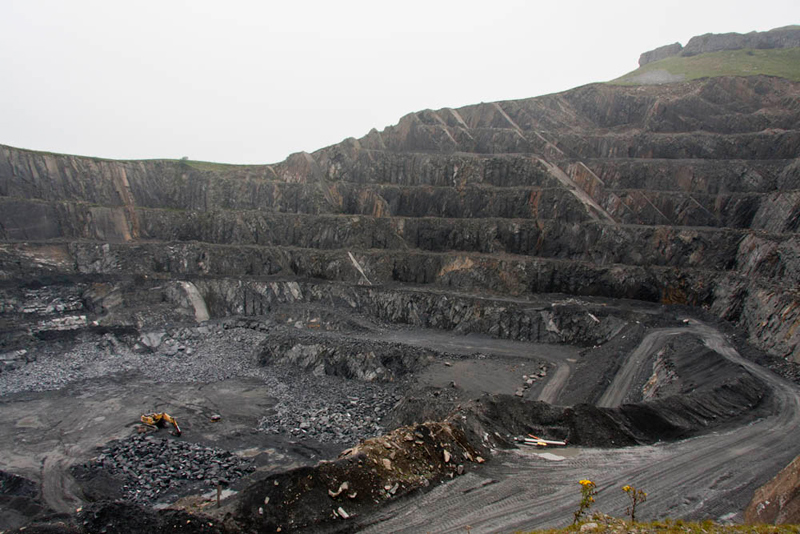
"Wow", breathed Little Eric. "It's massive. The digger looks like a toy."
We could hear pumps clanking, this to keep water out. At some time in the future, extraction here will cease, when over a number of years this area will be allowed to flood and form a deep lake. "It will look much nicer then", commented Allen.
The track went all the way round the perimeter of the quarry. This was followed before climbing a stile to descend to the road at Newfield.
"Turn right" called out Shaun.
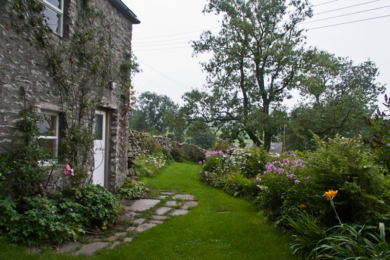
It was then just a short walk to the hamlet of Wharfe. The houses are full of character like this cottage. "Dad please take a picture?", asked Grizzly.
"We've walked through here before but in the opposite direction", said Tetley. "It was on the walk to Norber and Crummack Dale."
We followed this track again, but soon Shaun pointed, "the route is over that stile to the right."
Coming to Studrigg Scar we went for a closer look. Once a waterfall cascaded over it.
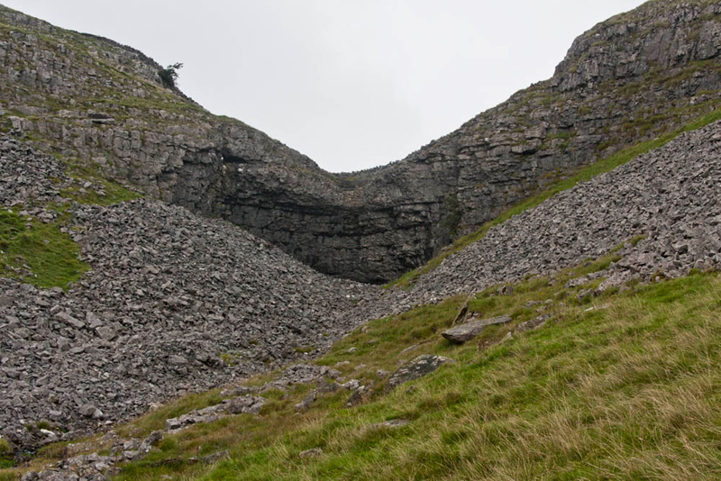
"We have to climb up the left side", pointed Shaun.
"There's the start of the path", said Grizzly.
It was narrow and steep but once at the top, a gentler climb followed, roughly north-west, to finally approach the summit of Moughton (pronounced Moot’n). The top is quite grassy. "I am surprised", commented Allen, "I had expected there to be more limestone pavement."
As can be seen the day was cloudy with poor visibility. "Aww, such a shame we cannot enjoy the extensive views of the surrounding hills", moaned Little Eric.
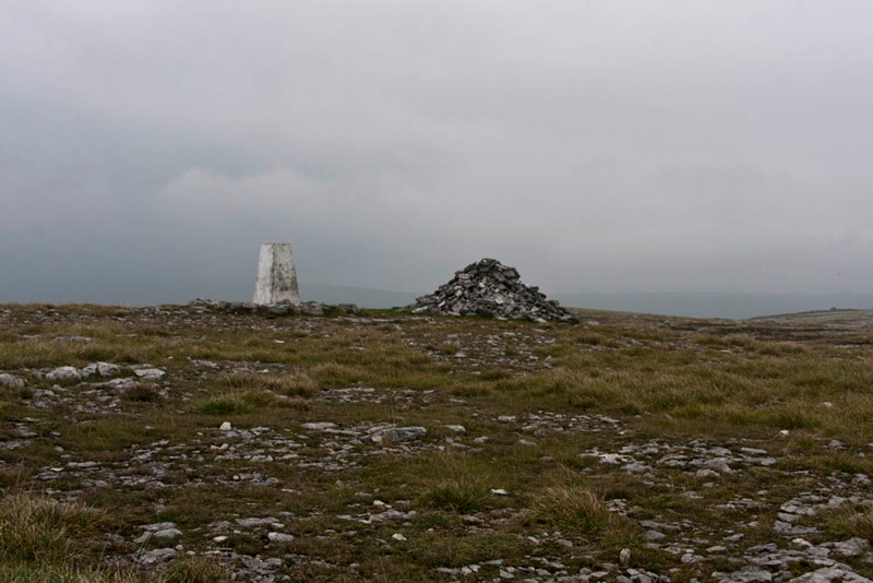
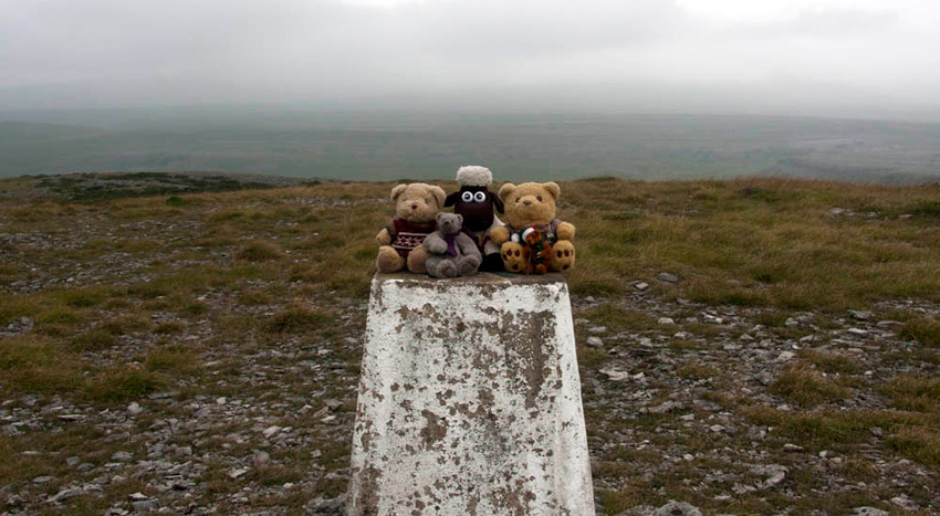
"A cairn and trig point. Spoilt for choice for our summit picture", commented Allen.
Dad took us at both but we have opted to include the one of us sitting on the trig point.
"It’s time we had some lunch," said Uncle Bob.
"Oh yes", said Allen rubbing his tummy. "I'm hungry", he went on as he promptly sat down, and got our sandwiches etc out of his rucksack.
We munched away at the sandwiches and cake, chatting about the walk so far. After a while Tetley said, "that's better, I'm ready for the off again."
Before doing so, Dad had his camera out again to take the summit area, but as he took a shot Uncle Bob peered round.
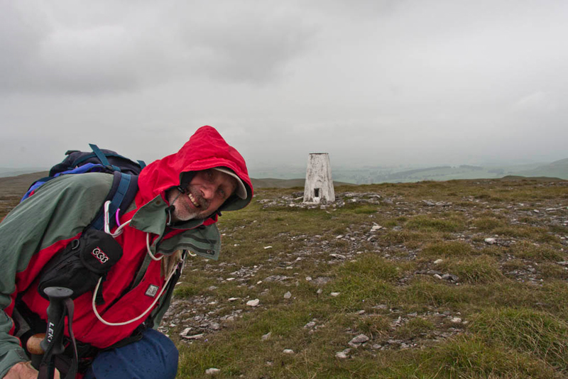
During the time on the summit the sky became more lowering, Bob saying "we had better get our waterproofs on mate."
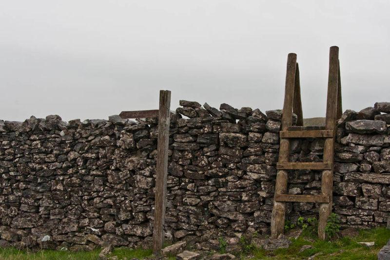
It was a wise decision as sure enough the rain came on as we all descended towards Horton. We hunkered down as best we could but the rain was not too heavy. Picking the way over some limestone pavement the wall was joined and crossed via this substantial ladderstile.
The path was followed in the direction of the signpost to a gate. Once through we joined the path from Ingleborough.
Grizzly said, "this is the path the fell runners use on the final leg of the 24 miles Three Peaks Race, over the mountains of Pen-y-ghent, Whernside and Ingleborough."
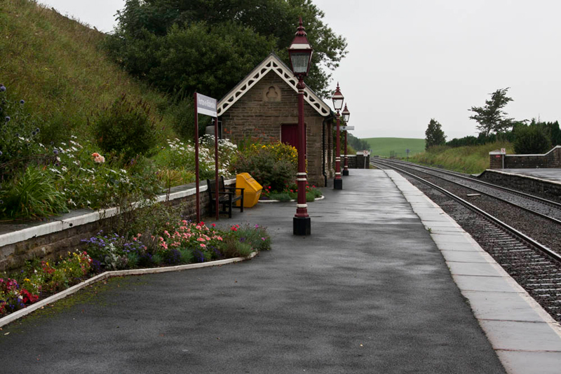
Soon Horton in Ribblesdale came into view and we reached the railway station, which is on the Settle – Carlisle line.
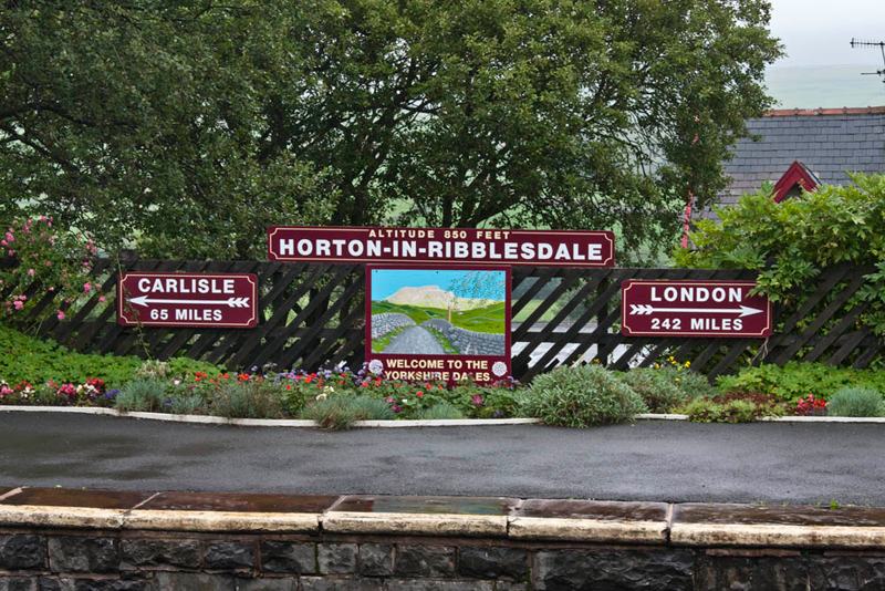
I love the sign depicting Pen-y-ghent", said Allen, "And the flowers look lovely."
Despite the rain we paused a little while to explore the station and admire how beautifully kept it is. "It is a credit to the volunteers who obviously put in such a lot of hard work", said Little Eric.
More details about this and other stations on the Settle – Carlisle line and can be found at - www.settle-carlisle.co.uk
A short walk now brought us into the village where, surprise surprise, Uncle Bob and Dad, went straight to the famous Pen-y-ghent Café, so we went too. Uncle Bob had a sausage sandwich, Dad a bacon sandwich, each with a pint mug of tea. Well deserved too!
"Thanks Uncle Bob and Dad for another great day" said Shaun on behalf of us all.
"You are welcome lads", replied Dad.
Apart from the section through Wharfe, it had been yet another completely new area that we had explored.