For the first time in what seemed
to be weeks the day dawned with blue skies and sun, so it was
great that Dad had arranged to walk with Uncle Eric. Our start
point was the village of Dent, which we reached via the Lune
Valley to the hamlet of Barbon and then along the narrow road
through Barbondale with the steep slopes of Middleton Fell on our
left.
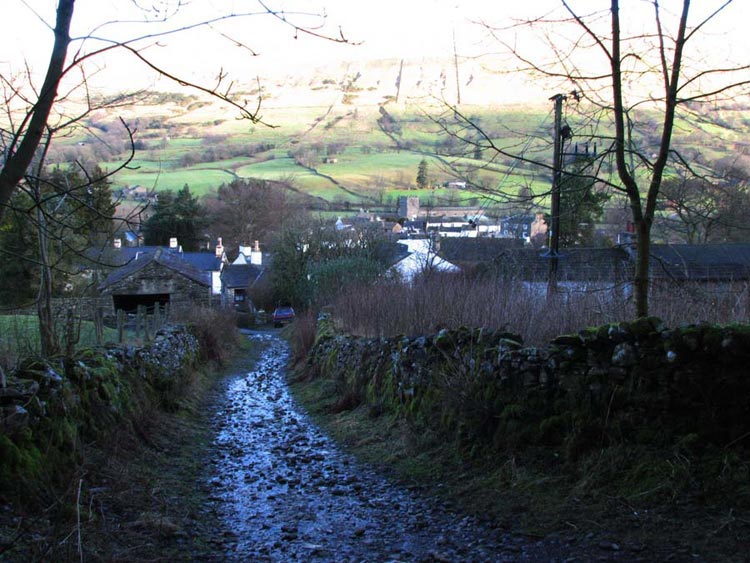
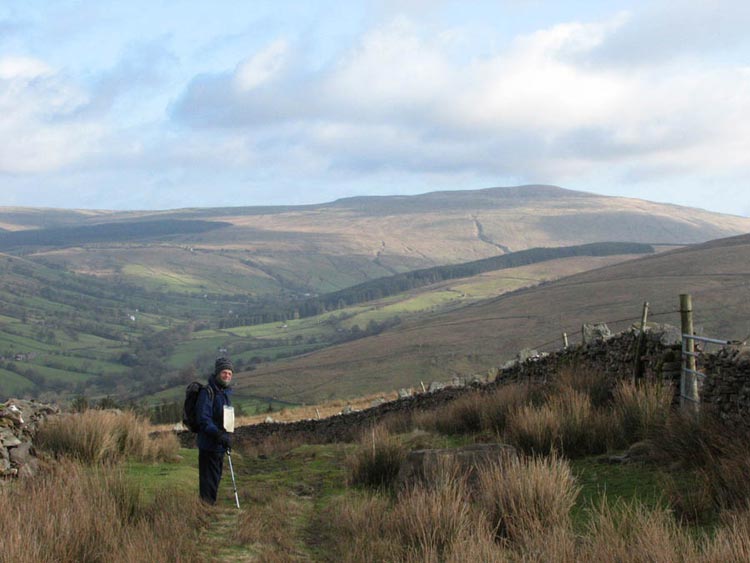
Dad was soon ready and we leaped
into his rucksack and settled in. The route was along the road
immediately opposite the car park. This soon petered out and
became a track that climbs up beside the stream. This is known as
Flintergill. Initially we could look back to Dent backed by the
slopes of Aye Gill Pike bright in the winter sunshine…
A little further on dad spotted a
sign that read "Dancing Flags". We were all mystified,
and to us conjured up visions of flags flapping in the wind. With
the help of the lady at the café and research by us on the
Internet we were able to establish exactly what the sign referred
to.
The "Dancing Flags", are
a large expanse of flat natural rock slabs that were used for
centuries by local weavers for "waulking" their newly-woven
lengths of cloth, or "webs" as they were called. This
was done by first wetting the fabric thoroughly and then treading
it with bare feet, causing it to shrink slightly and "felt
up" to create a much thicker and therefore much warmer
material. At one time this was a universal practice and in many
places became known as "dancing the web" - hence the
name of the stones.
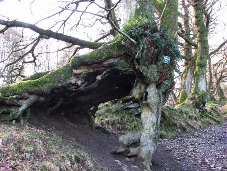
Further on another sign caught out
eye this reading "The Wishing Tree".
As you can see the trunk and roots
have formed it in such a way to create an arch. The story here is
that you make a wish and then go round through the arch three
times in a clockwise direction. Your wish is then supposed to
come true. Further on we next saw a lime kiln that had been used
in the 17th century to extract from limestone,
quicklime that had many domestic and agricultural uses. It was
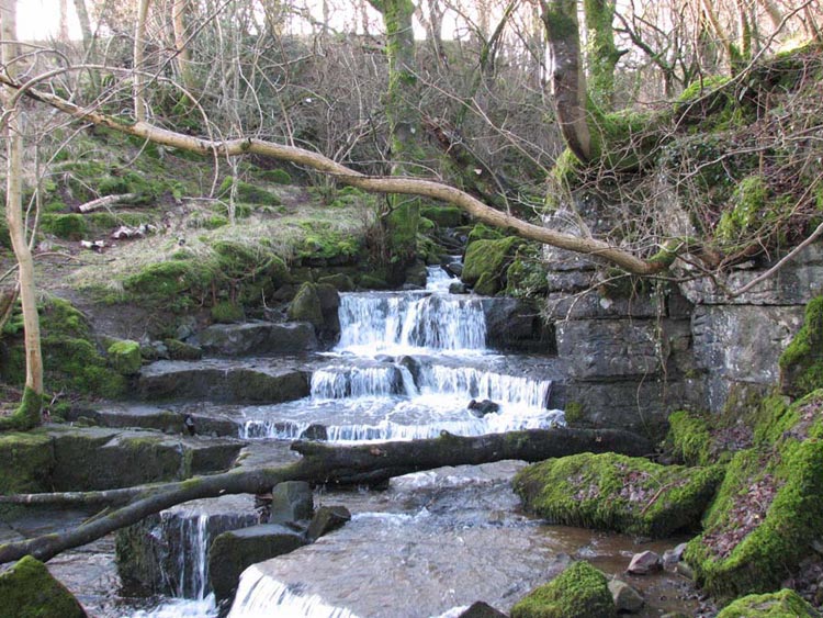
nice to see that it had been restored for people to view. Soon
after we came to this pretty waterfall…
This was in fact the site of the
quarry where the limestone was dug out for use in the kiln.
It had been quite fascinating
seeing all this. Soon we were clear of the trees and on the open
fell side and rewarded with a superb view over the valley. To the
left the Howgill fells, Aye Gill Pike in front and to the right
two tops that we recognised as Great Knoutberry Hill and Wold
Fell. These we had climbed a few weeks earlier with Uncle Bob and
we remembered then that Great Knoutberry Hill had been covered in
cloud. Soon we reached a t-junction and we turned left along the
Occupation Road or "Occy" as the locals know it.
Originally a drovers road it was rebuilt as an access road in
1859 at the time of the Enclosures. It was once a smooth road but
now is deeply rutted in places and very muddy after the wet
weather. With glorious views we walked along under the slopes of
Great Coum, another hill we had recently climbed, until we
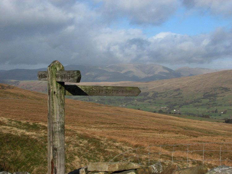
reached the signposted junction with Nun House Outrake. This we
took to start our descent to the valley.
Here the Howgill Fells back the
signpost and below Uncle Eric looks back with Great Knoutberry
Hill behind…
A little before reaching High Nun
House, we climbed the ladderstile to the right and crossed the
fields to reach the road passing the house called Hollybush.
Above Whernside towered over us dividing the valley. We were now
in Deepdale and at the next farm turned left and followed the
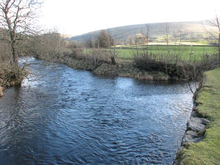
track to come beside Deepdale Beck. It was now delightful walking
across the fields with the beck to our right rushing by. Just
before Mill Bridge it came to its confluence with the River Dee
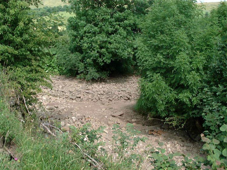
that runs through Dentdale…
We had been here before in July
2005 when amazingly the river was completely dry!
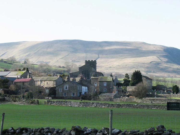
At Mill Bridge we joined part of
the long distance path called the Dales Way. It runs from Ilkley
in Yorkshire to Bowness in Cumbria See - http://www.walkingenglishman.com/dalesway1.htm for more information. We followed this over
more fields towards Dent, seen here with Middleton Fell
behind…
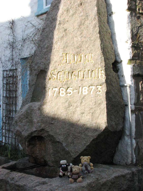
You may have noticed that our
photograph has not featured so far in this walk and we can’t
have that we perhaps hear you say, so dad kindly took us sitting
by the Adam Sedgwick memorial fountain in the village…
Born in Dent he was a professor at
Cambridge and at the time one of the pioneers of modern geology.
It was just a short walk to the car
now and we enjoyed our picnic while Uncle Eric and Dad went for a
nice meal at the nearby Stone Close tearooms. Well they deserved
it after taking us on a most interesting walk.
And finally Dent is also famous for
the tale of the "Terrible Knitters". The village was
once a powerhouse of hand-knitting the profits often providing an
essential addition to their meagre farming income. They employed
a technique where by one needle was in a wooden knitting stick
protruding from a belt and the other held in the right hand.
The left hand was thus free to do
another job, such as churning the butter or wrapping the cheeses.