STAG were sitting together having a chat,
and talking about walks past and those that were likely to be in
prospect in the future.
"Isn't it nice that Dad has added a
listing of our 2008 adventures to our website", remarked
Tetley.
"Yes", agreed Shaun, "but I
wonder if there are any more that we can write a story about."
Ever eager to expand the site, Allen piped
up, "I have been looking at the list and at the photographs
on Dad's computer, and think those two walks from Uncle Eric's
may be possibilities".
"Dad's not about, so shall we all have
a look?", said Grizzly, conspiratorially.
Allen is quite an expert operating the
computer, so he booted it up, and then brought up the photographs,
saying "what do you think?"
"Looks good to me", enthused
Tetley.
"I agree" said Little Eric who had
perched himself on Shaun's back so he could see the screen.
"Now all we have to do is convince Dad",
said Shaun.
KENDAL and the
RIVERS KENT, MINT & SPRINT
Summary
Date
- 21st October 2008
Distance
- 7 miles
Map - OL7
Start point - Kendal Green, Kendal
(SD 512937)
The Walk
It was a rather windy
day with heavy showers as we set out from Uncle Eric's, but
after about an hour it brightened considerably and the sun came
out. It was in fact our first walk for five weeks, since Dad
injured his ankle falling near Sour Milk Gill above Grasmere. To
test out his recovery he had decided that a level walk was best.
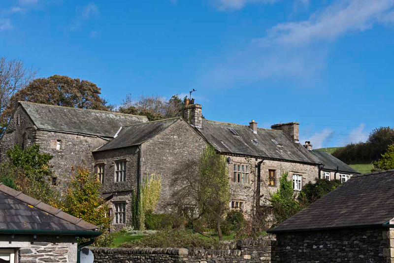
Uncle Eric has lived
in Kendal for a long time, and so is very conversant with the
many paths and tracks. Crossing the road the narrow path between
the houses, led over Prickly Fell, and then steeply down to
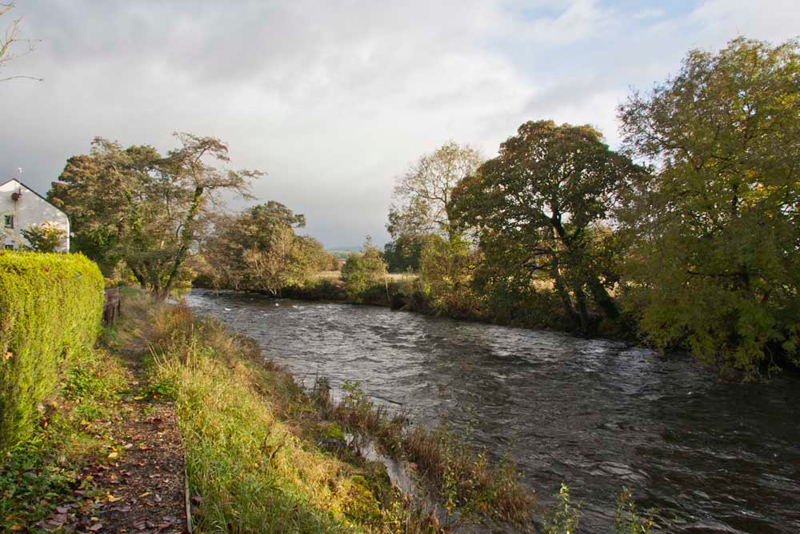
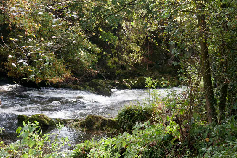
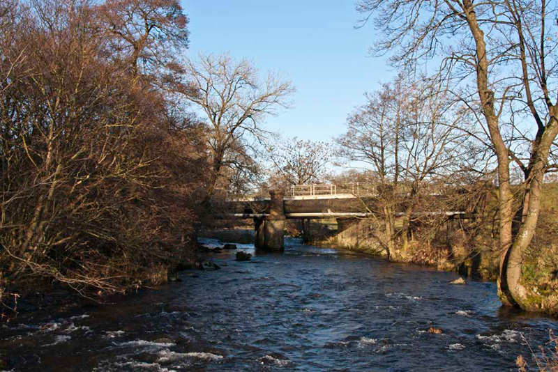
Horncop Lane. After some more street walking, another narrow path
brought us beside the River Kent, at Kentrigg. It was full and
flowing fast after recent rains. This river is relatively short,
starting in the Kentmere Valley, passing through the villages of
Staveley and Burneside, before reaching the town of Kendal. Then
after a few more miles it empties into Morecambe Bay. It is in
fact one of the fastest flowing rivers in Britain, rising
extremely quickly after heavy rains, but equally the level soon
falls once the rain stops.
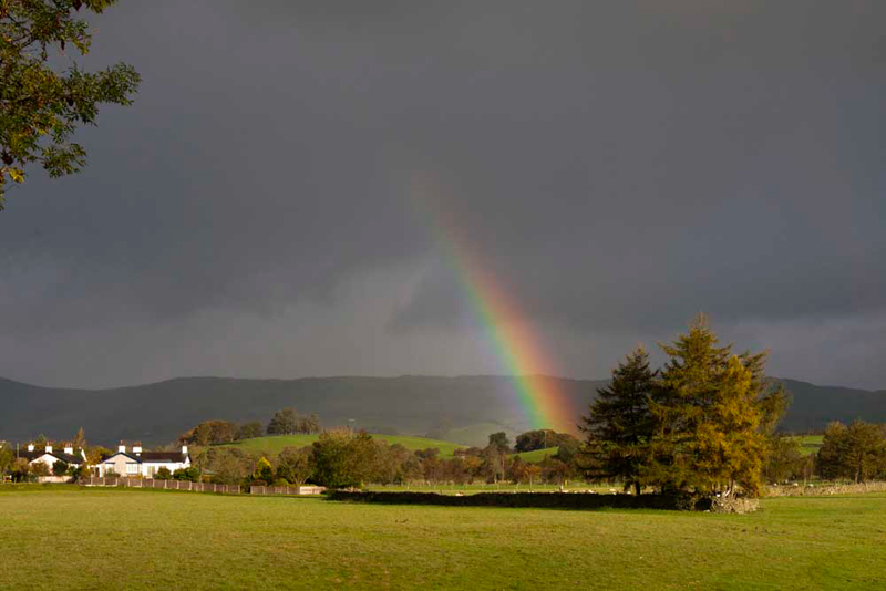
A few minutes later, a
heavy shower passed across ahead of us. "Look", cried Allen, "a rainbow. It really shines out
against the angry black sky."
"The pot of gold must be somewhere behind that green rise", laughed Grizzly.
The other rivers we
were to encounter today, both flow into the Kent, and after a
while we passed the confluence of the Kent and Mint.
As we continued
alongside the Kent we passed by Carus Green Golf Club. Tetley noted, "that hole requires teeing off across the river - some water hazard!"
"No chance of recovering your ball it you fail", said Allen with a laugh.
Eventually along further paths and the road, we reached the
village of Burneside. Walking through, passing the large complex
of Croppers paper mill, it was then along the narrow quiet road
towards Garnett Bridge. We all enjoyed the wonderful and
extensive views to the nearby fells, and of the beautiful
countryside.
Our route now lay
along a path to Tenement Farm (now very stylishly converted into
dwellings).
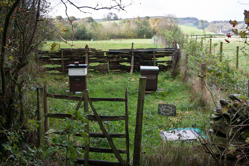
Passing a small allotment, Little Eric said, "look beehives. We had better stay
well out of range. We don't want to risk being stung!"
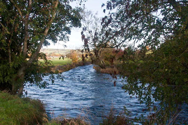
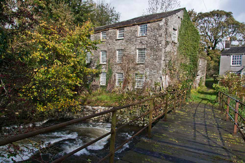
Then coming beside the
River Sprint, we arrived at Sprint Mill.
Grizzly told us, "The River Sprint has its
source high on the south facing side of Harter Fell. The first
two miles are a series of short flat sections interspersed by
spectacular waterfalls. Then it flows through the Longsleddale
Valley, eventually joining the River Kent just to the south of
Burneside."
We had seen some of the waterfalls, on a walk from Sadgill
in Longsleddale. After all the rain lately it was certainly
sprinting along.
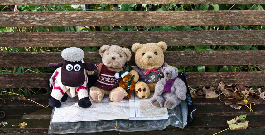
Seeing a seat, Uncle Eric said, "good place to stop of lunch."
"Ooh yes", called out Allen, rubbing his tummy. "I'm hungry."
"You're always hungry", laughed Shaun.
Before setting off again, we posed for our
picture. The seat was rather damp so Dad thoughtfully had let us
sit on the map cover.
Again Grizzly provided historical information about the mill. "the buildings are now
in private ownership, and have not been operated as a mill for
some time. This was once the largest mill on the river, having in
its time served as a corn mill and later as a woollen mill. Over
the centuries eight mills are known to have been developed along
the Sprint, using its fast flow for their power."
Tetley mused, "with all the
emphasis on renewable energy, perhaps the power of these rivers
should be harnessed to provide sources of electricity?"
Issuing directions, Shaun said, "we cross the bridge, drop down and then double back, along the opposite
side of the river."
Crossing fields we reached the hamlet of
Oakbank, where there was once a bobbin mill, built in the 1850's.
Here Shaun advised "Burton House Farm is the next objective."
To reach this more
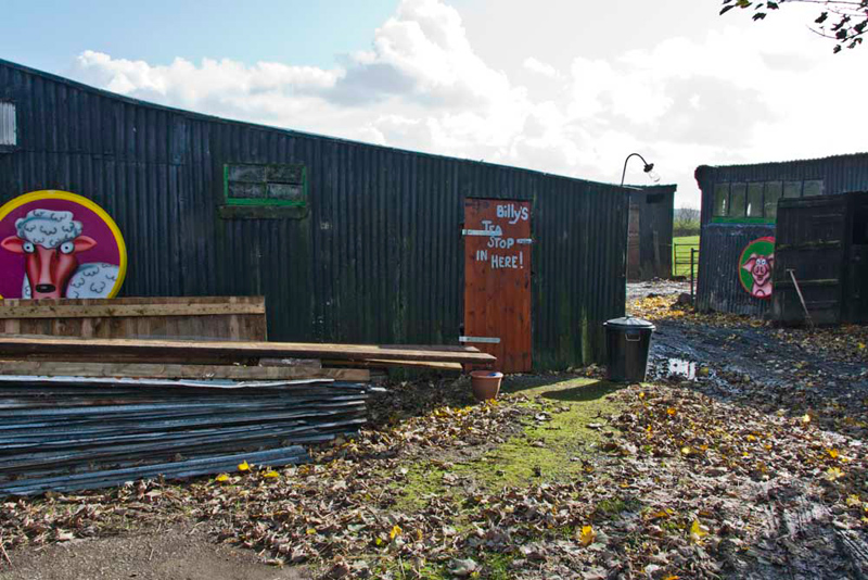
fields, that were very boggy in places, had to be crossed. It was here that we
encountered the most unusual tea room ever visited by Dad. It is
called Billy's.
This notice was inside
(we suppose in modern corporate lingo, it is their Mission
Statement) -
Me and my little sister have
pestered my mummy and daddy to get us some pets a little
different to my class mates.
My daddy found me and my
sister this little farm and said that we could get some pets like
chickens and baby piggies,
but there was a problem; how do we pay for the food for our
animals??
I thought of this idea as many
walkers come through this yard "let's make tea and sell it"!!
My dad said what a good idea
but we cannot sell refreshments without all the rules and
regulations that go with it,
so, we came up with this idea "let the people help
themselves and they could make a donation for our efforts in
the money tube on the wall".
If you like our idea please do
help yourselves and we would appreciate your contributions
towards our farm in the
hopper on the wall.
Thank you
Billy
Enjoy the rest of your walk,
have a nice day.
"How
enterprising - he will go far!", exclaimed Grizzly.
There are seats to sit on, tea,
coffee, biscuits etc etc. Just super and we all loved it.
Having scrambled up on
to the counter, Allen called out "please take our picture
Dad."
Dad signed the
visitors book, mentioning Uncle Eric and us too. We wish Billy every success in his venture.
Time now to be
on our way and we walked the access track to the A6 road.
Shaun advised, "we have to cross then it is down that bank to a gate into pasture below Chester Hag."
This was made a difficult due to Uncle Eric and Dad having to force their way through thick vegetation.
The path across the pasture then brought us to the impressive complex of
Skelsmergh Hall.
Continuing we passed
Dodding Green, the buildings of which are used as a Catholic
rehabilitation centre for ex drug addicts.
We had now come to
the third of the rivers today the Mint, and we followed the path
beside it, having to negotiate carefully one
particularly wet area.
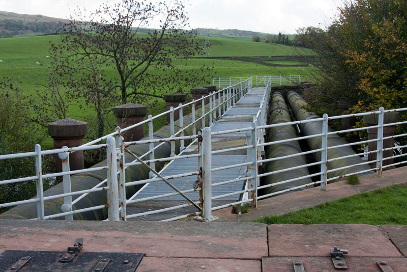
Little Eric pointed, "that bridge carries huge pipes. What are they for?"
Tetley replied, "they are part of the Thirlmere aqueduct, carrying the water on its 36 hour journey to Manchester."
Strolling on we then arrived at Mint Bridge. "We cross the road then keep on by the river but on the opposite side", instructed Shaun.
The path skirted the industrial
estate, to come to the confluence of the Mint and Kent again, but
on the opposite side
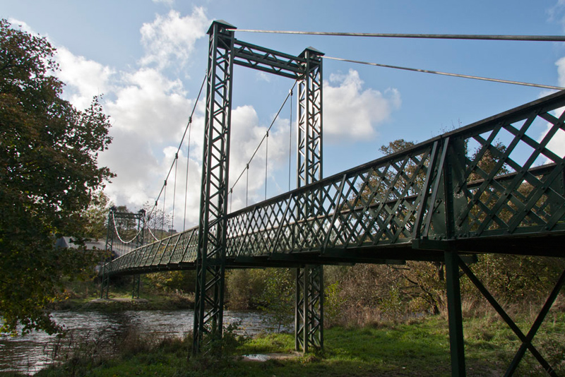
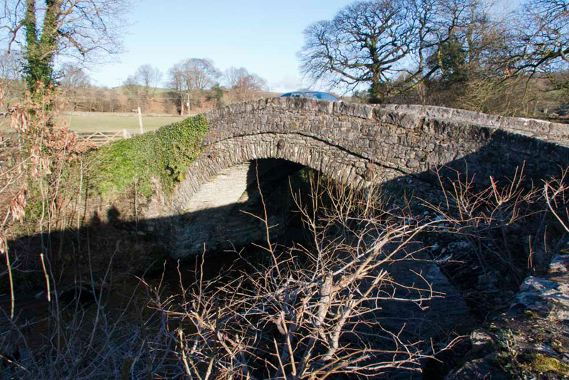
Then on the path by the Kent we came to
and crossed this suspension bridge.
Uncle Eric told us, "the bridge was once sited over
the river on the south side of town at the end of Romney Road. However it
was moved here, when a road bridge was built on its former site.
This was to allow speedier access for ambulances to the new
Westmorland General Hospital."
From the bridge we followed paths
to Burneside Road, and then it was not too far to Uncle Eric's.
Dad got changed and
then we all went in to Uncle Eric's and rested on his comfortable
settee. Dad of course had a nice cup of tea.
Thank you for a very enjoyable and
interesting walk, Uncle Eric", said Allen on behalf of us all."
"And made even more os by your extensive
knowledge of the area", added Little Eric.
"You are welcome lads."
Dad said, "it is great to be out again, and I have not experienced any problems
with my ankle."
This was great we thought, especially as on our
next walk he took us on the hills.
ASCENT TO HAY FELL
(BENSON KNOTT)
Summary
Date
- 9th December 2008
Distance
- 8.5 miles
Map - OL7
Start point - Kendal Green, Kendal
(SD 512937)
Summits Achieved
Name
Height (ft)
Height (m)
Grid Ref
Benson Knott East on Hay
Fell
1043
318
SD 5484 9414
Benson Knott West on Hay
Fell
1036
316
SD 5472 9413
The Walk
The summit
of this fell has only been officially accessible since the CRoW
act (Right to Roam). Dad had not climbed it before, so Uncle Eric
kindly agreed to visit again and be our guide. We were also
excited about reaching this summit as the road that we live on, 'Hayfell Avenue', is
named after it.
The first part was along a myriad
of ginnels and paths, so adding to our exploration of Kendal.
Some of this we had in fact done before but in the opposite
direction, bringing us to Mint Bridge once
again.
Here we then walked along by the Mint, again in the
opposite direction. It was frosty and the ground was hard, and
the very wet area we had experienced in October was
dry. "Thank goodness for that", said Little Eric.
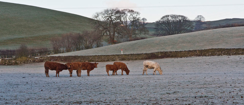
Reaching the entrance to Dodding Green we kept on along the
road towards Meal Bank, passing these cattle in the frost bound
field.
At the
bridge we crossed the river and continued climbing up the road,
but deviating on a path through the woods to ease the gradient.
This finally brought us to the main road by the bridge over the
railway.
"Dad, Uncle Eric, you need to be very careful", called out Allen. "The road is covered in
ice."
Clear evidence of this was the 4x4 that had lost control and was on its side in the
trees by the road. "I hope the driver and any passengers were not injured", said Tetley gravely.
Proceeding along
the road we arrived at the houses at Toll Bar. "The ascent starts here", commented Shaun. "Along that track to the right."
This led upwards through pastures to a gate and
stile in the wall that gives access to the summits. And we say this correctly, as there are in fact two tops divided by a small valley. Uncle Eric explained "the
whole area is Hay Fell, but the summits are called Benson
Knott."
"Which
one are we going to first" enquired Grizzly.
"The
east one on the left, as it is the highest", replied Uncle
Eric.
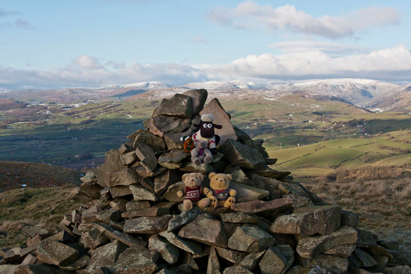
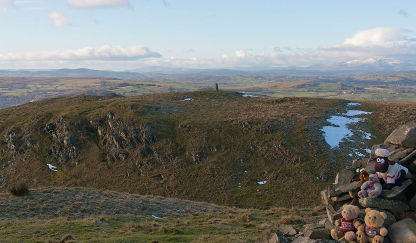
As we
reached it Allen remarked, "there is a big cairn."
"Yes"
agreed Tetley, as we all scrambled on to it.
Shaun said, "you're legs are short, so ride on by back Little Eric."
Settled Grizzly called out, "come on Dad take our picture."
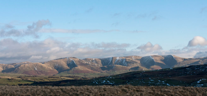
"Are those hills the Howgills?", pointed Little Eric.
"Yes pal", replied Shaun. "They are worth a photograph
too."
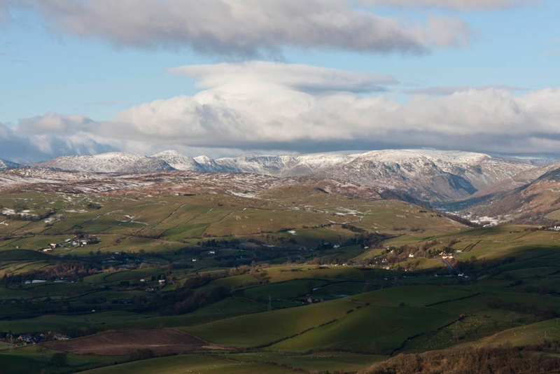
"Just
look over there to the north", Allen then called out. "What
a magnificent view"
"That is the Kentmere Horseshoe, with the Longsleddale Valley to the right,
through which flows the River Sprint", said
Tetley. "That's worth a picture too."
"The last time I was here it was raining so the views were totally obscured", commented Uncle
Eric. "It is a real bonus to be able to see them today."
Besides the
pictures above, the whole sweep of the view included the Coniston
Fells, Crinkle Crags, Langdale Pikes, Bowfell, Esk Pike, Great
End, Red Screes, Kentmere Fells and Longsleddale. To the east the
Howgills and Baugh Fell, Aye Gill Pike, Middleton Fell, and
Whernside.
"Breathtaking", said Little Eric in wonder.
"Truly magical!!", agreed Tetley.
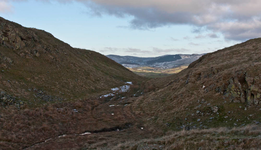
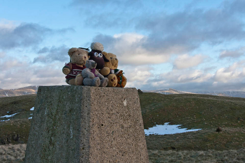
The
slightly lower west summit is adorned with a trig point, and
distantly to the right are the Coniston Fells.
Having jumped into the rucksack we now crossed to the trig point, Dad pausing to take this shot to clearly show
the valley between the two.
Here Dad
took our photo again, that was when Allen had stopped playing the
game of jump off the trig point!!
"Behave", said Tetley.
After a
last lingering look at the views, we now made our descent to the
stile we had crossed earlier.
Uncle Eric said. "if we take that path going north and then west it will bring us to a stile onto the track we walked
up from the road."
This variation made a nice circular route.
We
then retraced our steps to Meal Bank, and Dad took this shot of
the bridge over the River Mint.
We again
followed the river but this time on the opposite bank, all the way
to Mint Bridge. Before reaching it there was a good opportunity
to take a picture of the river.
Grizzly told us, "the River Mint has its source in
the valley of Bannisdale. This is the next valley north from
Longsleddale. The Bannisdale Beck starts high in the fells above
Bannisdale Head, and is joined by a smaller stream draining a group of small valleys from
headwaters in The Forest, Combs Hollow and Mabbin Crag. It is at
this confluence that it becomes the Mint. The only
habitation in Bannisdale is Bannisdale Head Farm."
Allen said, "the valley is
surrounded by hills that form a horseshoe, and is one of the
walks in Wainwright's Outlying Fells Book, which we did on 30th
August 2006. I remember as Dad got his boots on the farmer passed by in his
tractor leaving the valley. Some hours later when Dad was taking
his boots off at the end of the walk the farmer passed by again
returning up the valley."
"One wonders what the chance was of this
happening", laughed Shaun.
Little Eric commented, "that bridge carries the pipes of the
aqueduct, taking the water from Thirlmere to
Manchester."
At the
road, Morrisons supermarket was nearby, so Uncle Eric and Dad had
their lunch at the cafe. We had packed a picnic and munched away
while we chatted about the walk so far.
Then Uncle Eric took us
back via a different route and over the iron bridge that crosses
the railway.
"It's such a long bridge", said Allen.
Uncle Eric pointed, "that's because there was once sidings and a goods yard."
"Ahh, I see. It makes sense now", replied Allen.
Coming out on to Sandes Ave,it was along the riverside path by
the Kent to Dockray and so Uncle Eric's house, where Dad had once
again parked.
After Dad
had got his boots off, we all went in, Barnaby, Lee, Grisedale
and Ginger too, and settled on Uncle Eric's comfortable settee
again. Dad had a warming and welcome cup of tea, while he and
Uncle Eric chatted.
Yet
another super day and again, it just goes to show that you do not
need to be really high to get great views.